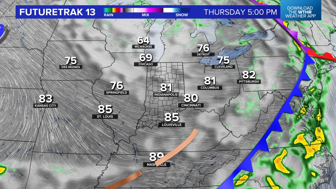
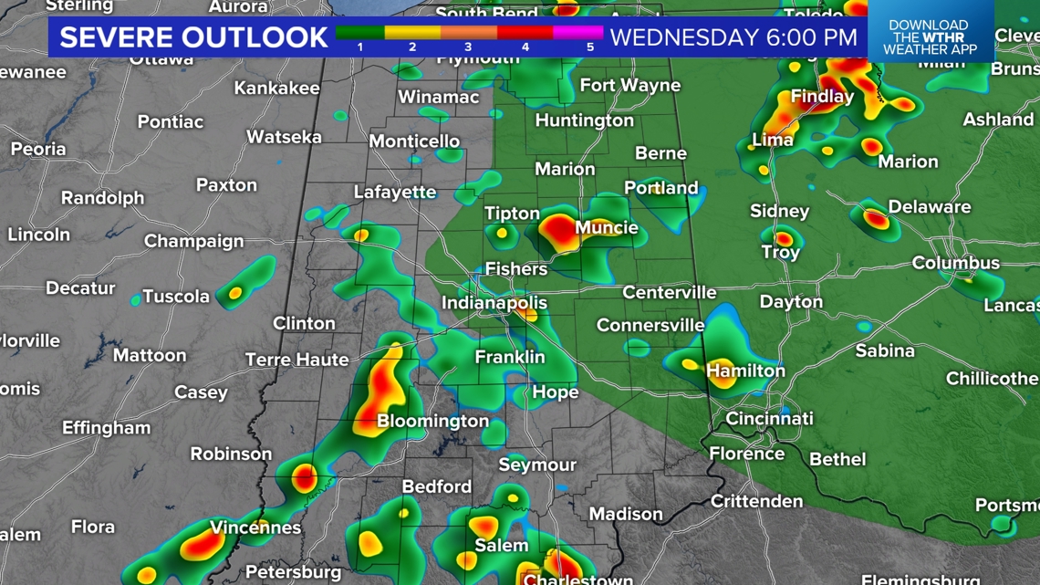
INDIANAPOLIS — Showers will be numerous between now and 7 p.m. with areas of heavy thunderstorms. There remains a low chance that stronger cells may produce 50+ mph wind, pea-sized hail, and/or have some rotation.
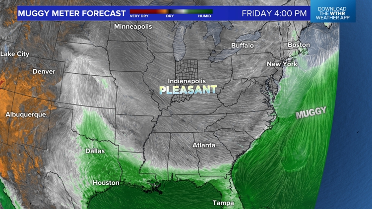
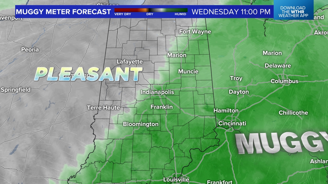
But downpours and lightning will be main threats with what's on radar the remainder of the day. Visible satellite shows clouds clearing in central Illinois behind the approaching slow-moving front. That front eventually delivers refreshing air as we get closer to midnight and you'll definitely feel the drop in the Muggy Meter out the door Thursday morning.


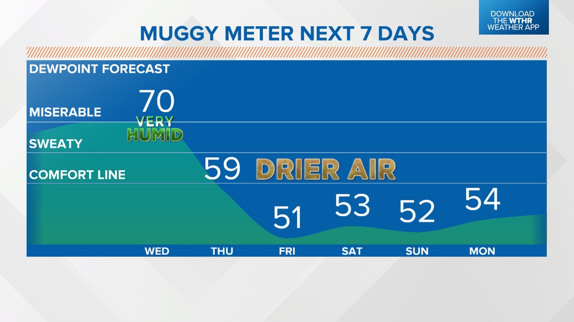
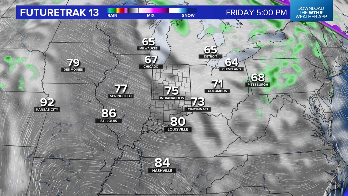
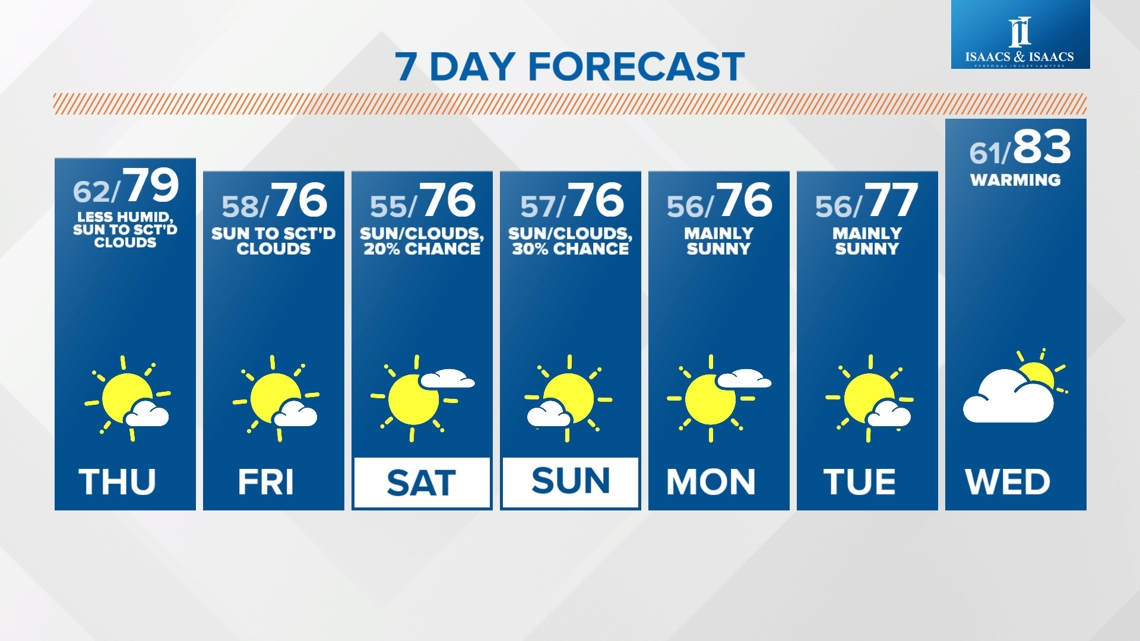
The pleasant air has some staying power and lingers into early next week based on latest modeling. It also comes with plenty of sunshine with intervals of some afternoon low cloud cover. But overall a rather comfortable set-up after today.
Some of the newest data is hinting of late-day shower chances Saturday into early Sunday morning. For now, we're keeping odds of rain low for the weekend but may need to adjust some if these trends continue.
Looking ahead to late next week and into Father's Day weekend, there are growing signs of hotter air returning. Stay tuned for updates.