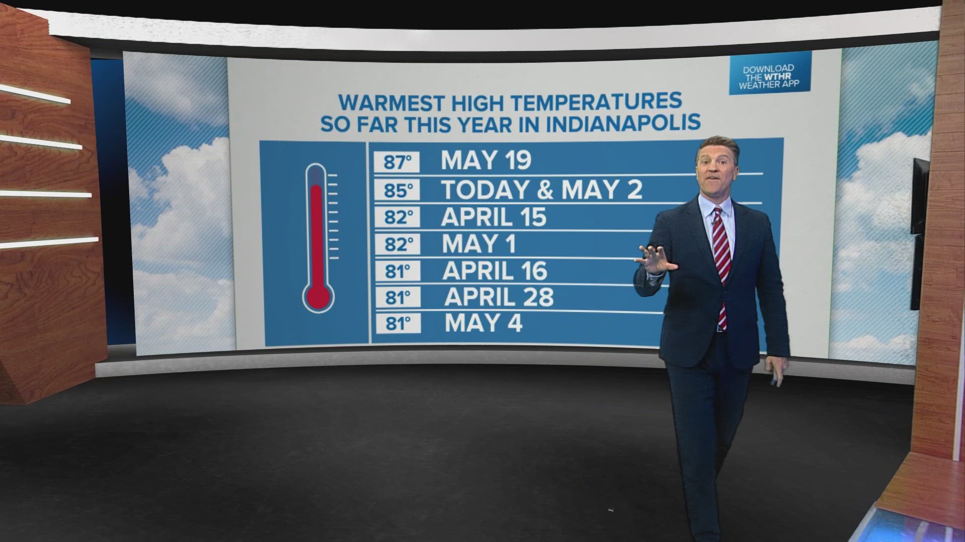
INDIANAPOLIS — Indianapolis reached 87 degrees on Sunday, which is the warmest temperature recorded so far in 2024. Today and tomorrow will likely top that, approaching near-record numbers.
TODAY:
Muggy but dry with a mix of sun and clouds and highs in the upper 80s. The current record stands at 90 degrees from 1977.
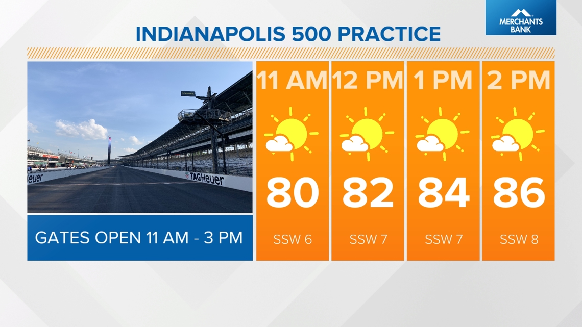
Stay hydrated and take advantage of the shade if you're headed to Indy 500 practice at the Indianapolis Motor Speedway this afternoon.

Heads up for tonight:
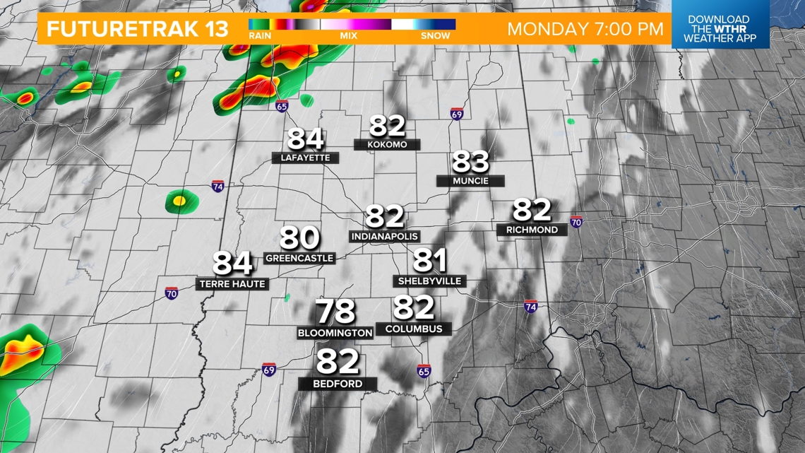
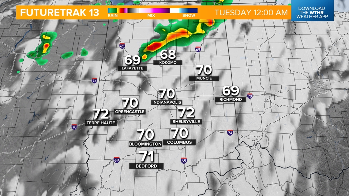
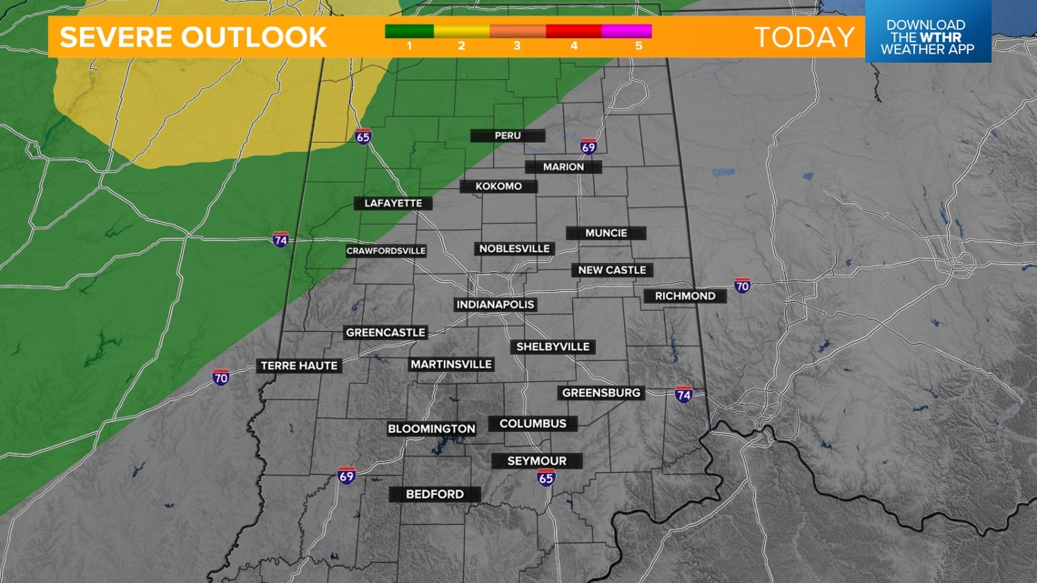
A weak wave will pass through and could prompt a few showers or storms after 7 p.m. across the northern tier of the state and fizzle out during the overnight hours. The Storm Prediction Center placed a small section in far northwestern Indiana under a level 2 of 5 for the risk of a few severe storms.



TUESDAY:
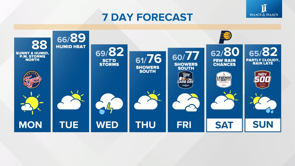
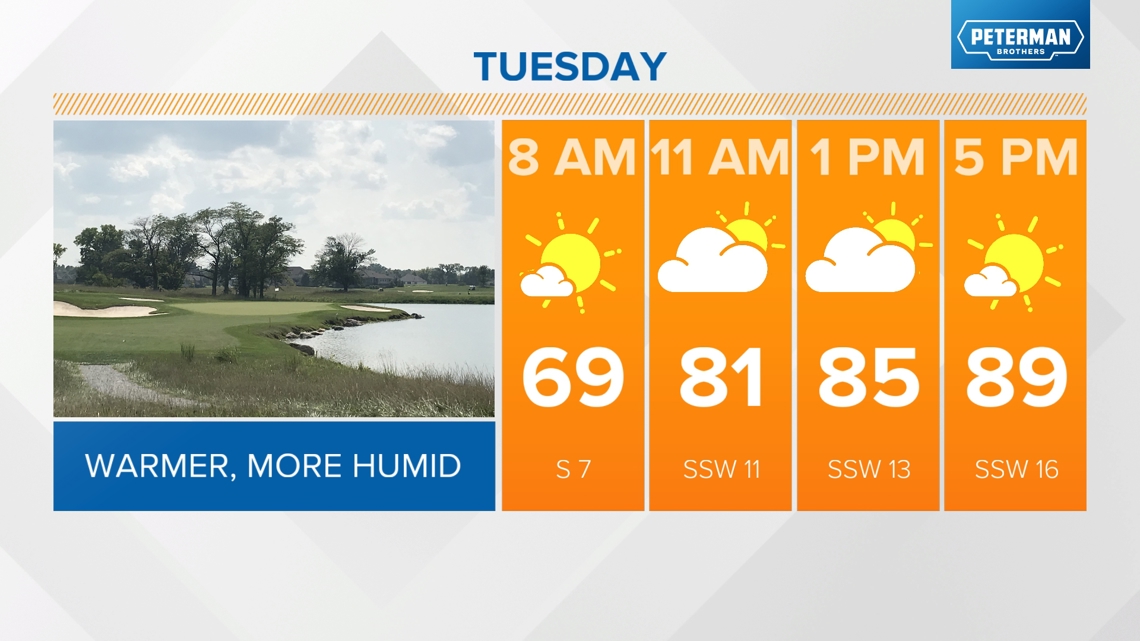
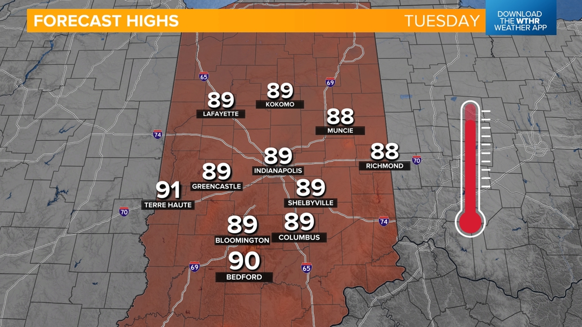
Lots of dry hours as the heat and humidity continues with highs in the upper 80s. The record stands at 92 degrees from 1941.


When will this summer-like pattern come to an end?
Things begin changing as our next weather system approaches late Tuesday. A few storms will develop during the overnight hours into Wednesday morning. This will be a low-end threat of severe weather.

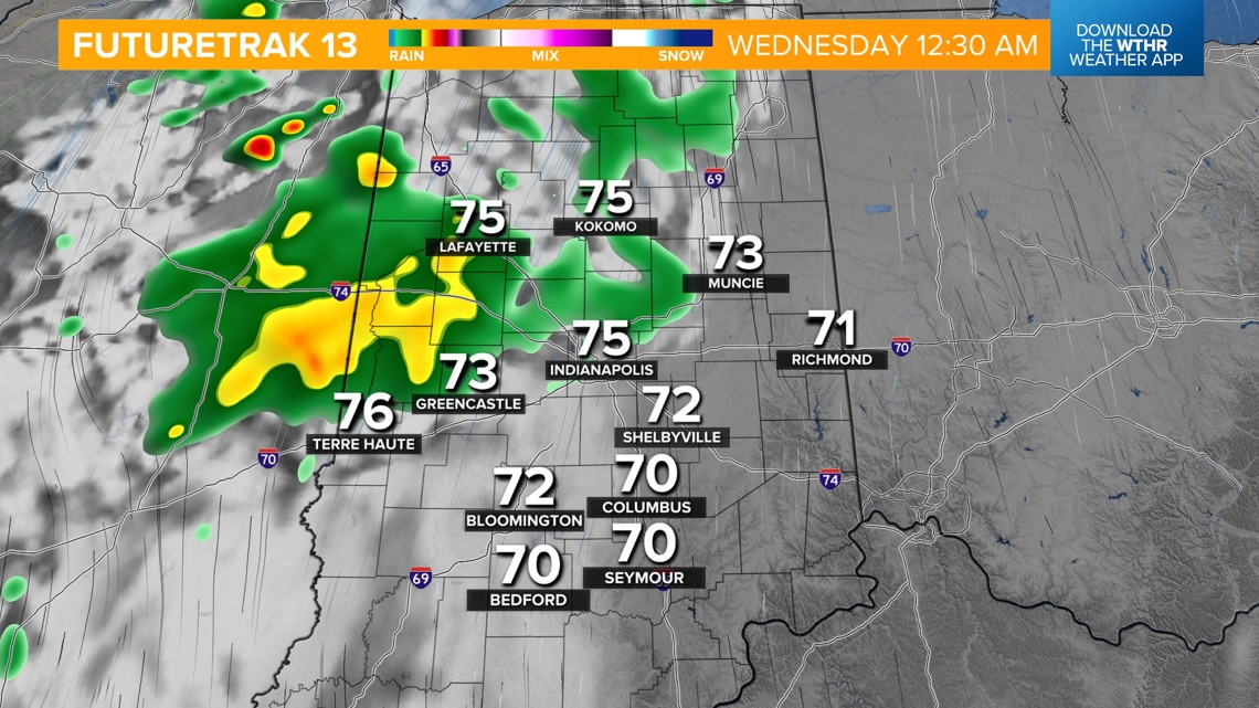

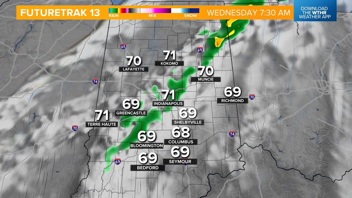
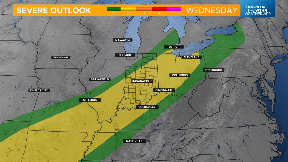
Wednesday will be the most active day this week as a cold front prompts more widespread storm chances. A few strong to severe storms can't be ruled out, especially in the late afternoon and evening.

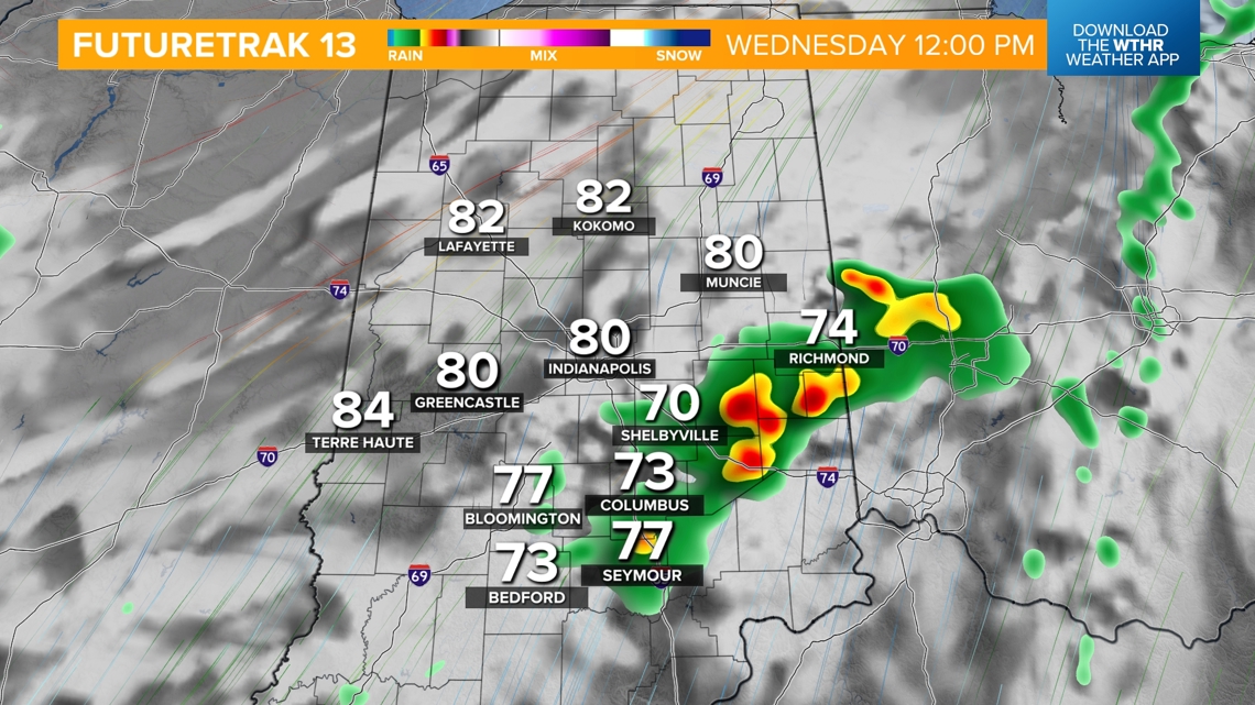

As this system slides south, a few showers are possible through Thursday morning, especially across the southern tier of the state.

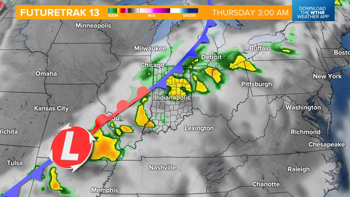
Behind the front on Thursday, temperatures will be more seasonal, and the humidity level drops back into the comfortable zone. Look for highs in the mid-70s Thursday and into the upper 70s Friday for Carb Day. While rain chances are low around the Indy metro Friday, a stalled boundary will keep a chance of scattered showers around across the southern tier of the state.
Looking ahead to race weekend, Saturday looks mainly dry with only a stray shower and a high near 80. Race day looks a little more interesting as a cold front will try and initiate some rain and potentially storms during the latter part of the day. Make sure to check back as we get improved data closer to the weekend.

