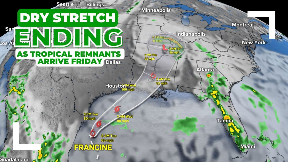
INDIANAPOLIS — Hot and dry weather will come to an end by Friday as the remnants of Francine arrive in central Indiana.

Increased risk of fire danger through Thursday as heat builds
With a combination of abnormally dry conditions, low humidity levels (20-30%), and higher temperatures, we'll see an elevated fire danger/risk of rapidly-spreading fires during this hotter streak. The National Weather Service recommends postponing outdoor burning at this time until we can get some rain.
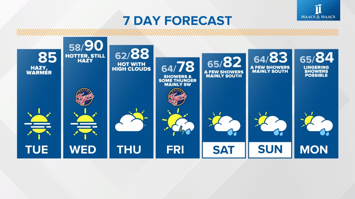
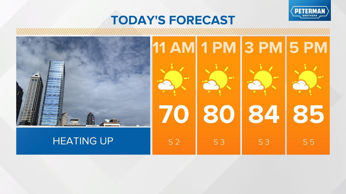
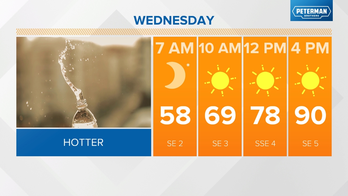
- Sunny, mid 80s this afternoon
- Wednesday will likely be the hottest day in the stretch with highs near 90 under sunny skies
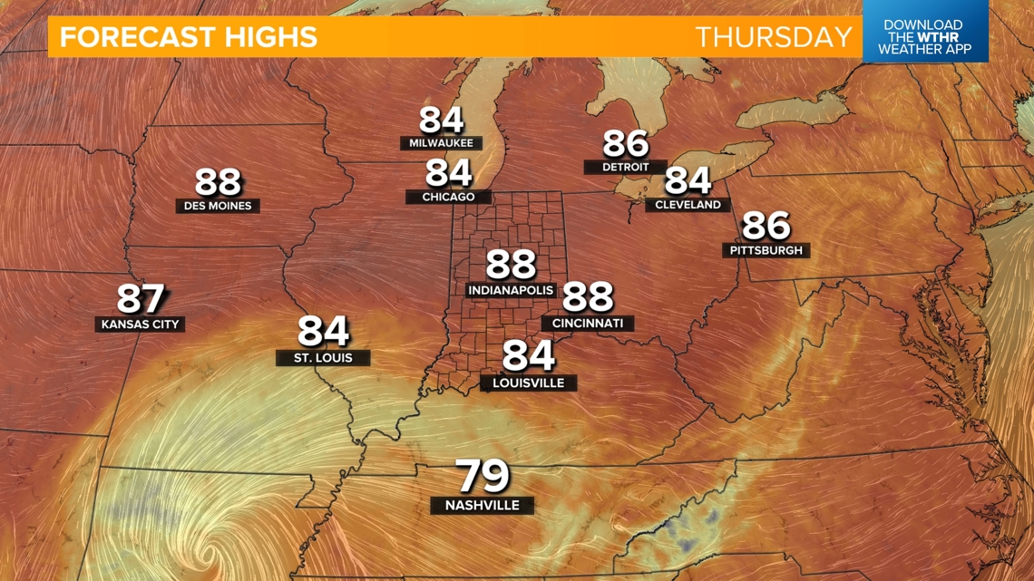
- Still hot in the upper 80s Thursday but with increasing clouds


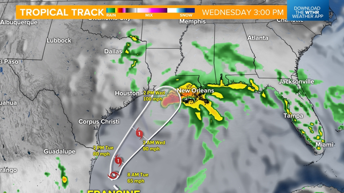
What's the latest on the tropical system "Francine" and its impact on Indiana?
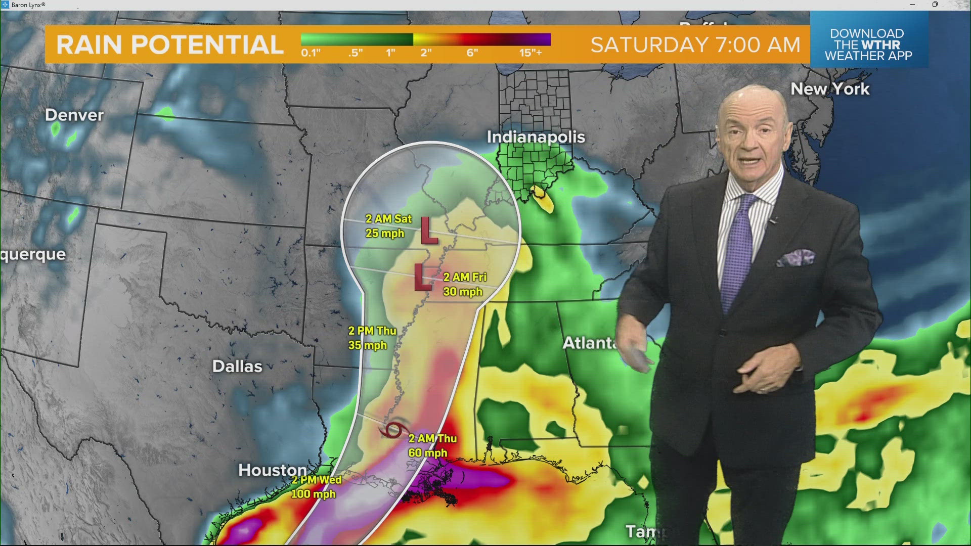
The next time we see rain looks to be dependent on Francine. This system is expected to strengthen into a Category 1 hurricane today and will eventually make landfall along the Louisiana coastline on Wednesday.

This system will continue to weaken as it tracks northeast toward central Indiana. This will first bring rain into southern Indiana by Friday morning, with the best chance of rainfall being contained to the southwestern tier of the state Friday. The more northeast you live in central Indiana, the better chance you have of missing out of much of the rain from this system.

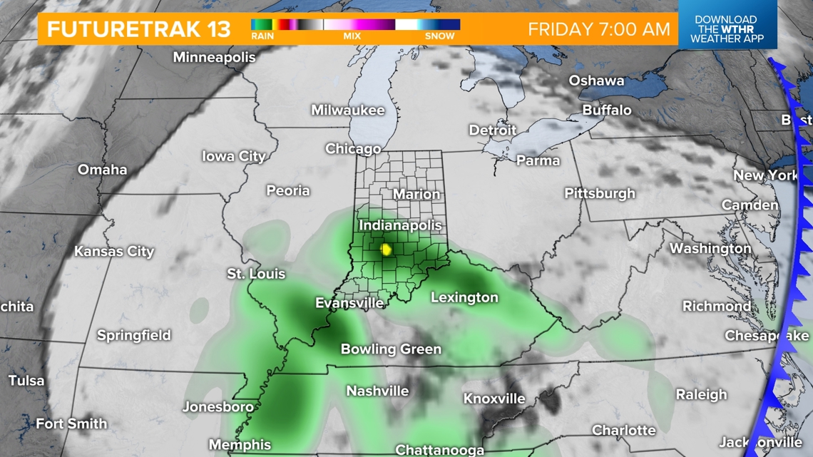

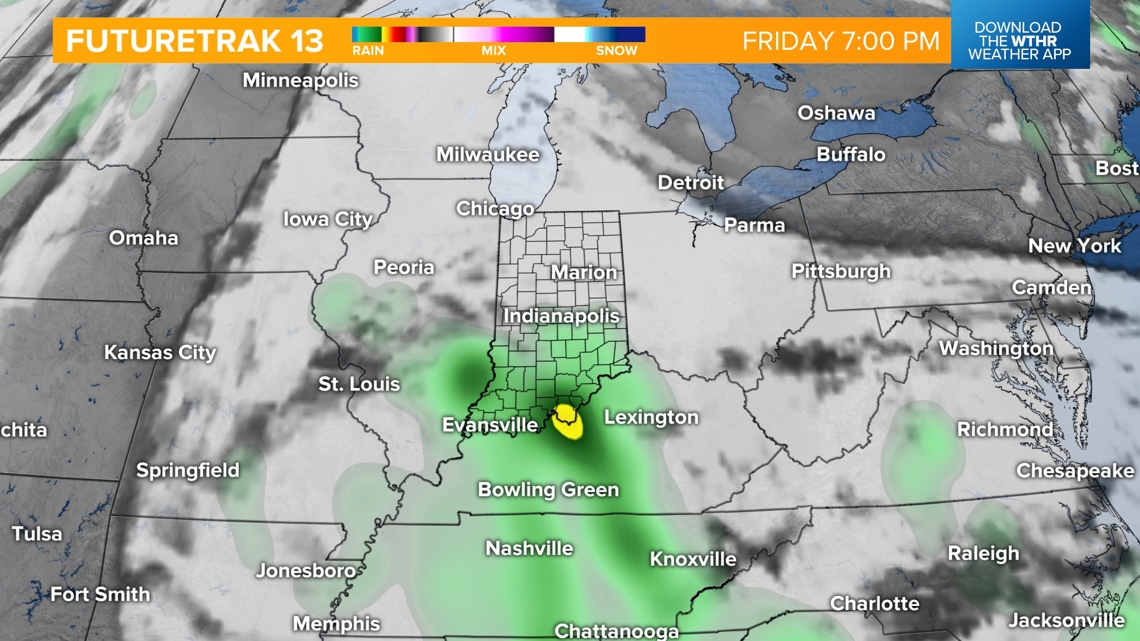
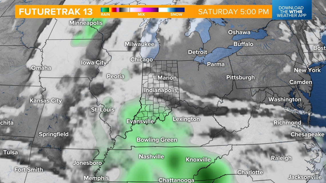
This system will then stall out around the Ohio River Valley for a few days, keeping a few showers around on Saturday, mainly in western and southern parts of the state. A stray shower will be possible again on Sunday in that same zone.

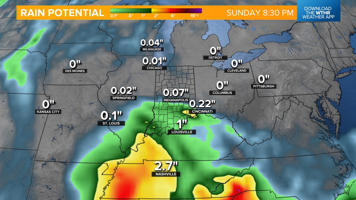
How much rain can we expect from Francine?
The best chance of measurable rainfall will be along the line from Sullivan to Bloomington and Seymour, where heavier bands of rain are possible. Even here, up to 0.5" will be most likely. From Indy north, most weather models are keeping rainfall totals under 0.15" through the end of the weekend.

Highs will be cooled due to rain and clouds on Friday to the upper 70s. Areas that stay mainly dry this weekend will likely be back in the 80s, with areas farther south staying in the rain-cooled area in the 70s.