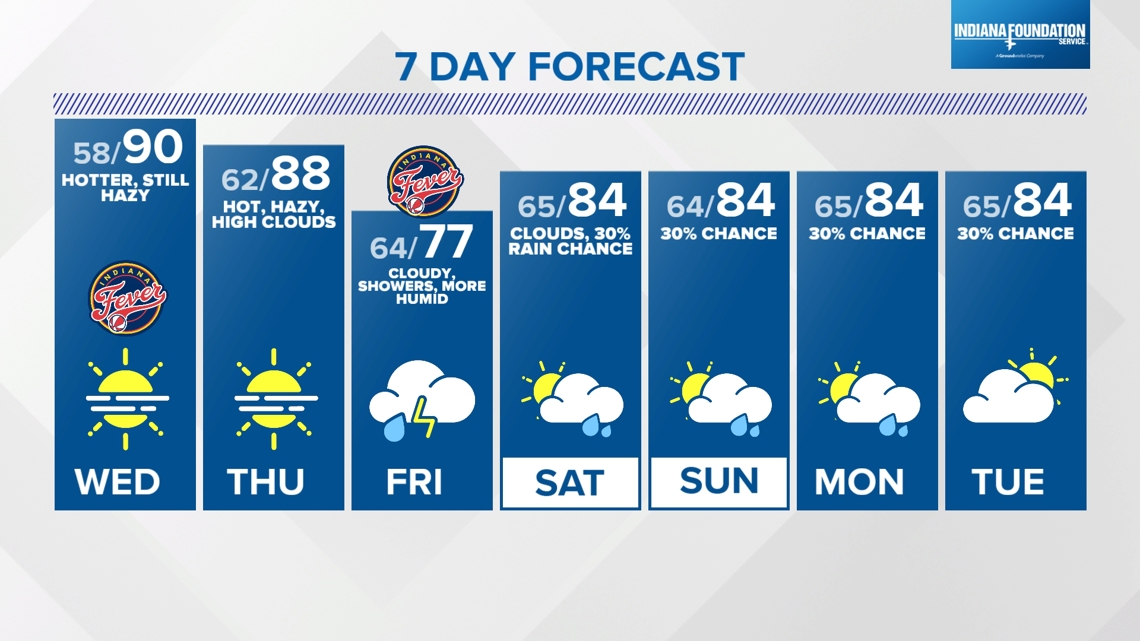
INDIANAPOLIS — Pleasant weather continues over central Indiana again today with varying degrees of haziness from remnant wildfire smoke. Air quality has dropped a bit in the past 24 hours, which could be a combination of some of that smoke and the airmass being stagnant. Either way, an expansion of moderate AQI (impactful to those with unusually sensitive respiratory systems) continues to expand away from the Indy metro area.
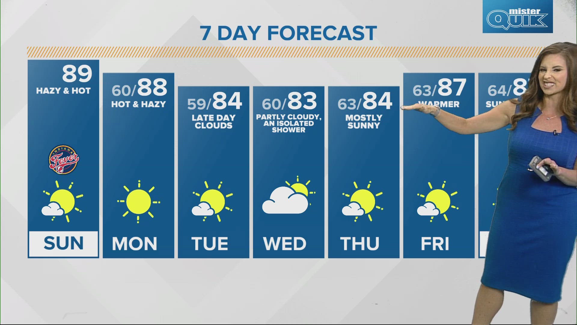
Otherwise, it's a rather comfortably warm day of warmer highs in the mid-80s but with relatively dry dewpoints in the 40s/50s. The warmup continues for the next 24-48 hours with highs nearing 90° both Wednesday and Thursday afternoons. Again, the Muggy Meter remains relatively comfortable, with humid air from the remnants of Francine not arriving until Friday.
Francine continues to strengthen in the western Gulf of Mexico and becomes a hurricane at some point today. Hurricane Warnings are up for parts of southeast Texas and all of the Louisiana coast, which is where it makes landfall during the middle part of Wednesday as potentially a Category 2+ hurricane.

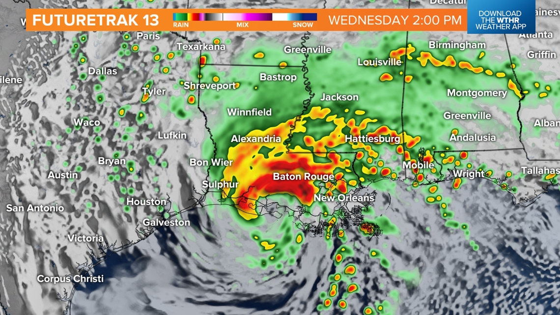

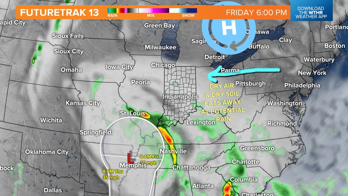
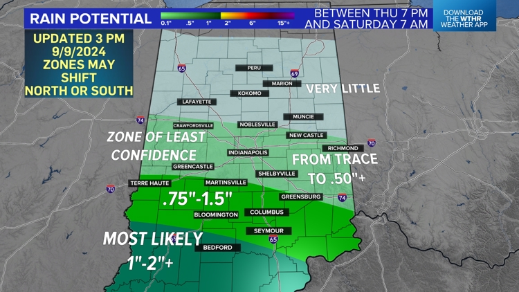
Since there's very little upper-level wind over the southern U.S., Francine moves slowly to the northeast in the coming days. The latest guidance shows quite the squeeze-play in rainfall distribution over the southwestern half of Indiana. This is due to the remnant circulation becoming less organized and the moisture fields encountering stubborn dry air that's already in place.
This results in a zone of highest rainfall south of I-70, very little rain in northern Indiana and a tricky zone of low forecast confidence along the I-70, where rain may range from a trace to a half inch. There will be a sharp cutoff from areas of downpours to areas that get just a few raindrops. And it's very possible Indianapolis is either in or near that zone.
The rain forecast map below was constructed this afternoon (2:30 p.m. Sept. 9) after reviewing the latest model data. Please know, there remains uncertainty on where the circulation drifts, and ultimately, that will cause further adjustments in the coming days.

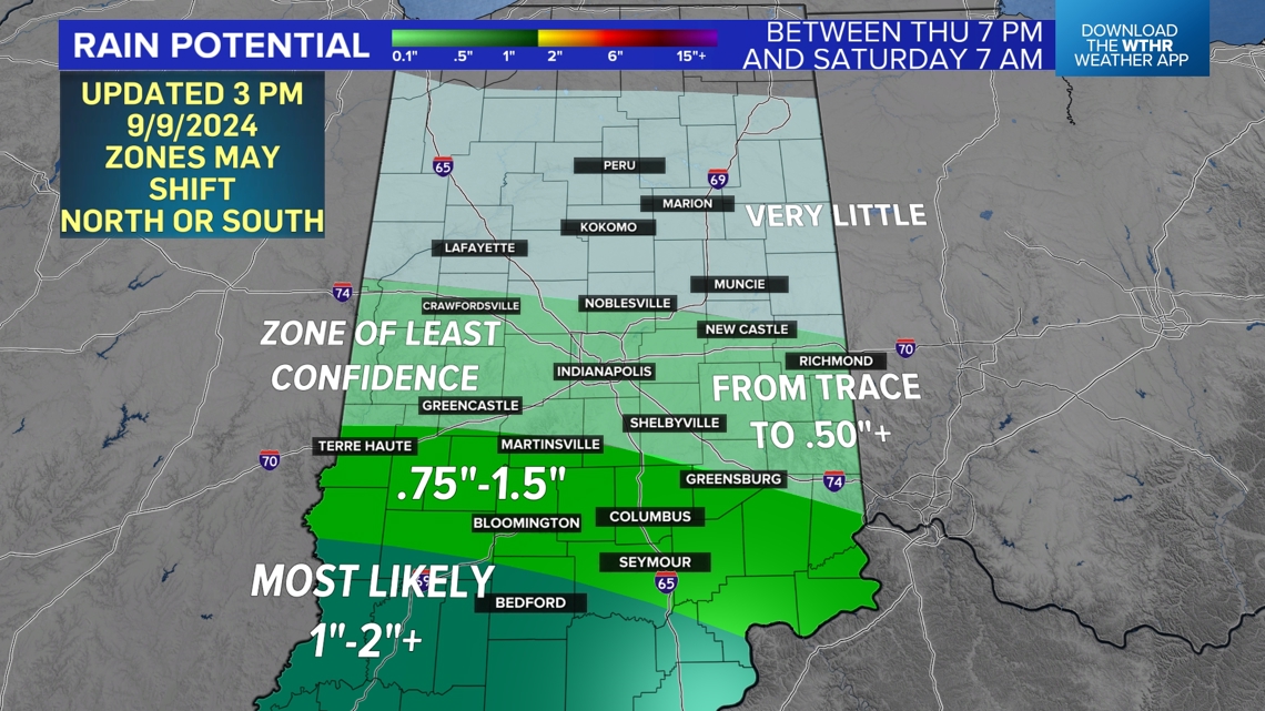
Bottom line: For some – mainly south of I-70 and west of I-65) – beneficial rain is a byproduct. While others don't get a drop of rain, the drought continues to build. Clouds knock temperatures into the 70s on Friday, but as the circulation becomes disorganized and weakens, we'll be right back into the mid-80s (at least) for most of next week.