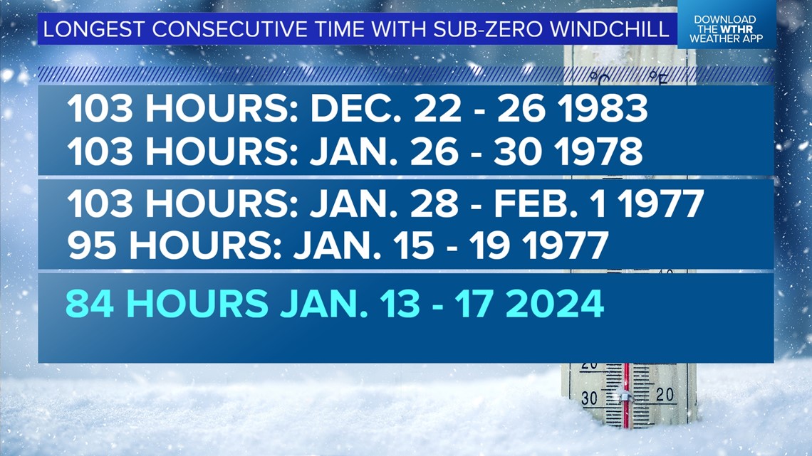
INDIANAPOLIS — While the air remains uncomfortably cold, for the first time since just before 10:30 p.m. Saturday, Jan. 13, Indianapolis' windchill is no longer below zero. That marks the end of a rather impressive weather feat here as the 84 consecutive hour streak of sub-zero windchills is the city's fifth longest and longest since 1983.
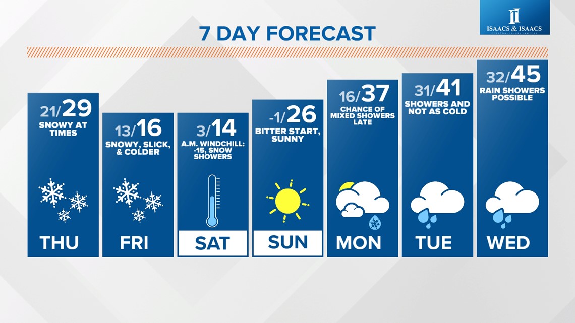
Windchills are in the upper single digits to mid-teens this afternoon and remain above zero until Friday when the next arctic front arrives. Between now and then, there will be intervals of snow varying in coverage and intensity.

Nothing doing in terms of precipitation today, with a mix of sun and clouds and a relatively "pleasant" day compared to the past several. But the wind remains brisk from the southwest and remains steady 10-20 mph range.
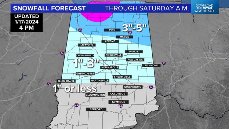
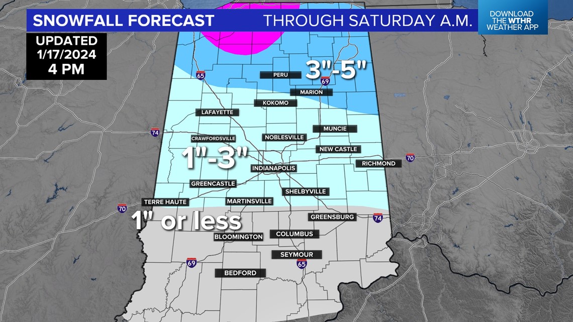
It's fair game for flurries and snow showers by sunrise Thursday, but latest guidance shows the best lift/moisture combination to be aligned much farther north in the state — at least for steadier snow throughout the day. Elsewhere, it looks more like periodic snow and amounts not expected to exceed a half-inch.

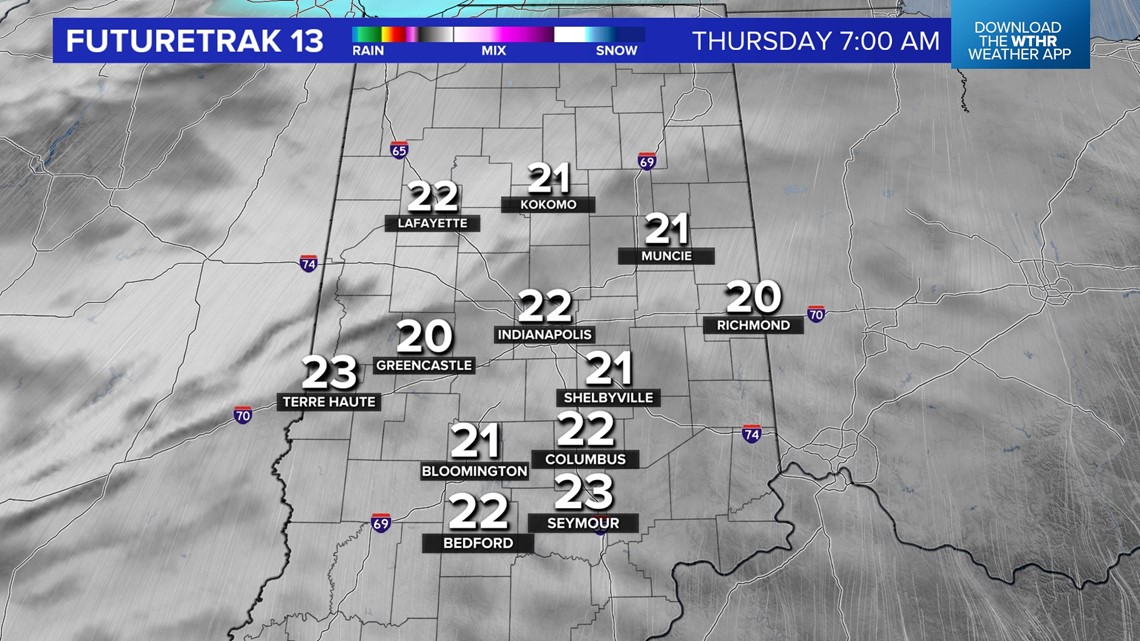

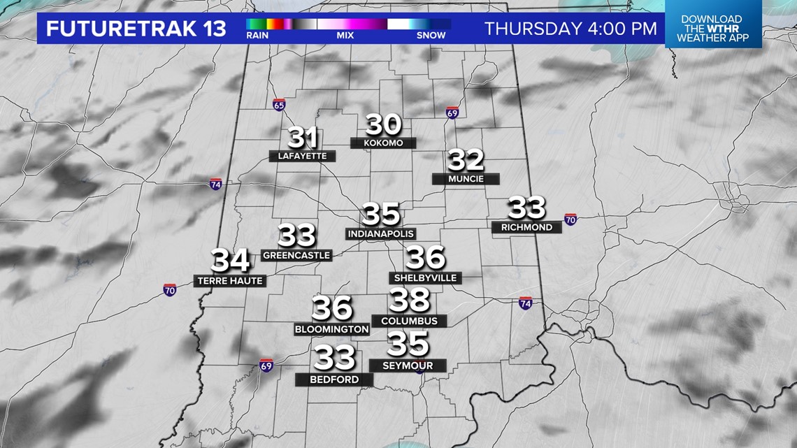
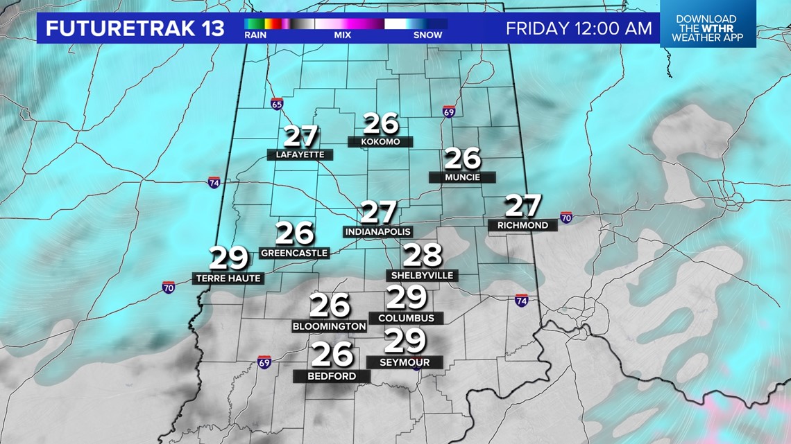
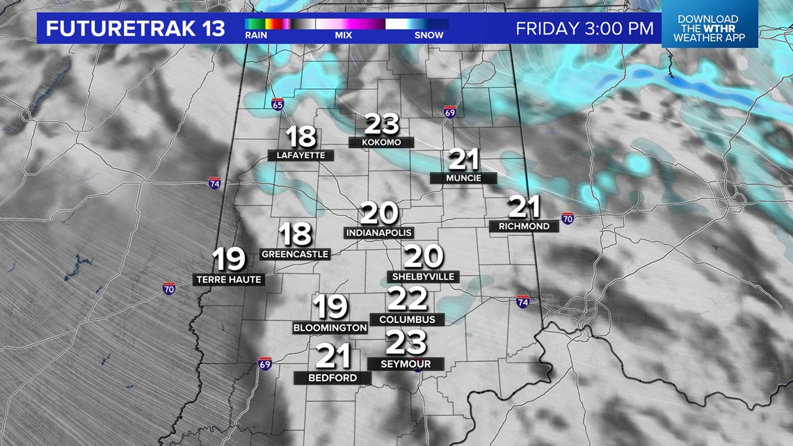
Thursday night into Friday, snowfall should have a bit more teeth to it, with temperatures dropping back into the teens Friday. Roads will likely become slick and slow Friday and remain that way into the start of the weekend, with continued snow showers and lake effect snow bursts dropping south.


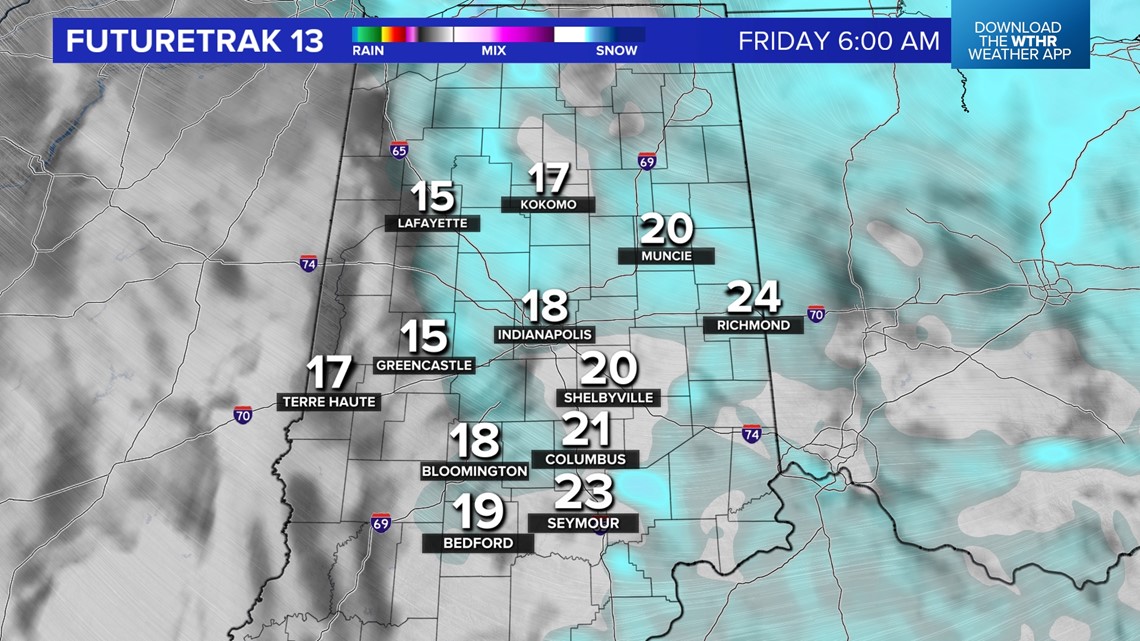


Lows Saturday reach the single digits and windchills well below zero with little recovery Saturday afternoon into the lower teens. The coldest night of the next week will be Sunday morning. That's when fresh snow, a clear sky and calm wind from a nearby high pressure system creates maximum radiational cooling, and we're forecast sub-zero lower temperatures.
But that high departs by Sunday afternoon, and the returning southwesterly wind boost highs in the 20s to finish the weekend. This marks a transition to the warming trend for next week that eventually sends temperatures well into the 40s and maybe eclipsing 50° by the end of next week.

