INDIANAPOLIS — Good morning! Some changes are being made in the forecast, and things are different than when you went to bed last night.
Here are the key points you will want to know:
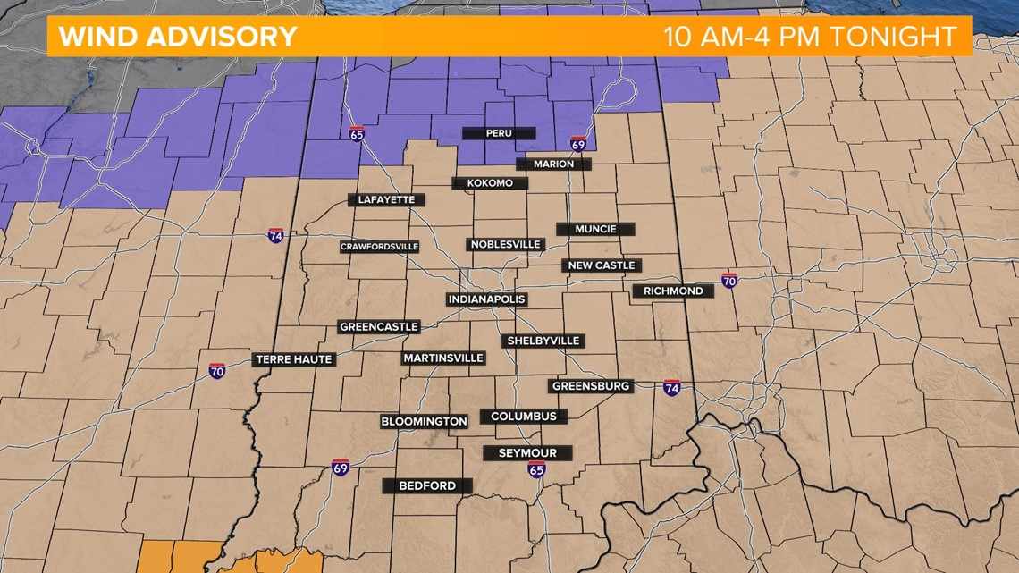
- The National Weather Service is dropping a High Wind Watch, but a Wind Advisory goes into effect at 10 a.m. and lasts through early Saturday morning. 50 mph winds are possible with power outages, difficult driving and some damage possible.
- A Winter Weather Advisory will stay in place for northern Indiana due to snow and slick roads. Logansport, Peru and areas north of Indy are included.
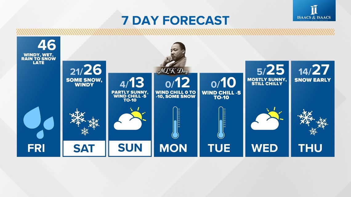
- Expect more than an inch of rain and 46 degrees for a high in Indy today, which will change to snow showers later this evening. We are not expecting a lot of snow in the metro area, but slick roads will be a problem.
- The week will stay very cold with sub-zero wind chills Sunday and Monday.

Now the particulars:
Look for a wet and windy 46 degrees today, and only 26 tomorrow with unorganized pockets of snow. Slick roads are a possibility. Sunday is very cold with a high of 13, but wind chills hovering between -5 and -15.
This is brutal cold, so make sure you are dressed in layers when you go outside and remember that it will be just as cold on Monday for Martin Luther King Jr. Day.
Stay tuned to our weathercasts on WTHR-TV for the latest weather updates, and download the Live Doppler 13 Weather app.