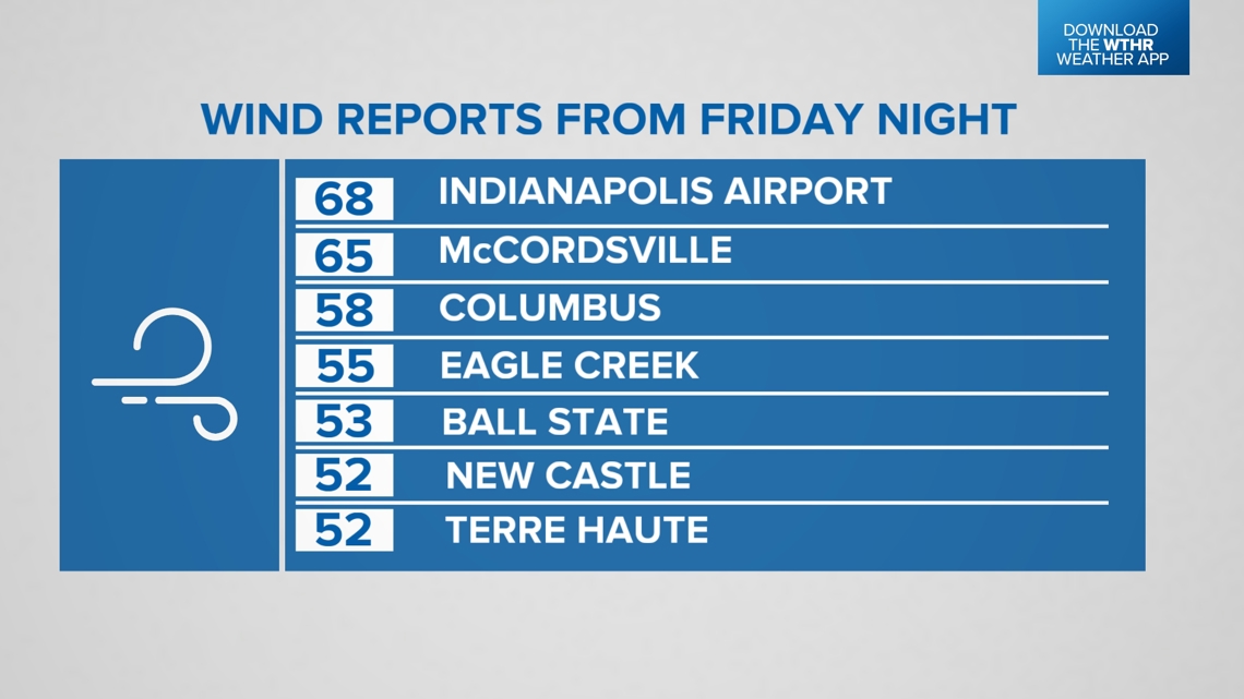
INDIANAPOLIS — What a wet, windy ride it's been the past 24 hours, courtesy of Helene's energy merging with an upper low over western Kentucky.
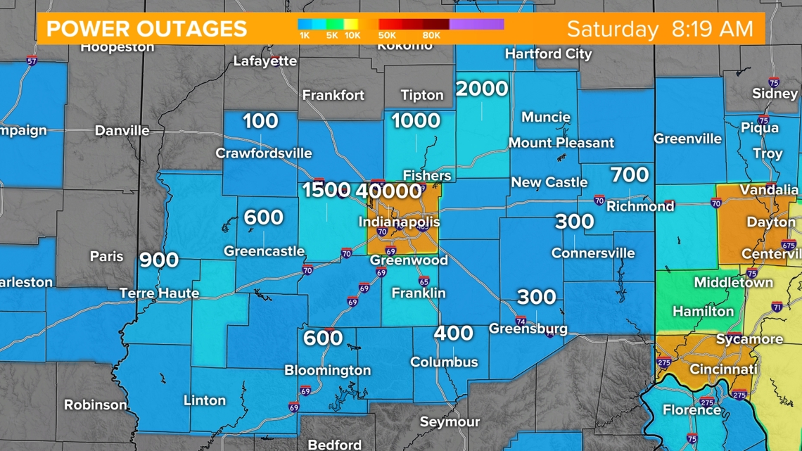
That process delivered a period of expected high wind across Indiana Friday evening with damaging wind gusts peaking in the 50 to nearly 70 mph range. So it's no surprise to see tens of thousands of customers remaining without power this morning and a large chunk of that in Marion County.


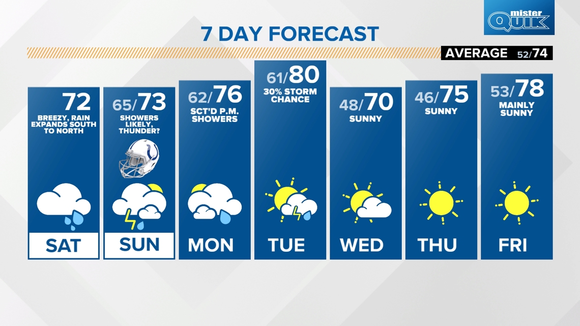
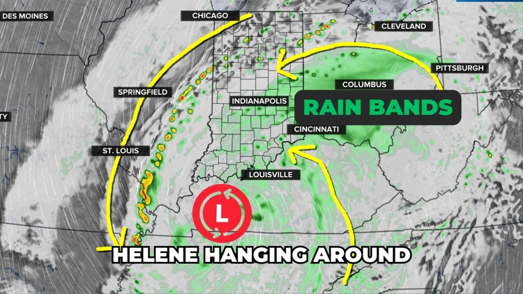
We can say the worst of the wind and heaviest rain is over. But it will still be breezy today and for some (central/south) it will be a damp Saturday with steady rain rotating around Helene's circulation south of the Ohio River. The rain shield gradually expands north throughout the day, but north-central Indiana will have longer stretches of rain-free radar conditions.
College football forecasts:
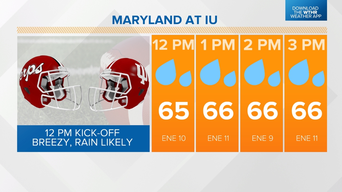
Based on proximity to Helene, the Maryland vs IU in Bloomington will be the wettest of the games locally today. Though the rain may not be terribly heavy, it will be steady and this includes tailgating and into the fourth quarter.

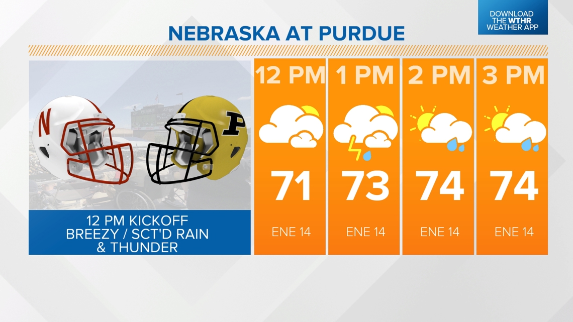
Tailgating for the Purdue game will be drier and possibly dry for kick-off at noon. But we do expect a scattering of showers and possibly some thunder by the fourth quarter as the atmosphere from peeks of sun.

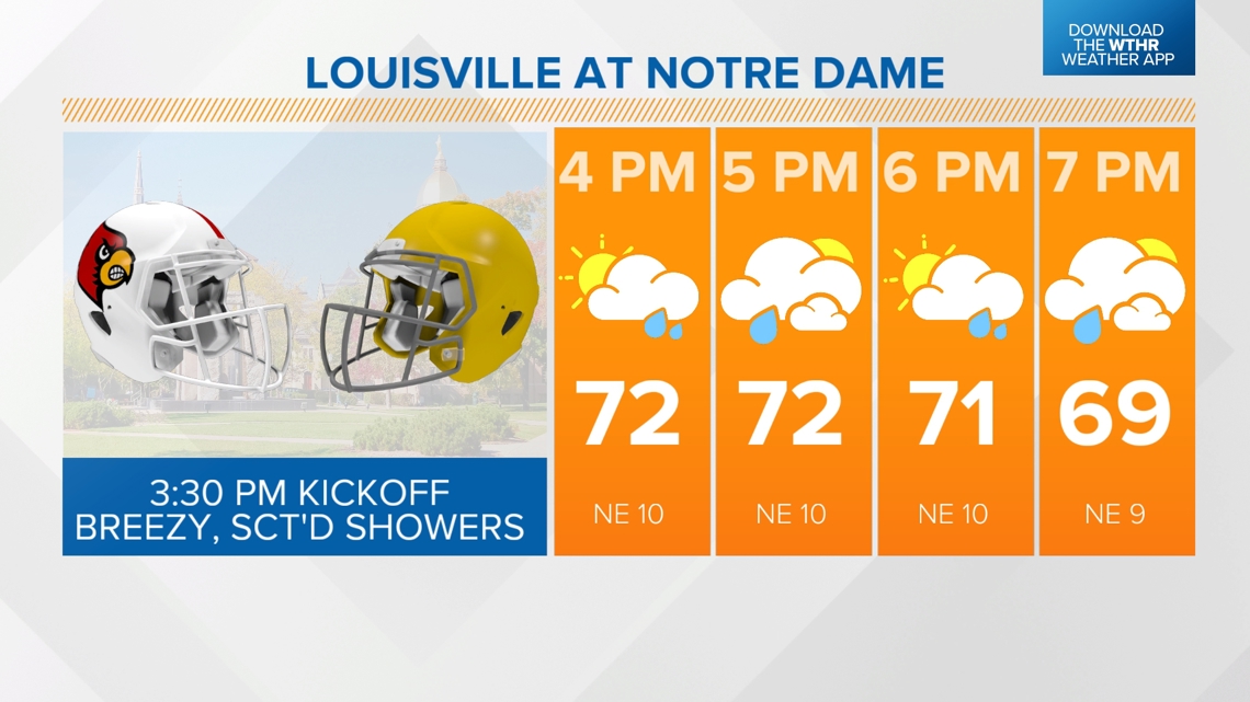
Breezy conditions will be apart of all games today and expect northeasterly wind of 15-30 mph if you're going to Notre Dame Stadium today for the Irish playing Louisville. It's a 3:30 p.m. kick-off in South Bend and there will be quick-moving showers at times around the stadium.

Peeks of sun over north-central Indiana will make the atmosphere warmer and more unstable and more suitable for quick-moving, possibly rotating, scattered showers and storms this afternoon/early evening. The zone of potential rotation will be from Fort Wayne to Attica.

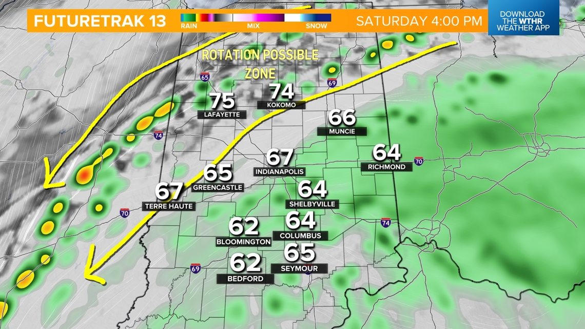
Please note that due to the counter-clockwise flow around Helene, these cells will be moving from northeast to southwest. Don't be surprised if you hear of reports of funnels and/or some Tornado Warnings issued for some today and/or Sunday as the spin from what's left of Helene meanders over the Ohio Valley the next three days.

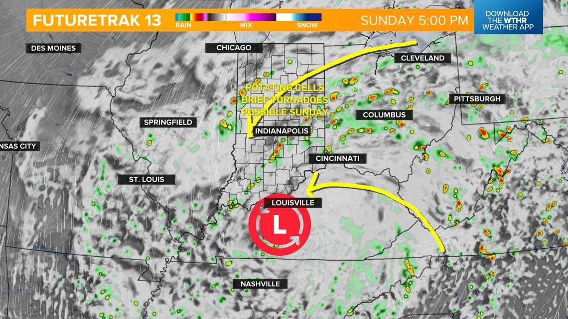

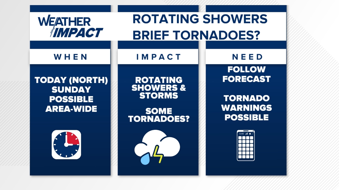
The potential of rotation will be area-wide on Sunday as the positioning of the the broader circulation shifts a bit toward the southeast. Expect scattered showers and some afternoon thunderstorms Sunday and again Monday.
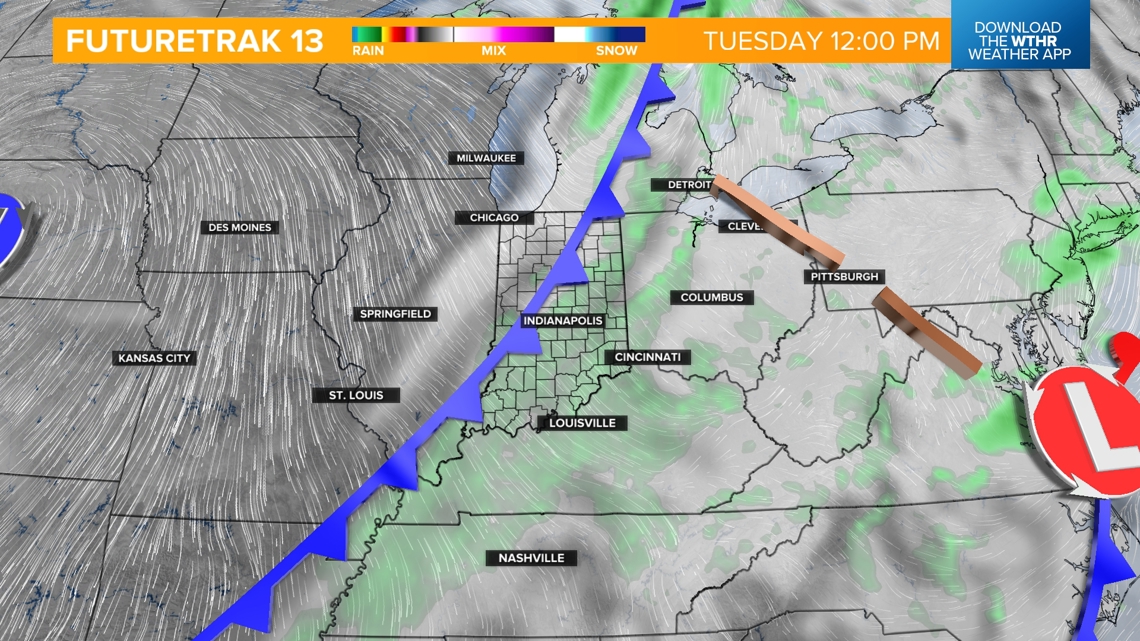
We've added a chance of showers and spotty thunderstorms on Tuesday along with an approaching cold front that delivers some very pleasant air for the middle and latter of half of next week.