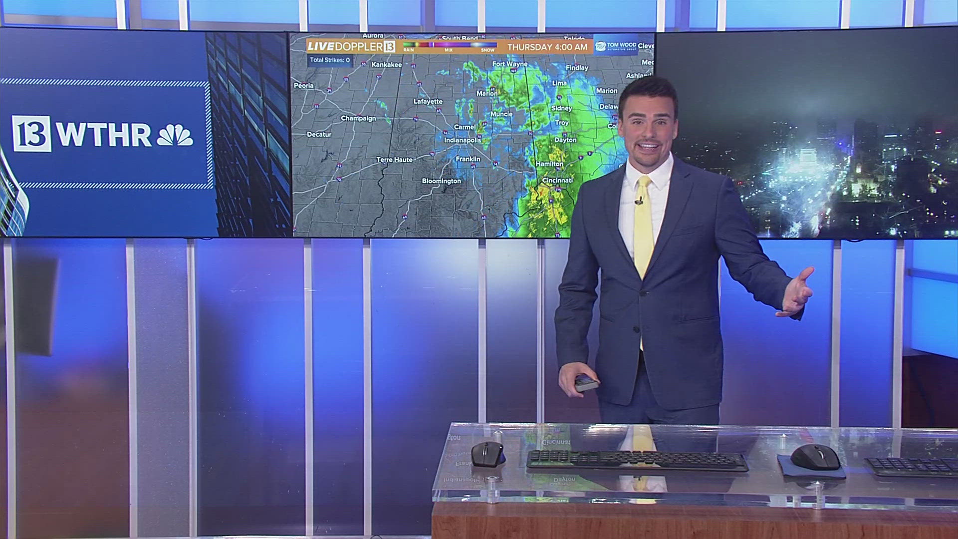
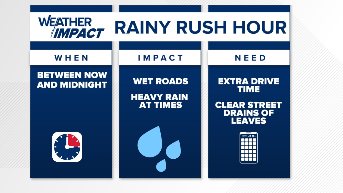
INDIANAPOLIS — Rain expanding over Indiana and will be heavy at times between now and midnight. Plan for a slower evening commute, wet roads, and localized flooding especially in areas of heaviest rain rates and/or any street drains blocked by leaves.
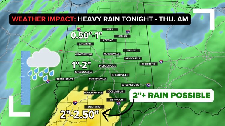
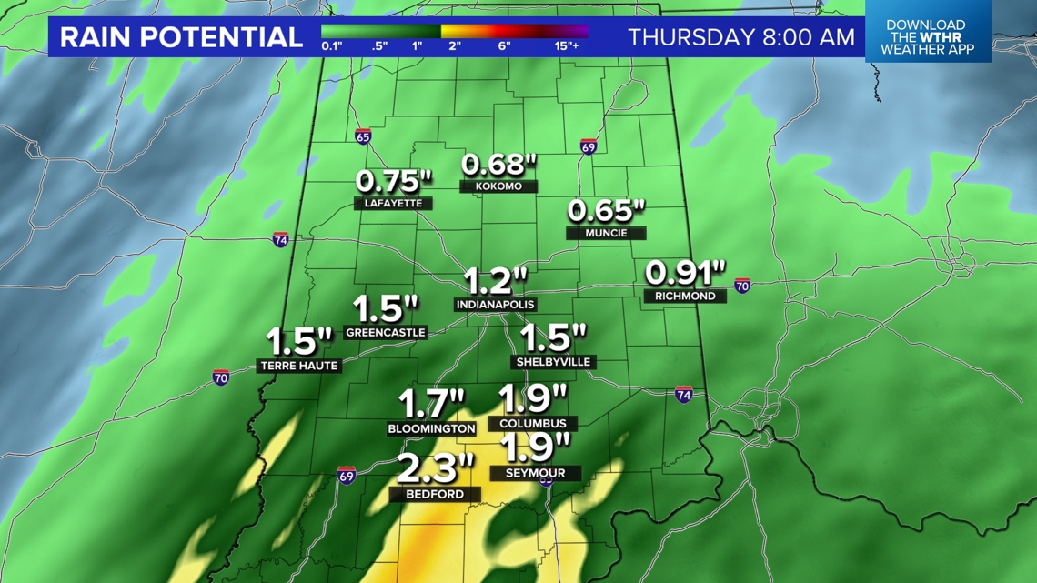
By Thursday morning, expect a widespread .75"-1.50" rainfall footprint in the WTHR viewing area with areas of 2" possible over southern-southeastern Indiana. While amounts will be lightest to the north-northeast, everyone gets wet and this is great news for a state that continues to climb out of drought.


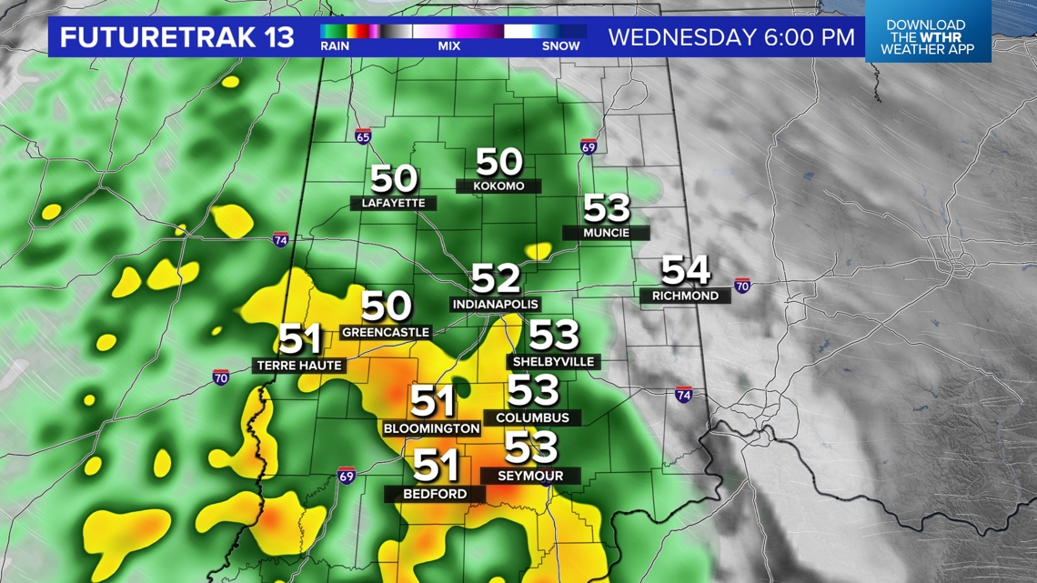

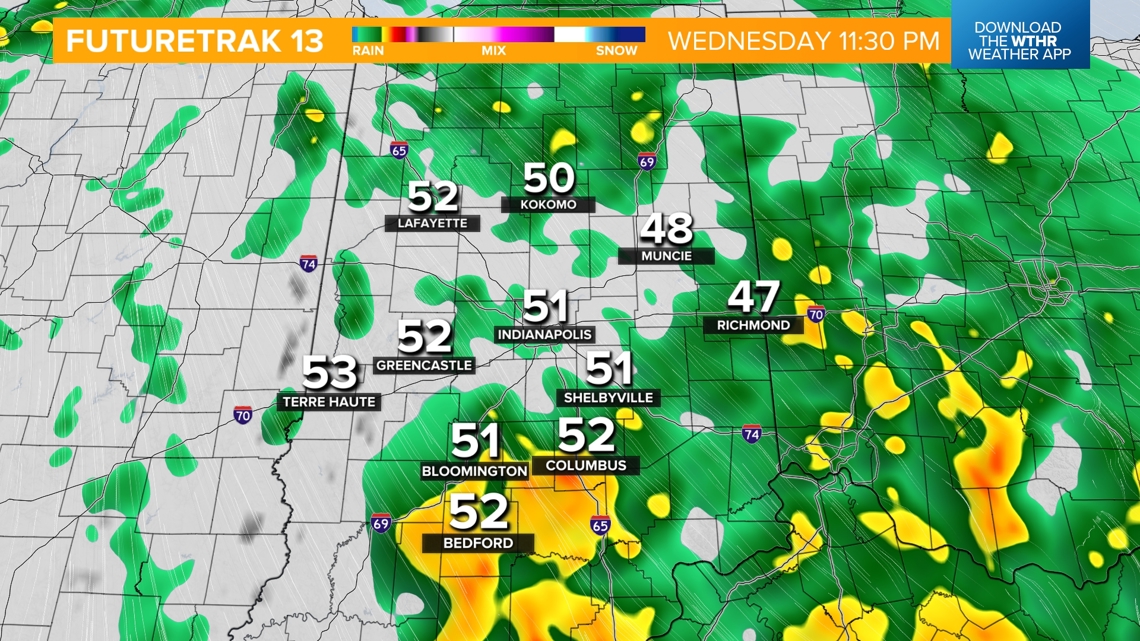
OVERNIGHT AND THURSDAY:
- Heavy rain starts to dissipate overnight with scattered showers lingering through daybreak Thursday.
- Steady temps near 50 degrees.

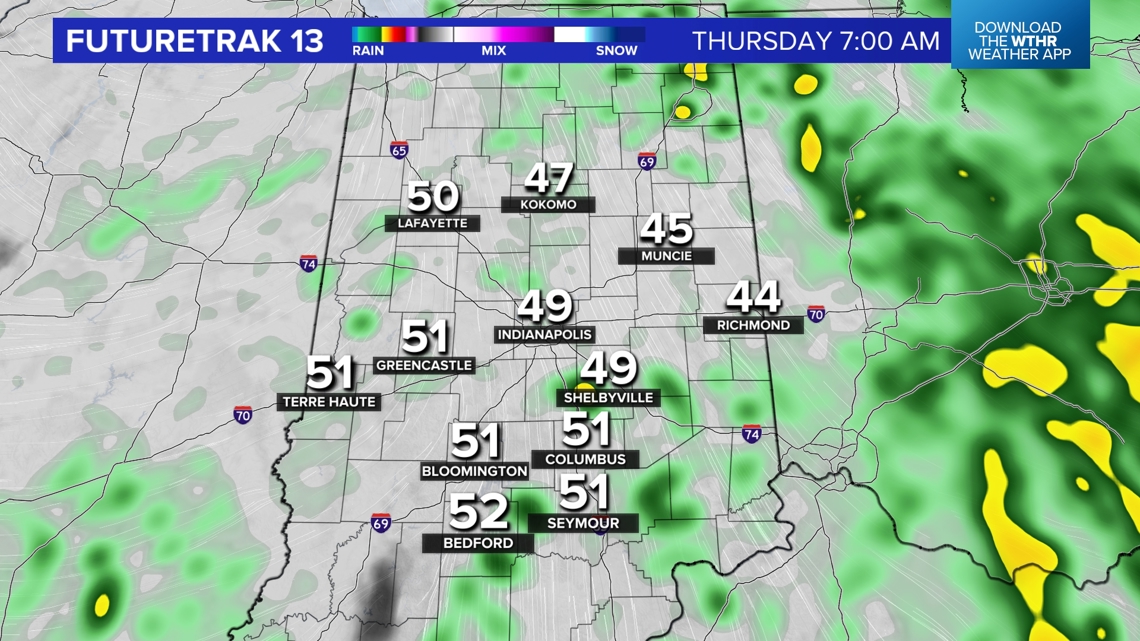
FRIDAY AND SATURDAY:
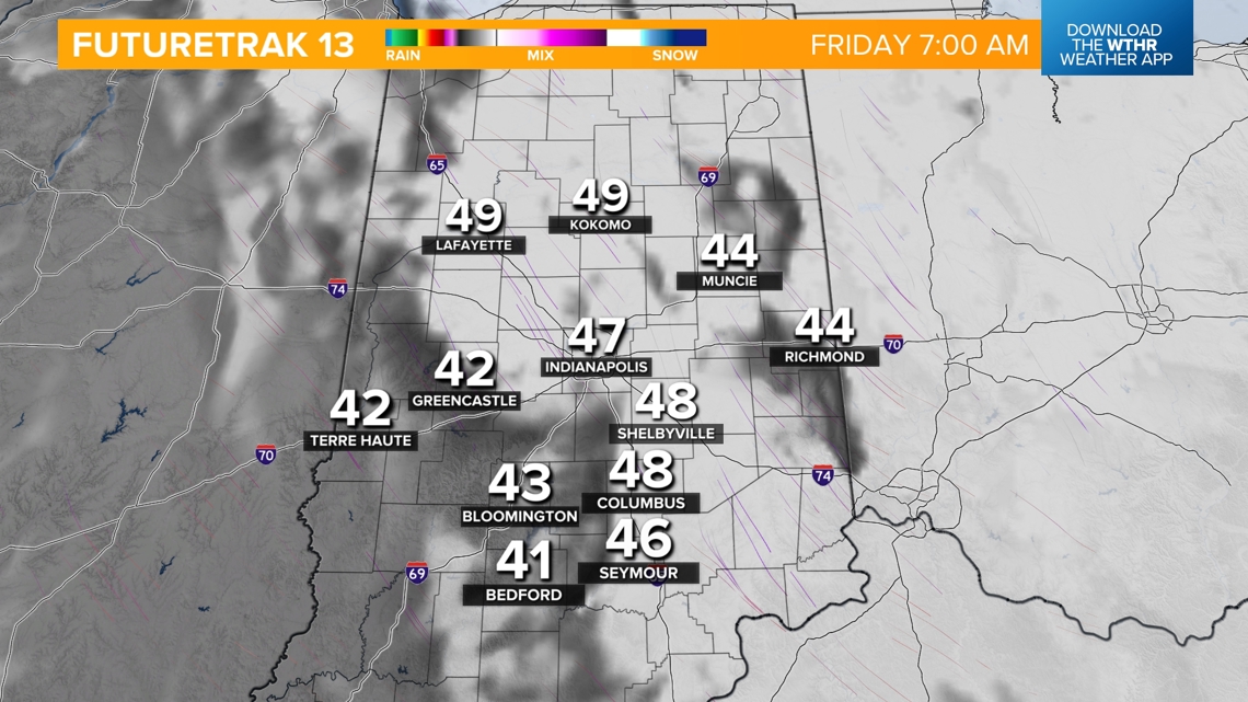
- Mainly cloudy with areas of mist or drizzle int he morning
- Cool high temps in the mid 50s.

RAINFALL POTENTIAL
- Most of the area sees around an inch of rainfall.
- Slightly lower totals expected across the northern tier of the state with Lafayette, Kokomo, Peru and Marion expecting 0.5-1 inches.
- Heaviest rainfall will bring the potential of two or more inches across southwestern Indiana including Bloomington, Bedford and Seymour.

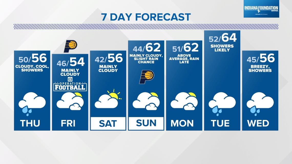
WEEKEND AND EXTENDED FORECAST
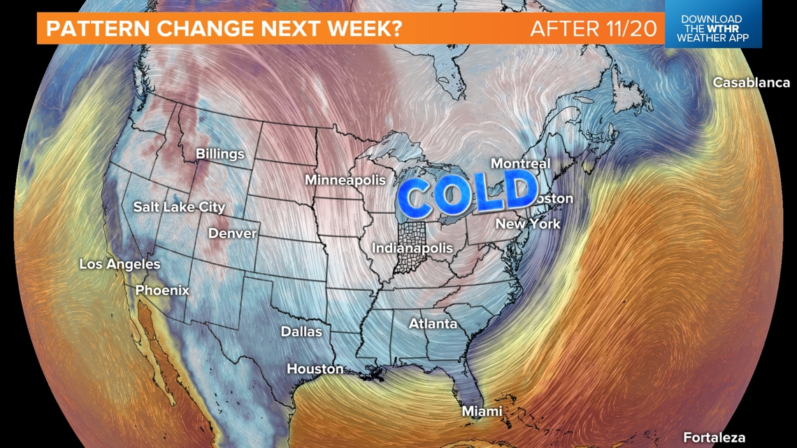
A gradual "warm-up" into the 60s early next week before a potential significant pattern change emerging later next week. While it's too early for local specifics...if the modeled set-up verifies it would deliver sharply colder air and possibly the first flakes of the season to the Great Lakes. We'll narrow-down temperature departures and whether or not lake effect or cold-air advection snow develops over the coming week.
But we're long overdue for below to well below average temperatures and this may bring us our coldest air since early April. Stay tuned.

