INDIANAPOLIS — The heat is on over the next few days. A high pressure heat dome has set-up across the southeastern U.S. which will help pump a humid air mass into central Indiana through early next week.
TODAY:
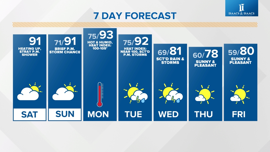
Low 90s. Fair weather cumulus clouds will develop with the heat of the day and could produce a stray pop-up shower or storm through the early evening.

Staying warm and muggy overnight with lows only in the low 70s.
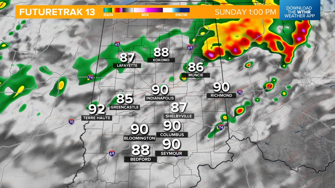
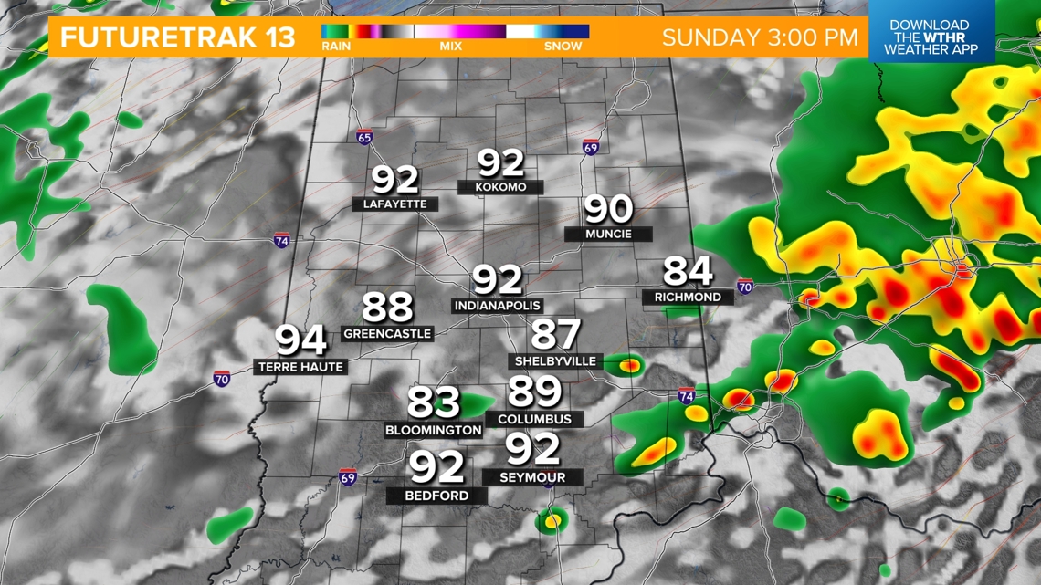
Slightly higher storm chance on Sunday
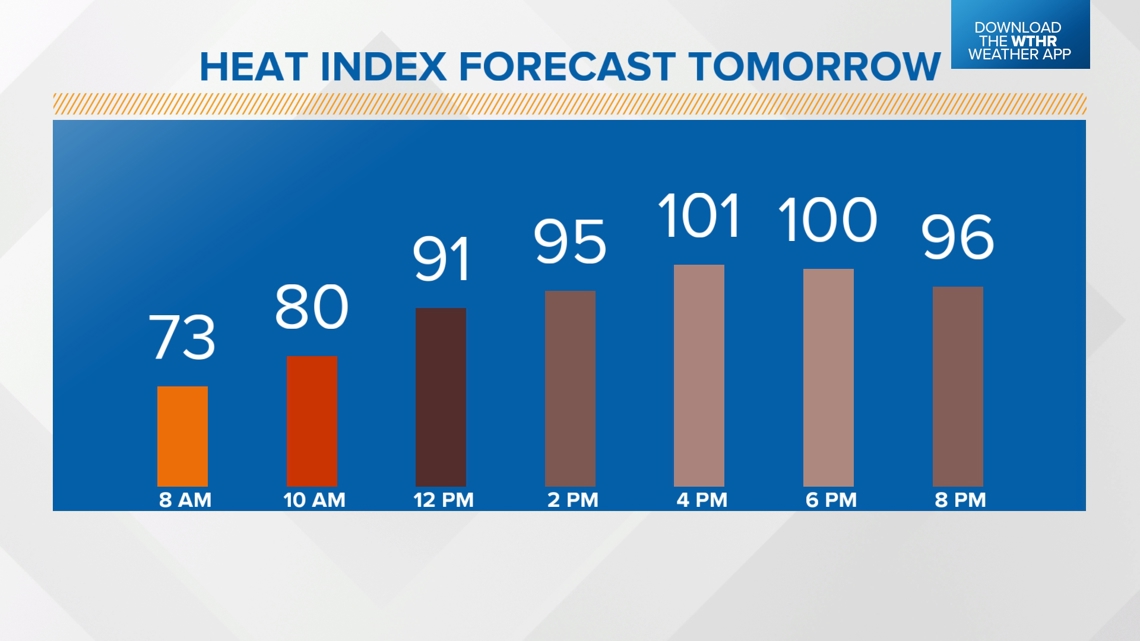
This hot and humid pattern continues into Sunday, but we're also watching a complex of storms tracking through the Midwest which could spark a few scattered storms in the early afternoon. Highs will be in the low 90s with peak heat indices up to 101.


How long is this stretch of heat going to last?
Monday looks to be the hottest/most humid day in this heat streak with highs in the low to mid 90s and heat indices up to 100-105 degrees.

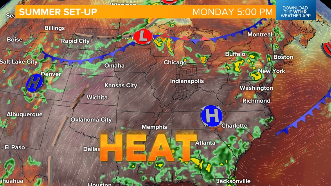
We'll see very similar conditions on Tuesday ahead of a cold front that will bring a chance of late day storms. Storms will again be possible Wednesday as the boundary continues to move through.

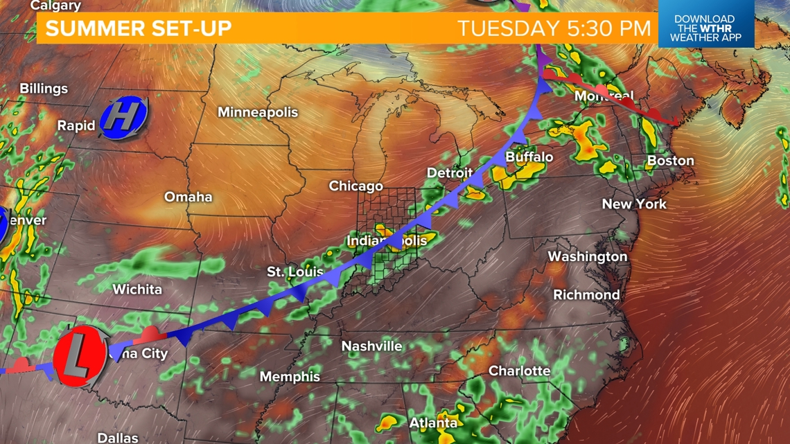
This will bring relief from the high heat and humidity as a more refreshing air mass takes over for Wednesday afternoon through the end of the work week.