INDIANAPOLIS — Today will be the transitional day, ending a seven-day stretch of 90+ degree days, as more seasonal temperatures and much drier air returns.

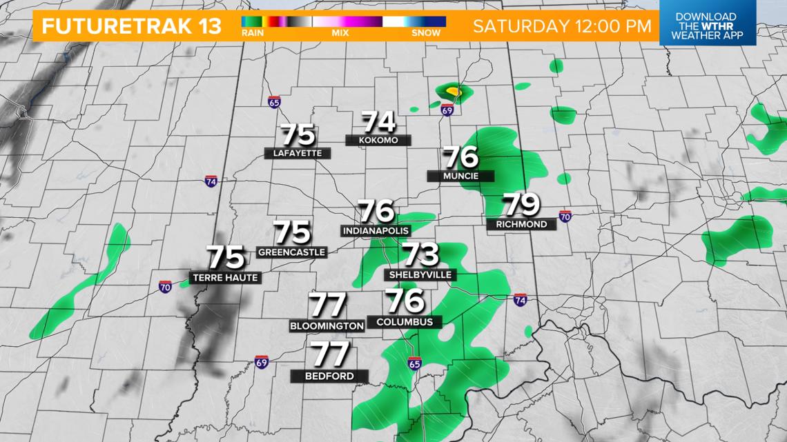
Saturday rain timeline:
- Scattered showers and isolated storms through midday
- Tapering off from the north to the south during the afternoon as the cold front continues to slide south
- Severe storms are not expected, but a few embedded thunderstorms could bring a lightning threat
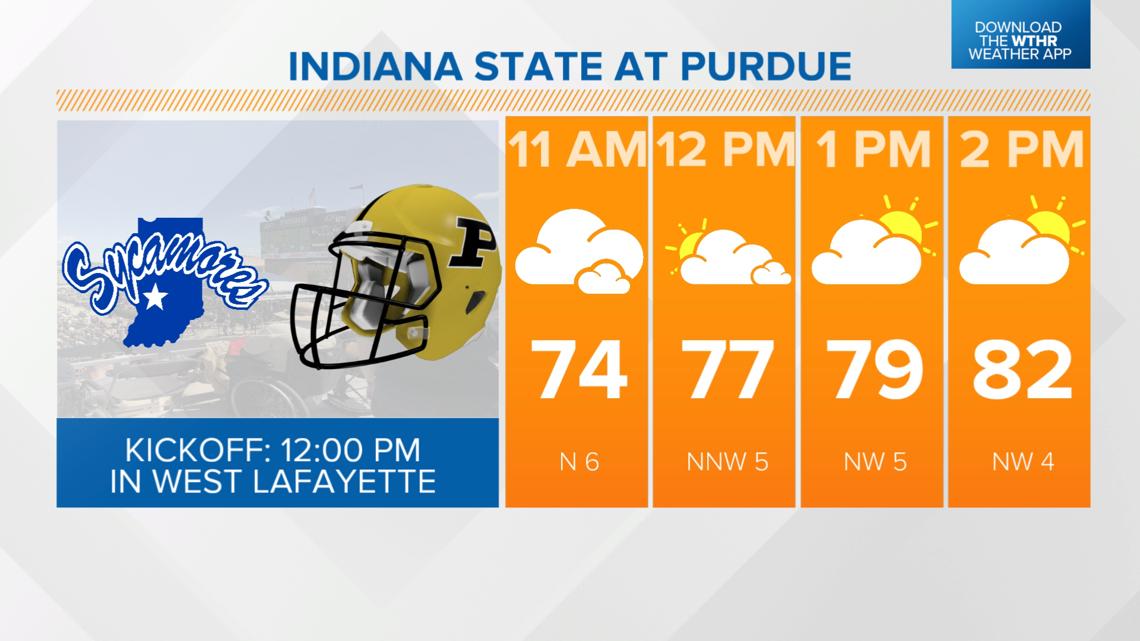
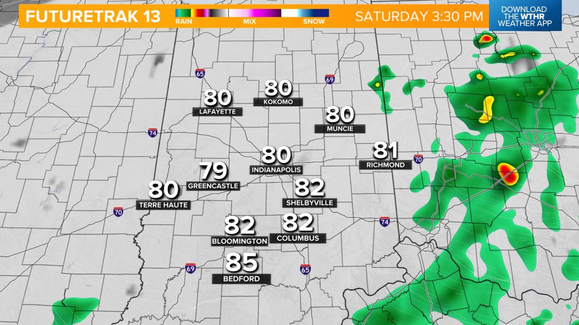
- With the exception of a stray shower during tailgate, Purdue hosting Indiana State looks mainly dry with temperatures recovering to the low 80s.


Since the cold front stalls in southern Indiana this afternoon, we'll keep a chance of an isolated shower or storm around during the IU football game today. Temperatures will hold steady in the low 80s.

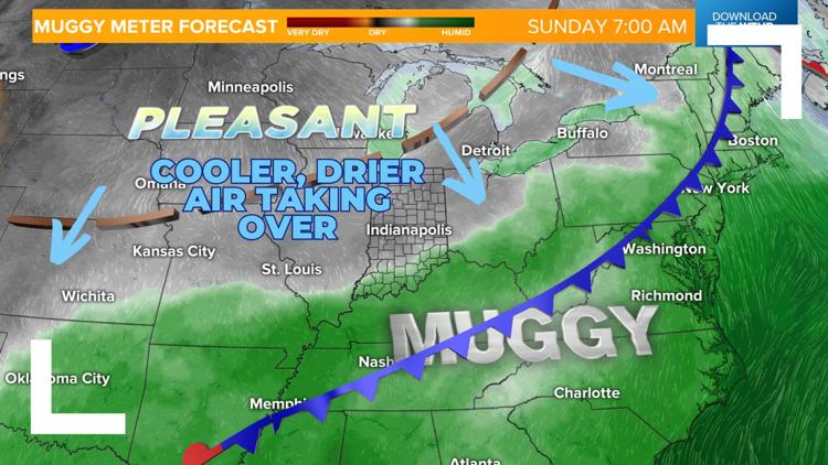
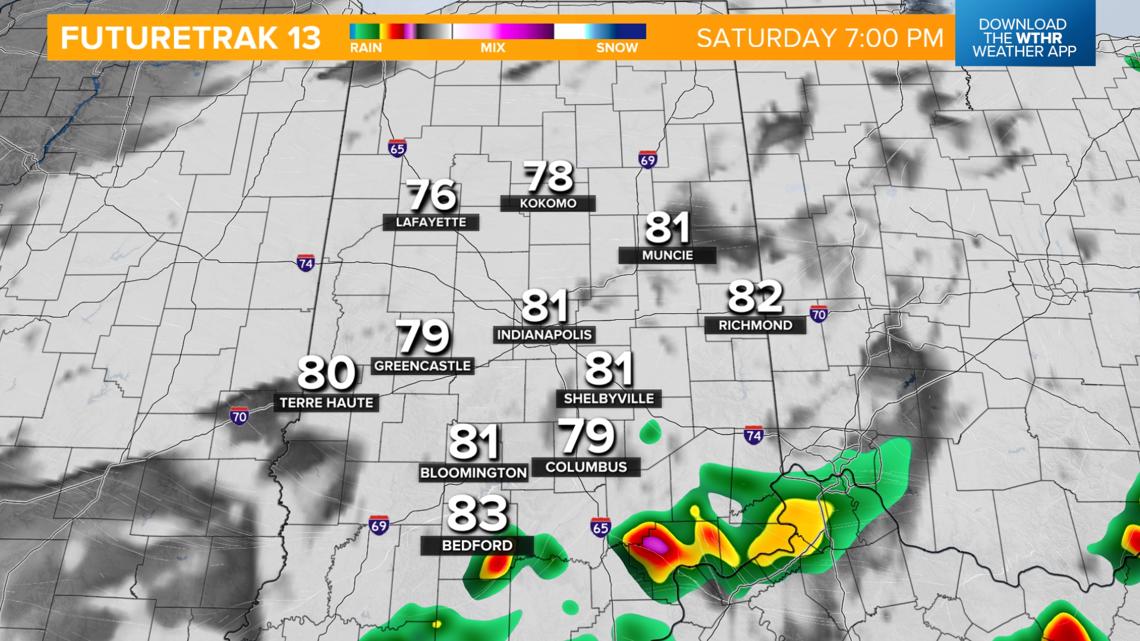
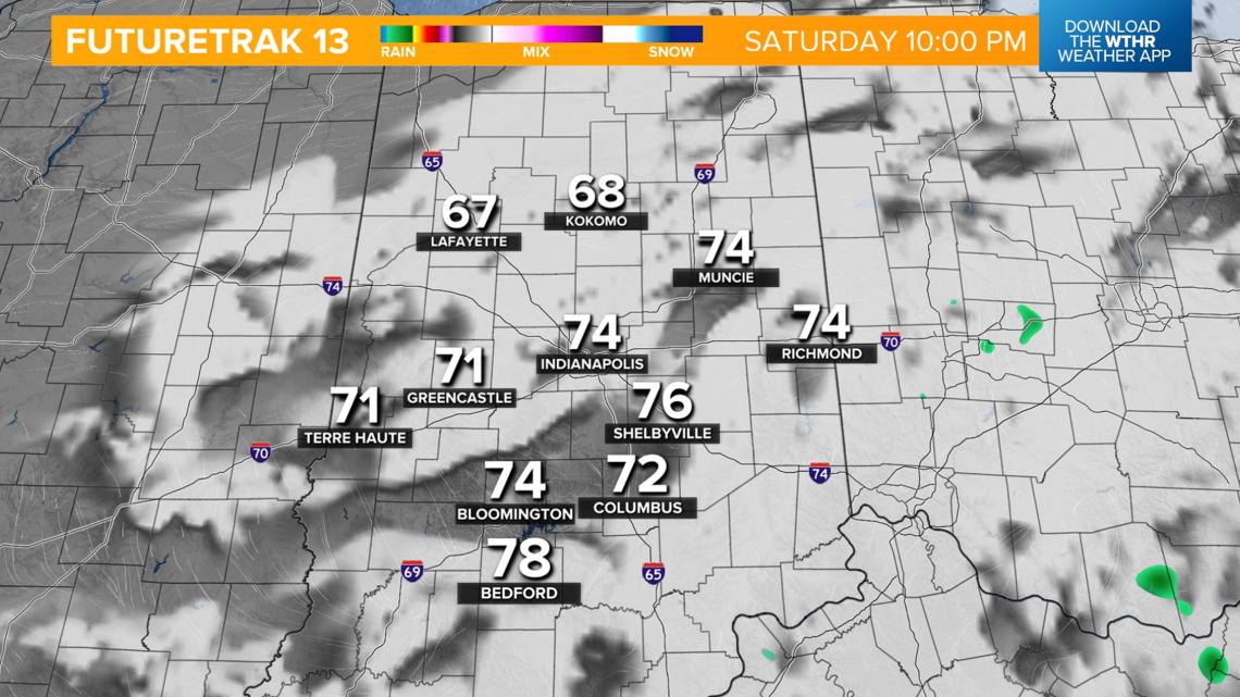
The best chance of an isolated storm tonight will be closer to the Ohio River Valley. Drier air continues to take over this evening, helping to clear the sky out. Temperatures will drop into the low 60s overnight.


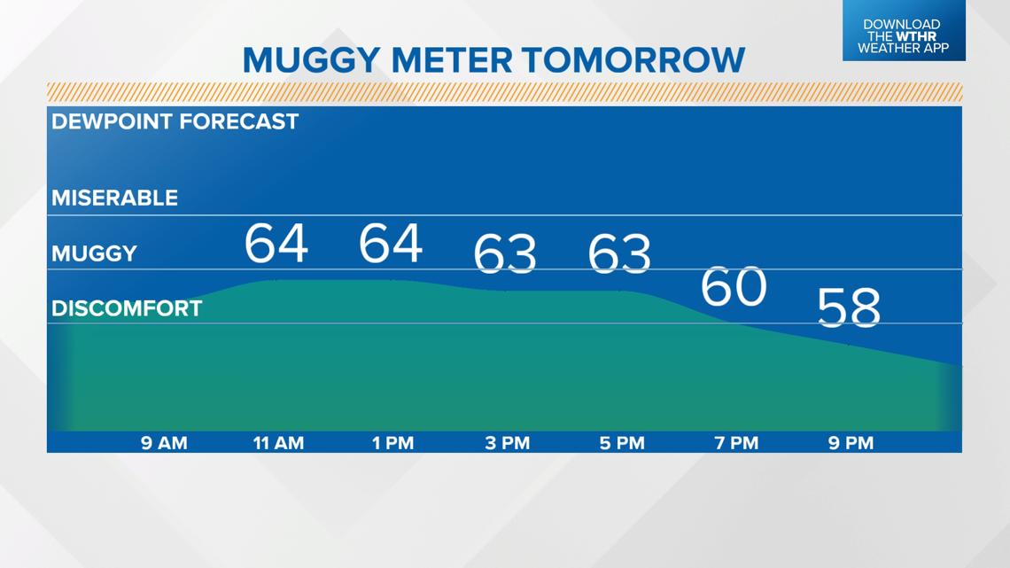
When will it become less humid?
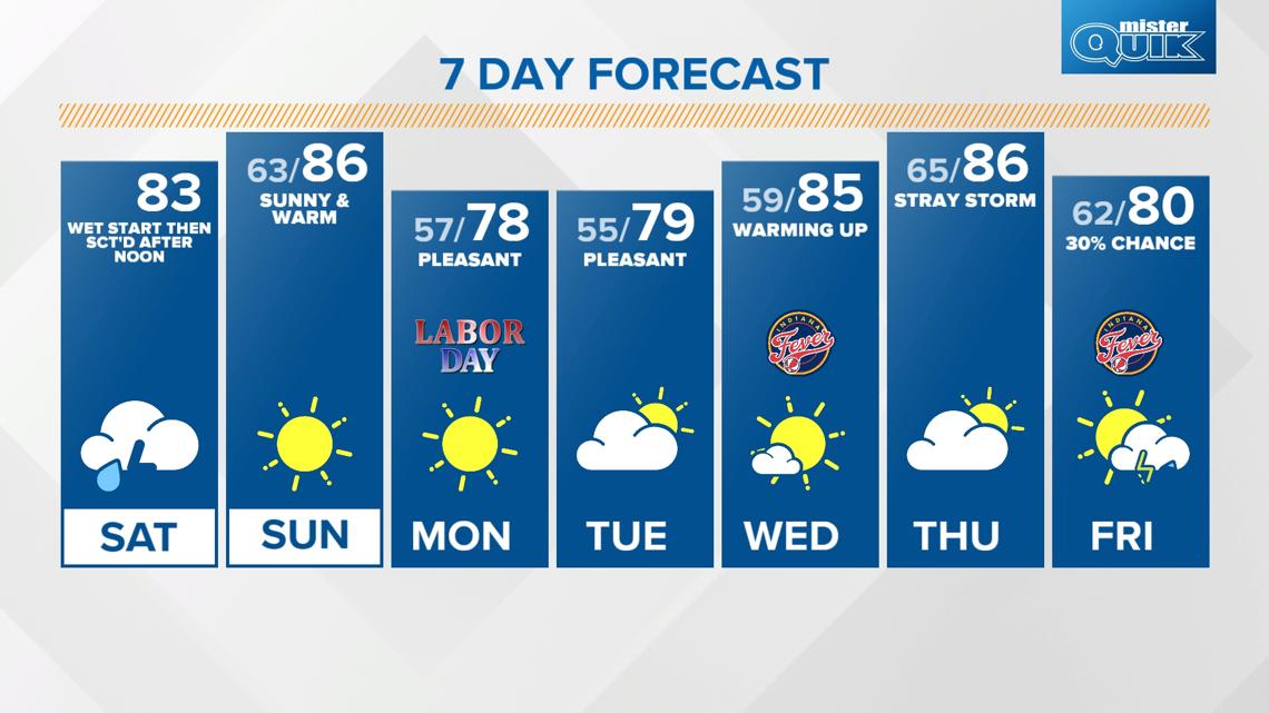
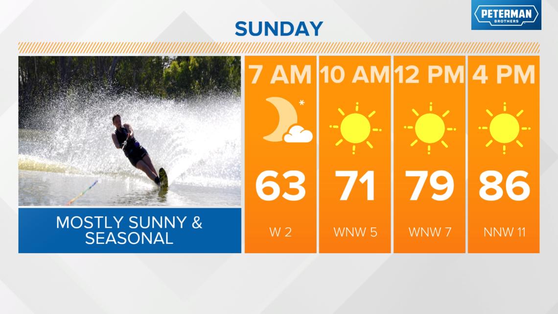
A secondary cold front will move through on Sunday, but this will be a dry front, only reinforcing the drier air mass taking over the area. Look for plenty of sunshine with seasonal highs in the mid-80s.


Labor Day brings below-average temperatures with low humidity and lots of sunshine. Highs will be in the upper 70s. We'll be in the upper 70s again Tuesday, with highs back in the 80s starting on Wednesday.