
INDIANAPOLIS — A complete of distinct cells dropped large hail Sunday in parts of central Indiana with the main swaths occurring from Summitville to Muncie, across western Franklin County, and a third in eastern Greene County.
The storm axis causing them is settling south of I-70 for the night and they'll continue to weaken/dissipate near/after sunset.
However, another round of scattered storms ahead Monday in the afternoon/evening.

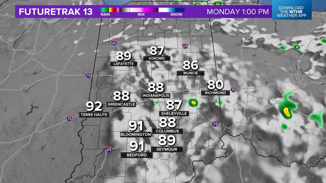

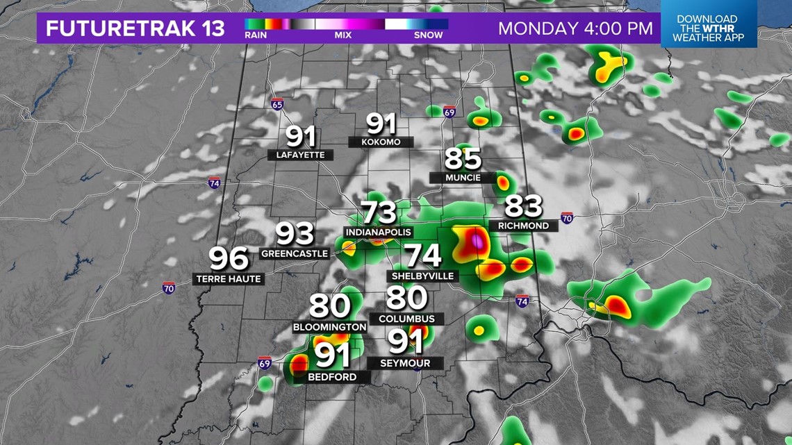

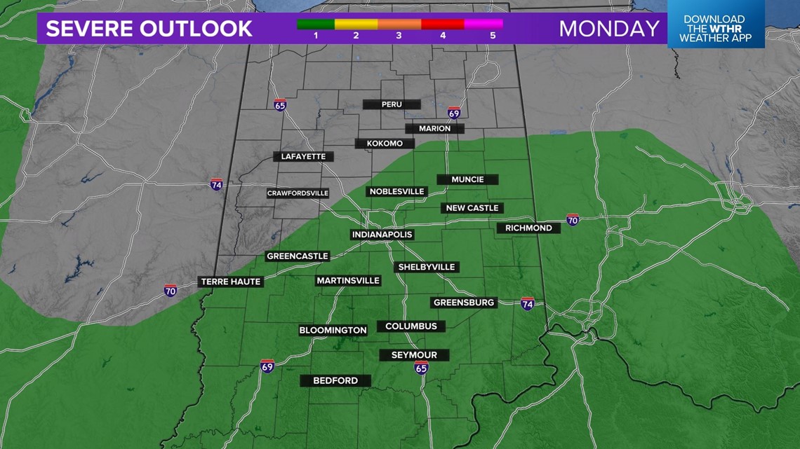
Like today, the storm that is expected to develop Monday could come with large hail and gusty winds, the main threats in addition to downpours/lightning that could impact some outdoor events.
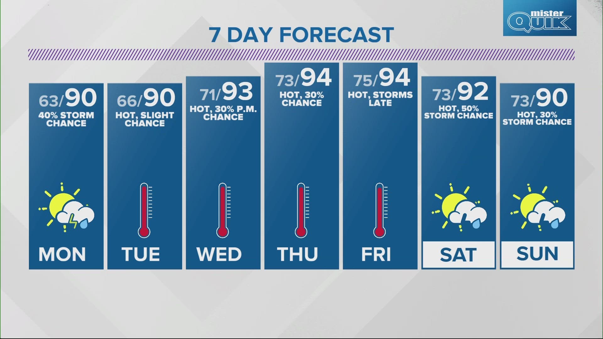
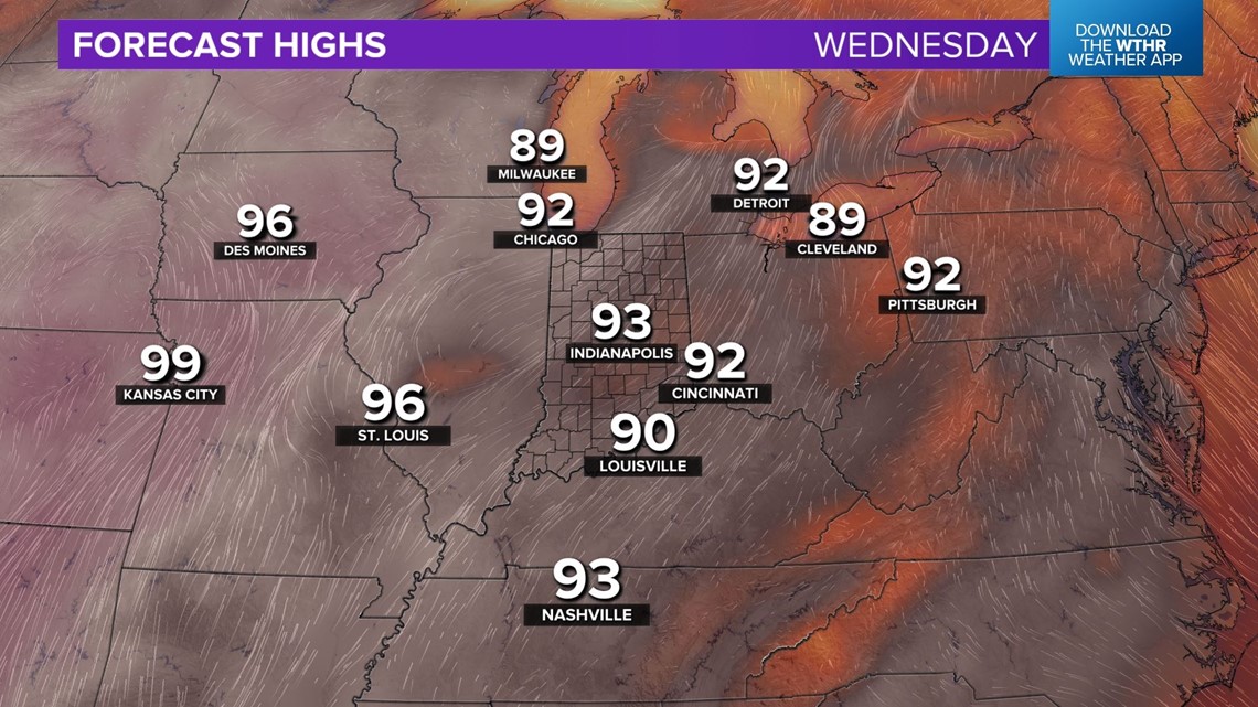
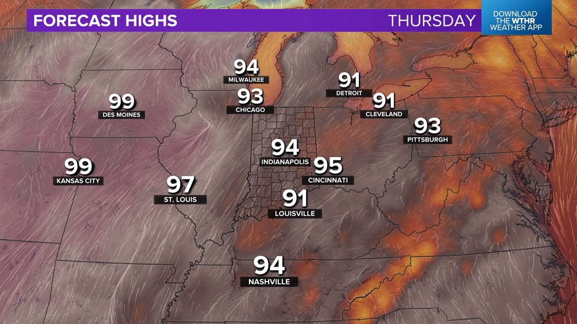
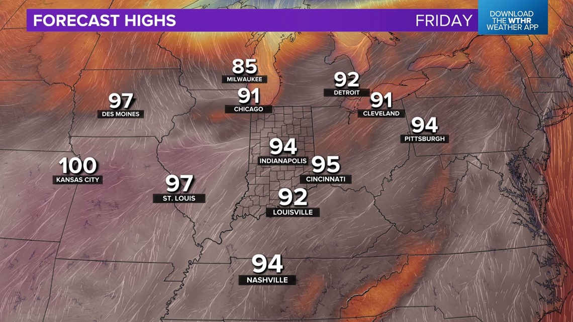
A bigger weather story locally will be our hottest streak of summer so far. Highs near 90 degrees Monday then go well into the 90s mid to late-week.
We're forecasting mid-90s Wednesday to Friday with heat indices near 100 degrees at times this week.

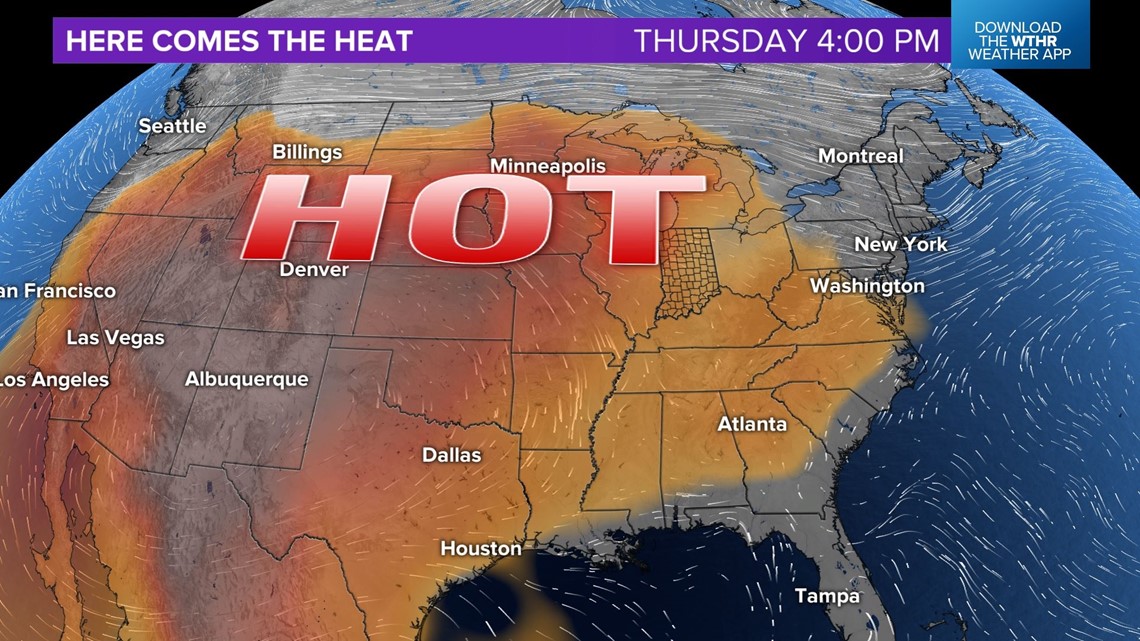


Heat Advisories and/or Heat Warnings could be issued for parts of central Indiana.
This coincides with the return of the Indianapolis Indians that have a six game homestand against the Louisville Bats starting Tuesday. The Indianapolis Colts summer camp begins Wednesday as well.
Plan on dressing comfortably to combat the rising temperatures this week with a daily chance of pop-up storms during peak heating hours.

