INDIANAPOLIS — You may have noticed the sky having a "milky" appearance yesterday, but you'll most definitely notice this today and tomorrow including more vibrant sunrises and sunsets.
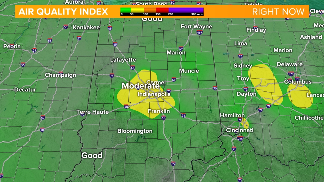
This haze in the sky is caused by a narrow plume of remnant wildfire smoke from western Ontario streaming into the Midwest along upper level winds. The good news is this smoke is expected to stay elevated in the upper atmosphere and will not bring air quality issues to the surface.

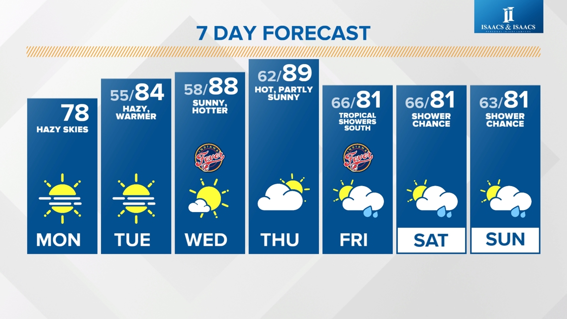
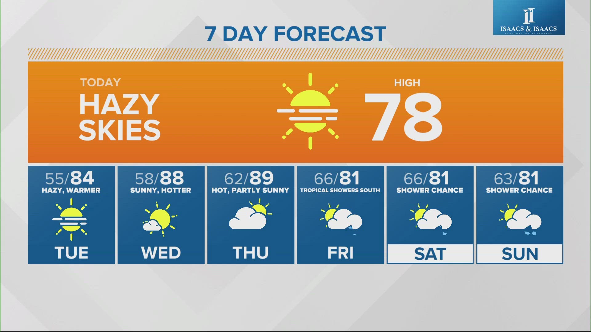
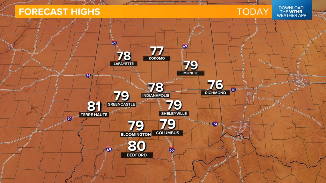
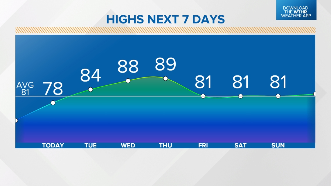
Heating back up starting today
A high pressure system will shift east of central Indiana today, forcing surface winds to become more southerly, pushing in warmer air.
- Highs in the upper 70s today
- Highs in the mid 80s on Tuesday
- Upper 80s for Wednesday and Thursday


Increased risk of fire danger Tuesday through Thursday
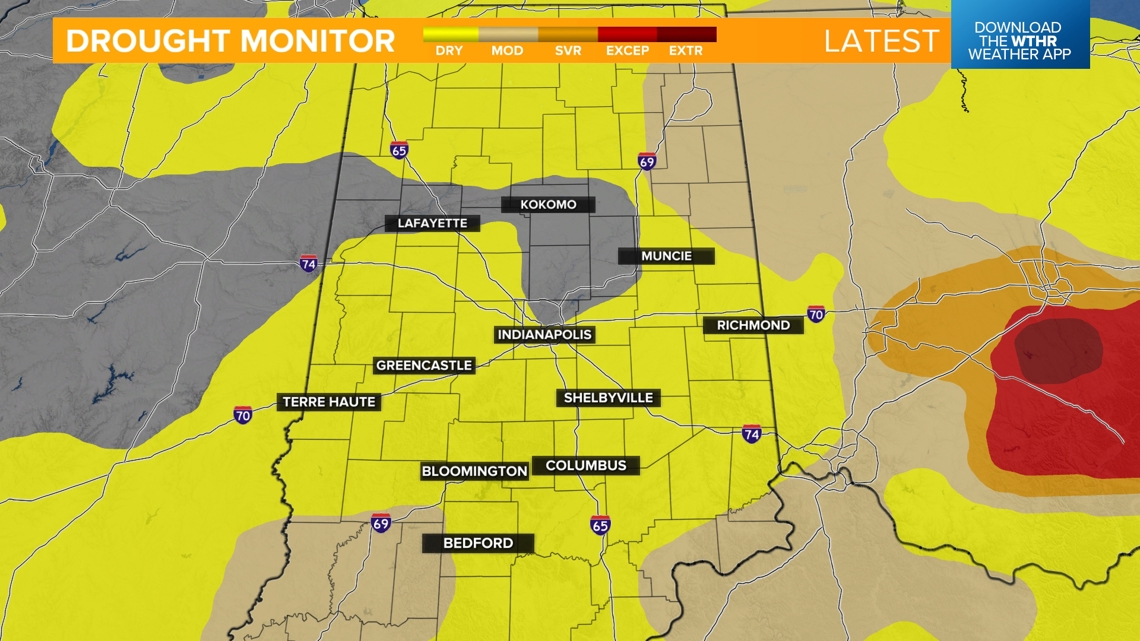
With a combination of abnormally dry conditions, low humidity levels (20-30%), and higher temperatures, we'll see an elevated fire danger/risk of rapidly spreading fires during this hotter streak. The National Weather Service recommends postponing outdoor burning at this time until we can get some rain.

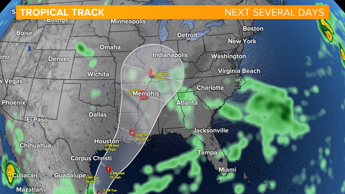
When will we have a chance at seeing some rain?
The next time we see rain looks to be dependent on a developing tropical cyclone in the western Gulf of Mexico. This system is expected to strengthen into a Category 1 hurricane making landfall near the Texas/Louisiana border Wednesday. This system will continue to weaken as it tracks northeast toward central Indiana. Only a slight chance of showers is in the forecast for now, and mainly across the southern tier of the state. We'll continue to monitor this storm track over the next few days.

Even though widespread rain isn't expected, increased cloudiness and cooler wind will cool temperatures off starting Friday and into next weekend with seasonal highs in the low 80s.