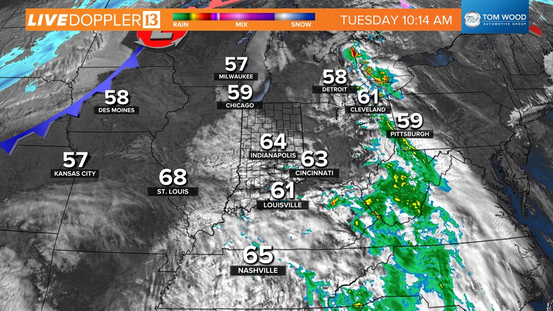
INDIANAPOLIS — Radar remains quiet in central Indiana at this hour and likely stays that until this evening due to the atmosphere being "capped" by a warmer layer of air aloft. This acts similarly to putting a lid on a pot of water on the stove to prevent the steam from coming out.
What's needed to break that cap is a trigger or lifting mechanism in the form of a front and/or a boundary. At this time, those are non-existent in central Indiana and why we expect quiet weather on radar for several more hours.


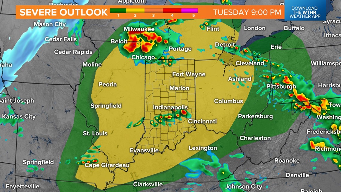

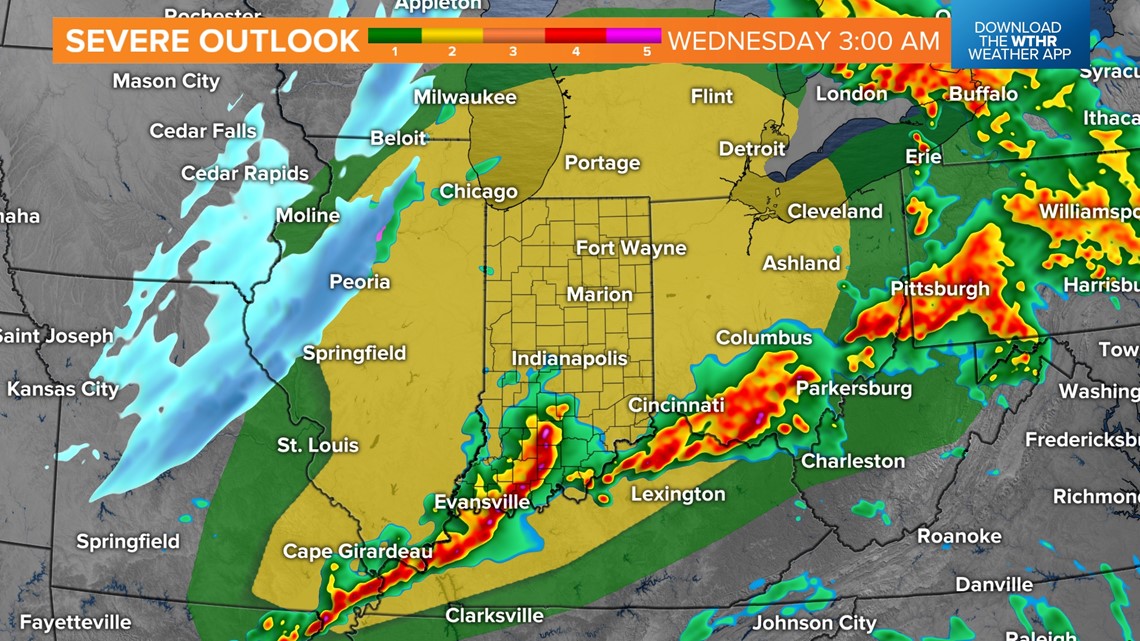
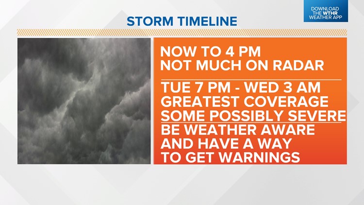
However, we urge you to remain Weather Aware with the expectation that storm coverage in our area maximizes in the 7 p.m. to 3 a.m. window, and any storm on radar at that time could produce all modes of severe weather including tornadoes and/or damaging hail.

Even this close to that time, there remains a high level of uncertainty of when/where storms will initiate/track due to a wide range of modeled solutions in guidance. It's conceivable that some places in our viewing area completely miss out on storms altogether the next 24 hours.
Two potential favored areas for storm development/coverage will be near Chicago-Michiana-Detroit, which are closer to a warm front.
And the other is near I-70 to the Ohio River, where upper-level wind increasing and a pre-frontal trough this evening could be the trigger needed to explode storms.

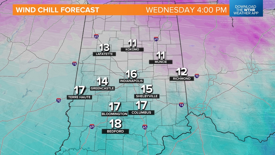

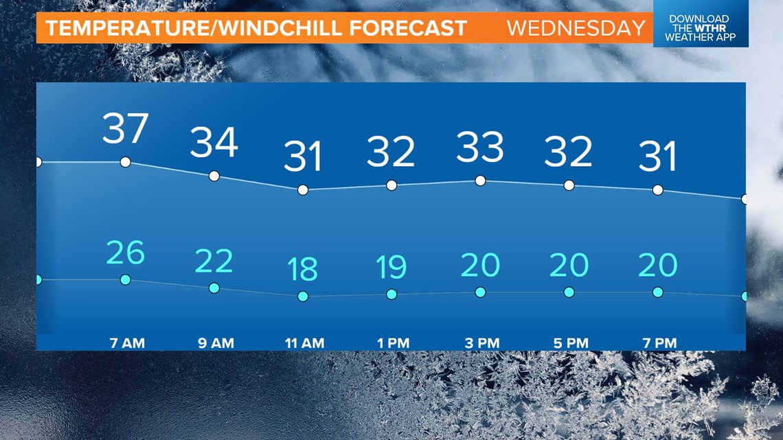
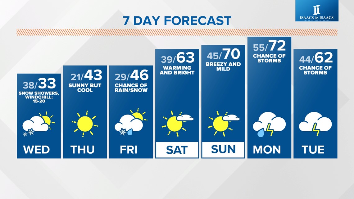
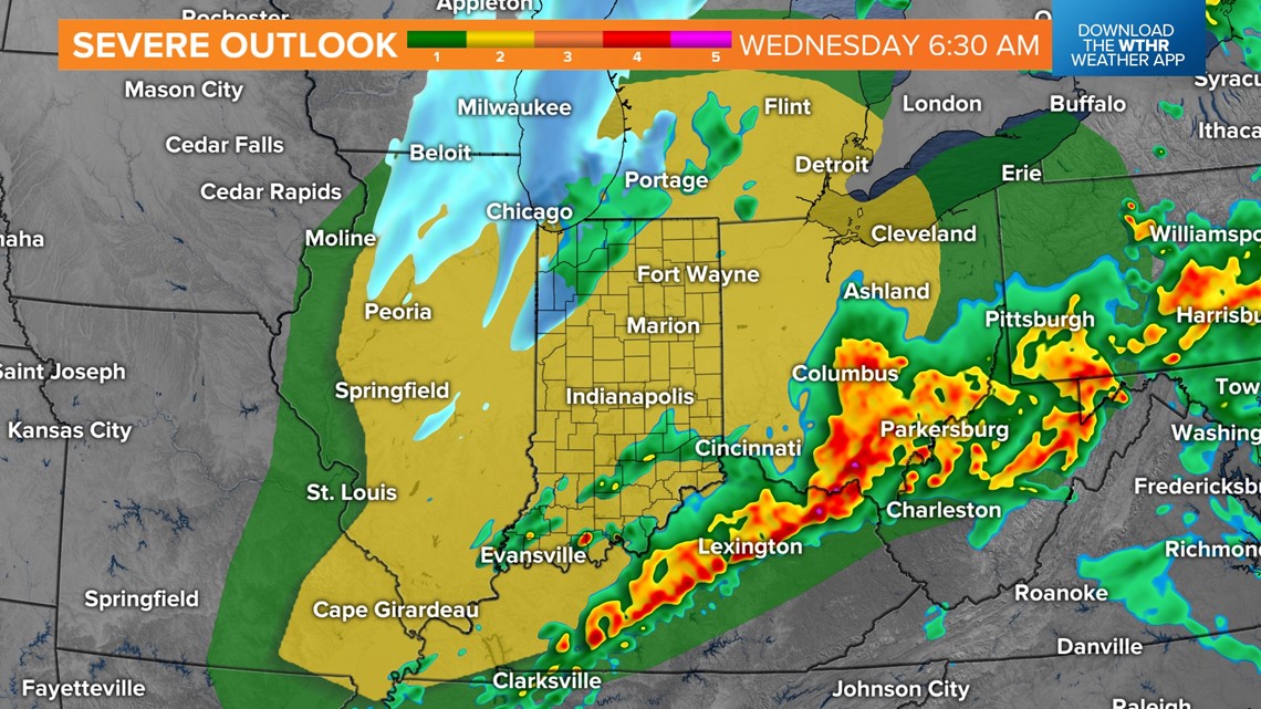
The severe threat diminishes by 4-5 a.m. Wednesday as much colder air arrives in the wake of a cold front moving through the state. Wind chills tomorrow make it "feel" some 60° colder in less than 24 hours of highs breaking record-warm levels.
Please stay tuned for updates.