INDIANAPOLIS — We had deceiving sunshine in central Indiana to finish the weekend. Despite the bright sky, a windshift to the north-northwest delivered a much cooler afternoon in the 50s versus the 70s of Saturday afternoon.
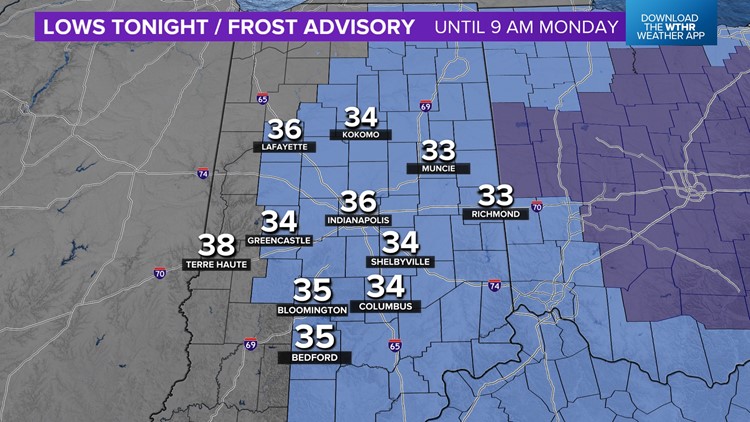
With a mainly clear sky and calming wind, we're forecasting our coldest temperatures since late April, with lows in the mid to low 30s come Monday morning.
As a result, the first Frost Advisory of the season is in place between 2 a.m.-9 a.m. Monday. Protect any plants that you'd like to save.

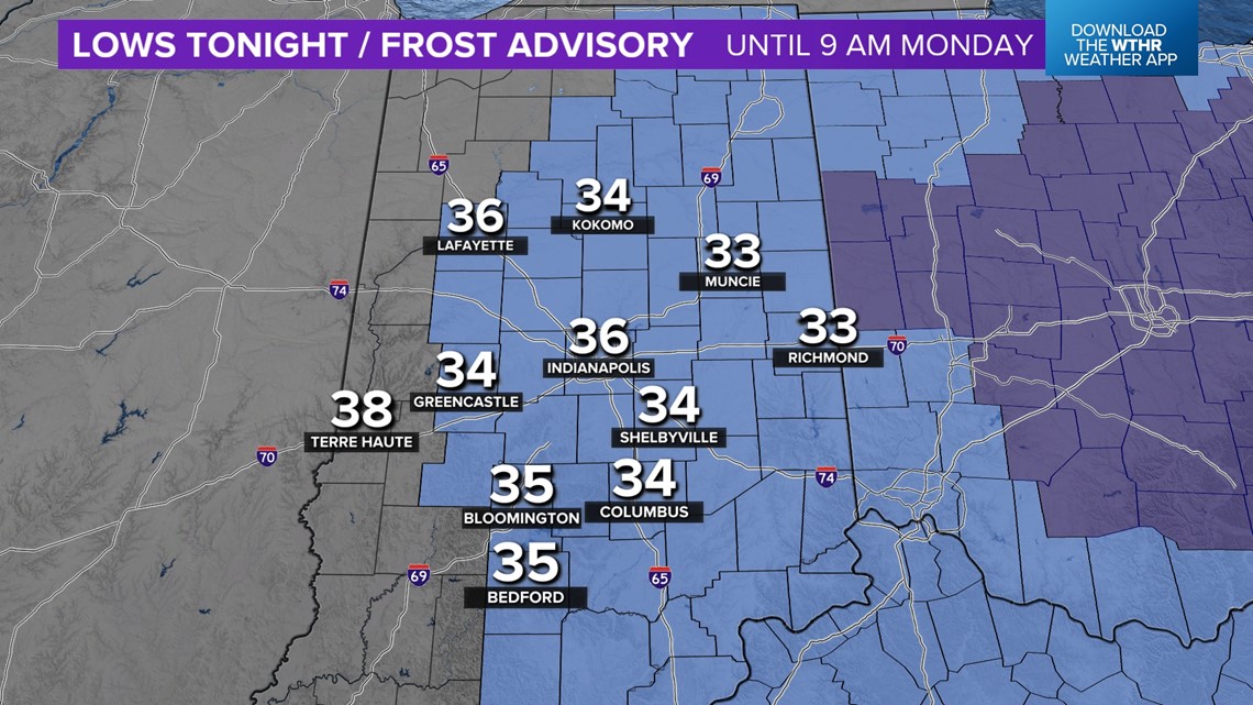

This is very common for this time of year, with the climatological average first date of 36 degrees in Indianapolis on Oct. 17.
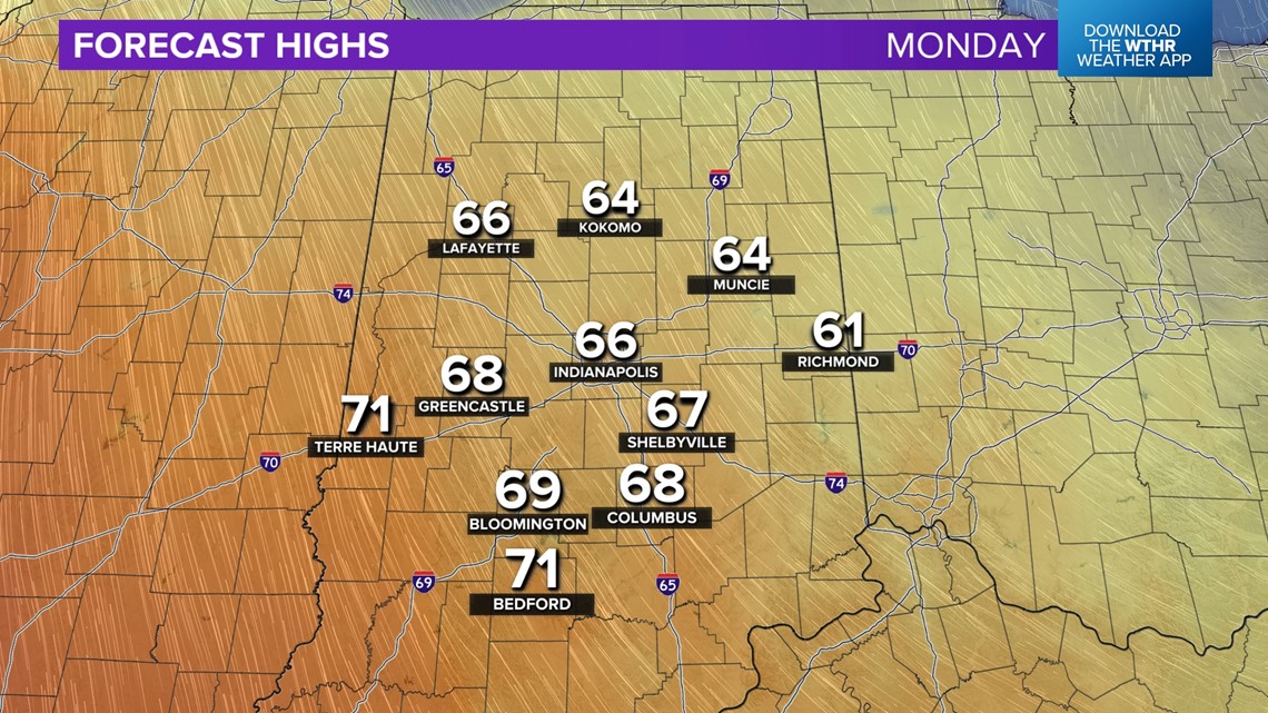
After some morning frost, expect a pleasant temperature recovery into the mid/upper 60s Monday afternoon, with decent sunshine, too. This marks the beginning of a multi-day streak of above-average temperatures.

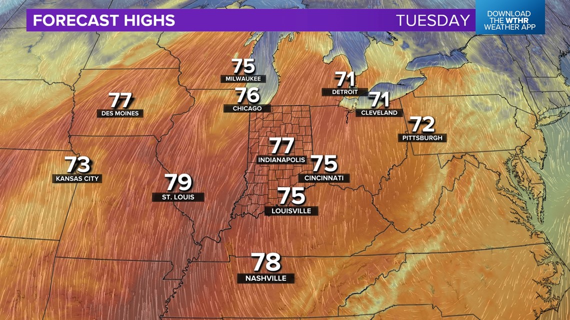

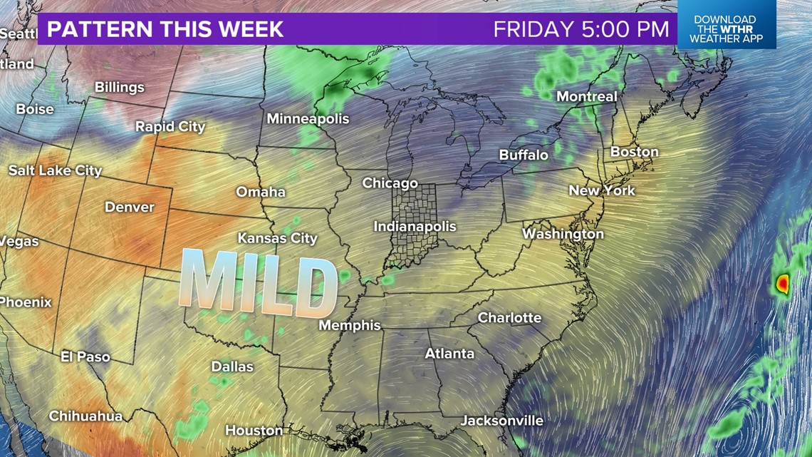

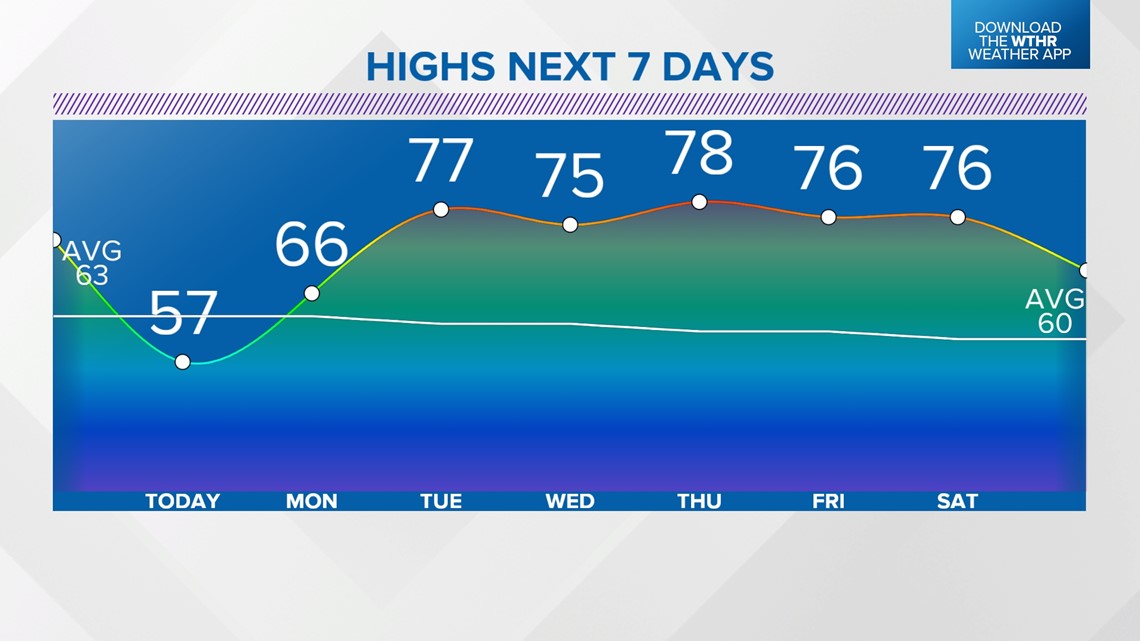
We're forecasting highs in the mid/upper 70s beginning Tuesday and lingering into at least Saturday of next weekend. That's a good 15 degrees above average of highs in late October. Even low temperatures climb into the upper 50s/lower 60s, which will be well above average for this time of year.

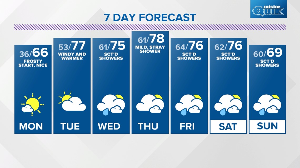
There will be occasional periods of showers, with the first chance arriving Wednesday. As of now, modeling suggests the balmy pattern snaps, with a sharp cold front sometime early next week. If that verifies, we could be staring down a chillier setup for Halloween — and possibly some rain during the transition.