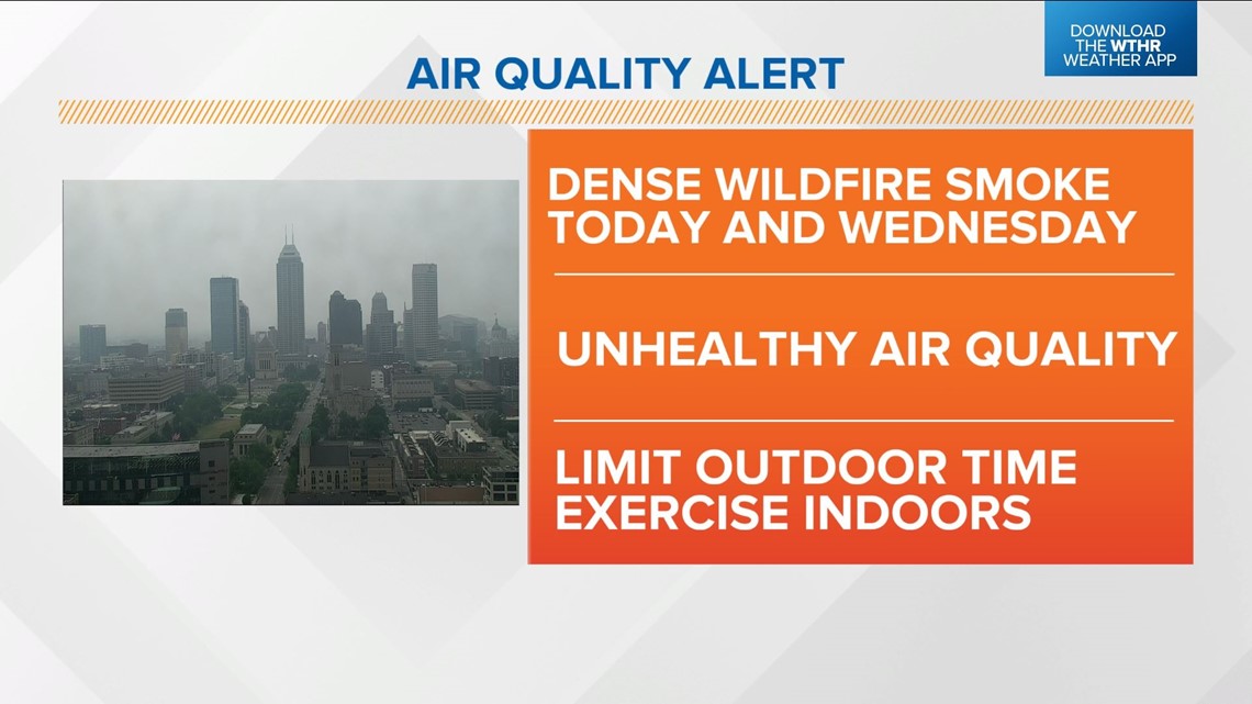
INDIANA, USA — You can add today and Wednesday to the long list of lost "Blue Sky Days" this year from remnant Canadian wildfire smoke.
Unfortunately, this latest round is the most dense we've seen locally all season, and it's producing the most poor air quality we've had to date this year.
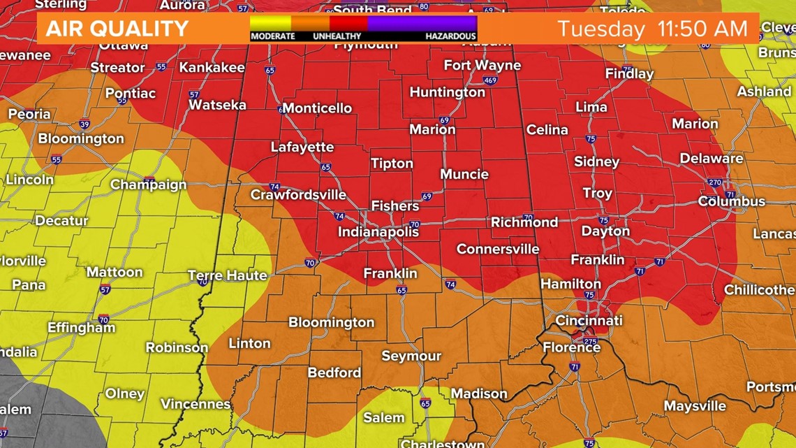
At the time of posting, Indianapolis' AQI was 166, and most of the WTHR viewing area had unhealthy air quality — which is the red area on the map below.
An Air Quality Alert is now in effect until Wednesday night. If you have a sensitive respiratory system, you're advised to limit outdoor time, and even if you don't, you may consider limiting exercise time outside.


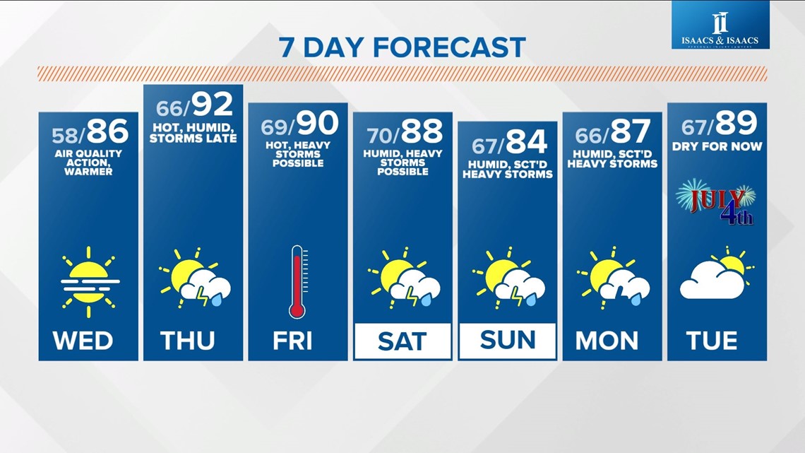
This latest bout of smoke should gradually diminish later in the week as the weather pattern shifts to a more stormier setup.
We're still expecting uncomfortably humid air and hot temperatures to spread into central Indiana Thursday into Friday.
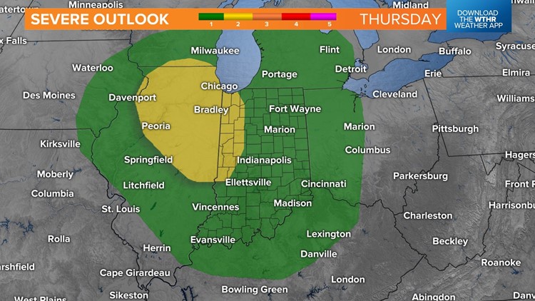
This coincides with what could be the first of several heavy storm clusters to bubble up on the edge of extreme heat and instability that will be draped just to our southwest.
This is a fairly common summertime setup that's called the "Ring Of Fire" pattern as storm complexes erupt on the edge of the "capped" hot dome centered over the southern tier.
Specific timing, location, severity and local impacts are uncertain, but it will be a good idea to monitor our forecast for updates as we narrow down if/where these stormy episodes occur.
Please know that we don't envision any all-day rains, but definitely the possibility of more than one bout of heavy storms between Thursday and the end of the holiday weekend.