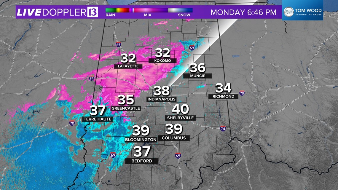
INDIANAPOLIS — The well-advertised ice setup for this evening into the Tuesday morning commute is taking shape. Temperatures in the upper 30s and relatively drier at the surface bought some time for Indy and points east. But that window will close quickly between now and 10 p.m. as the atmosphere moistens up and produces rain/freezing rain.
RELATED: List of closings and delays
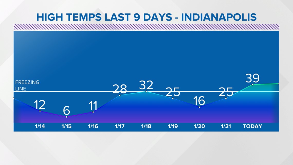
As we've noted the past several days, though air temperatures may be near/just above freezing during some of this precipitation, the ground/subsoil remains frozen as nearly 10 straight days of a deep freeze that also included several days of single-digit and sub-zero temperatures.


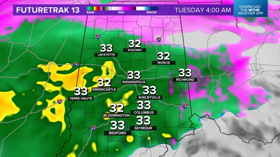

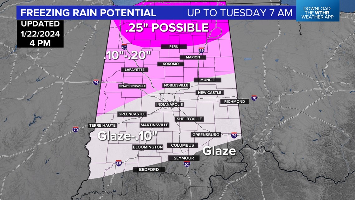
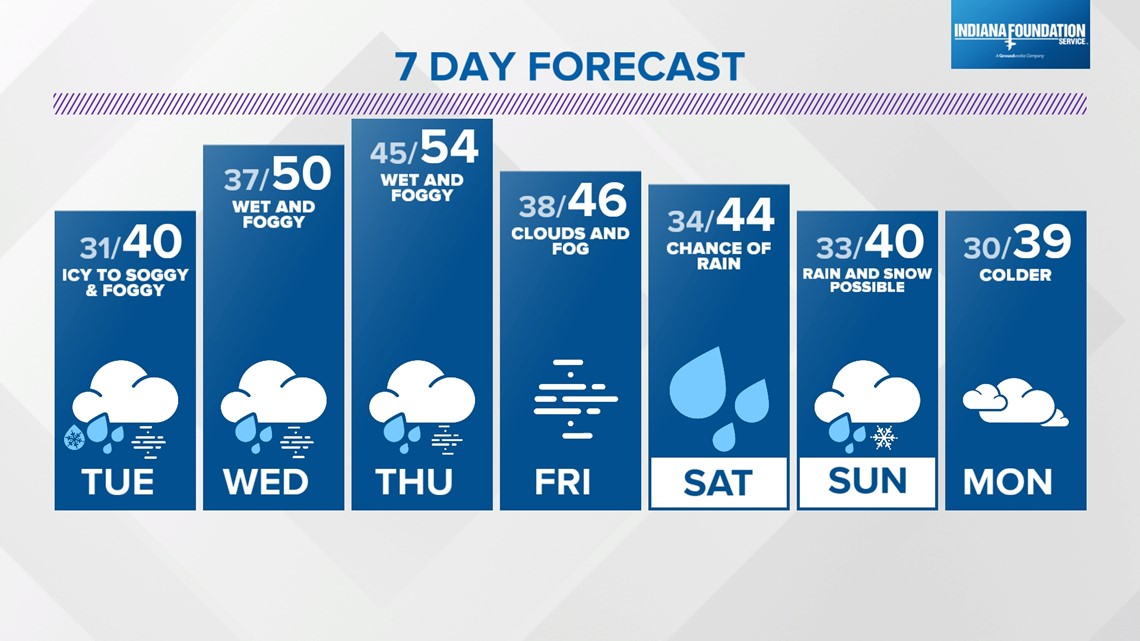
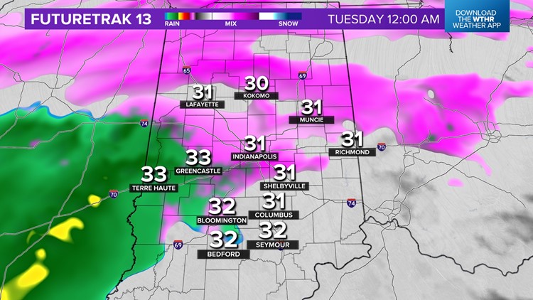
There will be a lag effect in warming that layer and that's problematic for tonight with steadier precipitation developing and lasting into Tuesday morning. Untreated will become icy and hazardous. Make preparations for school delays and/or closures. Ice amounts range from a glazing south-southeast, to around .10" in Indy, up to .20" north-northwest. It's important to remember that even a glazing of ice on road/sidewalks can be dangerous.

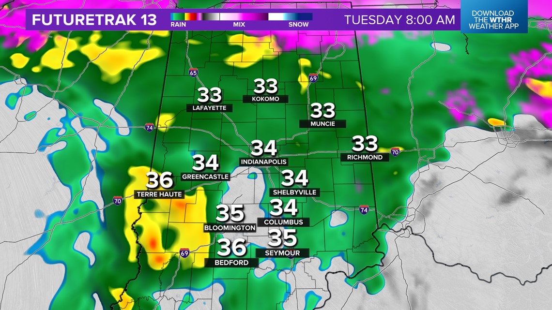

At some point Tuesday morning, specifically when to be determined, frozen ground responds to warming air above it and ice quickly becomes liquid. That's highly uncertain to pinpoint until it starts happening. Be mindful that roads may look wet, but actually be a sheet of ice. Same for steps, sidewalks, and driveways.

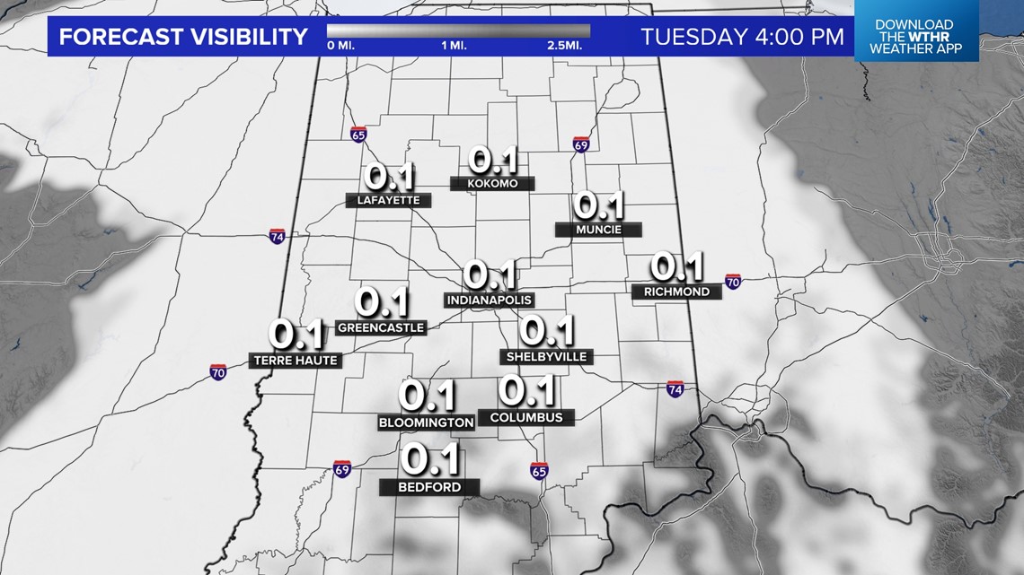
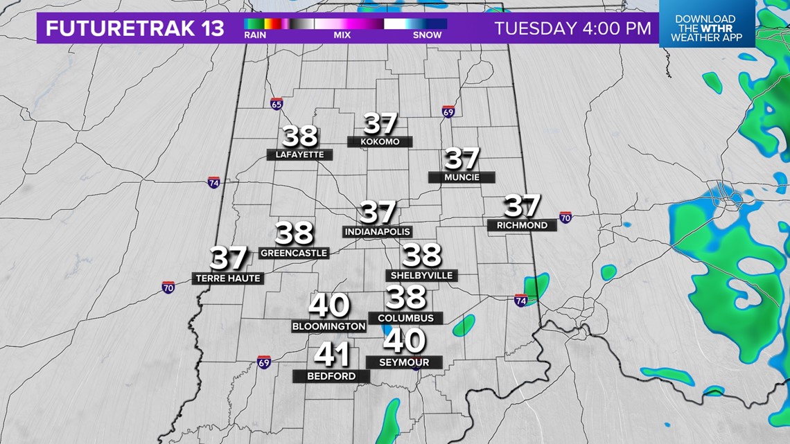
After an icy morning the focus quickly shifts to fog (possibly dense) developing Tuesday afternoon. Near-zero visibility conditions could emerge as the warmer air flows over the much colder ground then condenses into a near-surface cloud deck. Model soundings suggests this layer will likely linger for several days and we're forecasting dense fog days into Friday morning.

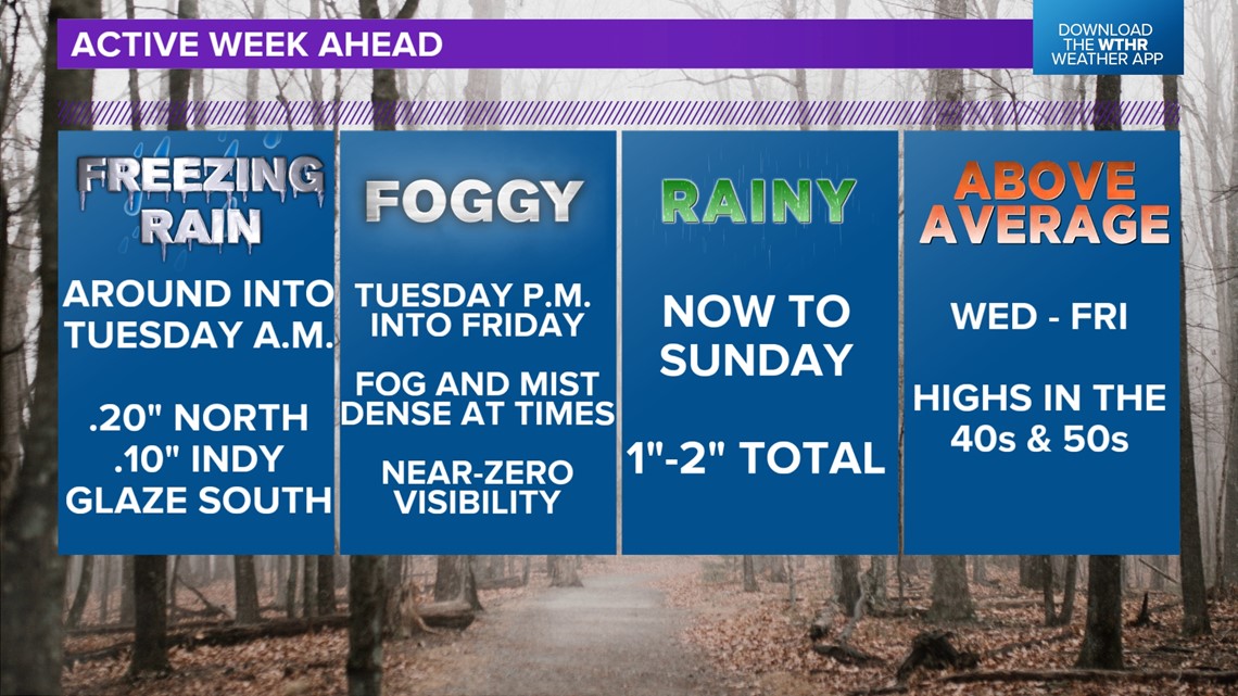
So additional school delays will likely the remain of the week. At the same time, temperatures continue warming into the 50s mid-week before cooling this weekend with another storm system. Please remain Weather Aware and check on road conditions before heading out and knowing that those conditions could change quickly.