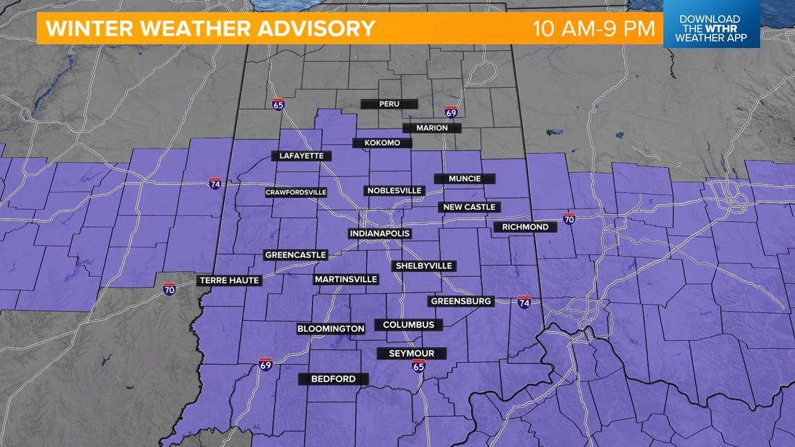
INDIANAPOLIS — Well, it looks like our February filled with above-average temperatures comes to a huge ending today. As snow moves into Indiana this morning, the National Weather Service has issued a Winter Weather Advisory for much of the state until 9 p.m.
Here is why:
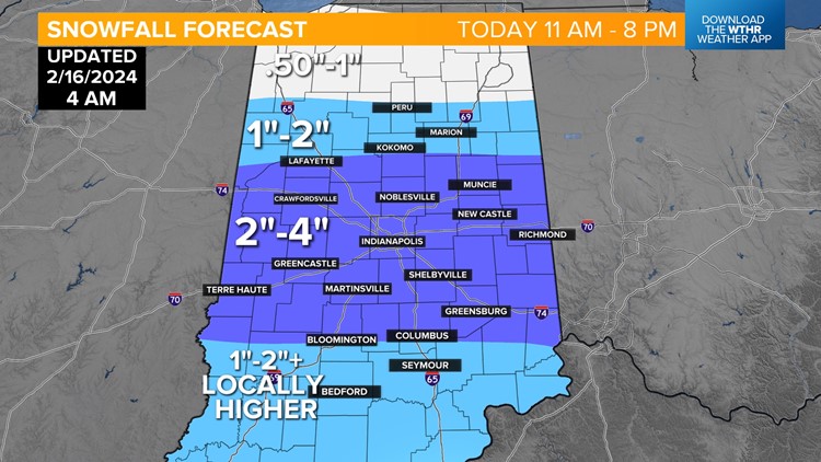
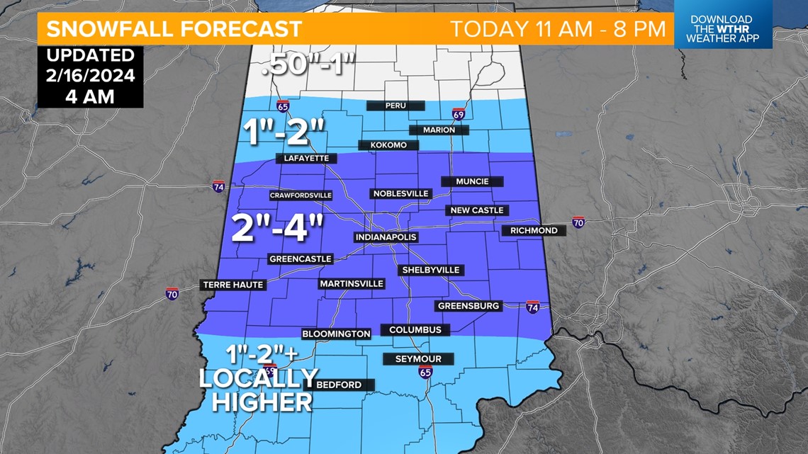
- What: Snow expected. Accumulations 1"-3" are likely.
- Where: Portions of central, east central, north central, south central, southeast, southwest and west central Indiana.
- When: From 10 a.m. this morning to 9 p.m. ET this evening.
- Impacts: Plan on slippery road conditions. The hazardous conditions will impact the evening commute.

With the snow arriving later this morning, look for some pretty slick conditions during the day. Temperatures will be worth watching because they will be hovering around the freezing mark, then slowly rising this afternoon.

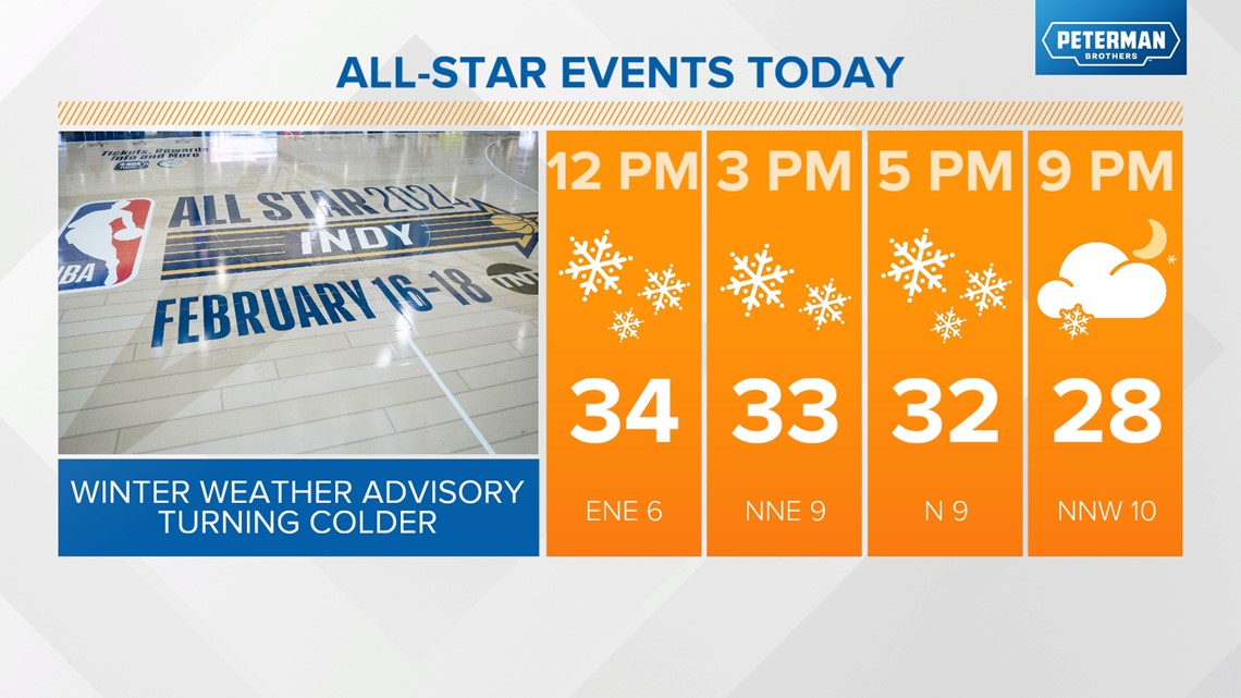
Road surfaces may be cooler then air temps, so that could lead to a lot of slickness. Be careful. The snow will accumulate, but because of wet conditions, will also melt quite quickly.

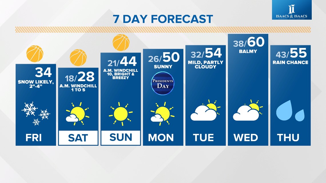
As the cold air blows in back of this system, Saturday will be the coldest day of the month so far. We will stay in the 20s all day long, and the sun will not help us much.
If you are longing for a return to the warmth of the past few days, it will not be a long wait. Sunday, we are back into the mid-40s, and by Monday, temps rise to the 50s. Look for a 60-degree high with sunshine Wednesday.
Again, this is going to be a wintry next couple of days, so remember the Winter Weather Advisory, and make sure you download the Live Doppler 13 Weather App for the latest weather updates.

