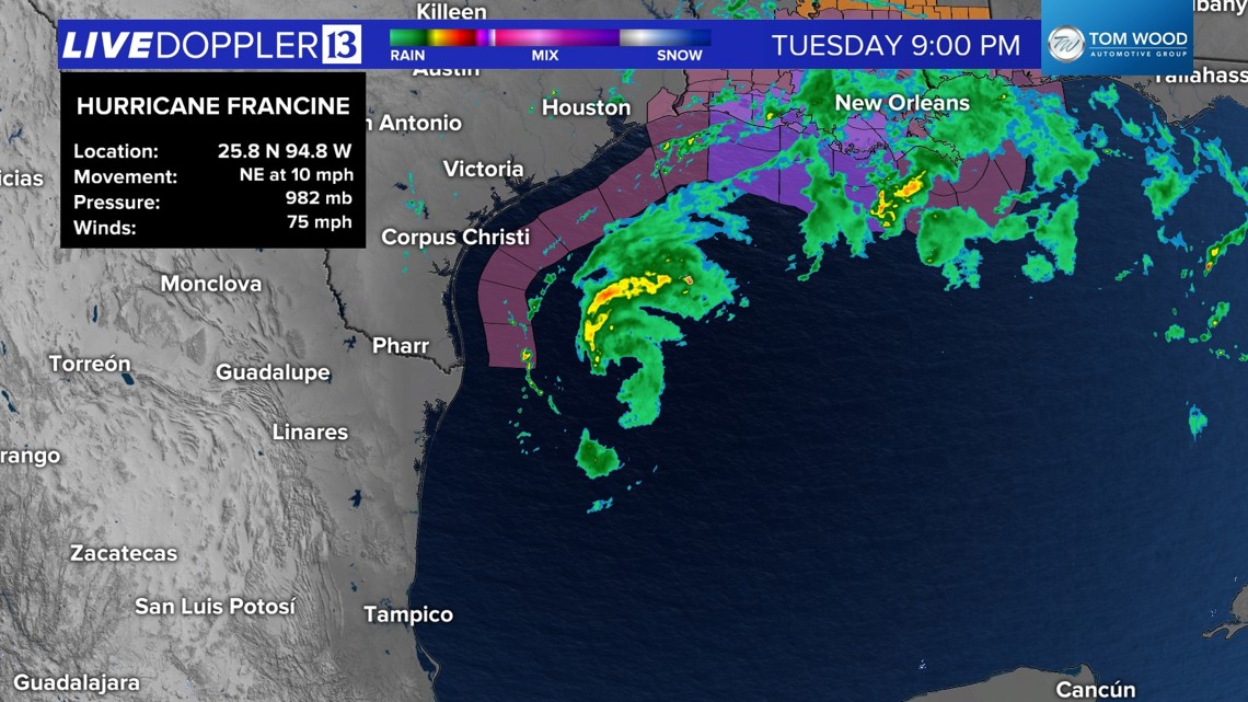
INDIANAPOLIS — Francine is now a Category 1 hurricane and is forecast to make landfall near New Orleans Wednesday afternoon/evening. There is still the potential the storm strengthens to a Category 2 before landfall. Rainfall potential of 6-12+ inches, tornadoes, damaging winds, storm surge and flooding are the threats along the Gulf Coast.

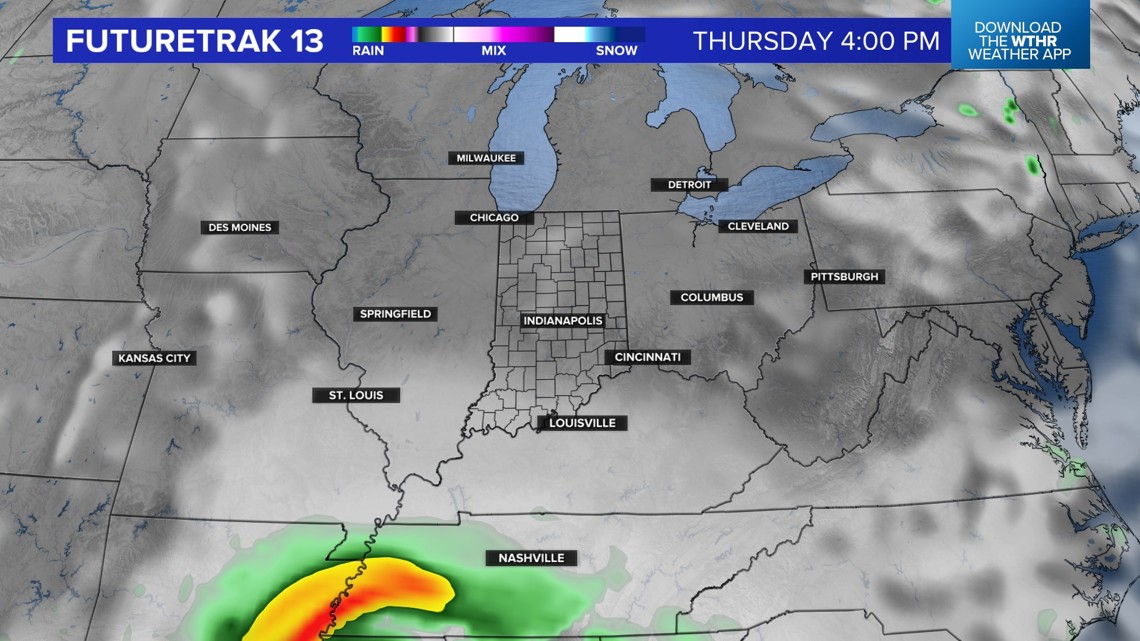
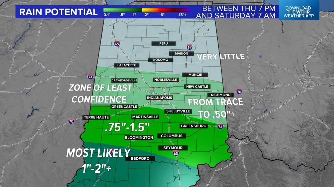
This storm will weaken and drift north and in our direction later this week. The tropical moisture will run into very dry air and the storm itself will become disorganized. All of this will reduce the amount of rain we get here in central Indiana.


We need the rain. August ended an inch below average and September is running an inch below average so far.
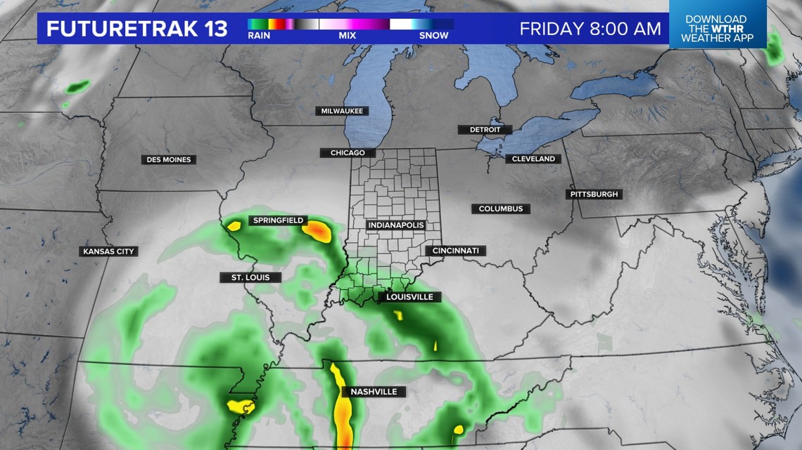
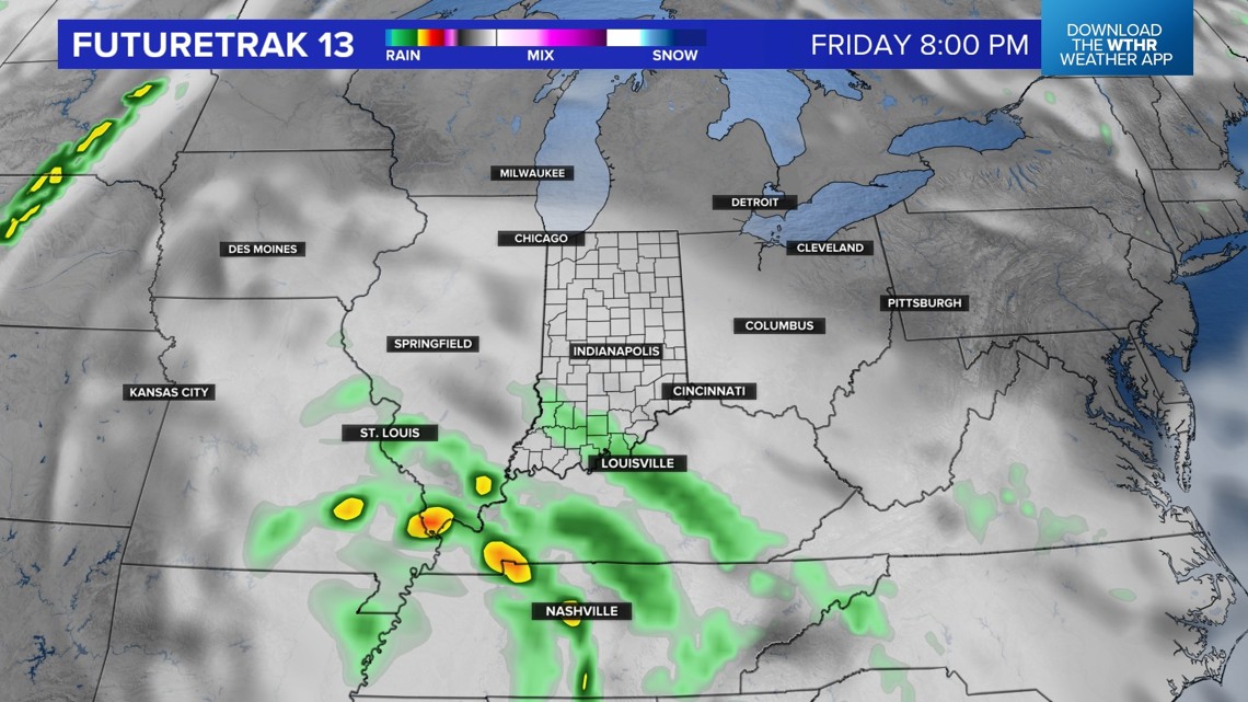
There will be a chance of rain on Friday, but the steadiest will fall across southwestern Indiana. Stay tuned for updates. A lot can change, especially with a tropical weather system.

Tuesday night: Mainly clear with lows in the 50s
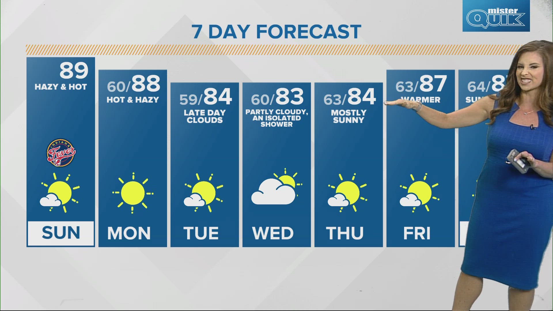
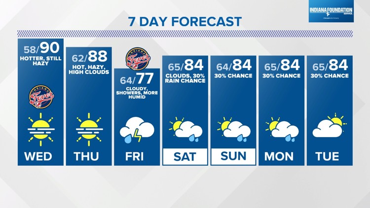
Wednesday: Warmer with highs near 90 (a layer of smoke may impact air quality later in the day)
Thursday: Increasing clouds with highs in the 80s
Friday: Scattered showers and storms; steadiest rain southwest