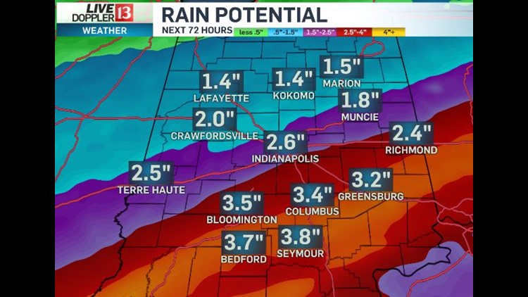
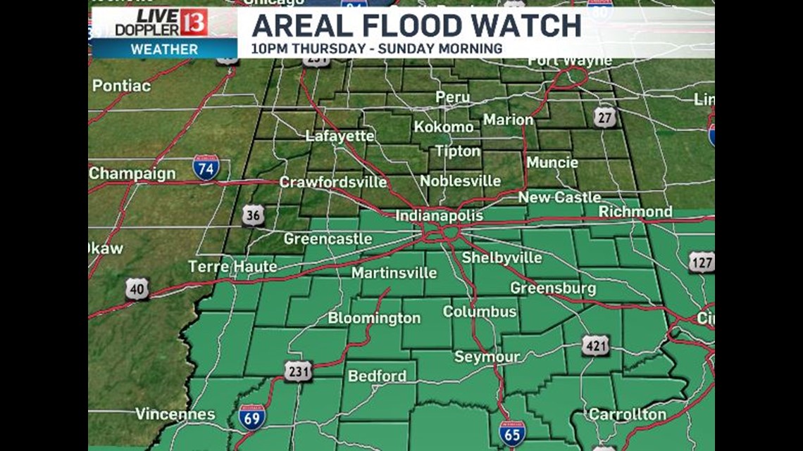
As advertised the past several days...the heaviest rain and rain rates the next 60 hours along/south of I-70. This is area is a under an Areal Flood Watch that begins tonight at 10pm and lasts until 7am Sunday morning.


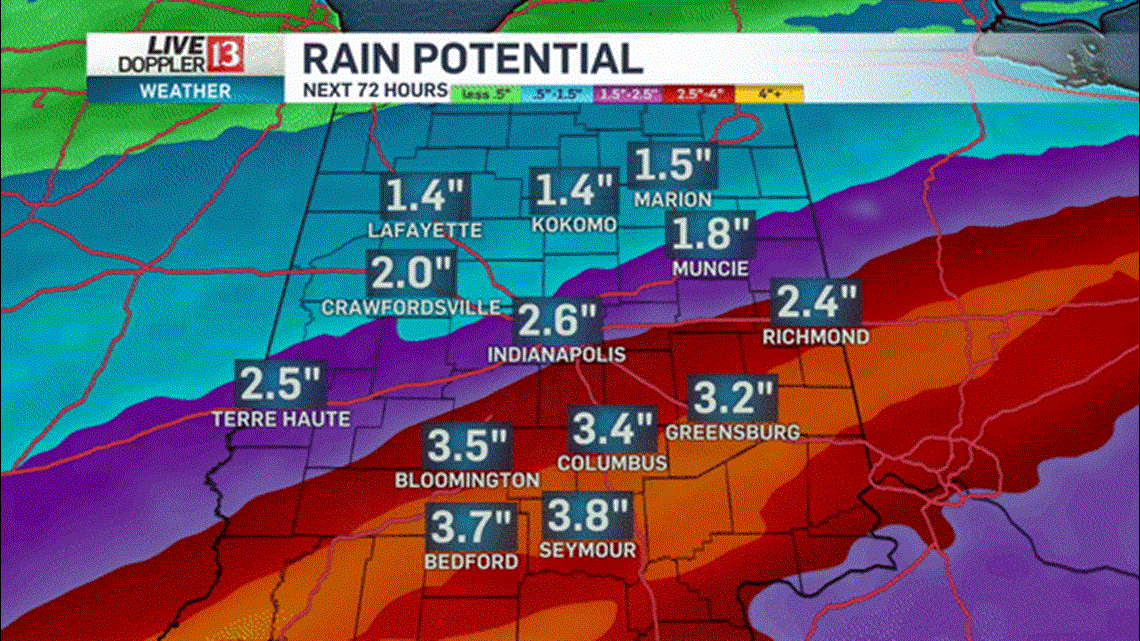
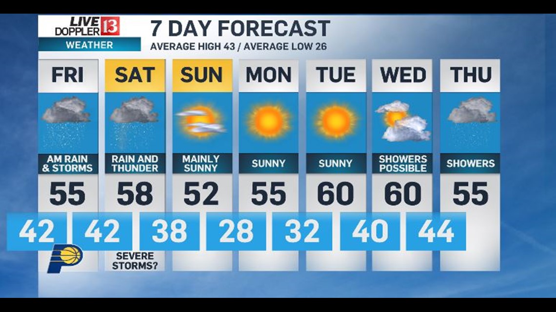
We're forecasting a widespread 2" to 4" rainfall for this zone with locally higher amounts very possible. Our latest round of rain arrives well after midnight and impact the Friday morning commute. Friday afternoon should be mainly dry and mainly cloudy.

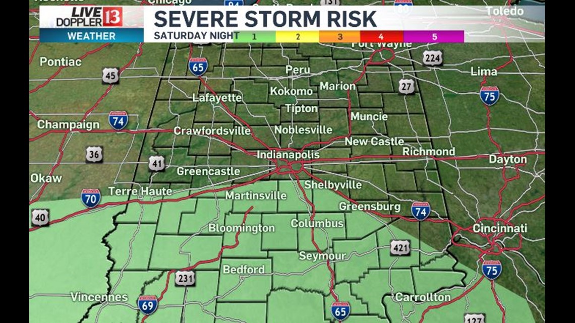

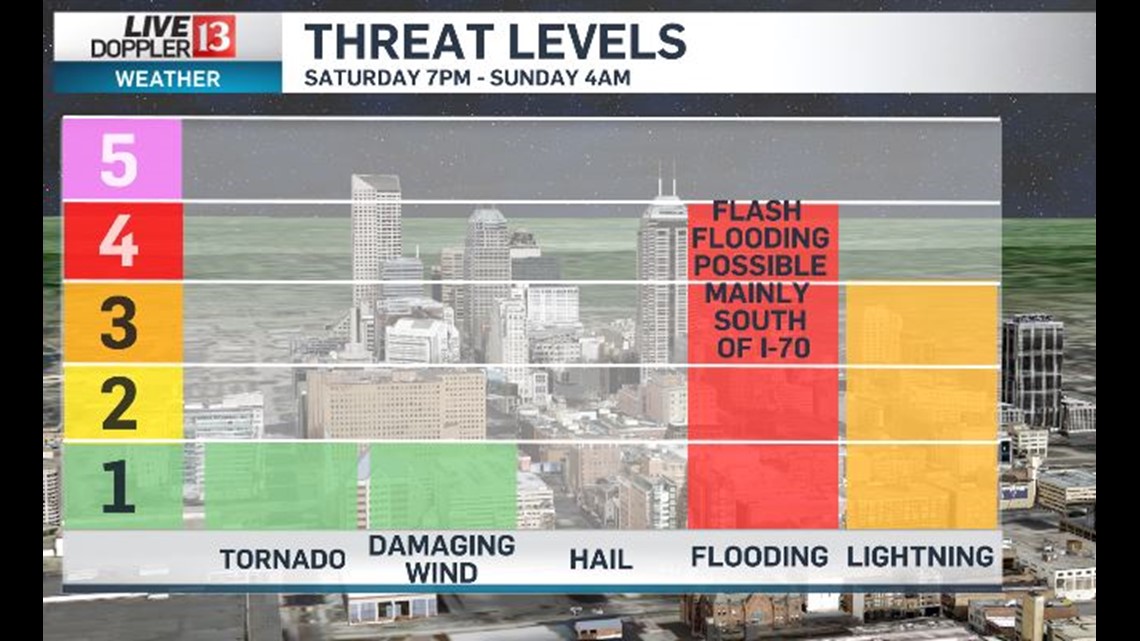
Saturday will be damp and we're expecting the heaviest rain rates to occur between Saturday 7pm and Sunday 4am. This is the most likely time of potential Flash Flooding and also the potential of severe storms... though the probability of severe wind and/or an embedded tornado along a squall line is much lower than flooding rainfall.

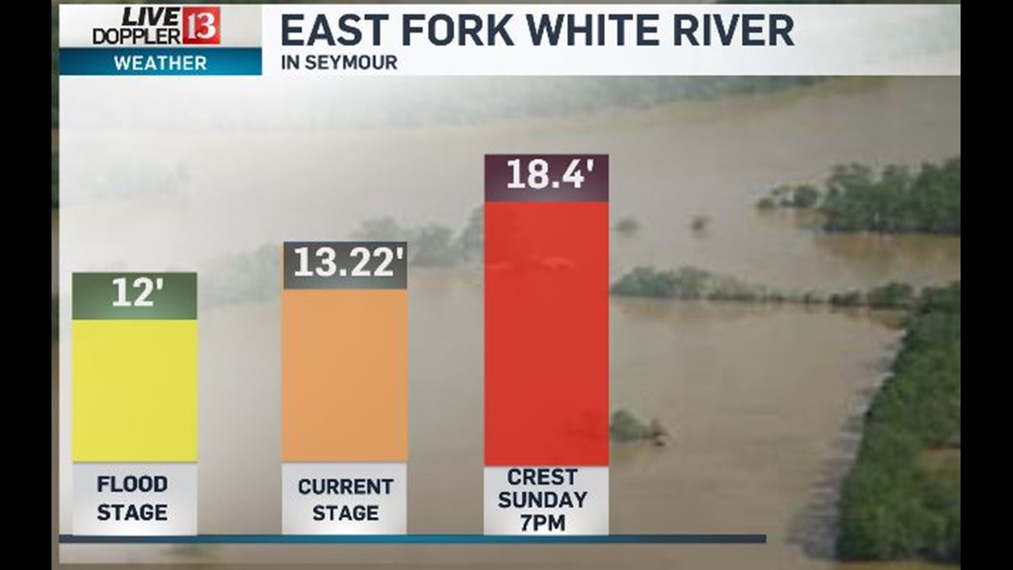

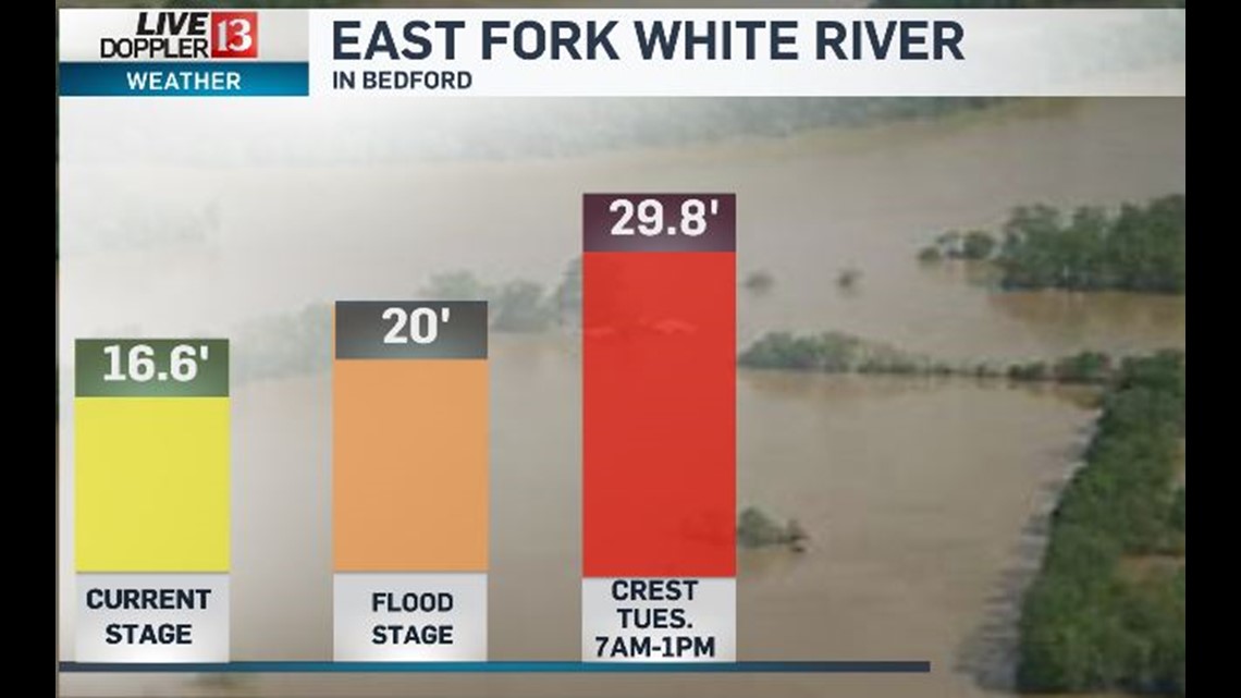
Flash flooding risk departs Sunday morning after the passage of a cold front, but river flooding will just be getting started south of Indy. Latest river forecasts for East Fork White River at Bedford and Seymour predict moderate flooding. Crests are expected Sunday evening in Seymour and Tuesday in Bedford. Follow the forecast and river levels closely this weekend.

