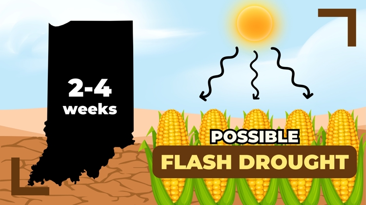
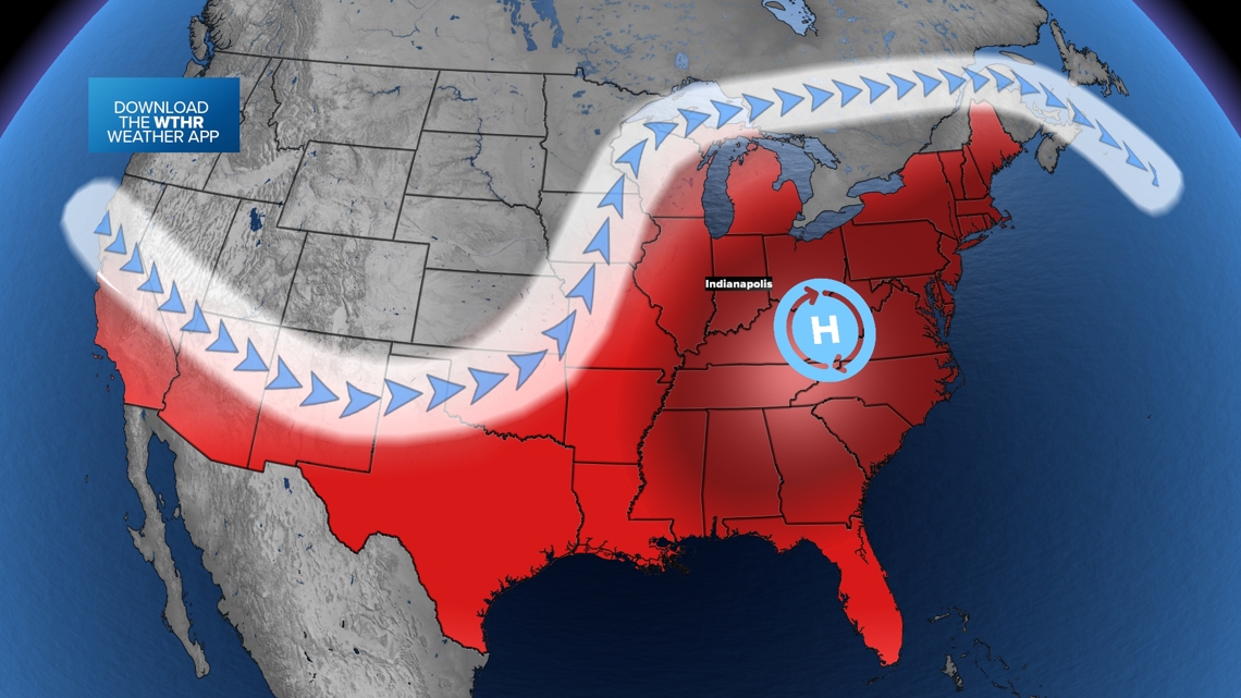
INDIANA, USA — An intense heat wave is moving into Indiana with lots of sunshine and temperatures skyrocketing well into the 90s. June is typically Indiana's wettest month and our highest tornado month. However, June 2024 is bringing late-summer heat that may bring a flash drought.
For the latest temperature and heat stress forecast, tap HERE.
What is a flash drought?
We all know what a drought is — a long period of drier than normal conditions, usually with hotter than average temperatures. This helps zap the ground of moisture. A flash drought is an accelerated drought. The onset or start happens very quickly. You can go from nice, rainy weather to losing a lot of that water with a few weeks of intense sunshine and heat. Basically it's when you go from lush, green conditions, to drought in only a matter of a few weeks. That's very fast.
It gets hot in the summer every year. That's nothing new. The problem with the coming heat wave is how hot it actually is (lots of mid 90s) and very limited rain chances for at least a week. The high pressure system, which helps block big rain systems, is very strong and will almost create an atmospheric wall blocking rain chances.

Because June is typically central Indiana's wettest month, getting almost no rainfall will be very hurtful to crops, livestock, and gardens across the state.
Why is it happening so quickly?
We were doing so well! As of June 1, Indianapolis was 3-4 inches ahead for rainfall for the entire year. We are still technically okay, but the top soil is about to lose most of its water very quickly.
There are a few reasons why:
- Very limited rainfall: You're not adding anything extra to the ground.
- High sun angle: June has the highest sun angle of the year, which makes the sunshine more intense.
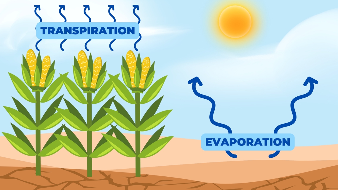
- Quick evaporation: The sun is heating the ground, evaporating water from the top soil very quickly. Plus, high heat in the mid-90s helps accelerate this process.
- High transpiration: Our growing crops are releasing a lot of water right now. They pull moisture from the soil and then let it out into the sky. This always happens, but usually we get a lot of rain in June so that does not typically matter.

Who has the highest chance for the flash drought?
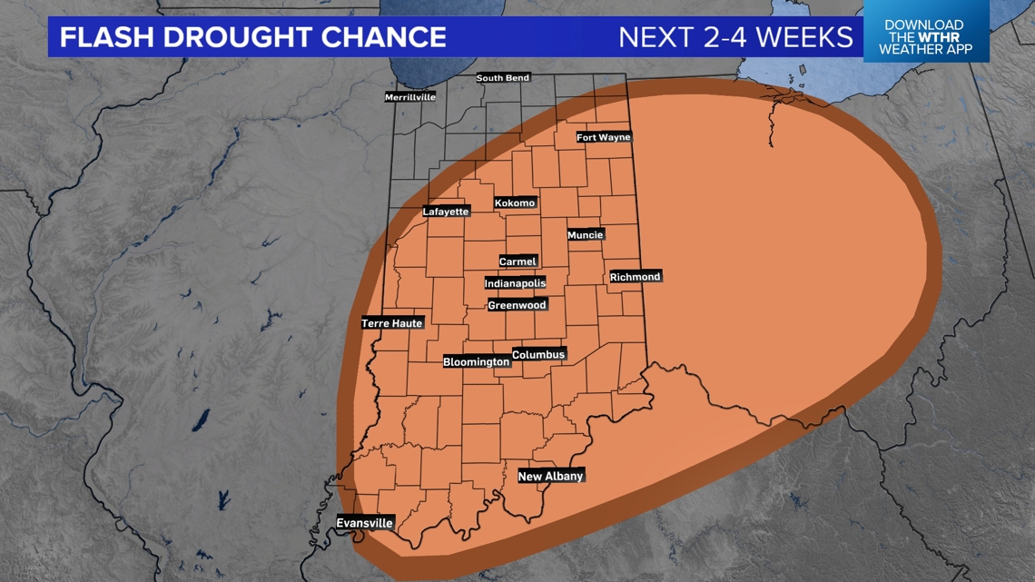
Most of Indiana has a chance for a flash drought, especially central and southern Indiana.
There may be a slightly higher chance in east-central Indiana, especially around Muncie, New Castle, Greenfield, and Richmond. There may also be another bullseye for drought conditions in southern Indiana, especially around Columbus, Seymour, Scottsburg, New Albany, and Jeffersonville.
This specific forecast can change, depending on where we can get isolated heat showers during the heat wave. These are quick showers and storms that can bubble up when the heat and humidity force the atmosphere to form a thundercloud.

What will be the impacts of a flash drought?
We will be closely monitoring the threat to agriculture across the state. Big, swift changes to soil moisture in Indiana can greatly impact the economy.
- Watch for cracking in the ground in corn and soybean fields, especially in bare areas.
- Your grass will start looking browner and get rougher (most likely less mowing).
- Rivers and stream water levels will lower.
- Lake water heights may gradually lower, but this may take longer.
If you have plants that you want to protect from the intense heat, make sure you give them extra water.
Stay tuned as this situation develops.
— 13News Meteorologist Matt Standridge


