INDIANAPOLIS — A taste of early September here in mid to late October across Indiana. With hazy sun and a stiffening south-southwesterly wind...temperatures soared back into the upper 70s/lower 80s.
While it wasn't record-breaking warmth, those temperatures were a good 15°+ above average for this time of year. Unfortunately, the combination of parched soils, dry air, and the breezy wind led to numerous brush fires across central Indiana. An elevated fire risk will remain in place until we can get sufficient rainfall which isn't in the forecast right now.
Elevated Fire Risk This Evening
With that said, there's a weak axis of energy moving across central Indiana that perhaps could spawn spotty sprinkles and/or a few showers in western-northwestern Indiana. But the very dry air (humidity 20-30%) eats away at that precipitation potential, leaving behind only mid/high level clouds this evening for a rather colorful sunset.
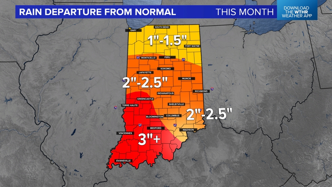
It also doesn't help that this has been one of the driest Octobers on record to date in Indiana with very little precipitation. Many areas near/south of I-70 are between 2"-3" below average for precipitation this month. That actually coincided nicely for Harvest 2024, but has definitely placed the state at higher risk of fires now.


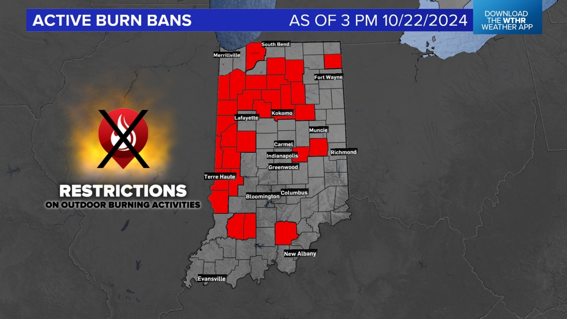
More counties were added to the Burn Ban list today in Indiana bringing the total to 30+ now. Please avoid any burning if you're in those counties or not, quite frankly. As the extended dry period, and the breezy conditions, ups the odds of even small sparks triggering bigger fires until further notice.
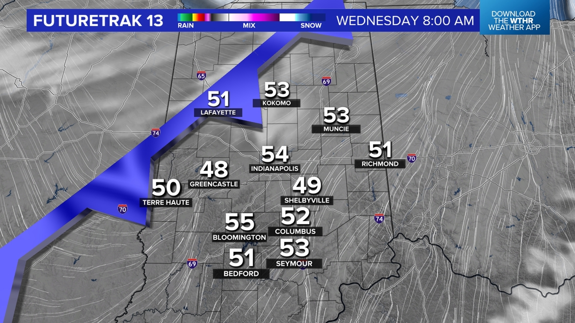
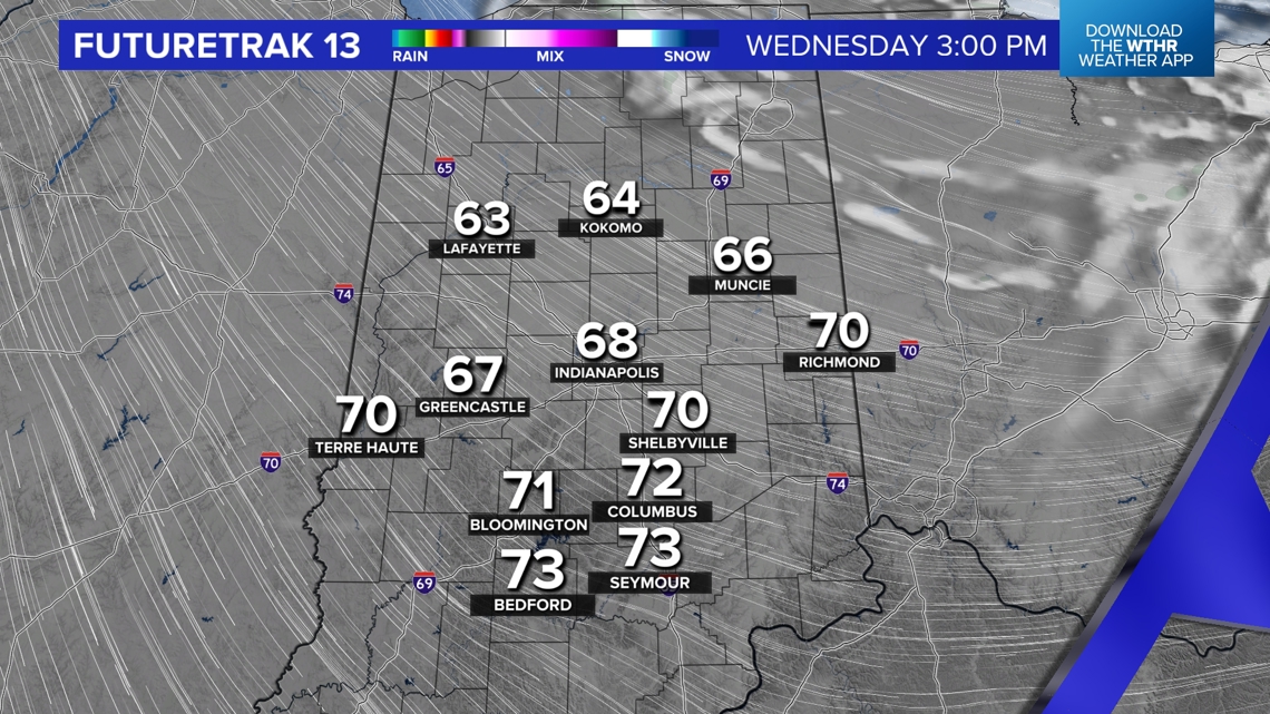
Dry Cold Front Tonight/Wednesday Morning
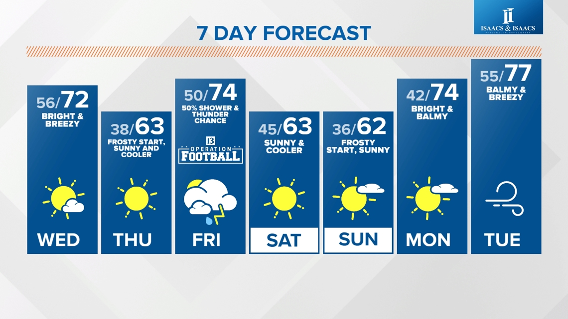
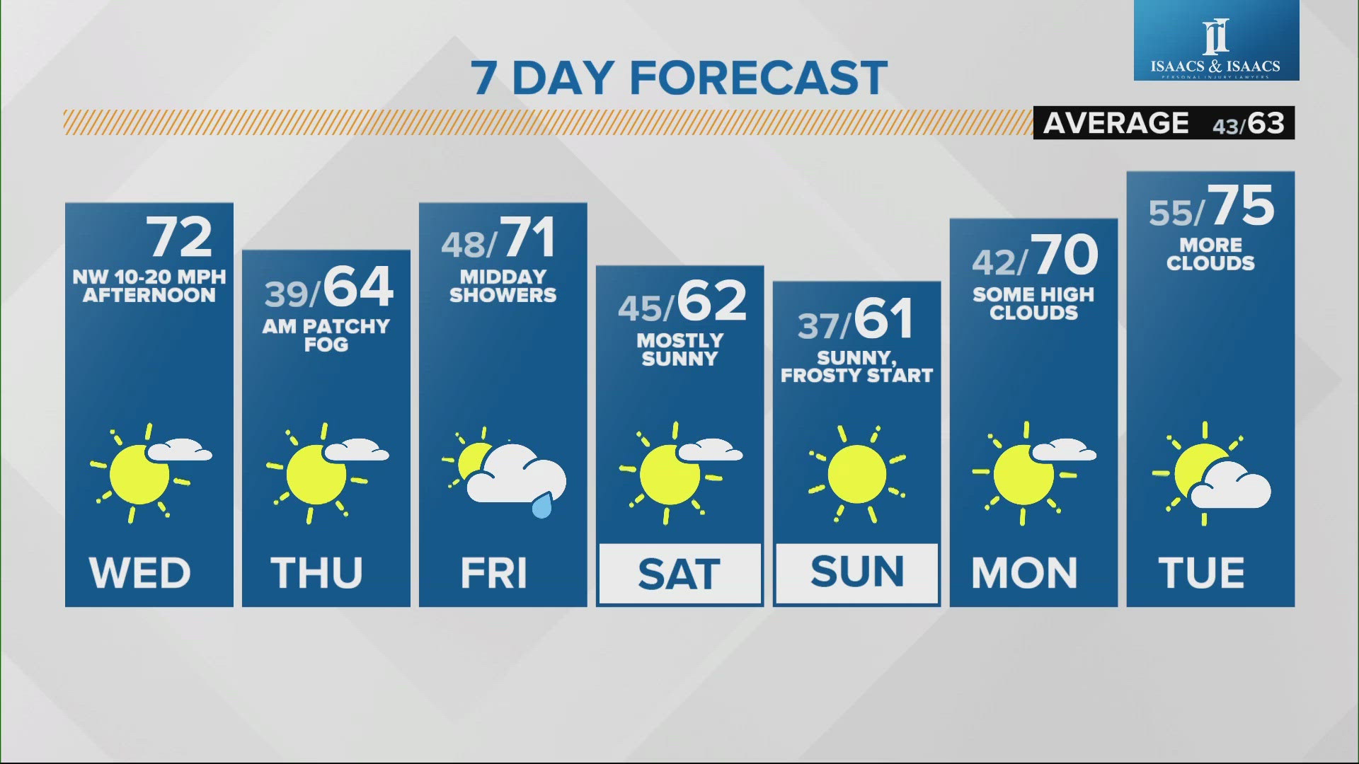
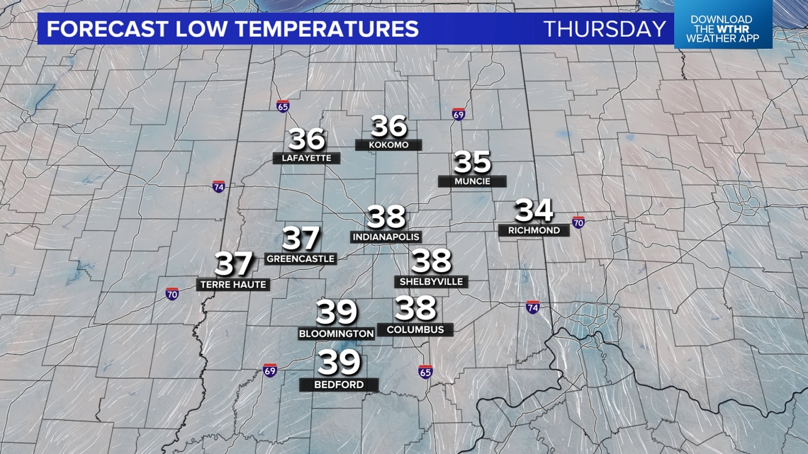
The first of two cold fronts crosses the state early Wednesday morning. It will noticeably cooler tomorrow with highs in the upper 60s to near 70°. But the chillier start Thursday morning (low/mid 30s) will be a bigger attention-grabber. Areas of frost likely to start that day before a full deck of sun gets afternoon temperatures comfortably in the 60s.


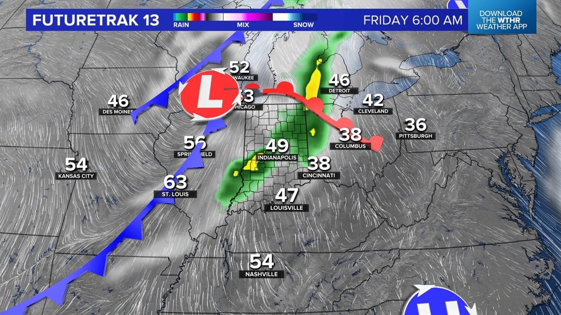
The second front arrives late Thursday night/early Friday with a scattering of showers and possibly embedded thunderstorms. It's uncertain how much coverage occurs and how much rain. But please know some outdoor plans will be impacted Friday. We'll have to wait and see how quickly that front exits, but it's trending to a drier solution now for Operation Football Friday night. Stay tuned.

Seasonably Chilly Weekend
Another quick shot of chilly air arrives just in time for a fabulous fall weekend in Indiana. Temperatures in the 40s Saturday morning only climb into the 60s despite a good dose of sunshine. Even colder temperatures Sunday morning with frosty lows near freezing for many areas away from Indy' urban heat island.
That chilly air quickly exits early next week when high temperatures flirt with 80° and daily records Tuesday/Wednesday. We're still expecting another frontal system the middle or latter half of next week. Stay tuned for timing and for potential impacts to Halloween.