INDIANAPOLIS — We'll see an ongoing unsettled pattern this weekend as an area of low pressure slowly tracks across the Great Lakes region.


TODAY'S HEADLINES:
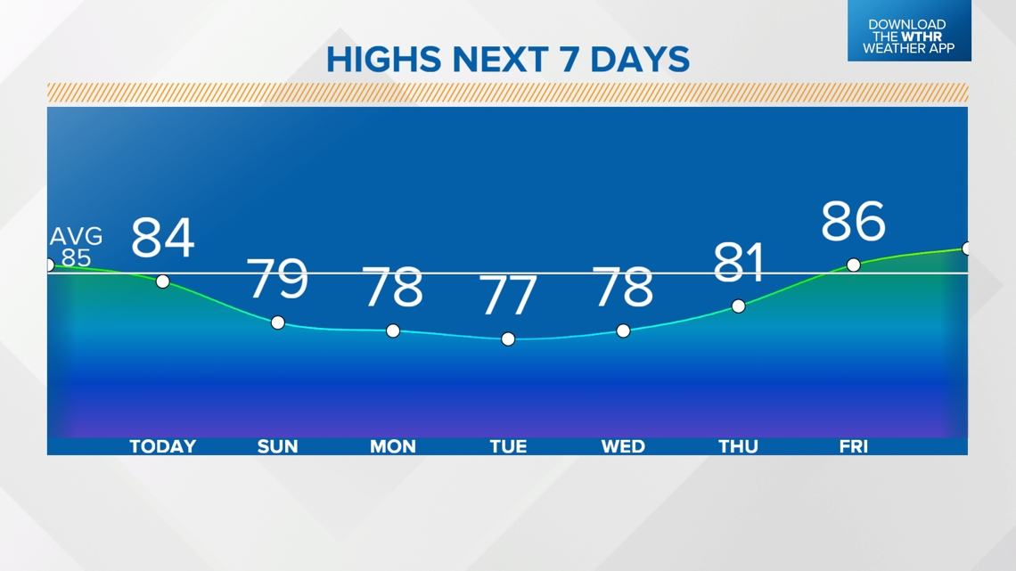
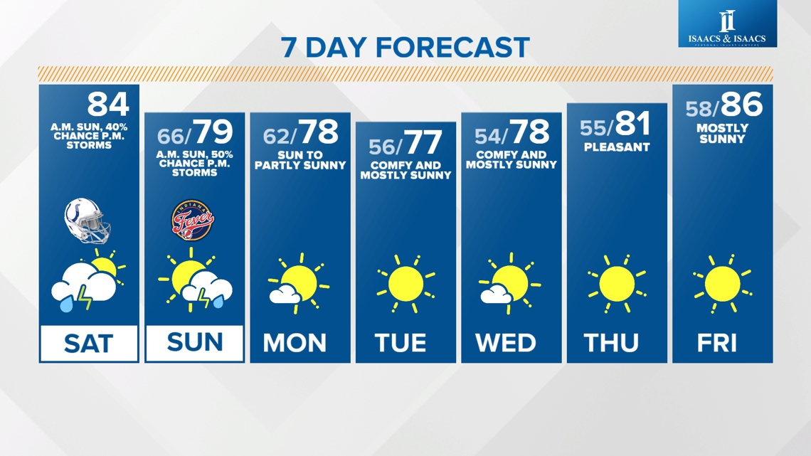
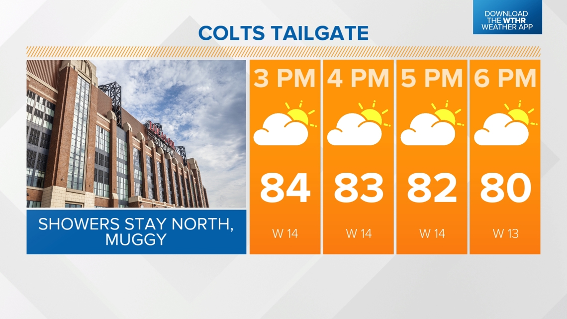
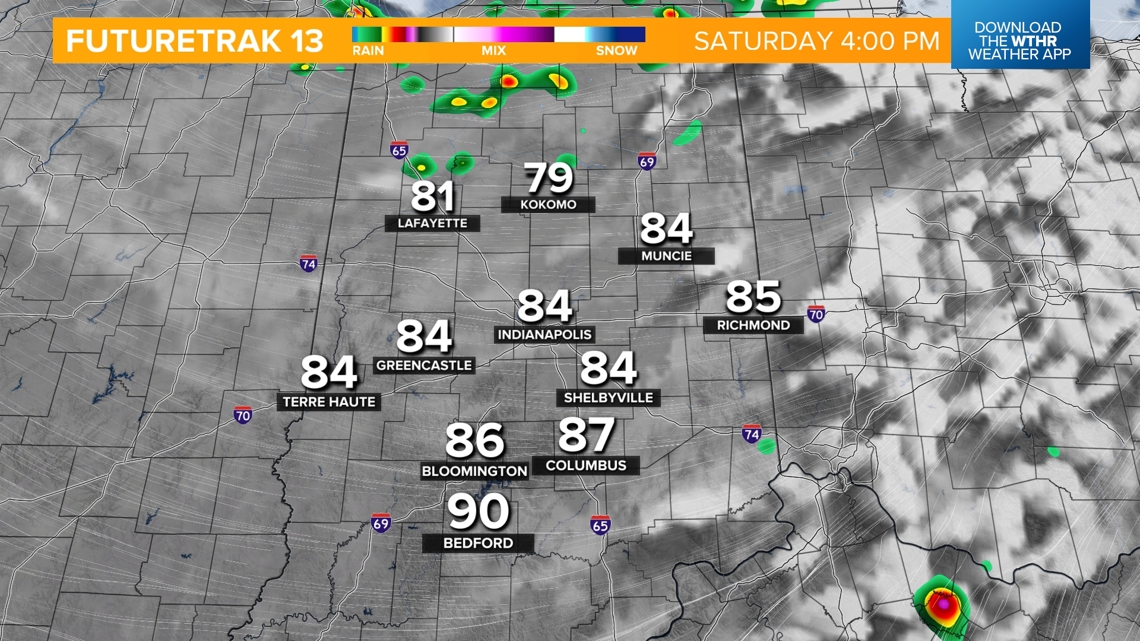
- Warm & muggy highs in the mid 80s, upper 80s south.
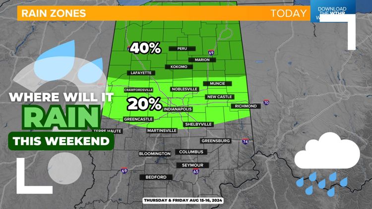
- A cold front associated with an area of low pressure system to our north will swing through this afternoon, prompting a few isolated showers and storms across northern Indiana.
- Front will lose steam as it pushes south, closer to the Indy metro area this evening. While a stray shower will be possible closer to sunset, most of central Indiana stays dry.


SUNDAY'S HEADLINES:
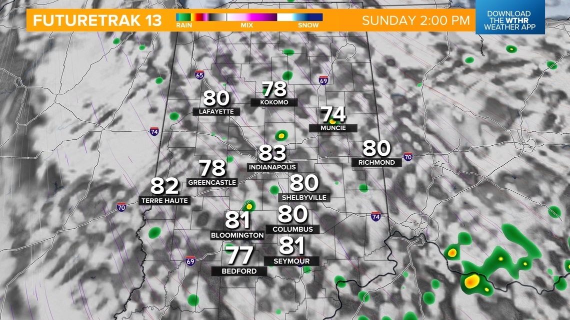
- Dry start with lows in the mid 60s.
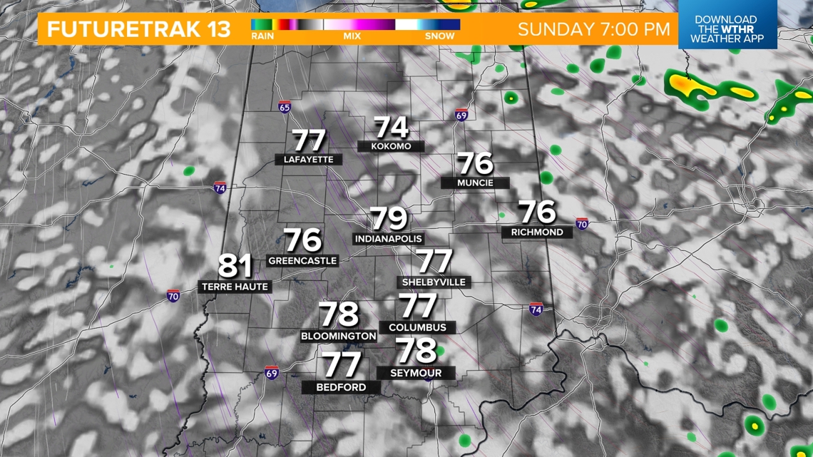
- A few "wrap-around" showers/storms will be possible Sunday afternoon, 1-6 p.m.
- Breezy with northwest gusts up to 25 mph.
- Cooler highs only in the upper 70s.


A cooler, drier air mass then takes over through next week...
This means plenty of sunshine with highs a little below average in the upper 70s through Wednesday. Temperatures will slowly trend upward back into the 80s by late next week.