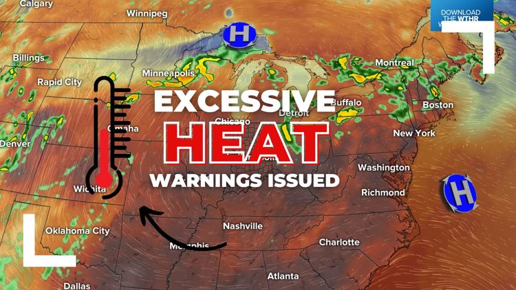
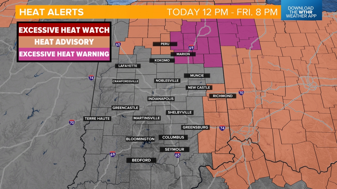
INDIANAPOLIS — An Excessive Heat Warning will go into effect this afternoon and continue through Friday evening for the northeastern tier of Indiana. Parts of northern and eastern Indiana will be under a Heat Advisory during that time frame.

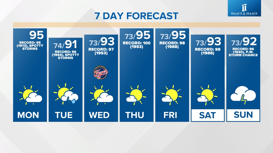
These heat alerts were issued as we are headed into a stretch of high heat and humidity. Not only are air temperatures expected to reach the low to mid-90s between now and next weekend, high dew points, humidity, and "feels like" heat indices will increase the risk of heat-related illnesses. This is especially true for those who are young, elderly or who spend a prolonged amount of time outdoors.
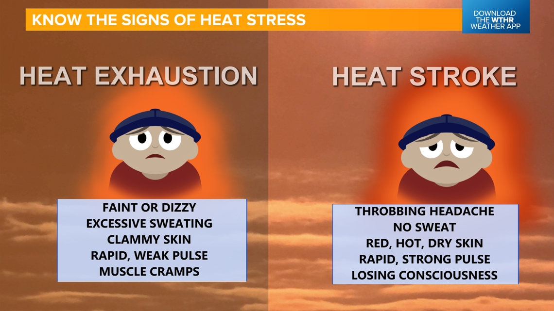
Know the signs and symptoms of a heat-related illness, including heat exhaustion and heat stroke!

TODAY:
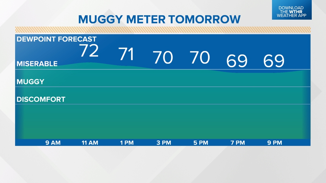
The forecasted high temperature is 95, which would tie the standing record of 95 from 1913 in Indianapolis. Dew points will hold steady near 70 — in the "miserable zone" of the muggy meter.

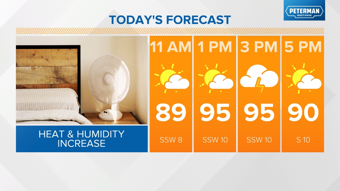

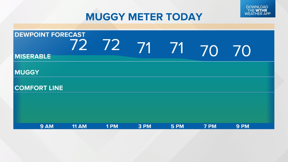
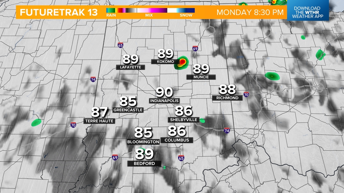
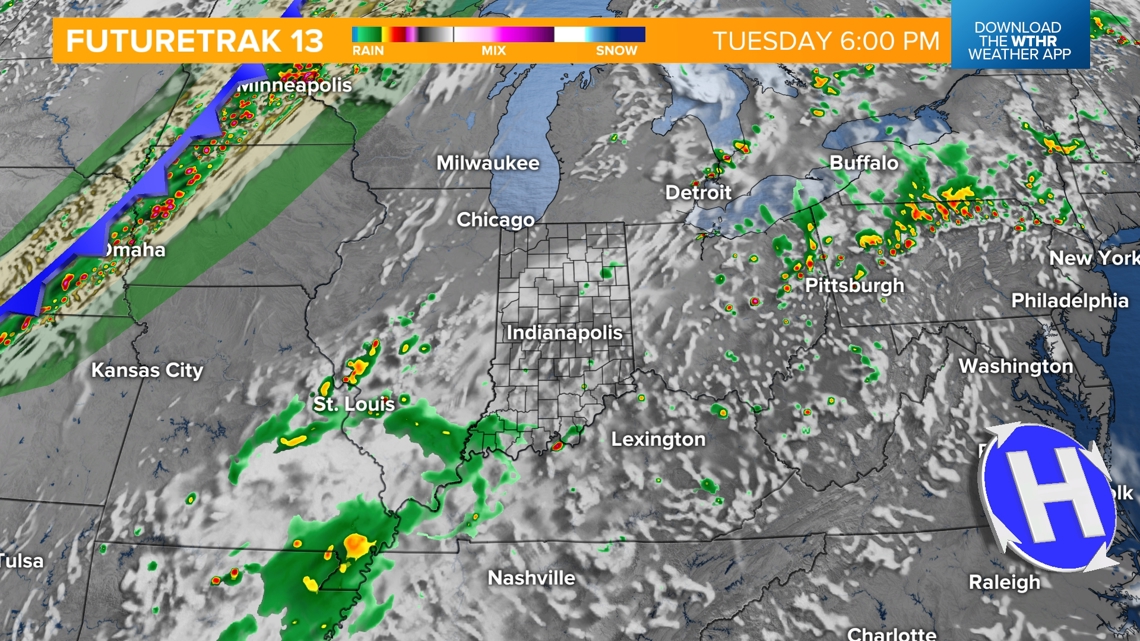
Increased moisture in the atmosphere will prompt the potential of late afternoon clouds and pop-up thunderstorms during the heat of the day — approximately between 1 p.m. and 8 p.m. Any rainfall is welcomed though as a stretch of heat we're anticipating could lead to the "flash drought" if the ground dries out too quickly.

TOMORROW:
Tuesday will be a similar day with dew points near 70. With increased clouds, highs will be hindered by a few degrees but still well above average in the low 90s.

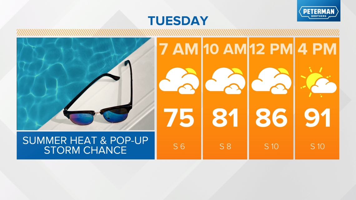

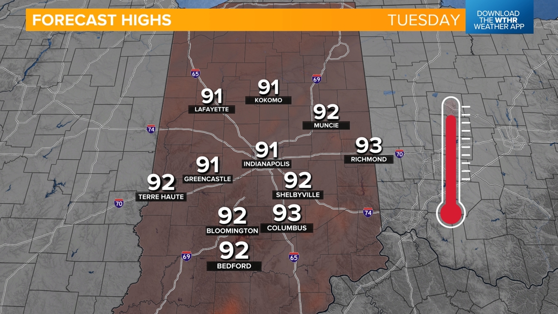

We'll again see the chance of late afternoon pop-up storms.

Our stretch of highs in the low to mid-90s continues through next weekend. Long-range weather models are hinting at a cold front arriving late Sunday into next Monday which could break the heat streak by a little bit, at least dropping highs into the mid to upper 80s. Make sure to check back for the latest updates.

