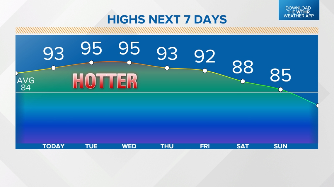
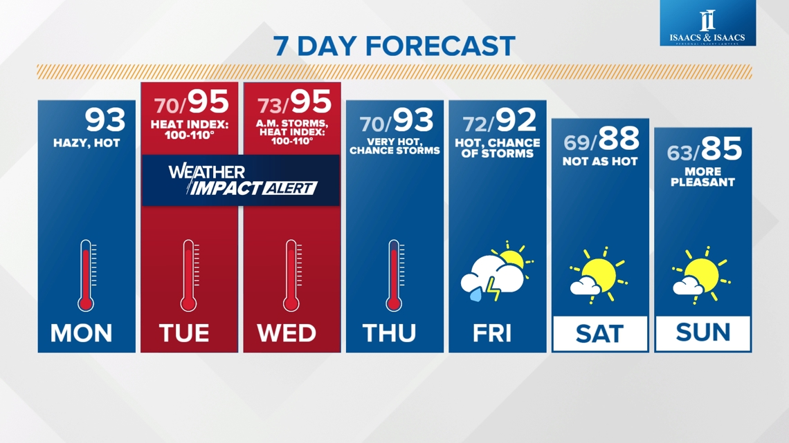
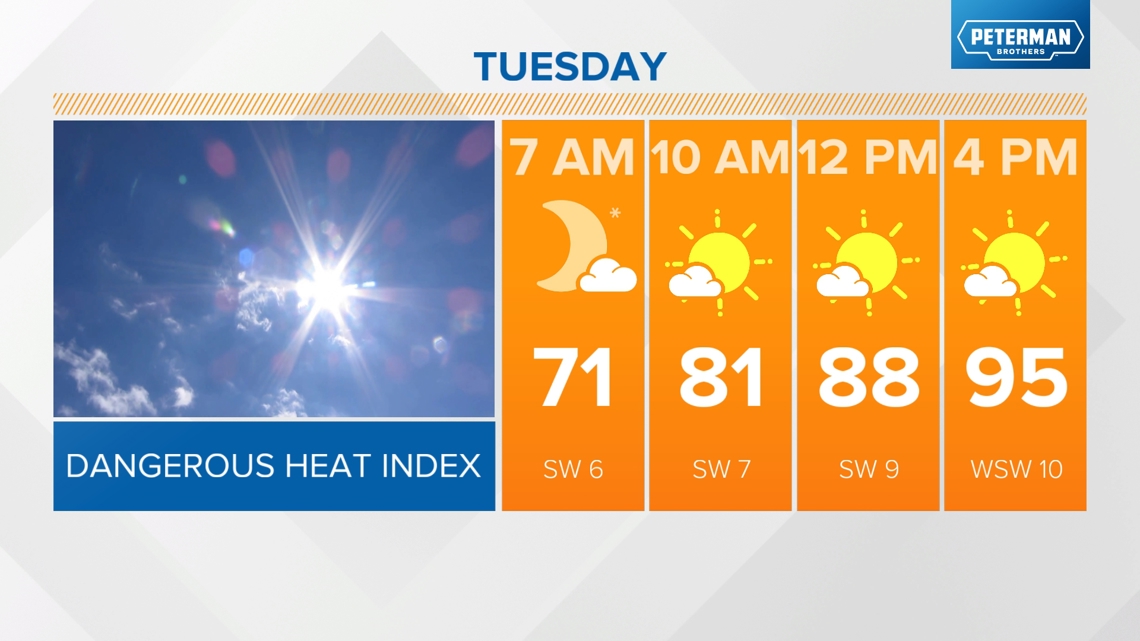
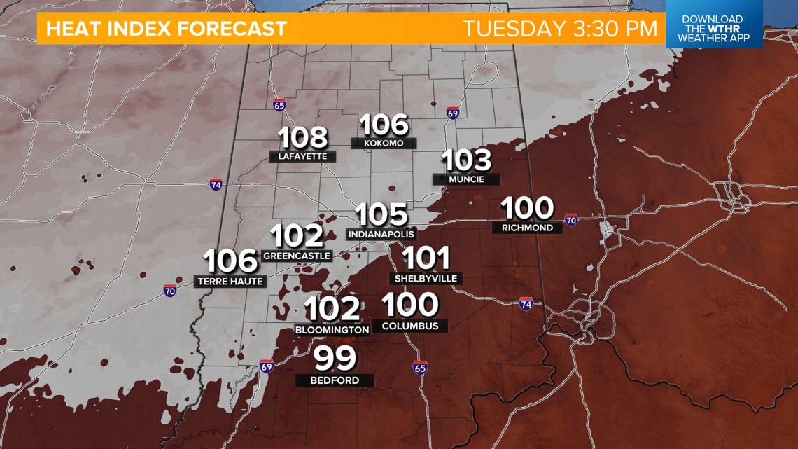
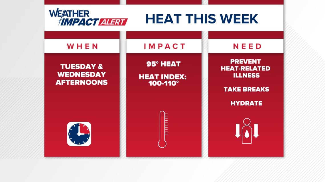
INDIANAPOLIS — Near-record high temperatures in the mid-90s and heat indices approaching 110 degrees for parts of central Indiana will increase the risk of heat-related illnesses, especially Tuesday and Wednesday.

Today's headlines:
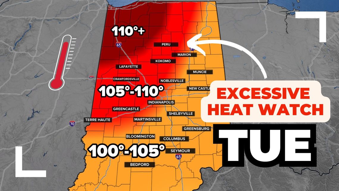
- Third day in a row with a high in the low 90s
- Dew points will be muggy but not "oppressive," keeping the heat index within a few degrees of the air temperature

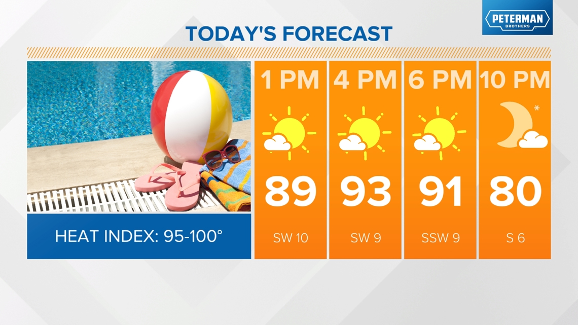
Weather Impact Alert for excessive heat Tuesday & Wednesday
We'll be watching out for the potential of dangerous heat starting tomorrow. Highs will be a few degrees hotter than today in the mid-90s, but the added moisture to the air will make all the difference.


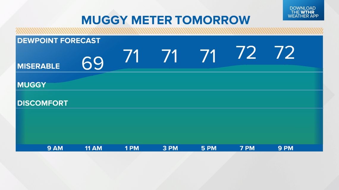
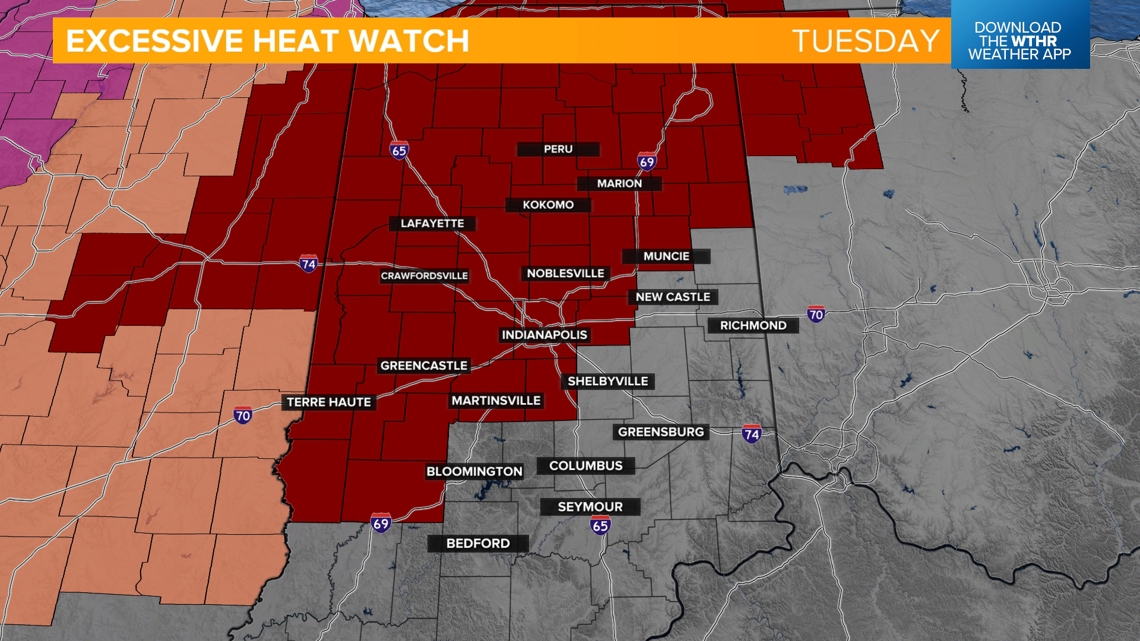
Dew points in the low-70s will make it "feel" more like 100-110° degrees across central Indiana. Due to this, the National Weather Service has placed west central and northern Indiana under an excessive heat watch.


- Plan ahead now if you work or must spend time outdoors during the afternoon hours
- High humidity/heat index makes it much harder for our bodies to keep cool, which increases the risk of heat-related illnesses
- Take frequent breaks, avoid caffeine, wear light/loose clothing, stay well hydrated

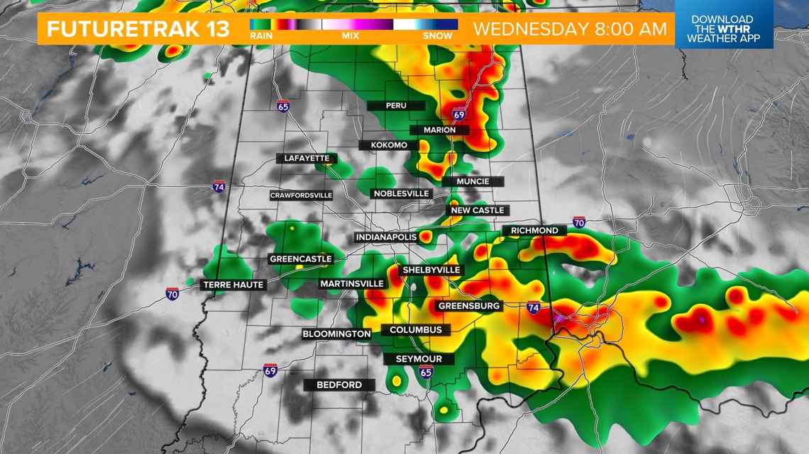
The only change for Wednesday is the risk of a few thunderstorms. Depending on the time of day storms pop up, increased clouds/rain risk could limit high temperatures by a few degrees. Most areas will stay dry, though, especially in the afternoon, so temperatures will likely be right back in the mid-90s with heat indices of 105+ degrees.

This heat streak will continue through the work week, but a cold front is forecast to move through the area late Friday. This will prompt a few scattered storms, but also help to break the high heat. Temperatures look to drop into the 80s next weekend.

