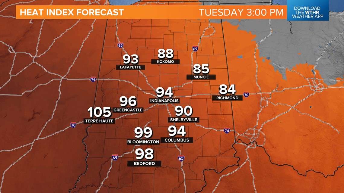
INDIANAPOLIS — It's subtle, but a wind shift to the east-northeast makes a difference in central Indiana, pushing the most excessive heat indices (100-105+ degrees) into western-southwestern Indiana.
While it won't be as bad around the Indy metro today versus Monday, dewpoints remain in the "miserable" category (70+ degrees), and heat indices peak in the mid-90s.
Farther east-northeast, it will be noticeably less humid, and heat indices peak only in the mid/upper 80s.
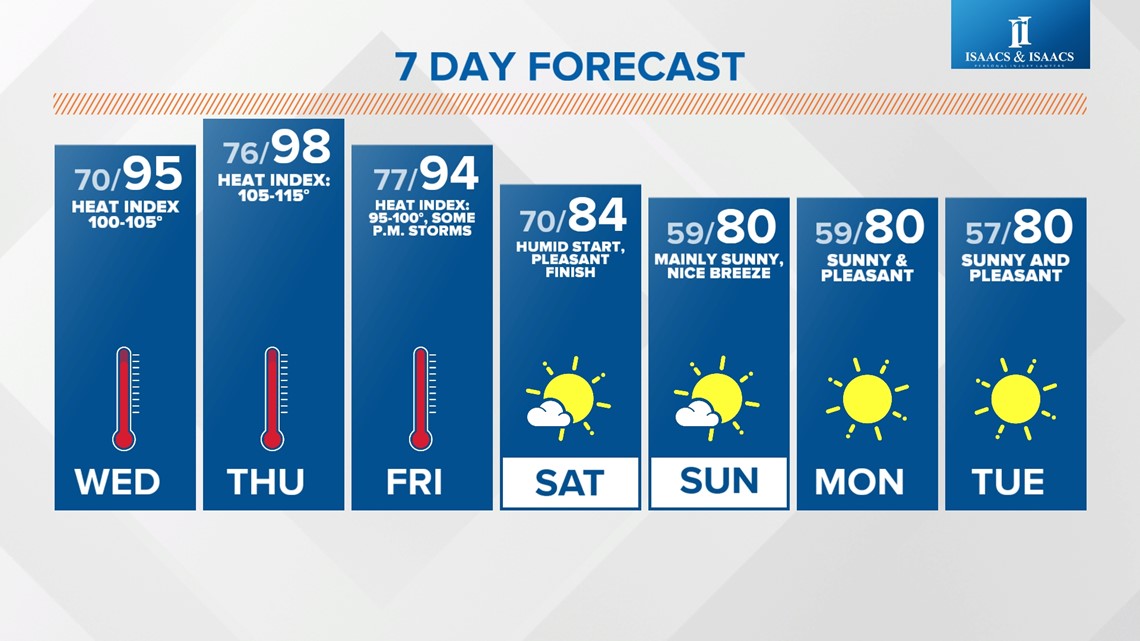
Low-level moisture increases area-wide on Wednesday and results in heat indices for everyone peaking in the 100-105+ degree range in the afternoon/early evening hours. This will require frequent breaks if you're going to be outdoors and follow heat safety precautions.

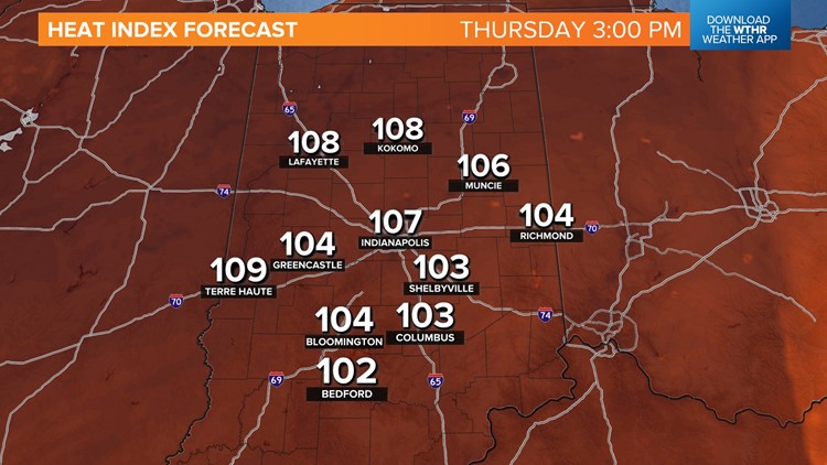
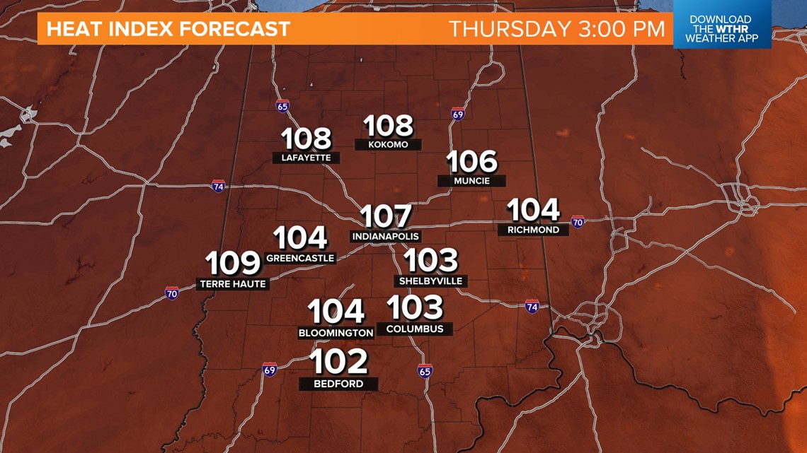
The most excessive heat conditions locally arrive on Thursday, with highs in the upper 90s, dewpoints in the mid/upper 70s, and heat indices 105-115 degrees. That puts the Heat Stress Forecast into the extreme range, which is recommended that outdoor practices be moved indoors. This measurement is a prototype in the National Weather Service level, but is currently used by OSHA and the U.S. Military to determine precautions during training.


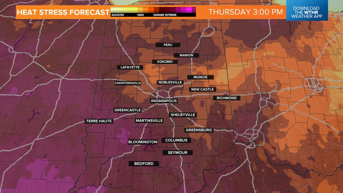
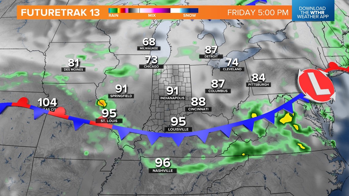
Some believe it's a better safety tool than just heat index. At any rate, this parameter peaks in central Indiana on Thursday and subsides going into the weekend as a front moves through the state.
That front could trigger some late-day storms on Friday but eventually delivers pleasant air Saturday afternoon into Sunday morning. It sets the stage for a pleasant streak of weather into the middle of next week.

