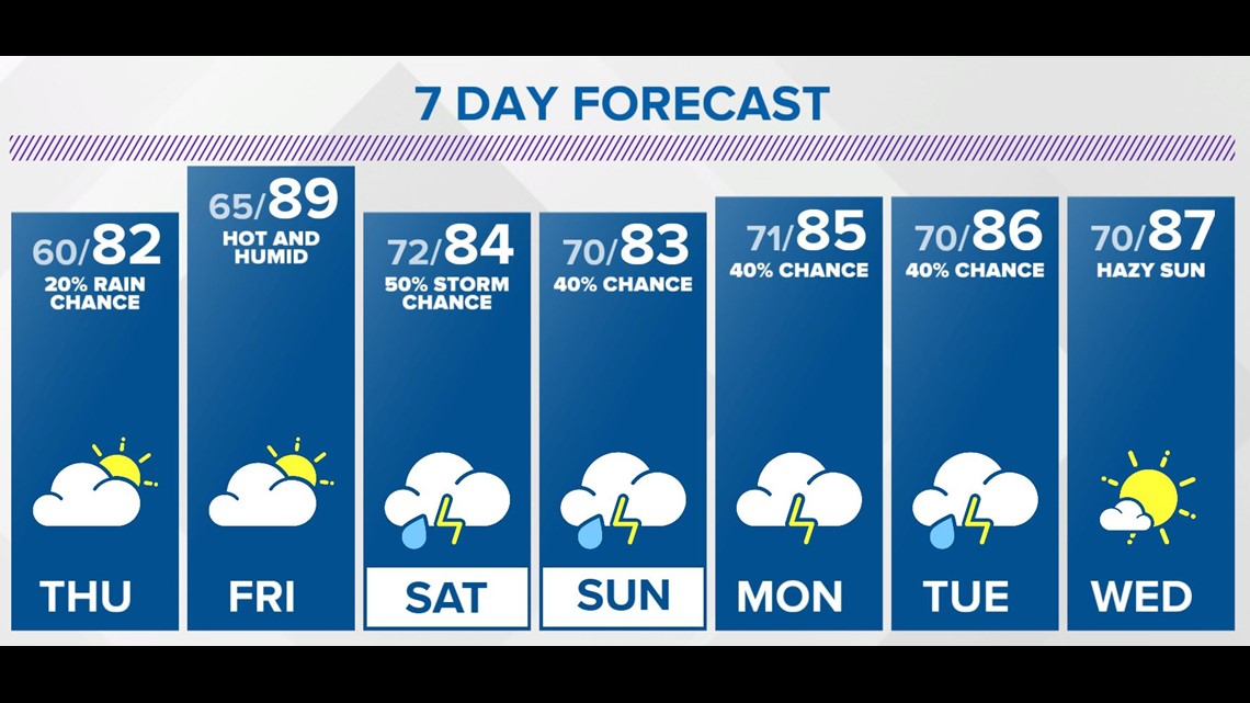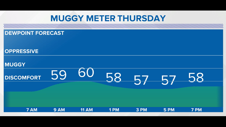
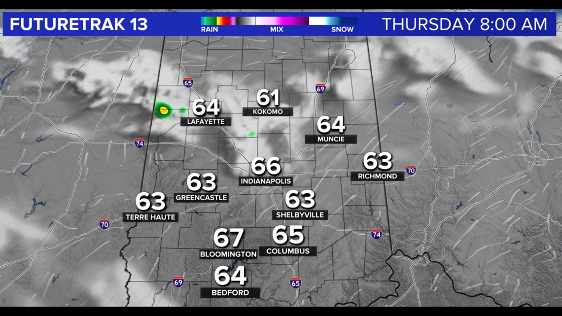
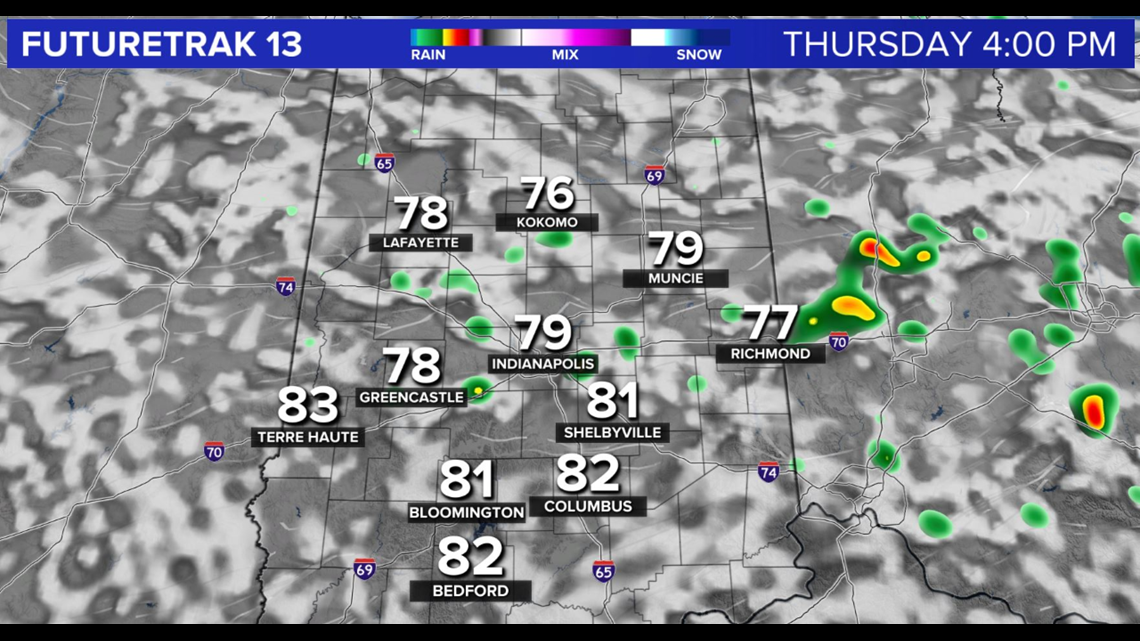
INDIANAPOLIS — Spotty showers and clouds diminish overnight and temperatures return to comfortably cool levels Thursday morning near 60°.

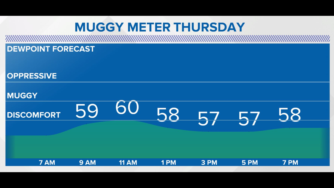


With dewpoints remaining in the 50s, the Muggy Meter remains comfortable though high temperatures will be a bit warmer in the lower to mid 80s.
We'll enjoy another day of blue sky with building scattered cumulus clouds in the afternoon with spotty splash-and-dashers developing in the peak-heating.

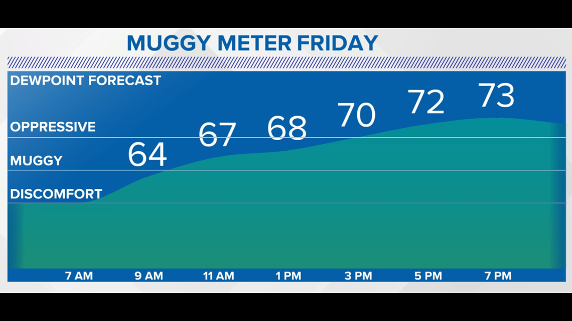

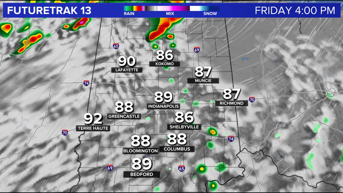
Enjoy the "comfort" Thursday as we continue to advertise building heat and muggy air Friday when highs soar to near 90° and heat indices could go above with dewpoints surging into the 70s.
The addition of tropical air, combined with daytime heating and an approaching front, will trigger late-afternoon/evening storms Friday.

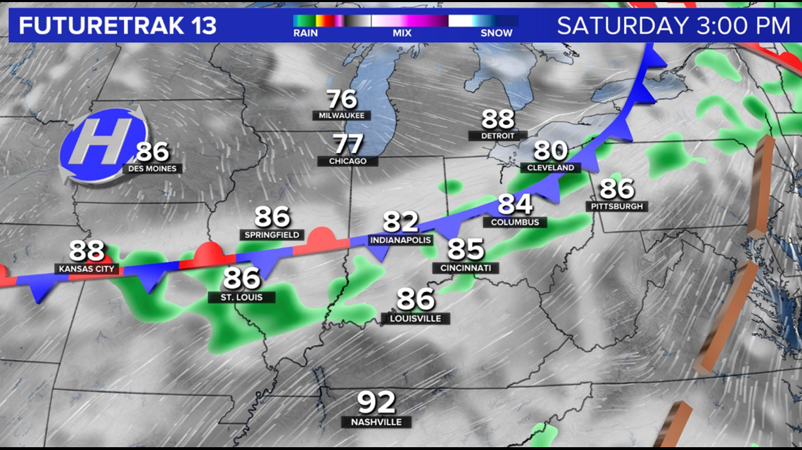

This front lingers around the region this weekend to provide daily storm chances within the humid air.
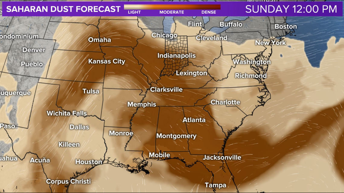
As we've noted the past several days, the Saharan dust layer blankets Central Indiana for a rather hazy sky this weekend. Typically this provides vivid sunrise/sunsets and can also create poor air quality.
Humid heat lingers into next week.