INDIANAPOLIS — Your wait is over! Morning satellite analysis of the GOES-16 nighttime low cloud channel shows the stubborn low cloud deck finally departing to the east.
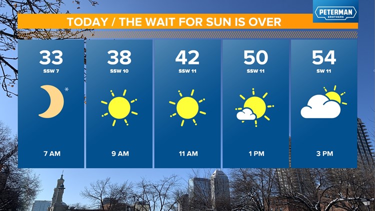
This sets the stage for central Indiana's sunniest day since Jan. 20 and 21 — and potentially the warmest since Christmas Day. A mainly sunny sky teams up with a southwest wind to deliver highs from the lower 50s northeast, mid-50s central, and near 60° south-southwest.
Regardless of temperature, it's going to be a spectacular day after the fourth-cloudiest January on record in Indianapolis. Even some increased high clouds in the afternoon won't matter much.

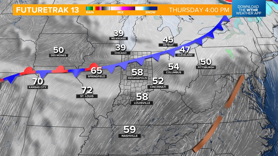

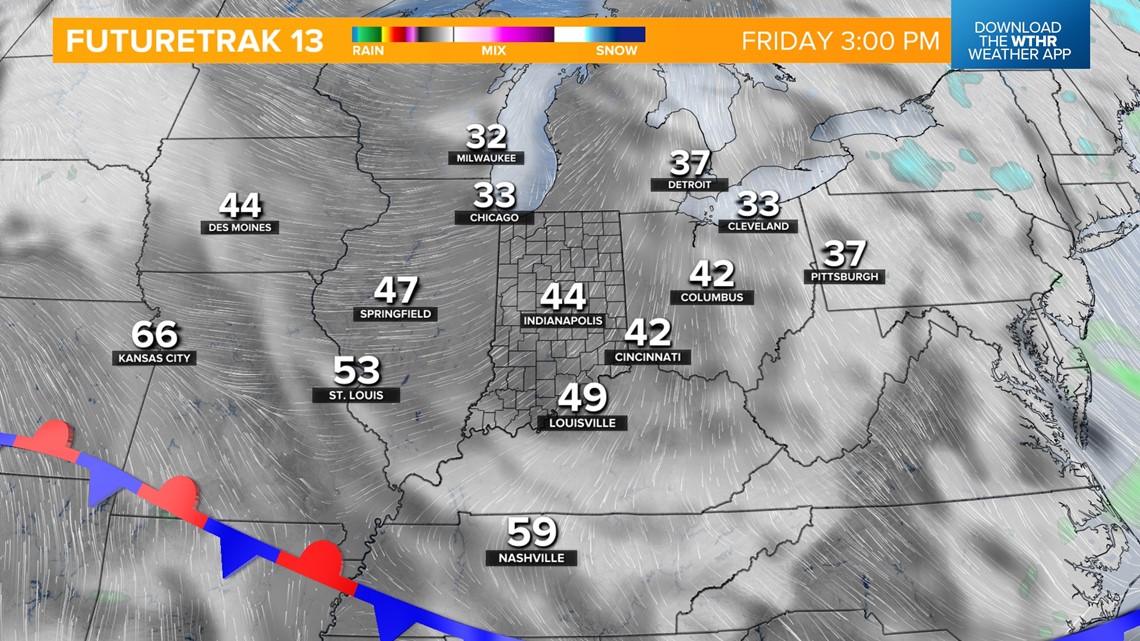
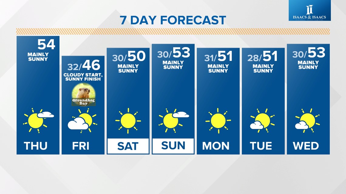
A new cool front arrives this evening with increasing lower cloud cover and maybe a few showers. More importantly, it brings a cloudier start to Friday in the mid-30s and a cooler day overall with highs in the 40s. Late afternoon from east-to-west the low clouds depart for a mainly sunny finish Friday.

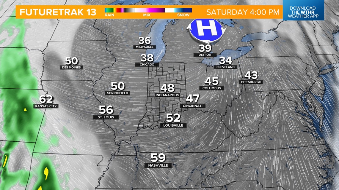

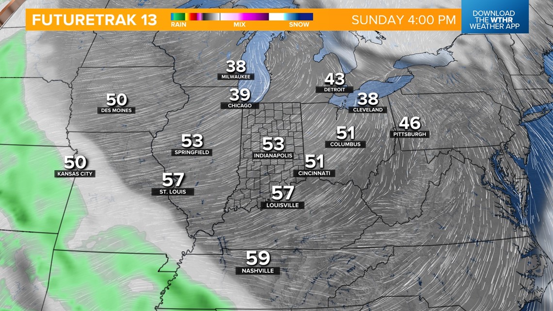
This is a wave of the future for the weekend that features some patchy morning fog but overall, plenty of sunshine. Highs will be in the 40s Saturday then reach the lower/mid-50s again on Sunday.
We'll see mainly clear conditions into the middle of the next week with above-average temperatures during the first full week of February. This quiet pattern is just what the doctor ordered after a wet and cloudy January. It will also allow road crews to begin the task of filling the growing number of potholes.

