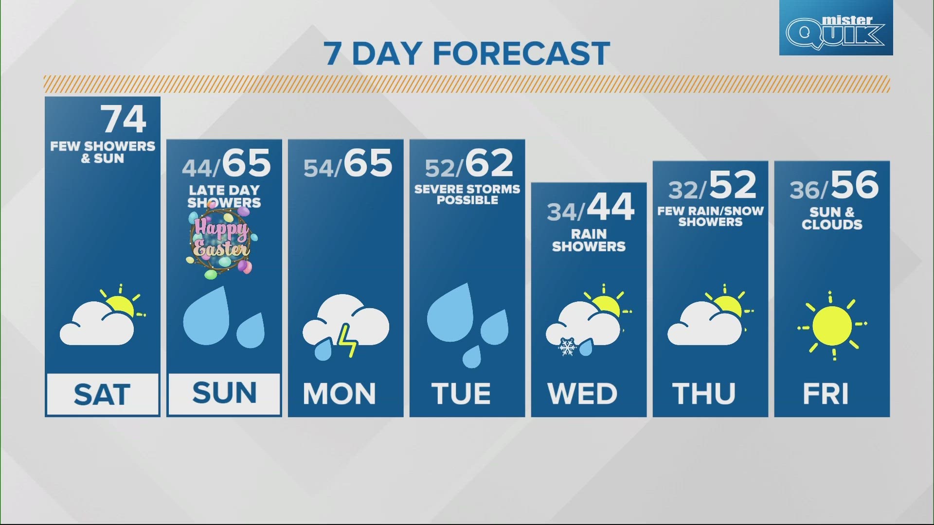
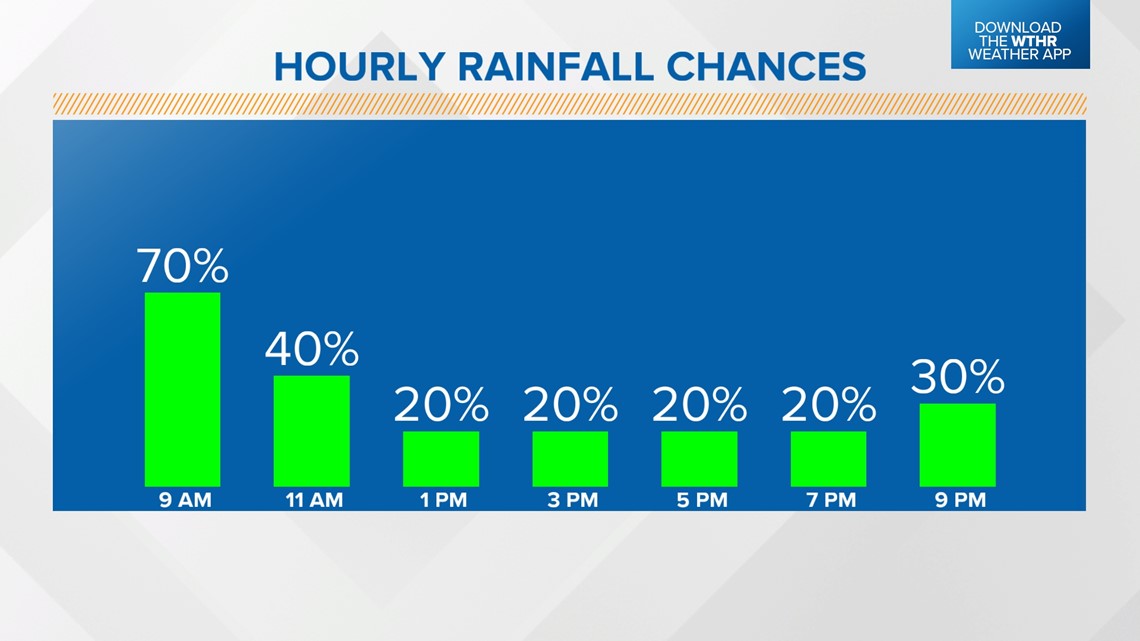
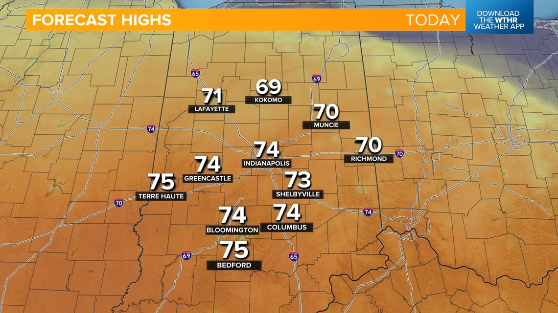
INDIANAPOLIS — We'll kick off the holiday weekend with a warm front lifting through Indiana which has prompted scattered showers and thunderstorms. Most storm activity will push east before the lunch hour with lots of dry time this afternoon. Winds will increase from the southwest today gusting as high as 35 mph. This pushes in much warmer air as temperatures will climb into the mid 70s.



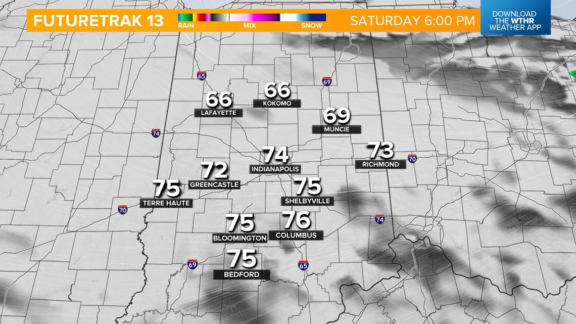
This boundary will then shift south this evening and overnight and could potentially spark a few stray showers through early Sunday morning. Temperatures drop into the mid 40s. We'll see quite a bit of dry time to start Easter Sunday as temperatures recover to the mid 60s.

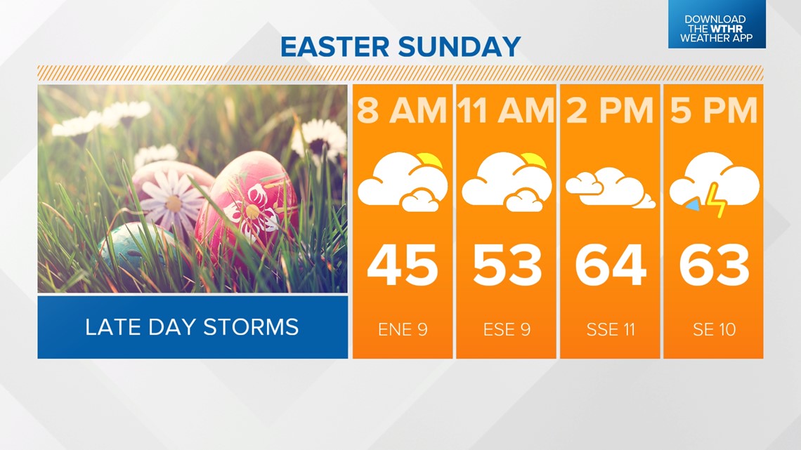

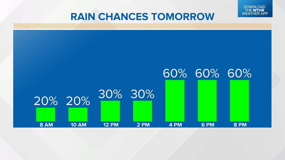
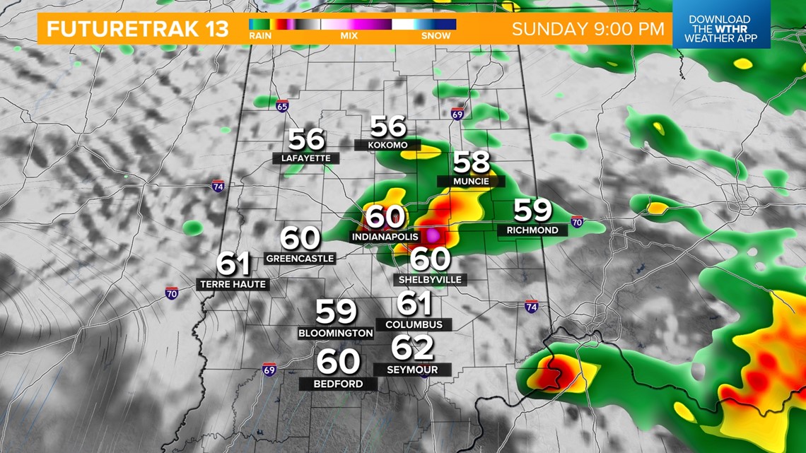
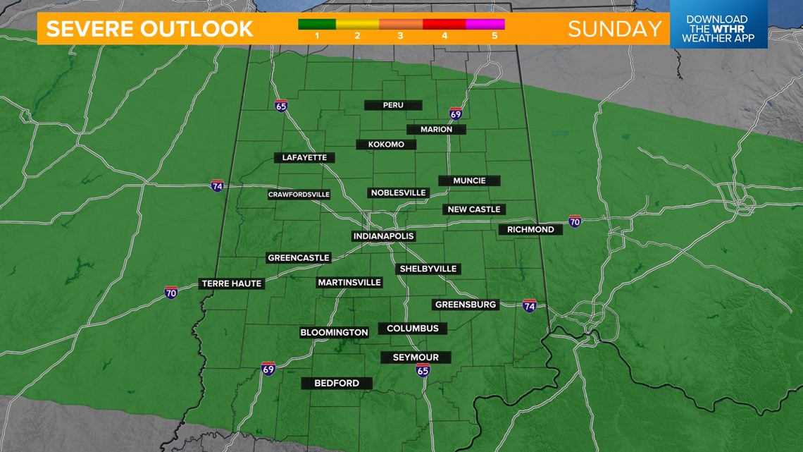
Rain chances increase after 4 p.m. with some embedded thunderstorms possible through the evening. The Storm Prediction Center is watching the potential of an isolated strong storm Sunday evening with damaging wind gusts and large hail possible.

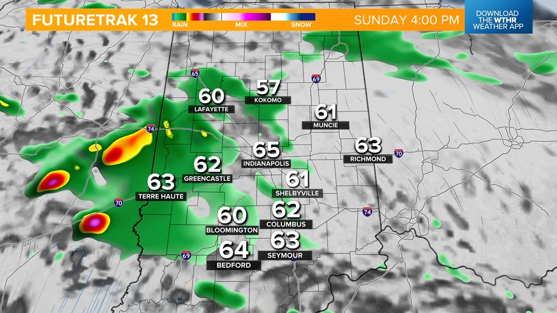


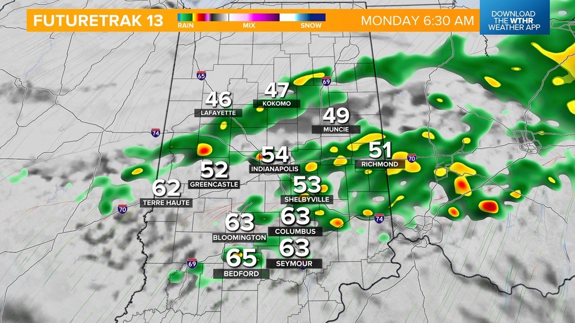
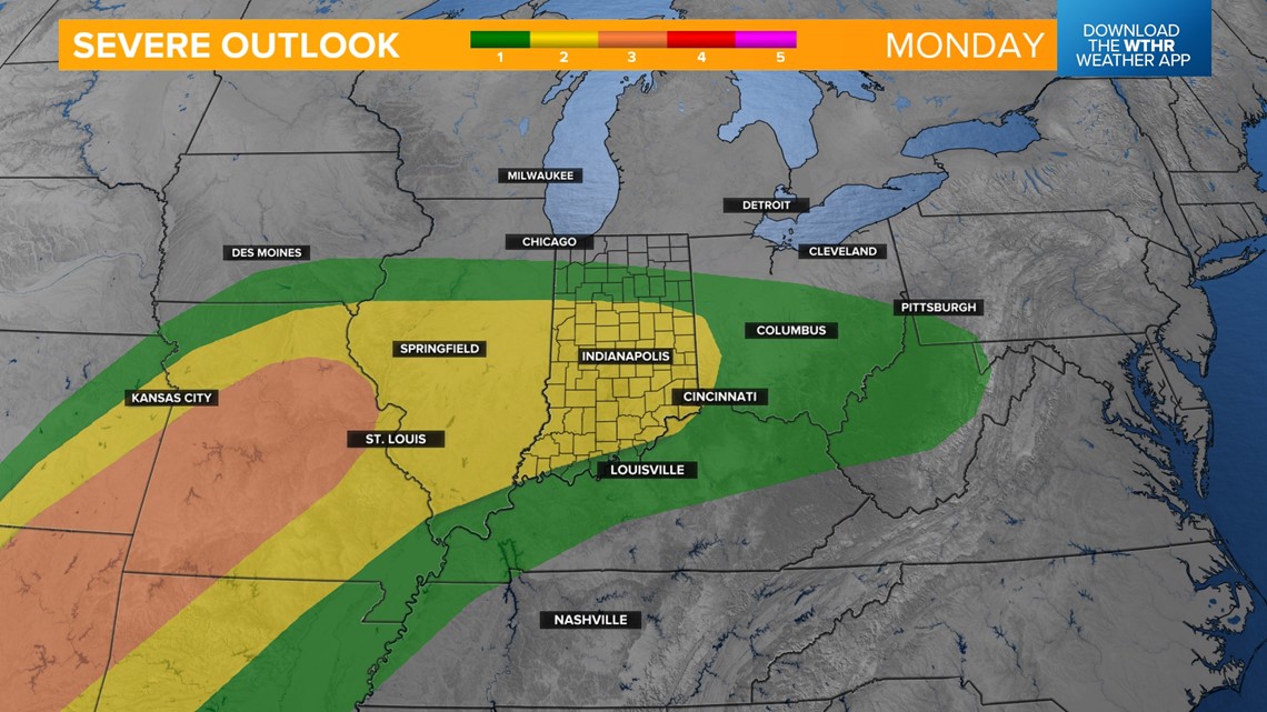
Scattered rain and storms continue into Monday as this storm system stalls out across central Indiana. Temperatures will be dependent on where the frontal boundary sets up but most see steady temperatures in the 60s. The risk of strong storms ramps back up Monday evening into Tuesday morning as the frontal boundary moves through.



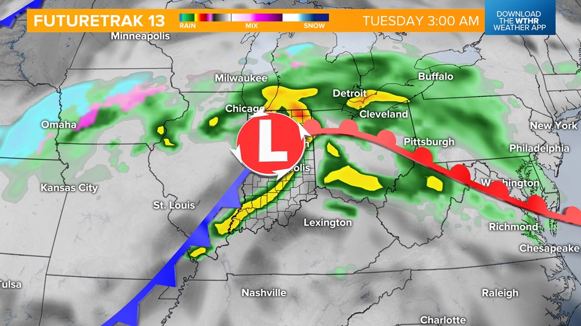
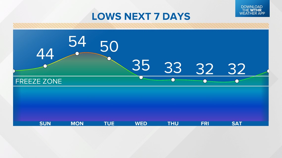
A few showers will linger through the first part of the day Tuesday. As cooler air returns Wednesday, moisture will wrap around the backside of this system and could prompt a wintry mix across the northern tier of the state with scattered rain showers elsewhere. Highs will be limited to the mid 40s. We'll dry out for the remainder of the week but keep the unseasonably cool air around with lows near freezing and highs only in the upper 40s for Thursday and Friday.

