

INDIANAPOLIS — Thursday has been another "severe clear" day in Indiana — and a good portion of the Ohio Valley and U.S. for that matter. We've had noticeably warmer afternoon temperatures near 80° today, and it marks the beginning of a brief warming trend into the weekend. But thanks to relatively drier air (dewpoints in 40s), our nights are seasonably crisp, and that continues until Sunday morning, when the Muggy Meter creeps up a bit.
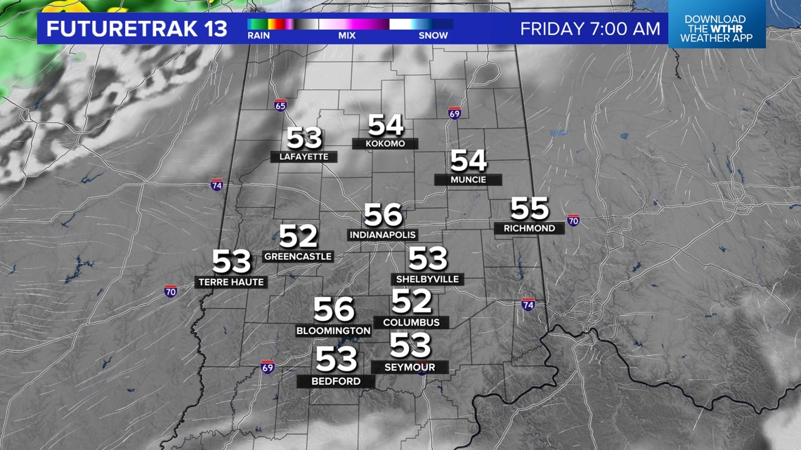
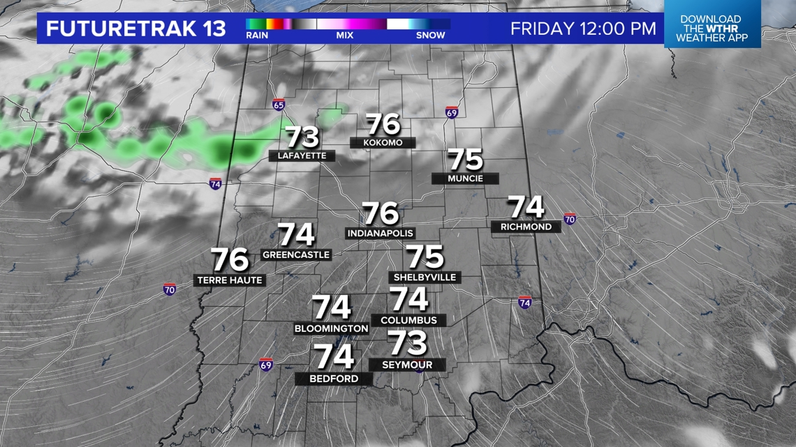
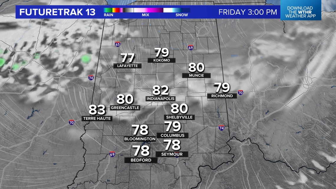
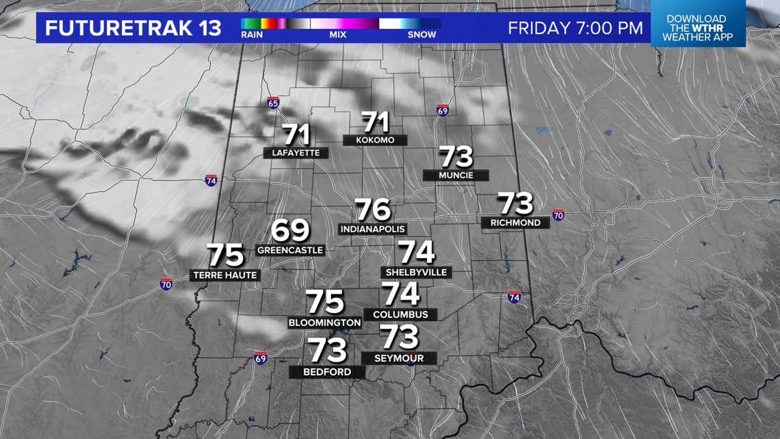
Plan for a pleasant evening and quick cooling after sunset (7:23 p.m.) with lows dropping into the lower 50s to start Friday morning. Another sunny start tomorrow, but the second front to impact Indiana this week arrives by midday. It will be moisture-starved but perhaps just enough to allow for spotty showers north of I-74 in the morning. Otherwise, we'll just notice some mid to high level cloud debris from this front and not much change in afternoon highs that peak near 80°.


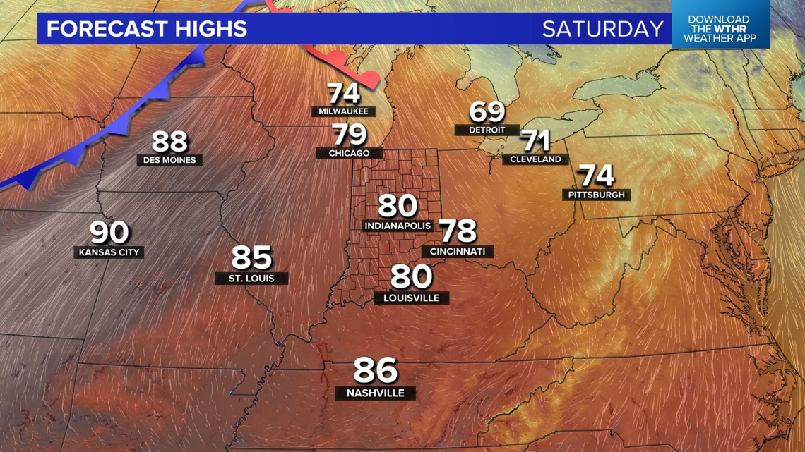
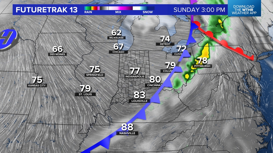
A third cool front crosses through Indiana on Sunday. But it too has limited moisture to squeeze out of the atmosphere, though it will be noticeably more humid to finish the weekend. As a result, lows only drop into the 60s Sunday morning, and we'll continue to mention the potential of spotty showers with that front before it passes in the afternoon. Highs still peak in the upper 70s and lower 80s, which is a good 10°+ above average for early October.


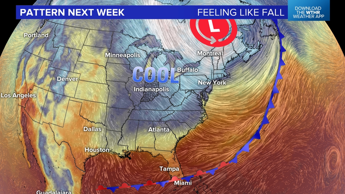
The airmass in the wake of that front will be more typical of this time of year and looks to have staying power with a strengthening low pressure system emerging over eastern Canada. This provides a steady diet of northwesterly to northerly wind next week. So we're forecasting several mornings in the 40s, a few afternoons in the 60s and plenty of sunshine all week.

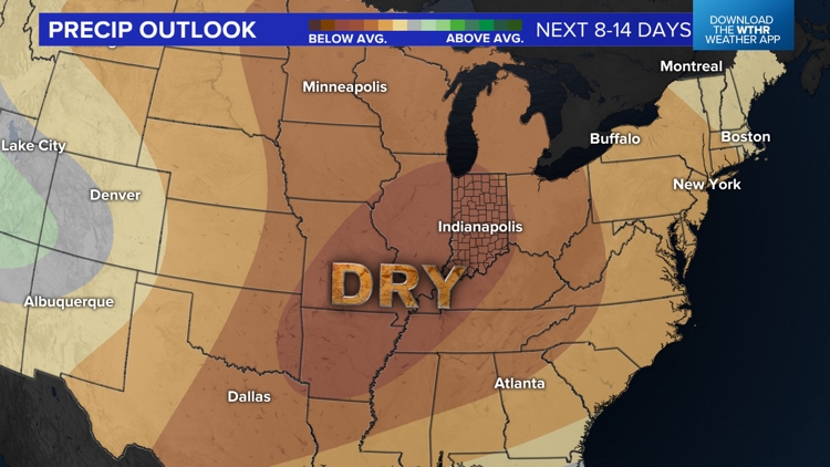
Despite the passage of the aforementioned fronts in Indiana, we're not expecting much more than spotty showers between now and the end of next week. That's great news for Harvest 2024, but will allow for soil moisture to dry quickly and likely produce an expansion of moderate drought conditions across central Indiana.

Matt Standridge explains here the impacts of Helene's moisture on drought conditions up to Oct. 3. Be we expect things to go in the opposite direction moving forward.
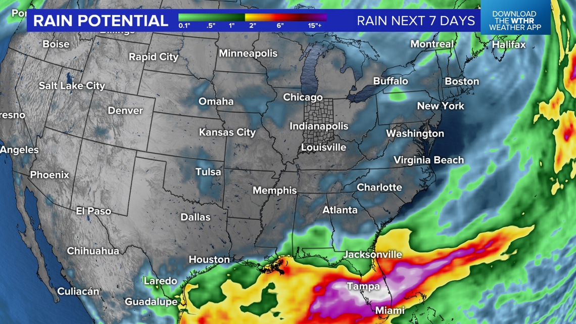
One area of the Lower 48 that's going to get absolutely crushed with heavy rain and flooding will be the Florida Peninsula. This is due to a stalled front, highly moist air and several disturbances that will lead to rounds of heavy rain, especially over central/southern Florida. Whether or not an actual Tropical Storm and/or Hurricane is uncertain, but it won't matter in terms of flooding rainfall there.

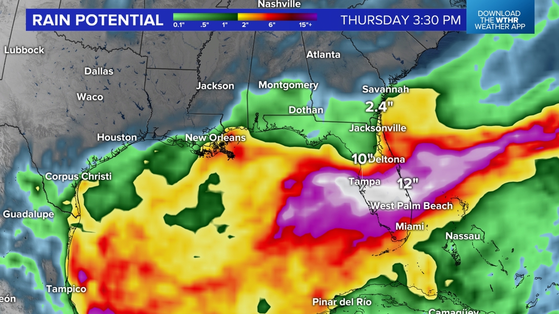
But we'll monitor closely for tropical development in the Gulf this weekend and next week for possibility of wind impacts there. However, it should be noted a series of front and the upper air pattern next week will keep inland areas impacted by Helene mainly dry and mainly tranquil for multiple days.
