INDIANAPOLIS — Central Indiana is in quite the late-season heat streak.
Here's some interesting statistics:

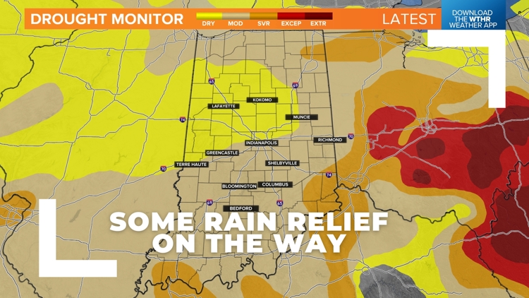
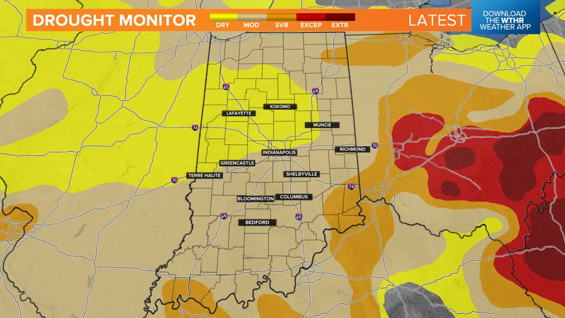
Latest Drought Monitor:
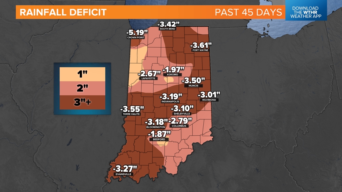
Many areas of Indiana are now under "moderate drought" conditions and there are isolated pockets of "severe drought" as well in the Drought Monitor Index map released this morning. This isn't a surprise at all considering most of the state is dealing with a 3"-4" rainfall deficit over the past 45 days. Lack of rain combined with mainly sunny days has quickly depleted soil moisture and it's evident by the brown lawns and stressed crops currently in the state.

Burn bans as of 2PM Thursday September 19, 2024:

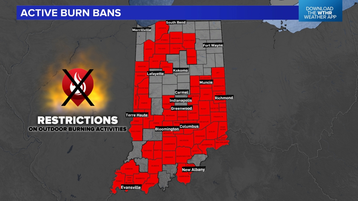

There are now over 50 counties with burn bans, and that number likely grows the next couple of days with three more days of near 90° and minimal rain chances. Please avoid any burning even if you're not in a burn ban with fire conditions conducive for even small sparks to cause big problems.
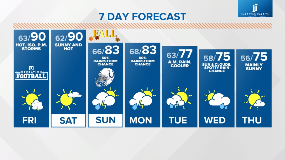
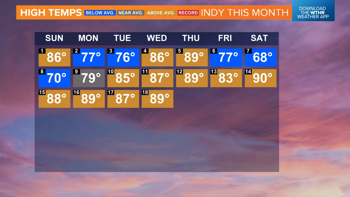
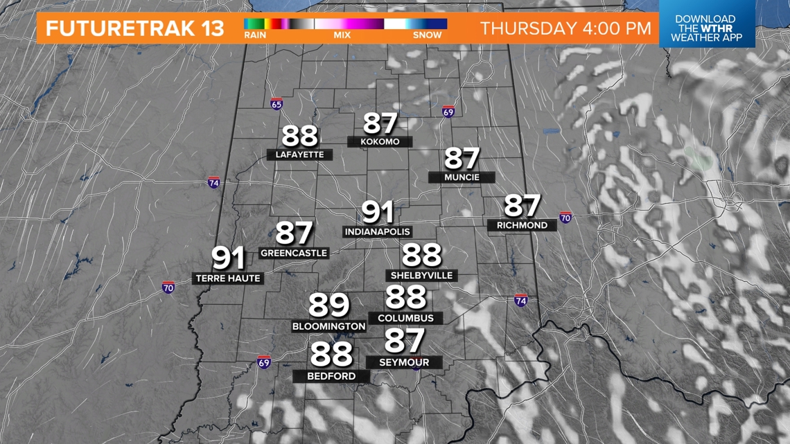
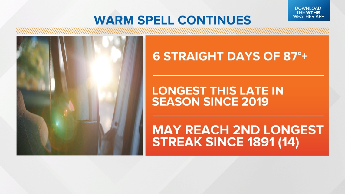
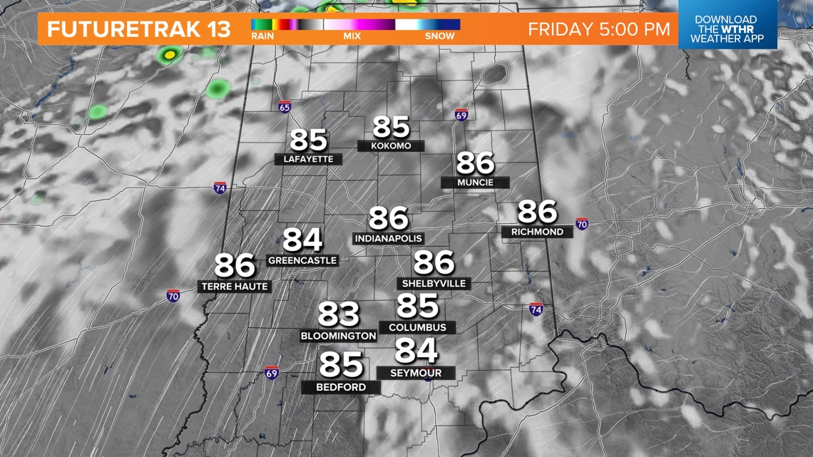
Sunshine today boosts highs back into the upper 80s and lower 90s for the sixth straight day...the longest streak this late in the season since 2019. With our forecast of two more straight days near 90°, this will become the second longest streak of 87°+ in Indianapolis this late in the season behind 14 straight days way back in 1891.


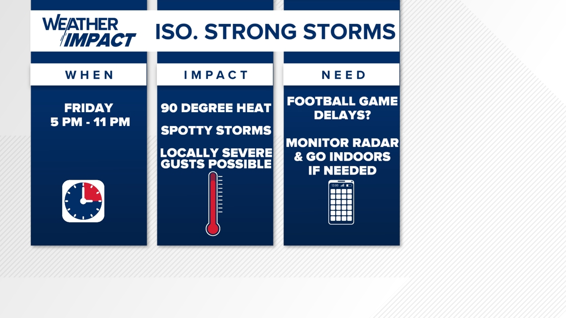
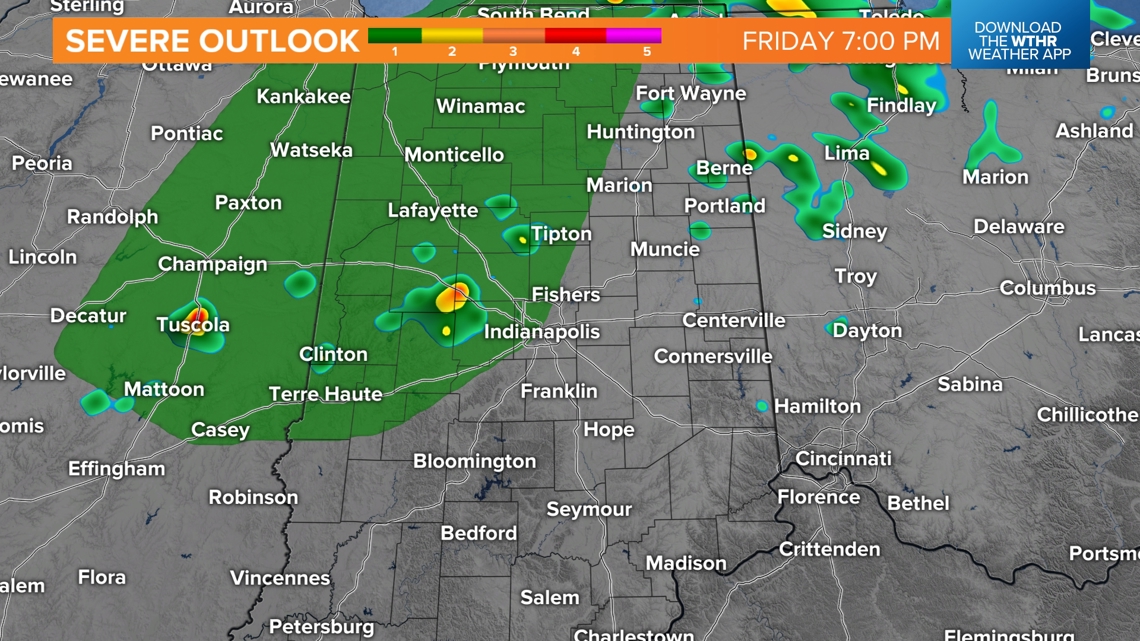
Based on the latest guidance we continue to advertise isolated, but potentially strong, storms developing late Friday as increased low-level moisture teams up with better lift from an approaching front. While many areas don't see a drop of rain, the timing of potential storms between 5 p.m. and midnight could impact someone's outdoor plans. It's best that you monitor radar and be Weather Aware that lightning or brief downpours could delay some Operation Football games and/or force some indoors until they pass.


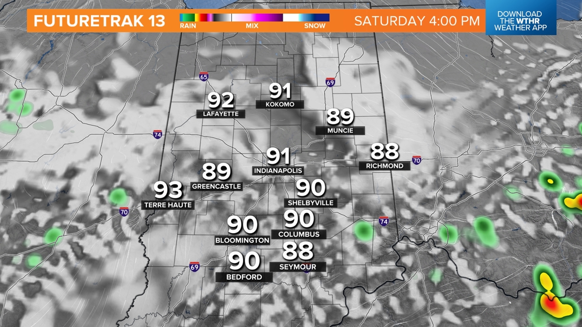
That subtle boundary settles south and washes out near the Ohio River on Saturday. It may be just enough to trigger isolated storms Saturday afternoon near the river, but most of the state will be rain-free, sunny, and hot to open the weekend with highs near 90°.
Our biggest forecast adjustment in this package is for increased rain and thunderstorm coverage going into Sunday afternoon, with the expectation of scattered to possibly numerous showers and/or storms.


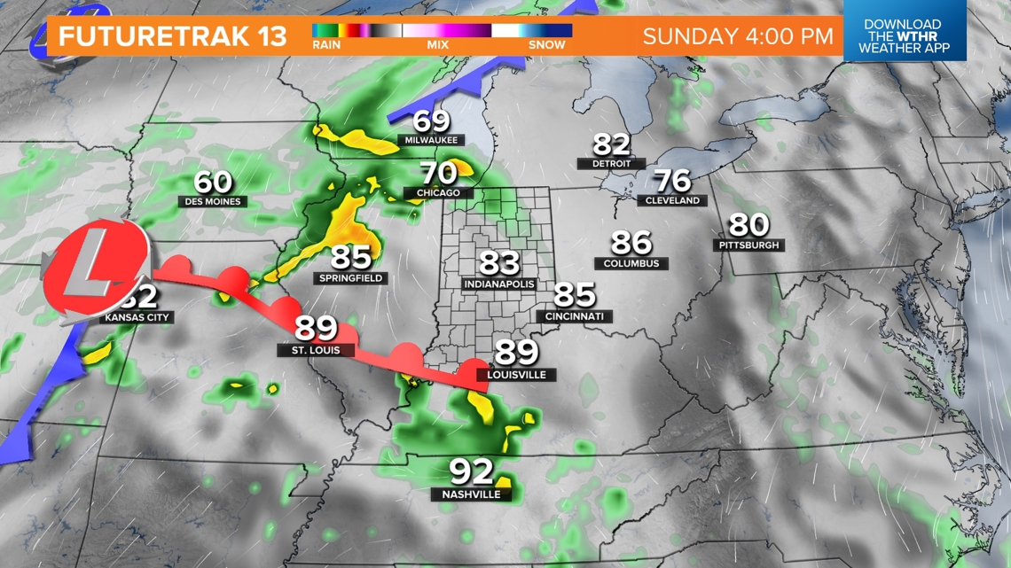
You'll certainly want to be monitoring radar for any outdoor weekend plans on Sunday and going into Monday with additional pockets of much-needed rain to start next week.
We still can't pinpoint at this time which areas get the heaviest rain, but confidence is growing that at least some of the state will get 1"+ rainfall by the middle of next week. Updates to come.