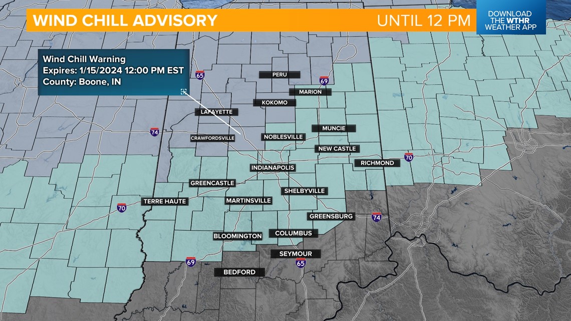
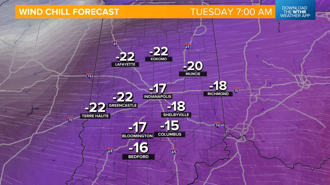
INDIANAPOLIS — Several counties across west central and northern Indiana have been upgraded to a Wind Chill Warning that will be in effect through noon Monday. Frostbite could occur within 30 minutes on exposed skin with these dangerous wind chill values. You should also limit outdoor time, wear extra layers and bring pets inside. The rest of the state remains under a Wind Chill Advisory through noon.

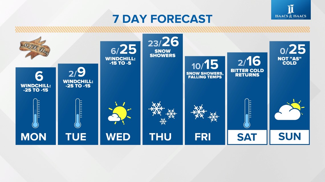
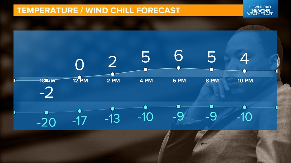
Air temperatures today remain in the single digits with a high near 6 and wind chill values staying below zero. We will see some sunshine to start the day, with increasing clouds this evening as a weak wave moves in.

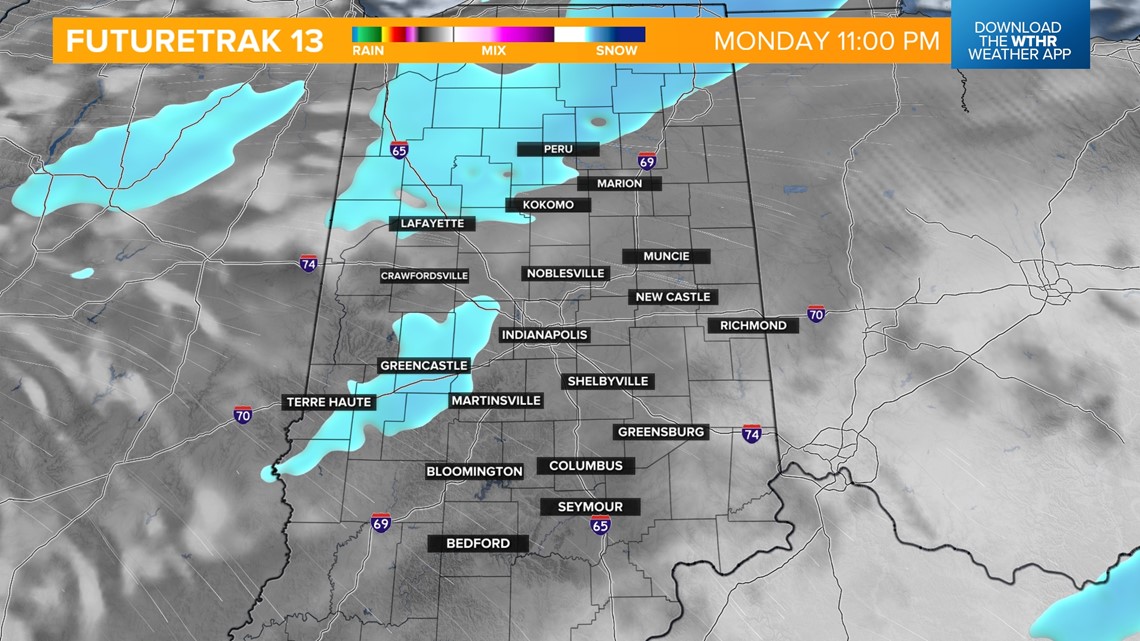
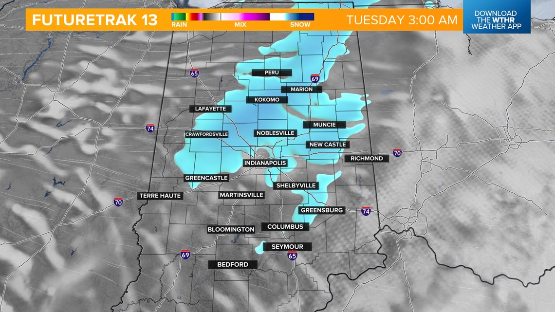
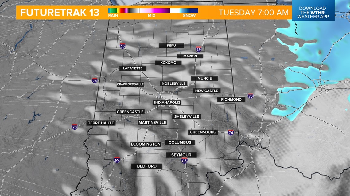
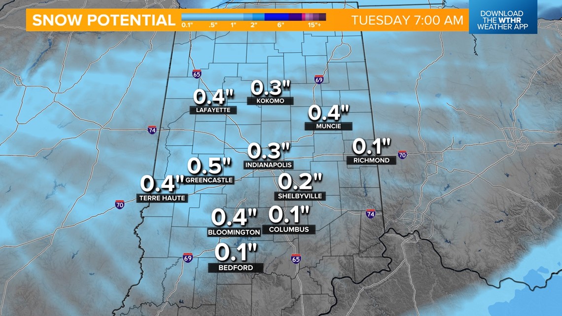
A few scattered snow showers will be possible starting around 11 p.m. and continuing overnight. This will clear out by Tuesday morning's commute, but there will be potential impacts. While moisture will be lacking and snowfall potential remains under the 1-inch mark, this could create new slick surfaces for the morning rush hours.


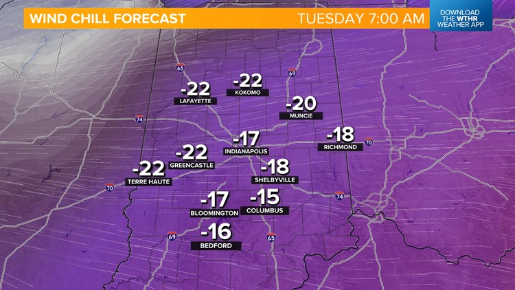
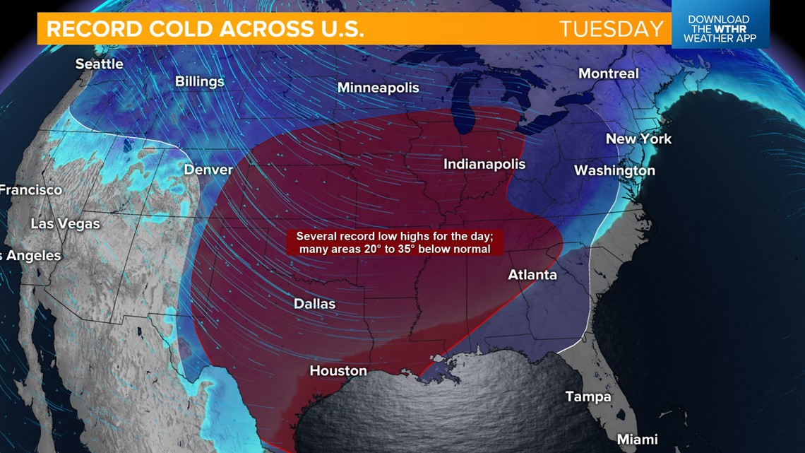
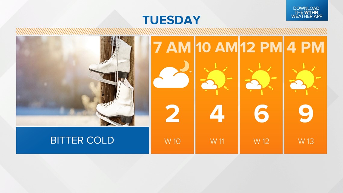
Temperatures drop to near 2 degrees overnight with wind chill values again expected to fall as low as -25. Arctic air holds strong across a good portion of the country Tuesday, bringing the risk of record-low "high" temperatures as far south as the Gulf Coast.


At least we see sunshine returning for Tuesday afternoon as it stays cold with highs in the single digits.

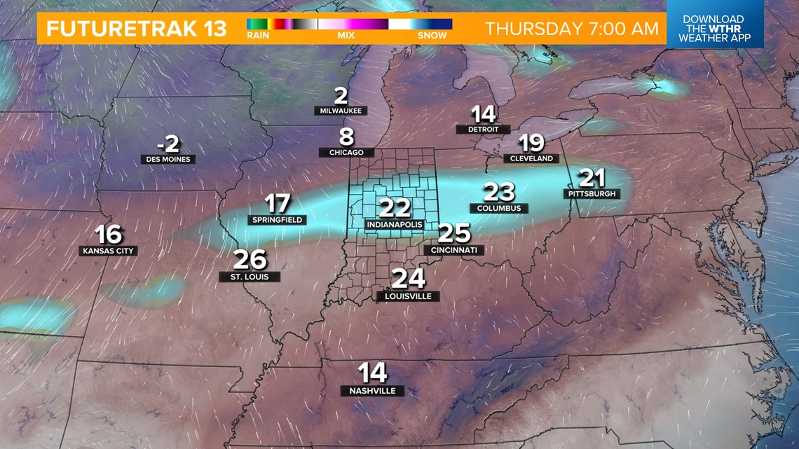
Temperatures moderate a bit by mid-week with highs in the mid-20s Wednesday and Thursday. While we stay dry Wednesday, our next storm system brings more snow chances by Thursday morning. Scattered snow will be possible again Friday as cold air returns and temperatures drop back into the teens. Minor snow accumulations will be possible.

Bitter air lingers through next weekend with highs in the teens Saturday and mid-20s Sunday. It is still looking like central Indiana won't get back above freezing until the start of next week.