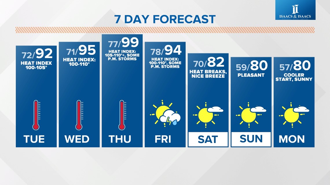
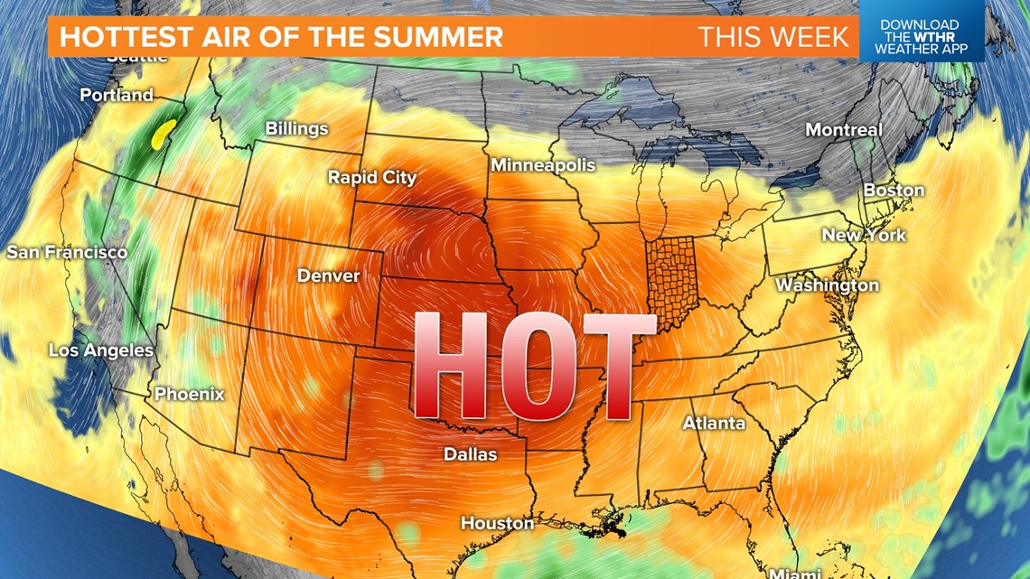
INDIANAPOLIS — Ready or not... it's here. "It" is the hottest air of summer for central Indiana so far, with a nasty combination of sunshine, miserably muggy air, and hot highs in the 90s. The end result will be a heat wave that lasts into Friday afternoon, with daily peak heat indices in the 100-110+ degree range.
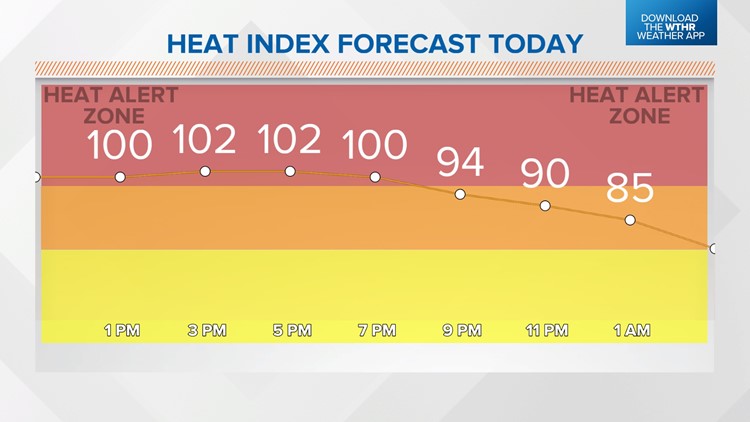
Heat Advisories will likely become Excessive Heat Warnings between now and the end of the week. Either way, it doesn't matter. Please take necessary steps to keep you and your family safe.
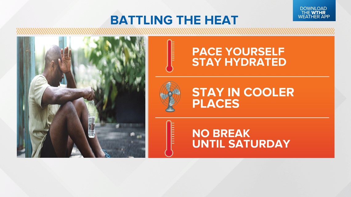
This type of air demands your attention and demands that you heed warnings to stay hydrated, take frequent breaks, seek A/C when possible and know the signs of heat exhaustion. Heat like this can be deadly if you ignore the warning signs. We urge to keep a close eye on children, pets and elderly neighbors.


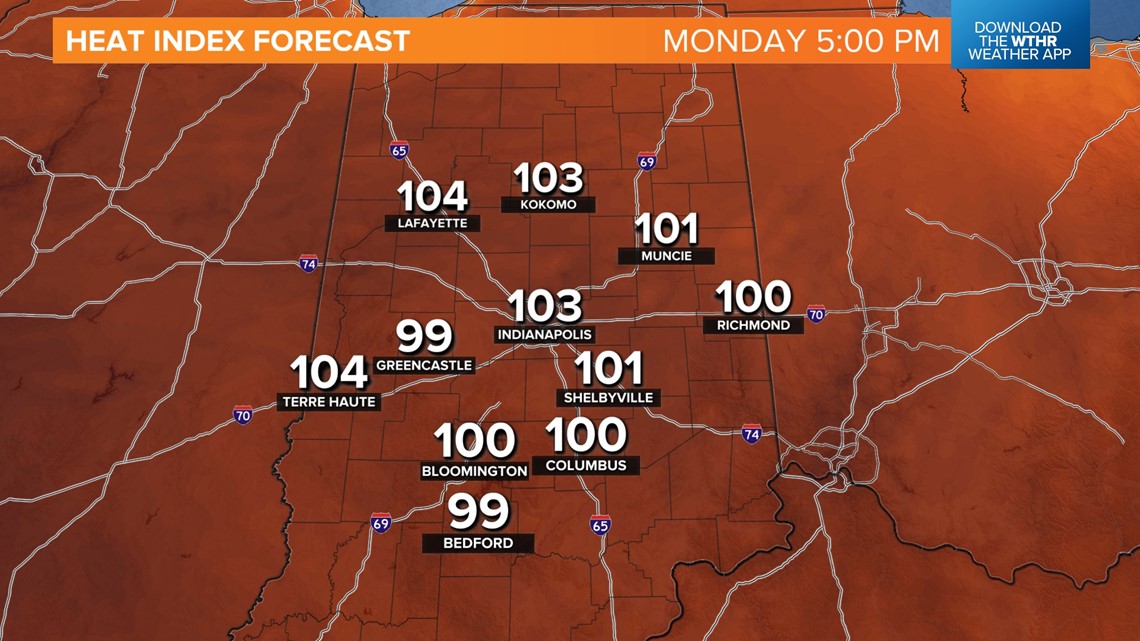

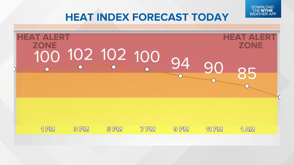
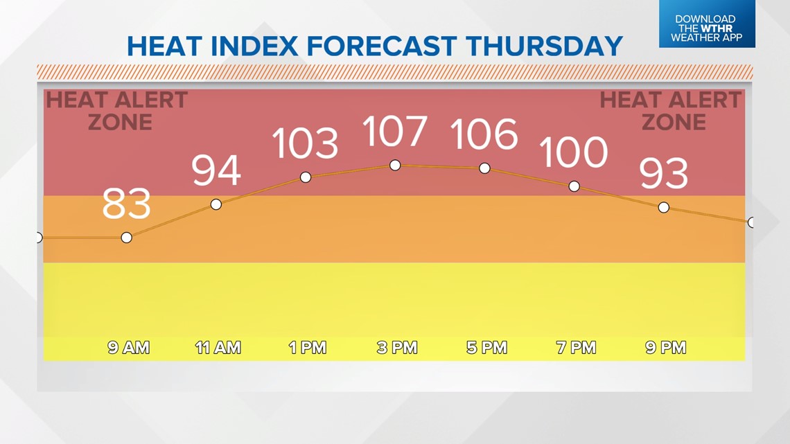
The highest heat indices/temperatures occur in the 11 a.m. - 8 p.m. timeframe this week, but please know that conditions will be highly uncomfortable before and after those hours due to the muggy air. Dewpoints in the mid/upper 70s don't allow your body to cool as efficiently as drier air.
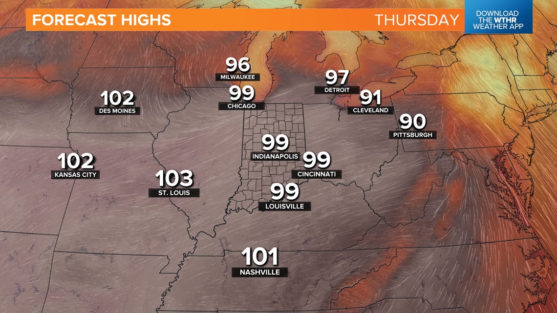
Air conditioners will continue working overtime because of that muggy air, too. We're still expecting the hottest day to be Thursday as air temperatures flirt with 100 degrees. Triple figures are rare in Indianapolis. The last 99-degree day in Indy was July 5, 2022, and the last 100+ degree day was back in the brutal summer of 2012.


It typically requires dry soils to reach 100 degrees in Indy, which was the case during the extreme drought in the summer of 2012. Central Indiana has been hit with beneficial rains in the weeks leading up to this heat wave. This means heat indices of 110+ degrees are more likely to occur than 100-degree air temp. But that's all for record-keeping and doesn't diminish the severity of the hot, humid air.


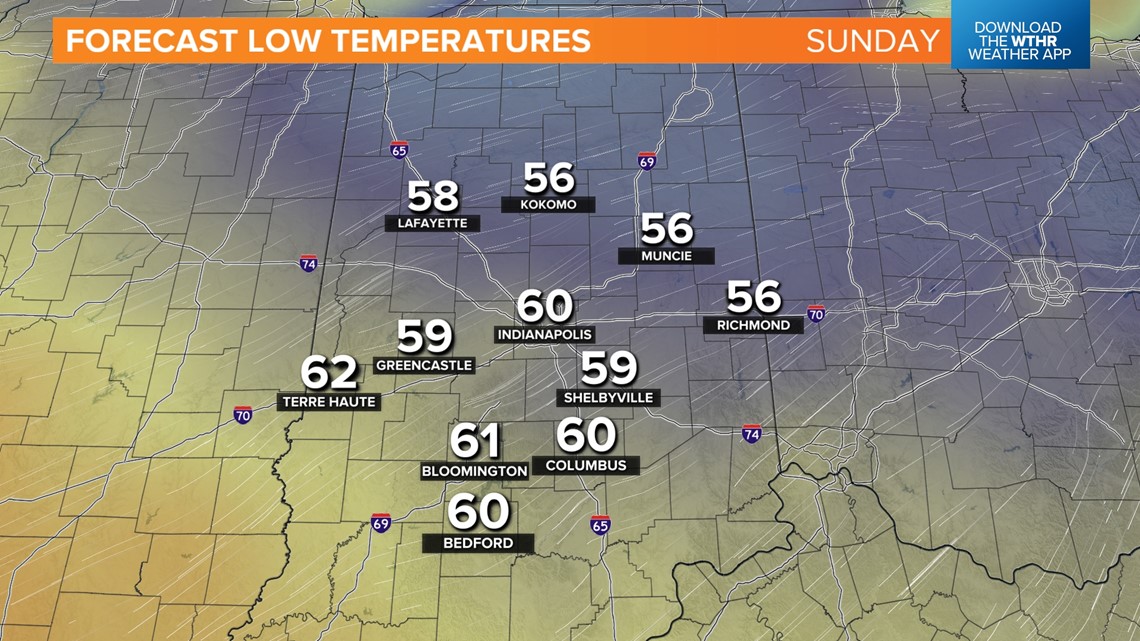
Late-day thunderstorms may bubble up both Thursday and Friday afternoons, but at this time, we don't envision widespread storm coverage. The passage of a front delivers much cooler air this weekend, and eventually, a substantial drop in the Muggy Meter Saturday afternoon into Sunday morning — when low temperatures drop into the 50s!
But we're definitely going to earn the expected cooldown by enduring the hottest stretch of days this year.