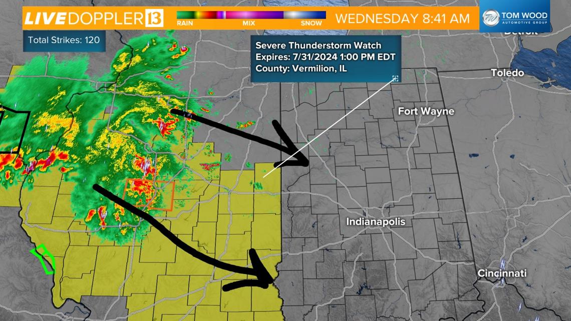
INDIANAPOLIS — A complex of strong storms in central Illinois has prompted a Severe Thunderstorm Watch across the border in Illinois until 1 p.m.
This storm system is tracking southeast toward Indiana. Here's what to know.

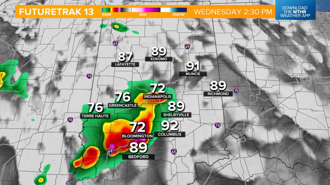
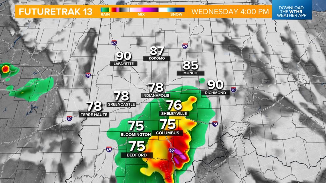
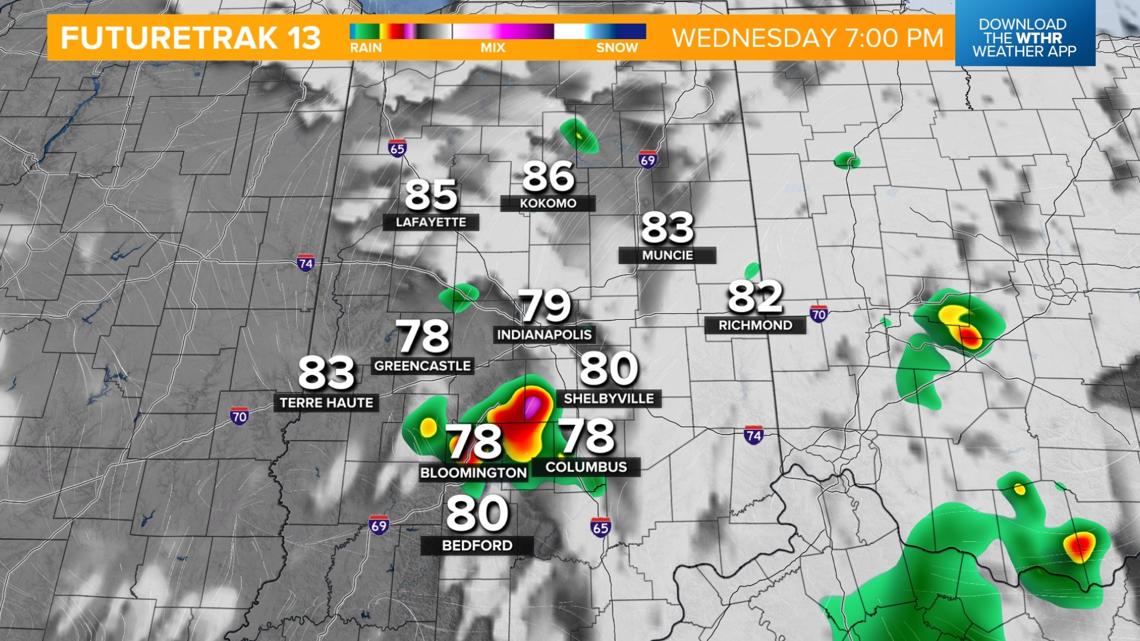
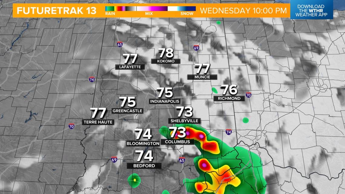
Severe risk across Indiana again Wednesday
The Storm Prediction Center has once again placed all of central Indiana under a level 2 of 5 severe risk.

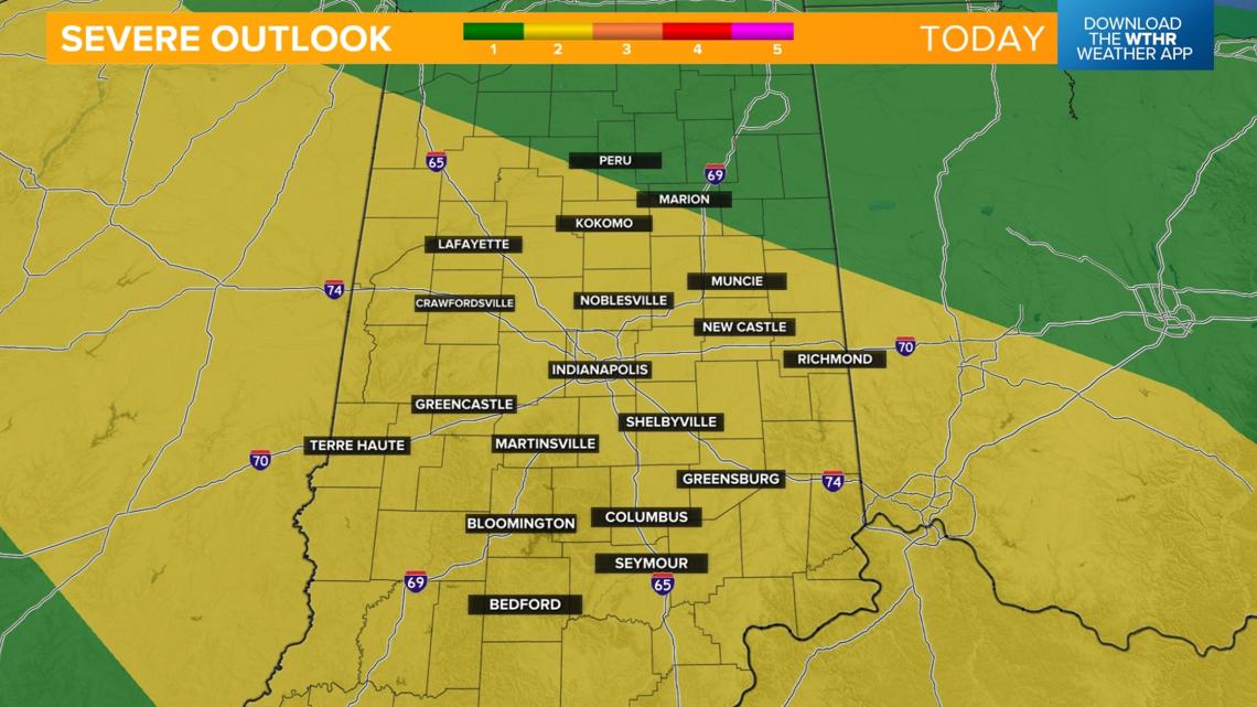
WHEN: After 1 p.m. - 10 p.m.
IMPACT: Damaging wind threat, isolated large hail and heavy rain/localized flooding.
NEED: Keep an eye on radar as storms approach, and have a way to receive warnings.


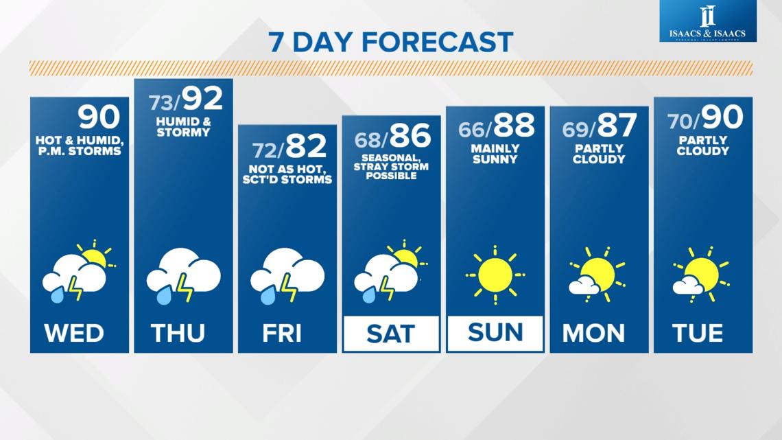
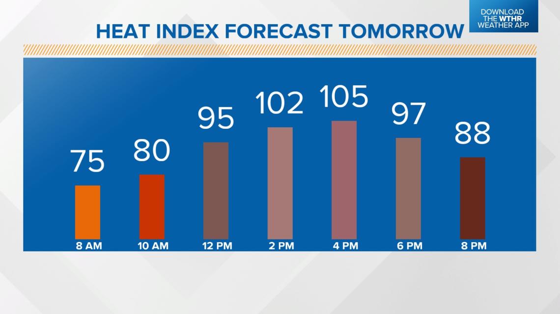
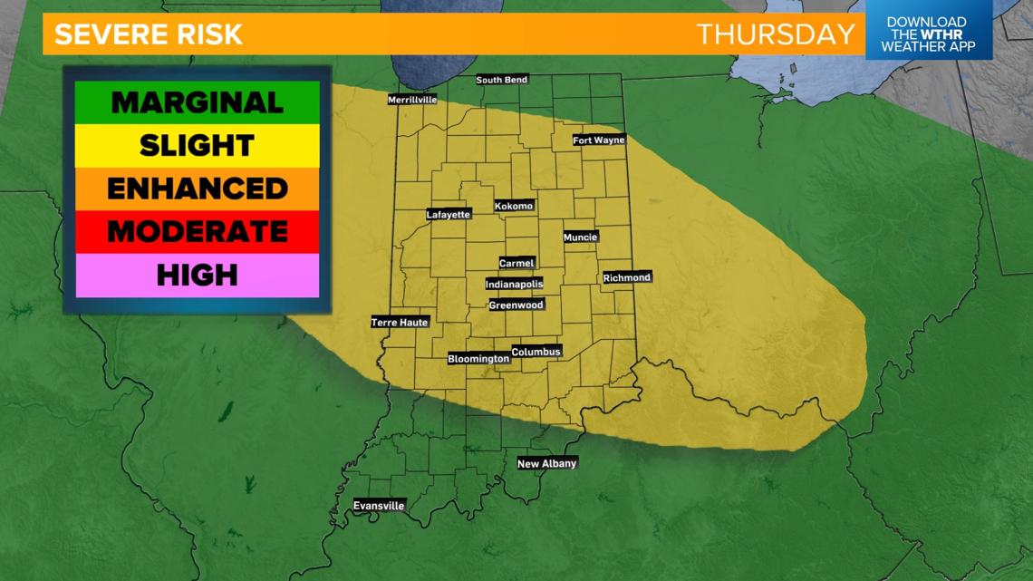
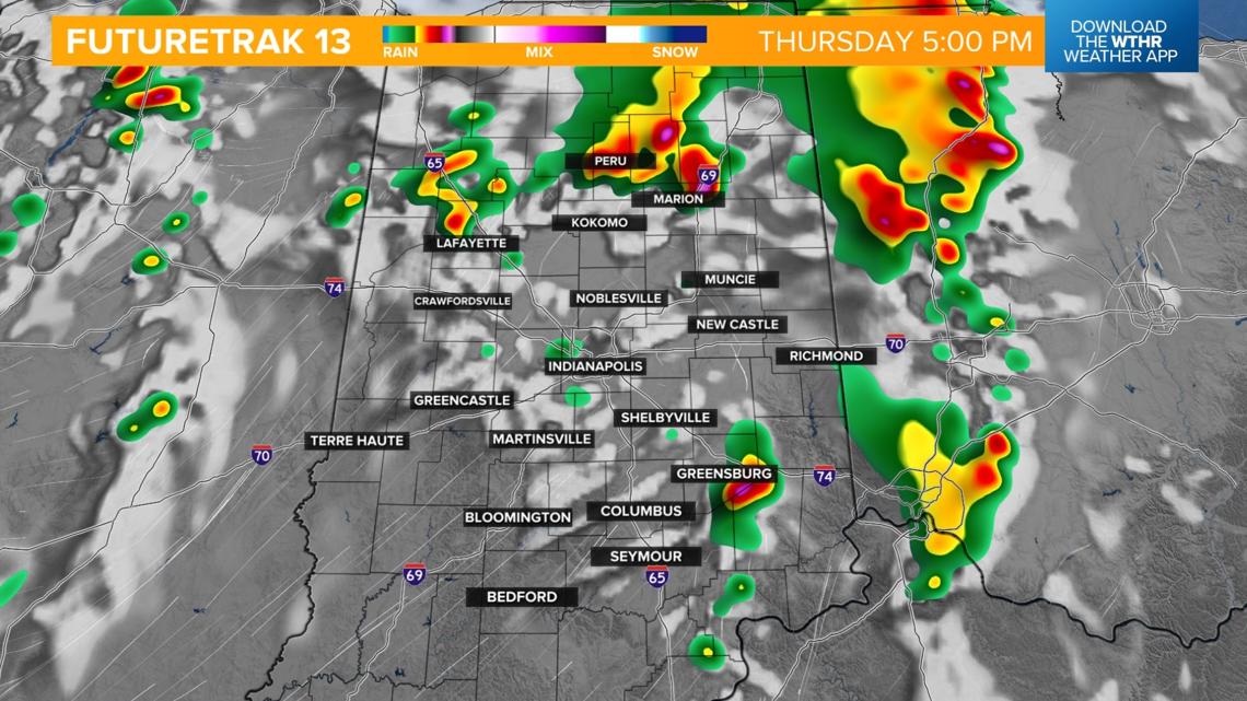
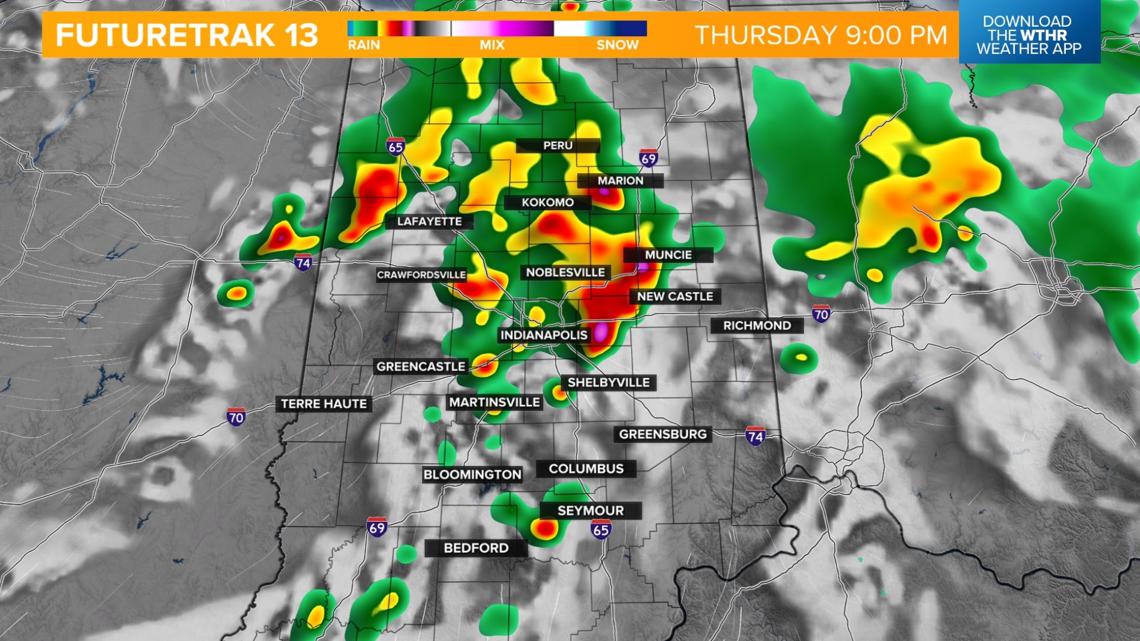
THURSDAY: Severe storm threat continues. Damaging wind gusts and flooding rain are the primary threats. Storms will likely begin firing up as temperatures warm into the low 90s in the early afternoon. Dangerous heat index values from 100-110 degrees Thursday afternoon.


When will this pattern change?
We're finally looking at a low pressure system arriving on Friday which will swing a cold front through the area. It'll still be rather humid to start the day Friday which aids storm development as the boundary arrives.
Look for scattered showers and storms impacting most of the day Friday.
Temperatures will be hindered though with highs in the low 80s.

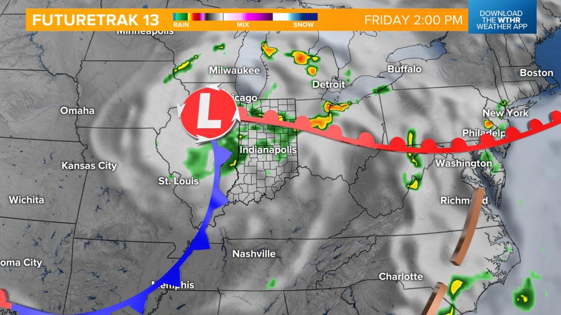
This weather system won't be a quick mover, though.
Models are hinting at it stalling out across central Indiana, keeping a chance of storms in the forecast through the start of the weekend.
High pressure looks to then take over starting on Sunday putting an end to the stormy stretch.