INDIANAPOLIS — It was noticeably more humid Sunday afternoon, with dewpoints in the 60s making the Muggy Meter a bit more uncomfortable.
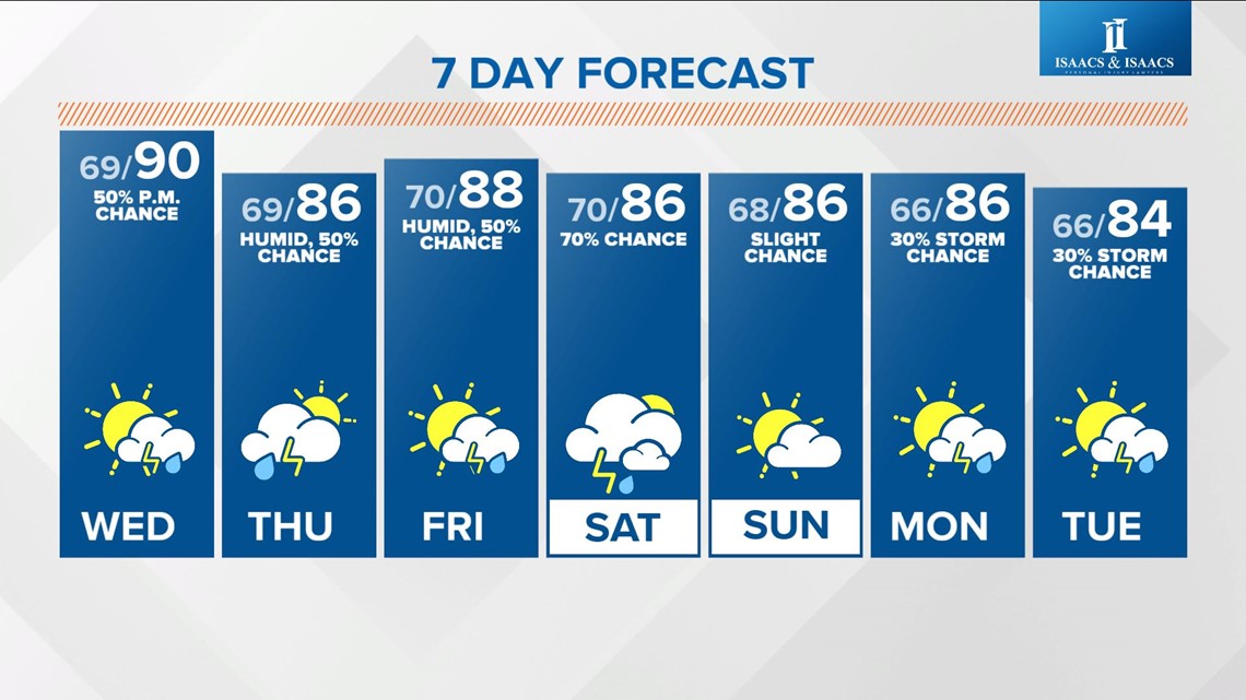
This is just scratching the surface on miserable mugginess inbound mid-week into this weekend.
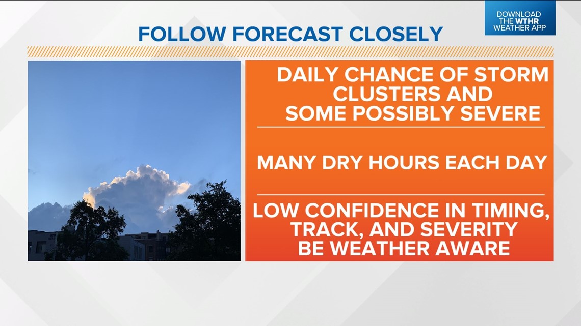
That return of tropical moisture also coincides with daily chances of heavy storm clusters, or bigger storm complexes.
No rain or storm worries this afternoon with only a slight chance of pop-ups in far northern Indiana near a slow-moving frontal boundary.
Everyone enjoys a healthy dose of hazy sun with highs near/above 90 degrees today.
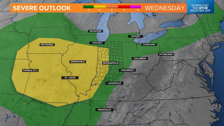
We'll be monitoring upstream radar over Nebraska, Iowa and the Dakotas for a potential storm complex.
It remains highly uncertain when and where this complex will develop and track, but its remnants could be near the Illinois/Indiana border by midday Wednesday.


There are several possible modeled scenarios for Wednesday, some splitting this feature around the bulk of central Indiana, some taking it farther south-southwest and some bringing weakening remnants through the state by early afternoon.
We'll see how this progresses in the morning and what type of shape it's in on approach to the state.
You shouldn't cancel any plans but be ready to move outdoor activities indoors if you hear thunder.
It will be a good idea to get up each morning, or before bed, and see what our latest forecast looks like.
This pattern can be frustrating in regard to timing, track, and severity with each of these complexes and admittedly, our forecast confidence is low right now.
While we do feel there will be storms on the radar each day, it's impossible to say right now when the most likely time will be each day and whether or not we'll definitely have severe storms.
Confidence is high on muggy air lingering into this weekend. Stay weather aware and check radar before beginning outdoor activities.


