INDIANAPOLIS — Much of the day felt and looked like early October versus early June in central Indiana with low clouds, a brisk northwesterly wind, and temperatures in the 50s/60s.
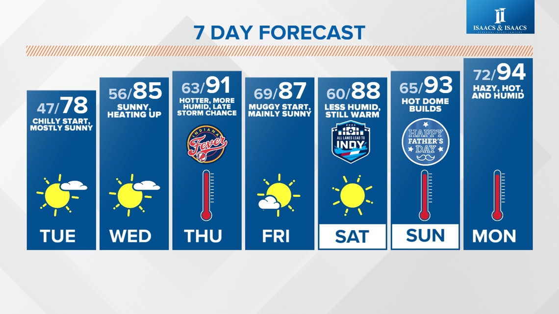
Satellite analysis shows the low cloud deck clearing from north-to-south and temperatures responding quickly with late-day highs near 70° expected. That's still below average for June 10, but noticeably milder than the 50s of earlier.
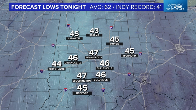
The clearing sky, combined with a calming wind, sets the stage for our coldest night since late-April with unseasonably chilly lows in the lower to mid 40s. While the record low in Indianapolis (41°/1980) is safe tonight...our forecast low of 47° is a good 15° below average. Away from Indy's urban heat island, expect lows closer to 40° in rural where maximum cooling occurs.


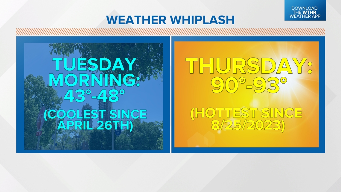
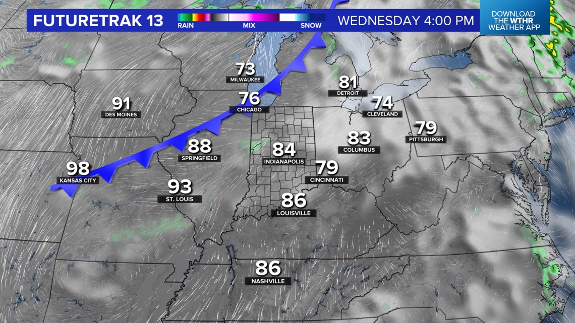
This may be our coolest temperatures until after summer with long-range guidance continuing to advertise our hottest temperatures of the year and hottest temperatures since late last August. We're forecasting the first round of 90s on Thursday before a frontal system arrives Thursday night.
That front may bring a scattering of downpours and thunderstorms within increasingly humid air. The muggy air lingers a bit Friday before easing Friday night into Saturday. Though temperatures may not be as hot those days, we're still expecting upper 80s to near 90° as the edge of an upper level high begins to expand into the Ohio Valley.


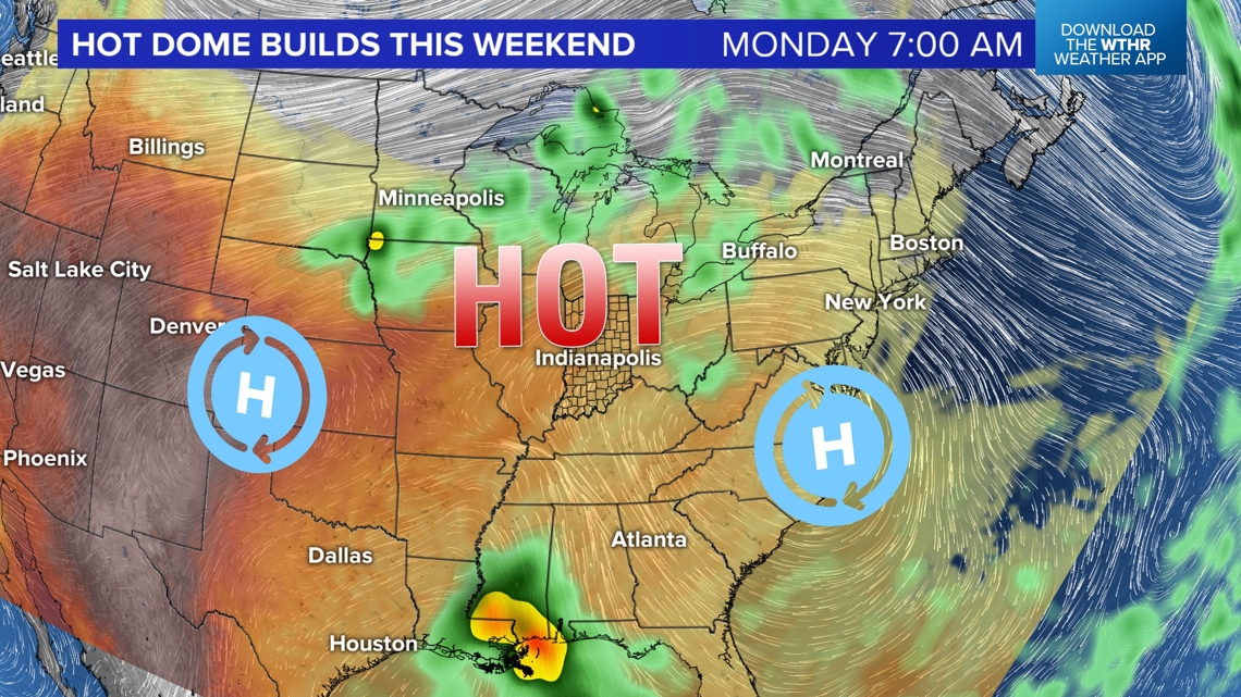
Underneath the upper level ridge, multiple days of highs well in the 90s are likely beginning Father's Day into the middle of next week. What could prevent 90s beyond that would be any potential tropical systems coming out of the Gulf of Mexico, which is always a possibility this time of year and beyond.