INDIANAPOLIS — Central Indiana remains on the influence of what's left of Helene's circulation that's meandering over southeastern Kentucky. This is the fourth straight day of mainly cloudy conditions, but the least number of returns on radar since Helen arrived on Friday. Spotty sprinkles and/or showers remain possible this evening, with greater probability closer to the Ohio River.
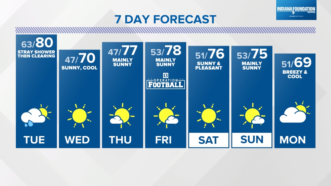
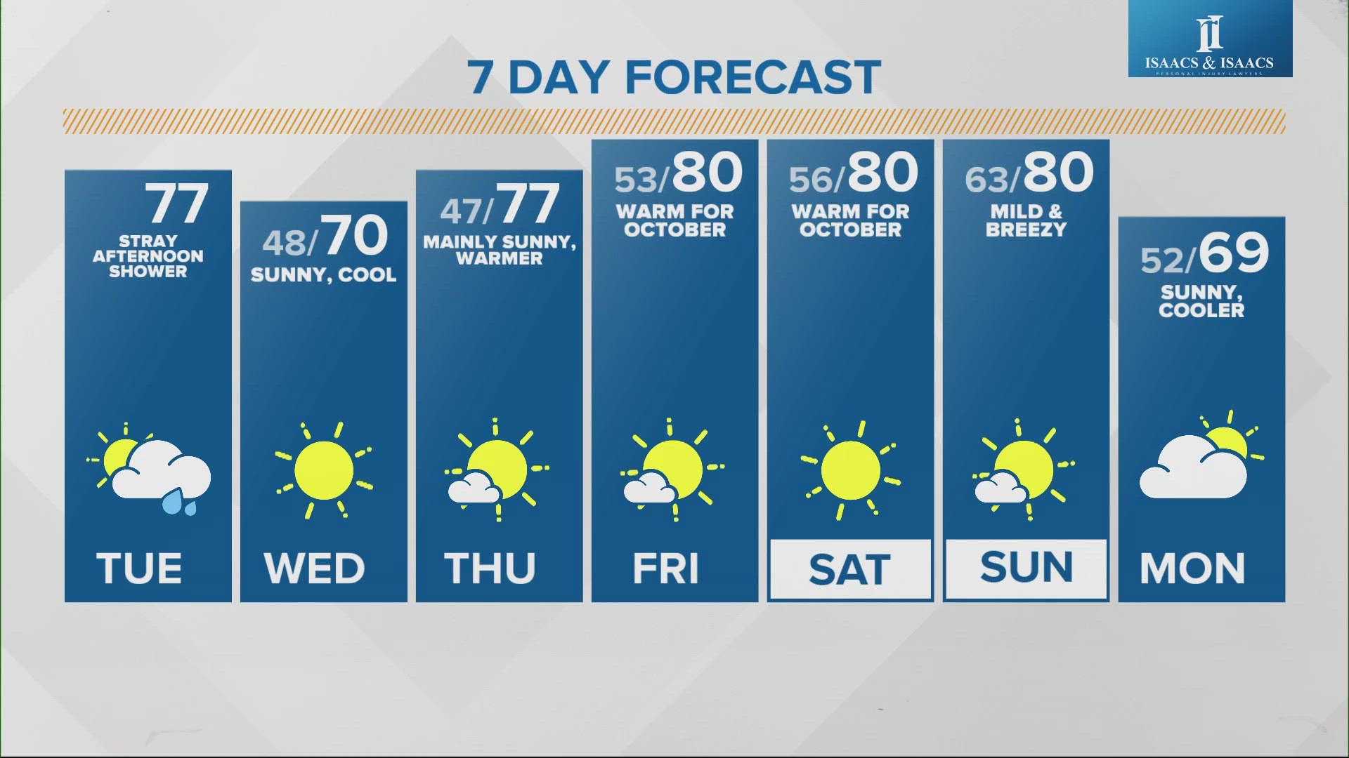
Clouds keep temperatures elevated in the 60s tonight with relatively humid air. We're monitoring the timing of an upstream cold front that eventually pushes Helene's off-shore and delivers the coolest temperatures locally since Sept. 9. To get to the cooler of the boundary, we'll have highs near/above 80° Tuesday with hit-and-miss showers and thunderstorms.

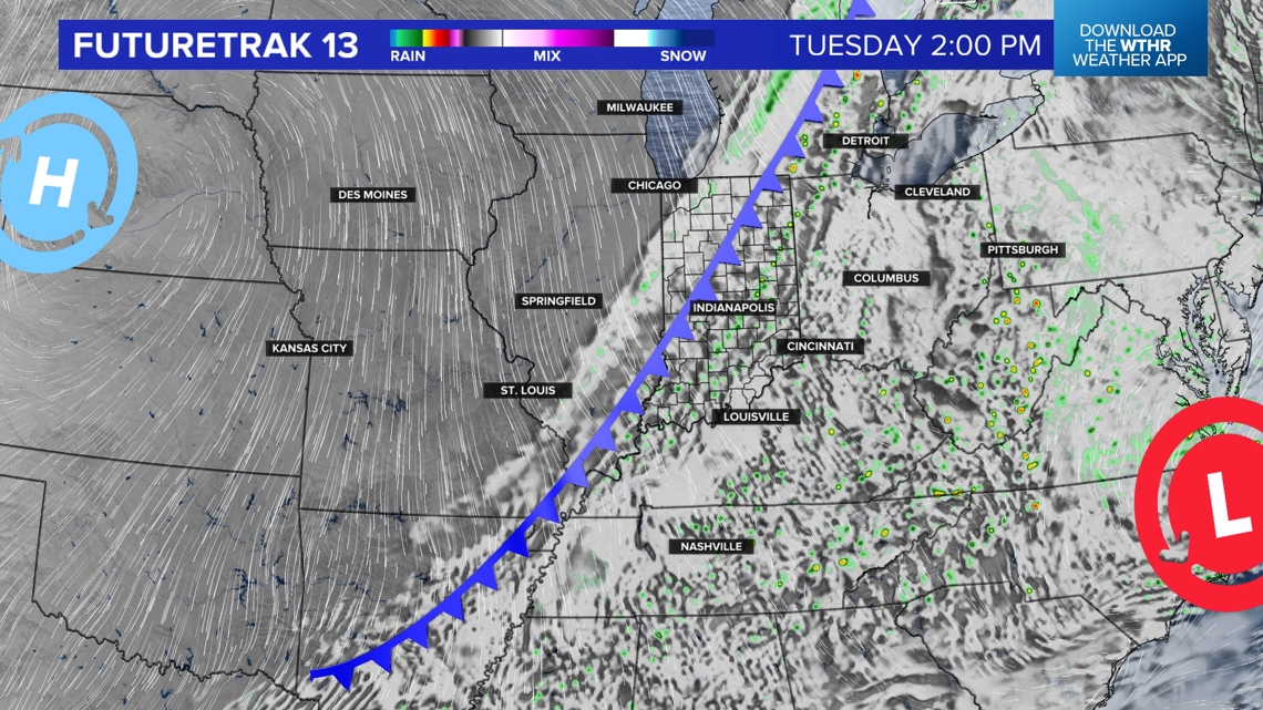

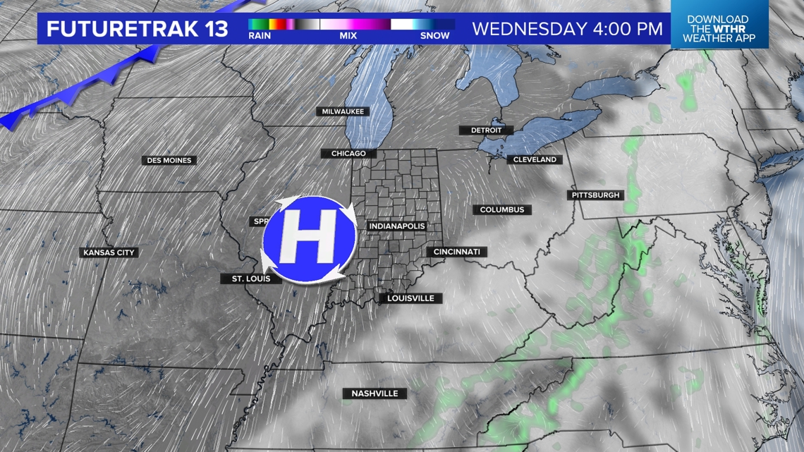
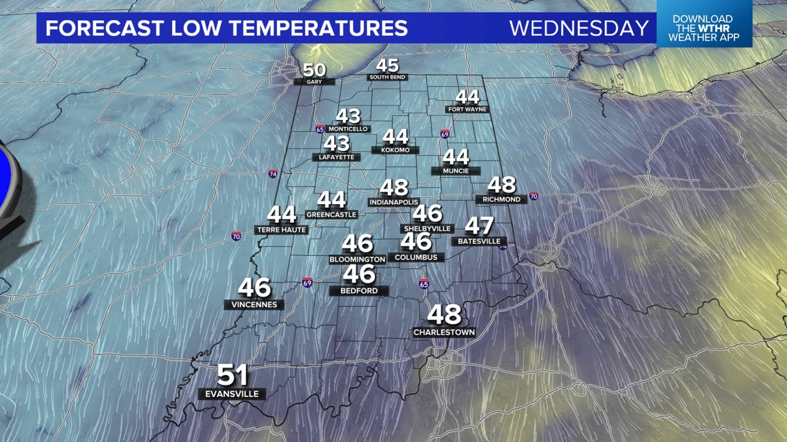
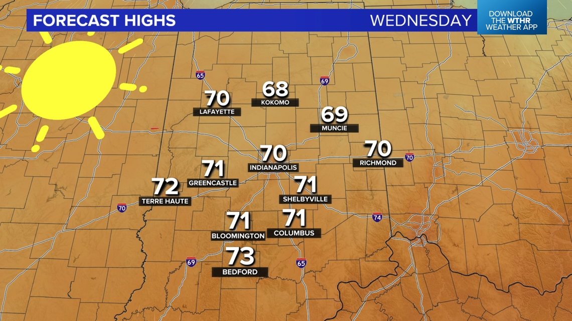
Any rain will be brief, and expect a clearing of any cloud cover Tuesday evening as the drier, brisk northwesterly wind takes charge and brings into 40s for low Wednesday morning. Wednesday is a strong candidate for pick-of-the-week with sunshine and mild afternoon highs near 70°, along with plenty of sunshine.


Tranquil weather continues Thursday and much of Friday too, despite another boundary crossing through the state. However, this front has very limited moisture, and for now, we're keeping the forecast mainly dry.
The weekend looks 180° different compared to the cloudy, showery one we just left behind. Sunshine and highs in the 70s will be a nice break for outdoor time and precedes seasonably cooler air next week.