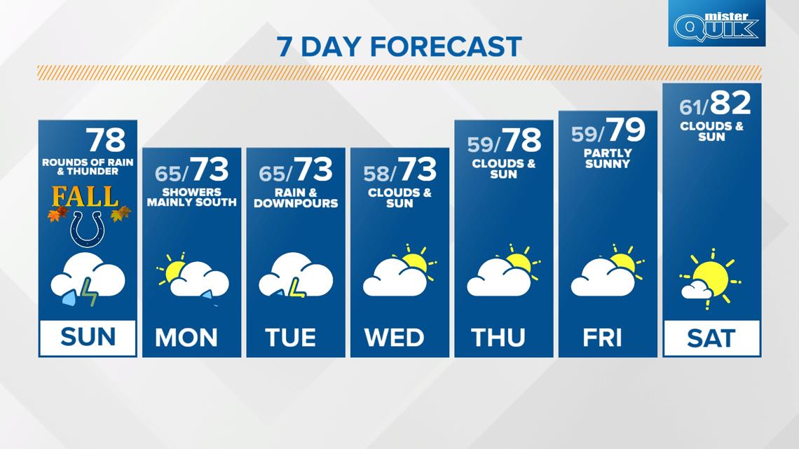
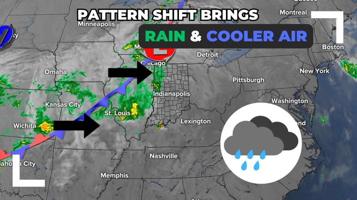
INDIANAPOLIS — A major pattern shift from hot and dry weather brings multiple rounds of rain and more seasonal temperatures starting today.

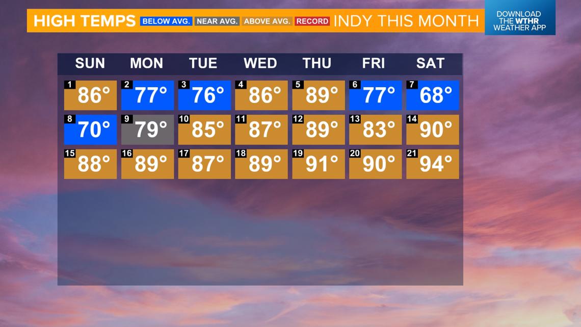
Heat streak ends...
Indianapolis hit a high temperature of 94 degrees yesterday, just a few degrees shy of tying the standing record of 96 degrees set back on Sept. 21, 2010. This marked a stretch of 12 days where we had a high of 80+ degrees which is the longest this late in the season since Sept. 9-22, 2019.

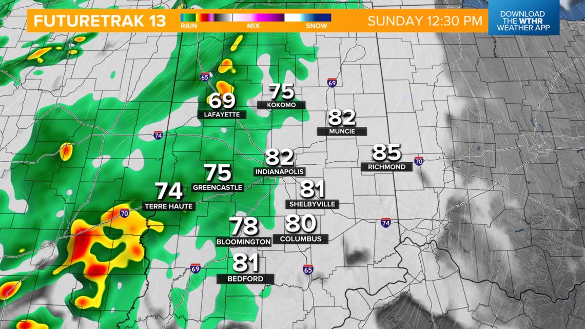
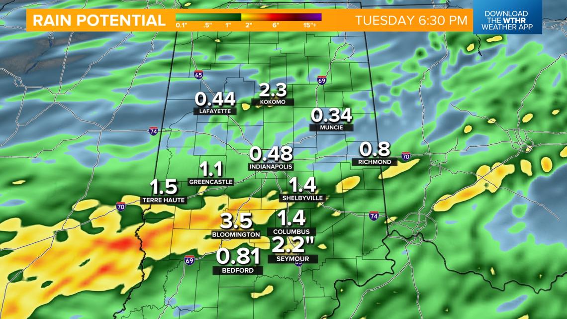
Today's rain timeline and totals:
- More seasonal temperatures arrive today with highs in the upper 70s as a cold front moves through and rain keeps us cooler
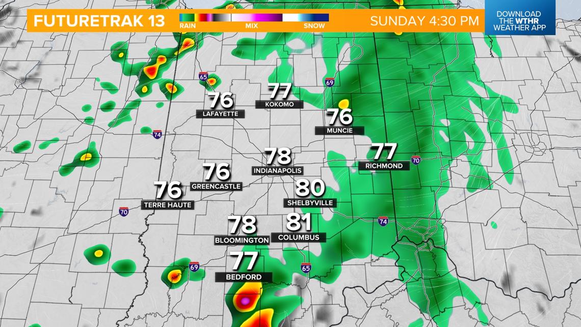
- Rain chances increase from west to east
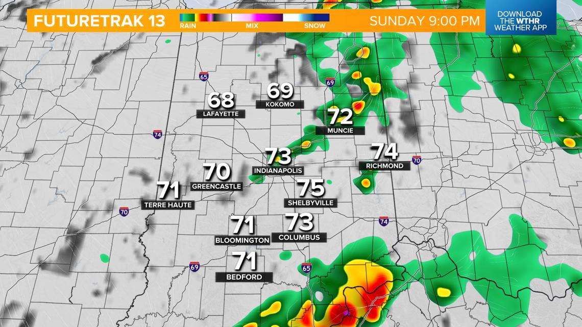
- Scattered showers and isolated storms will be likely in the afternoon and taper off after 9 p.m. This first round of rain will bring around 0.25" up to 1" under heavier rain bands


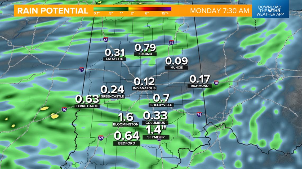
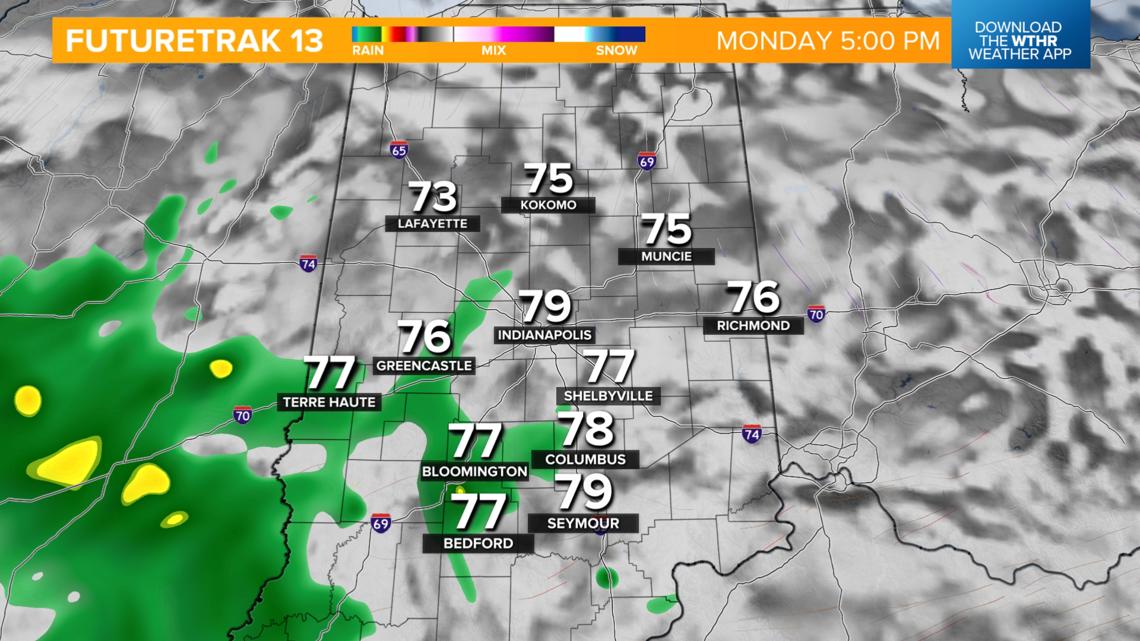
Lower rain chance on Monday
Scattered rain and a few storms will again be possible on Monday, but mainly across the southern half of the state closer to where this frontal boundary stalls out. Temperatures will actually be a few degrees below average in the 70s.

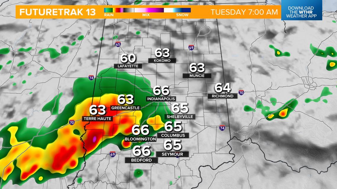
Another round of heavier rain Tuesday morning
This front will push back north late Monday night into Tuesday morning bringing another round of heavier rainfall and isolated storms through the first part of the day Tuesday.

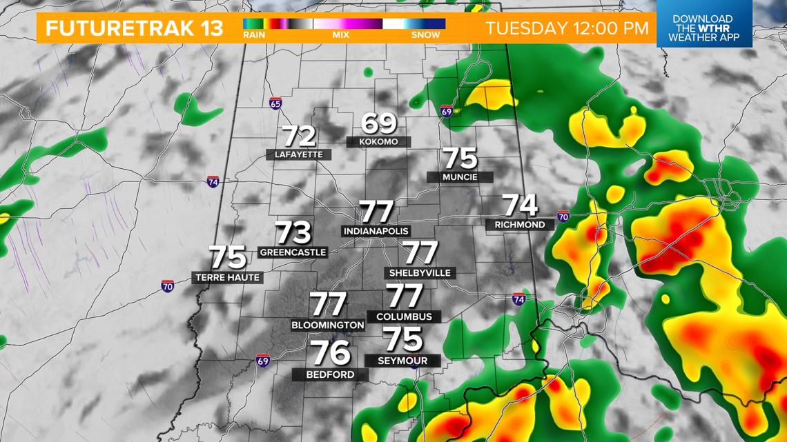
Rain will then taper off in the afternoon and evening. As far as rainfall potential, a few inches are possible for those areas who see heavier rain bands. While this is helpful to the recent dry stretch, it will likely not be enough to completely wipe out the drought conditions across the state.


As this system departs on Wednesday, look for a mix of sun and clouds with highs still cooler in the low 70s. Temperatures then recover to the upper 70s and low 80s starting Thursday with only a stray shower possible.