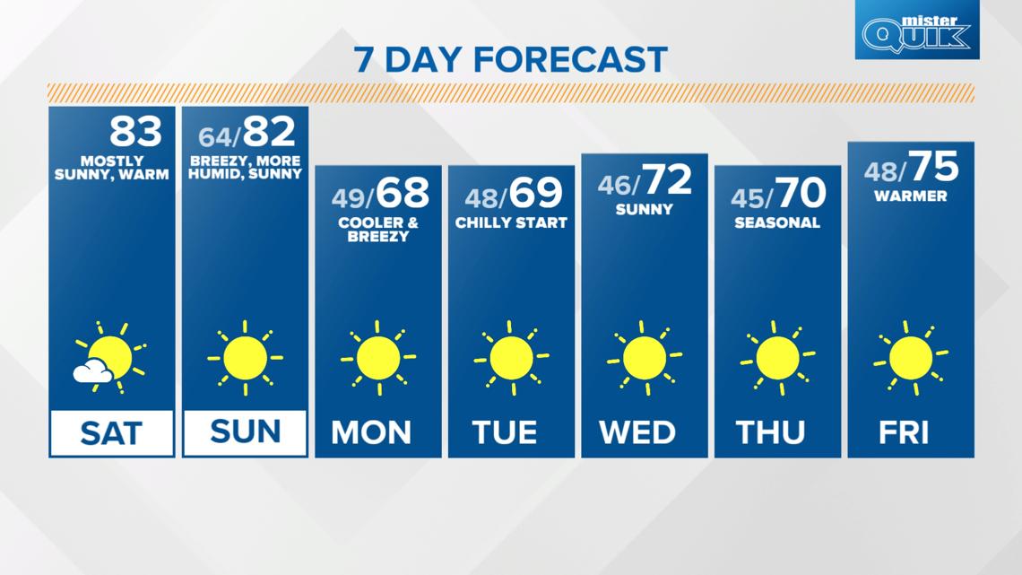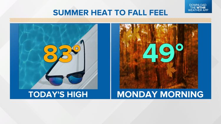
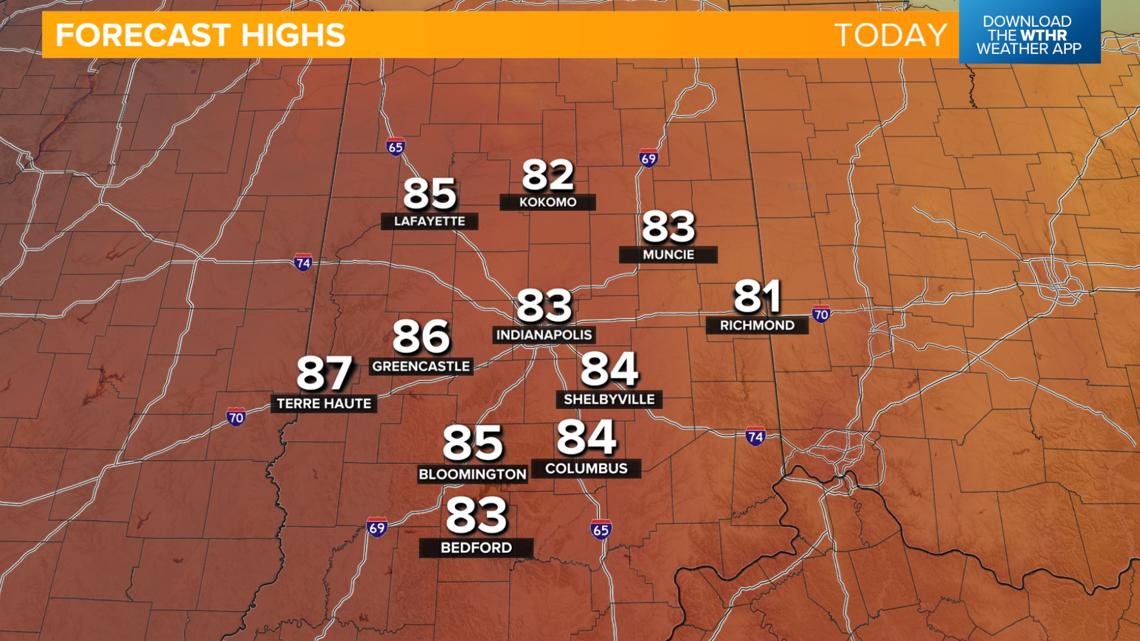
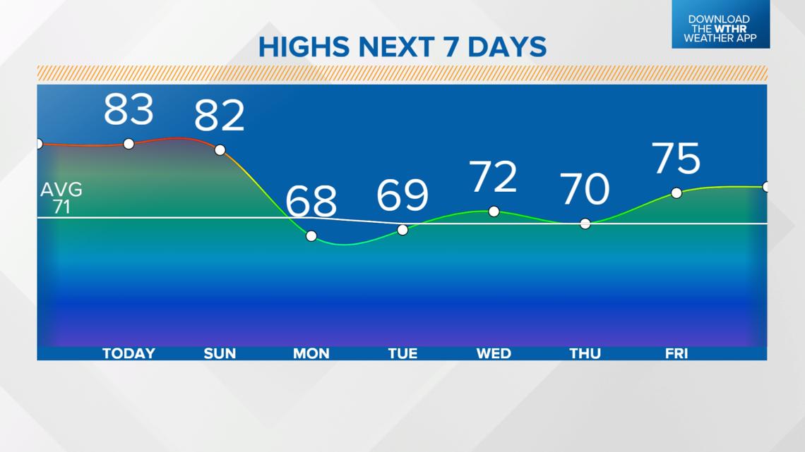
INDIANAPOLIS — We have an unseasonably warm weekend ahead with high temperatures running 10-15 degrees above average before cooler air returns to start next week.


TODAY'S HEADLINES:
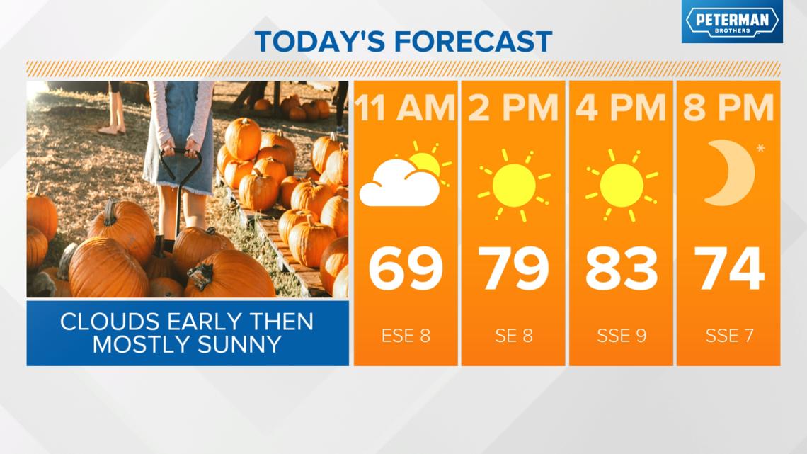
- A weak warm front will briefly increase clouds and wind gusts to 20 mph before midday
- Turning sunny this afternoon
- High temperatures into the low to mid 80s


TONIGHT:
Southerly winds continue this evening and overnight so temperatures won't be as cool with lows in the mid 60s.
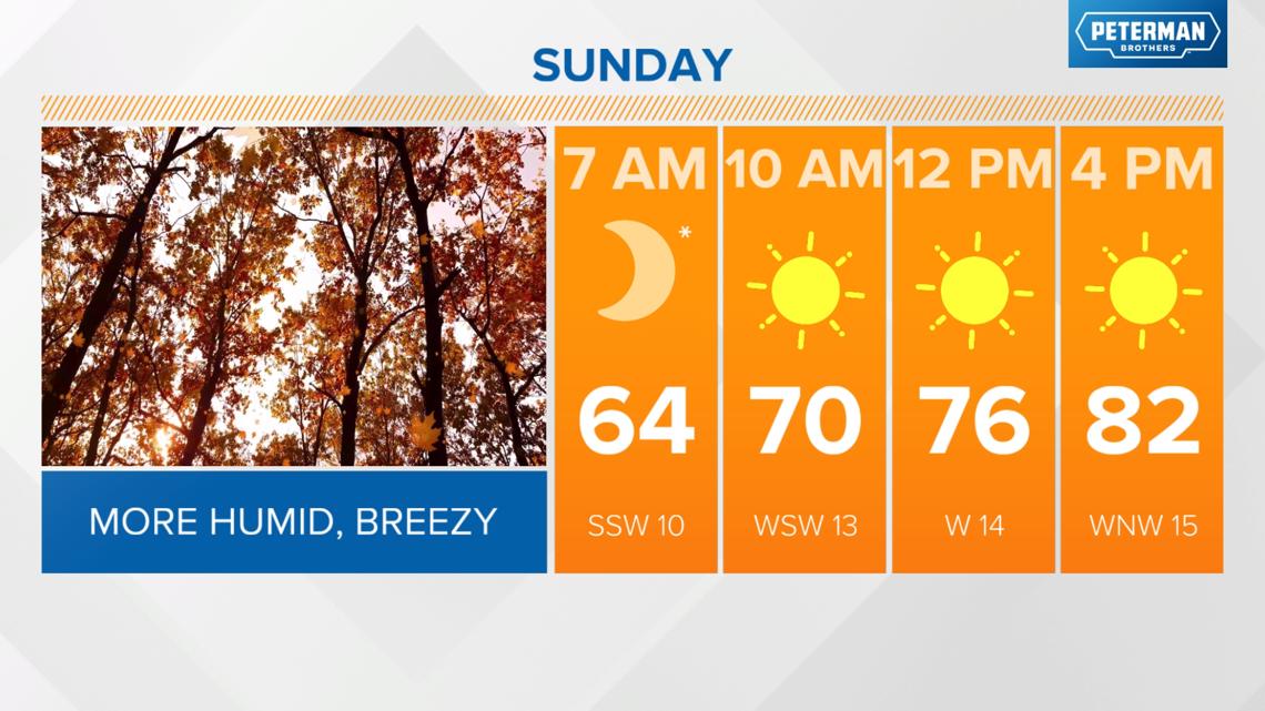
Cold front Sunday initiates cooler changes to start next week
We'll still be on the warm side of a cold front during the first part of the day Sunday. Temperatures will recover into the upper 70s and low 80s in the early afternoon ahead of this frontal boundary moving through. This system lacks moisture so expect just increased clouds and gusty winds up to 25 mph as the front moves through in the afternoon. Winds will decrease behind the front Sunday evening as winds shift from the northwest.

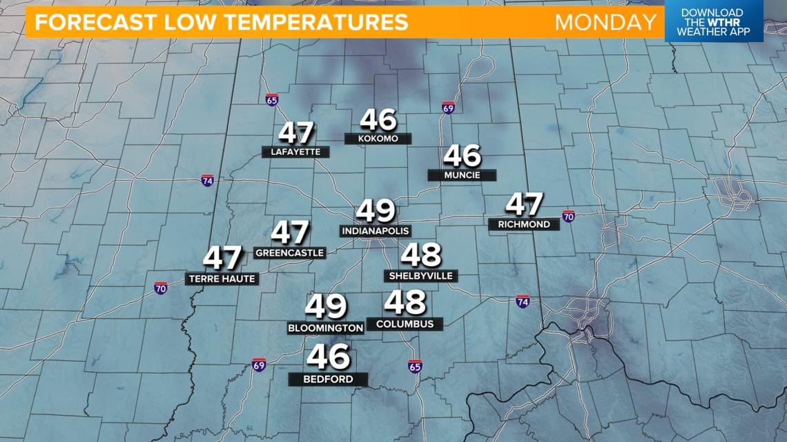
Temperatures will fall into the upper 40s to start the day on Monday with cooler-than-average high temperatures in the upper 60s both Monday and Tuesday under sunny skies. Temperatures will be more seasonal by mid-week as the dry pattern rolls on. Look for highs in the 70-75 degree range through the end of the work week.


Long range forecasts keeps Indiana dry, brings another tropical system into the southeast
With no significant rain chances in the extended forecast, drought conditions may begin to worsen again by late next week.
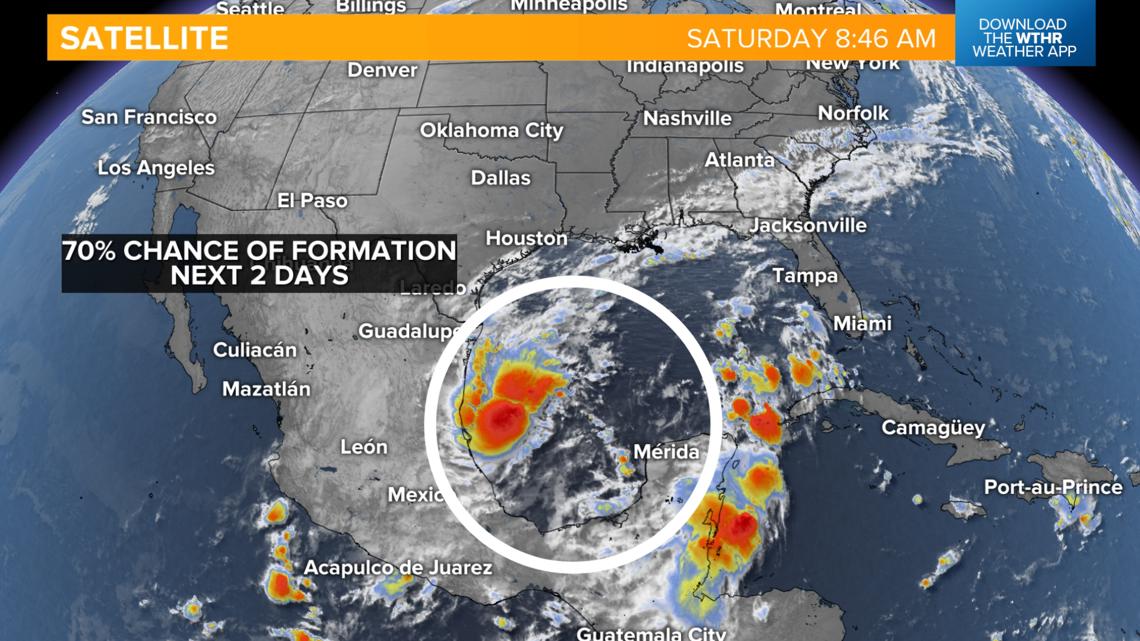
While there won't be any impacts locally, we are continuing to watch a developing tropical system in the Gulf of Mexico. The National Hurricane Center has placed this storm complex under a 70% chance of developing into a tropical depression or storm. It will likely bring another heavy rain event to the Florida peninsula by mid-week next week.