INDIANAPOLIS — It was the first frost for the fall season in Indianapolis, but many cities in central Indiana had their first hard freeze of the season with morning lows in the upper 20s. This is also the coldest central Indiana has been since April.
Are these frosty/freezing temps typical of this time of year?
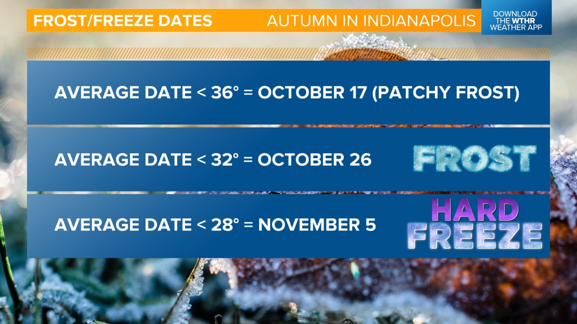
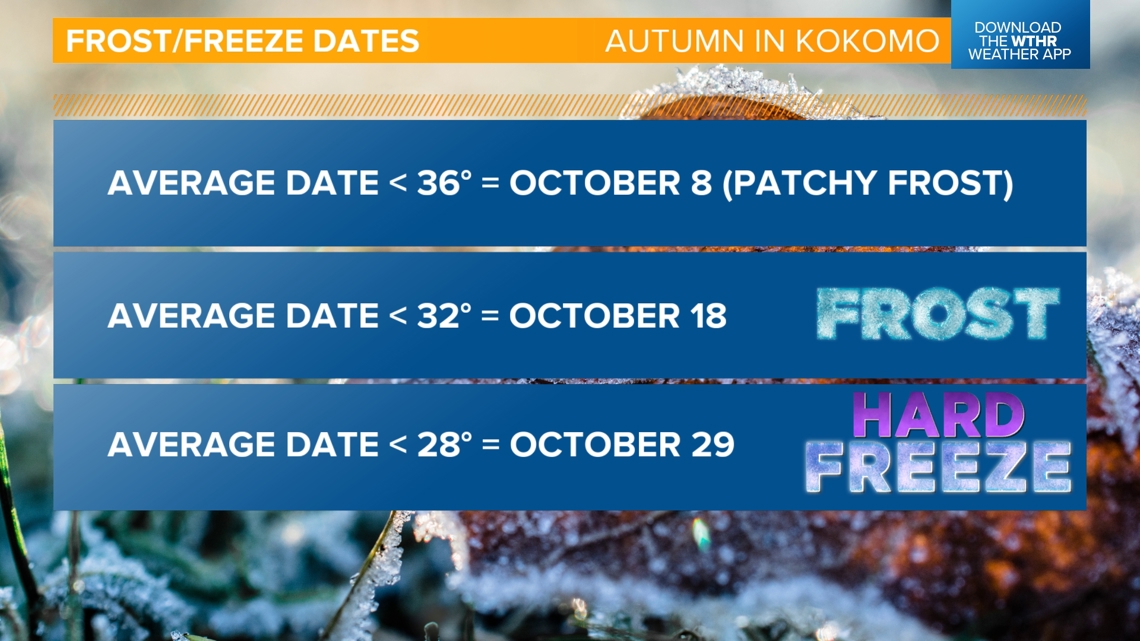
For Indianapolis, we're right on schedule. Indy typically sees the first frost (36 degrees or below) on Oct. 17. The first frost/freeze dates vary drastically across central Indiana based on how rural, low-lying or urbanized the location is.
Colder spots this morning, like Kokomo, dropped all the way to 28 degrees, which is the temperature where a hard freeze is likely. For Indianapolis, the average first hard freeze is Nov. 5, but for Kokomo, it is Oct. 29. So even for more outlying locations, temperatures this cold are a little ahead of schedule.


Is there a risk of frost in the forecast still?
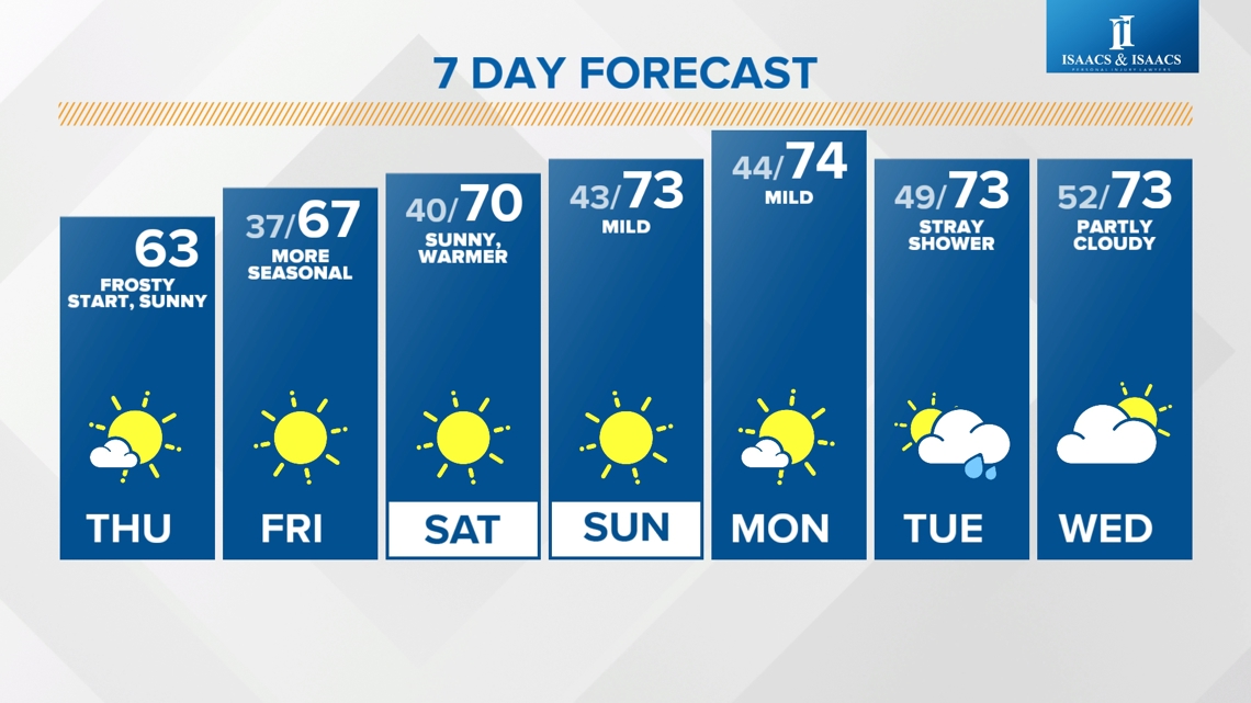
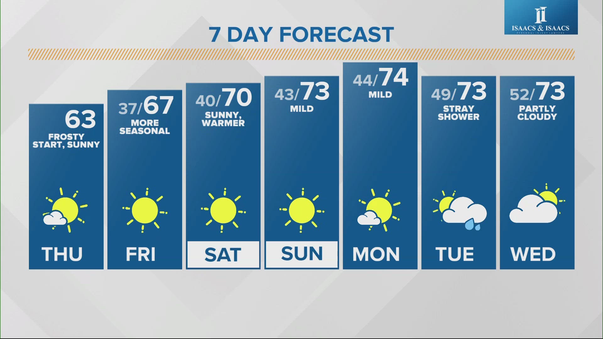
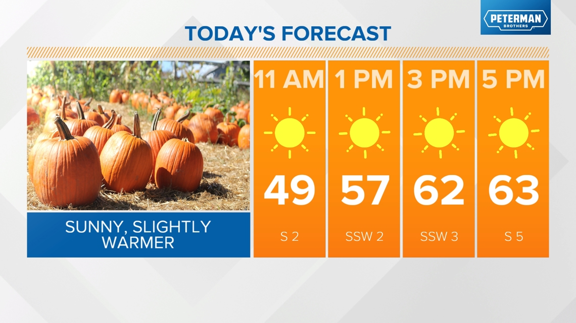
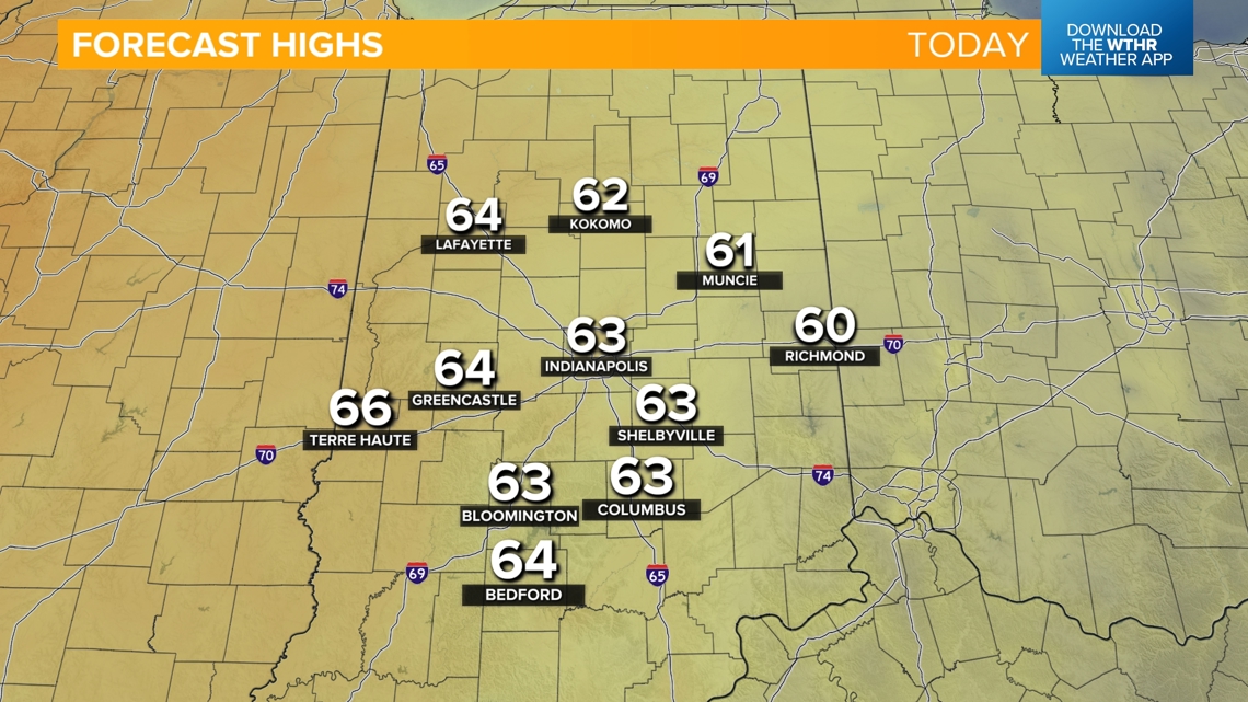
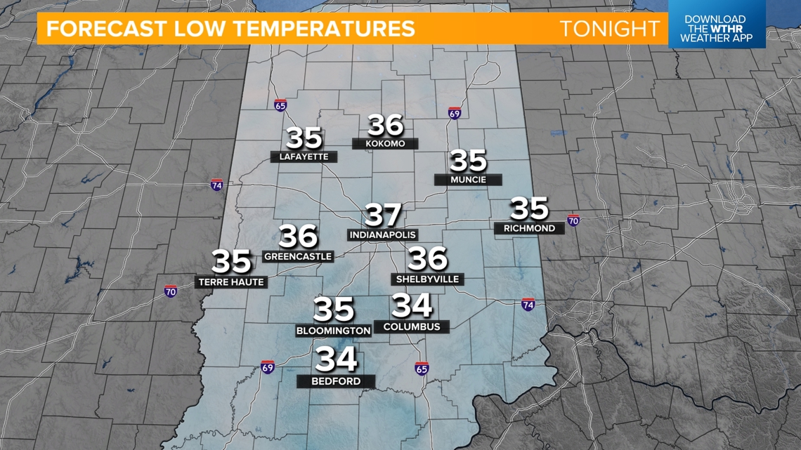
Frost will be possible overnight tonight with lows in the mid-30s in outlying areas. Before that though, we'll kick off a slight warming trend today with highs back into the low to mid-60s.


Here comes the warming trend...
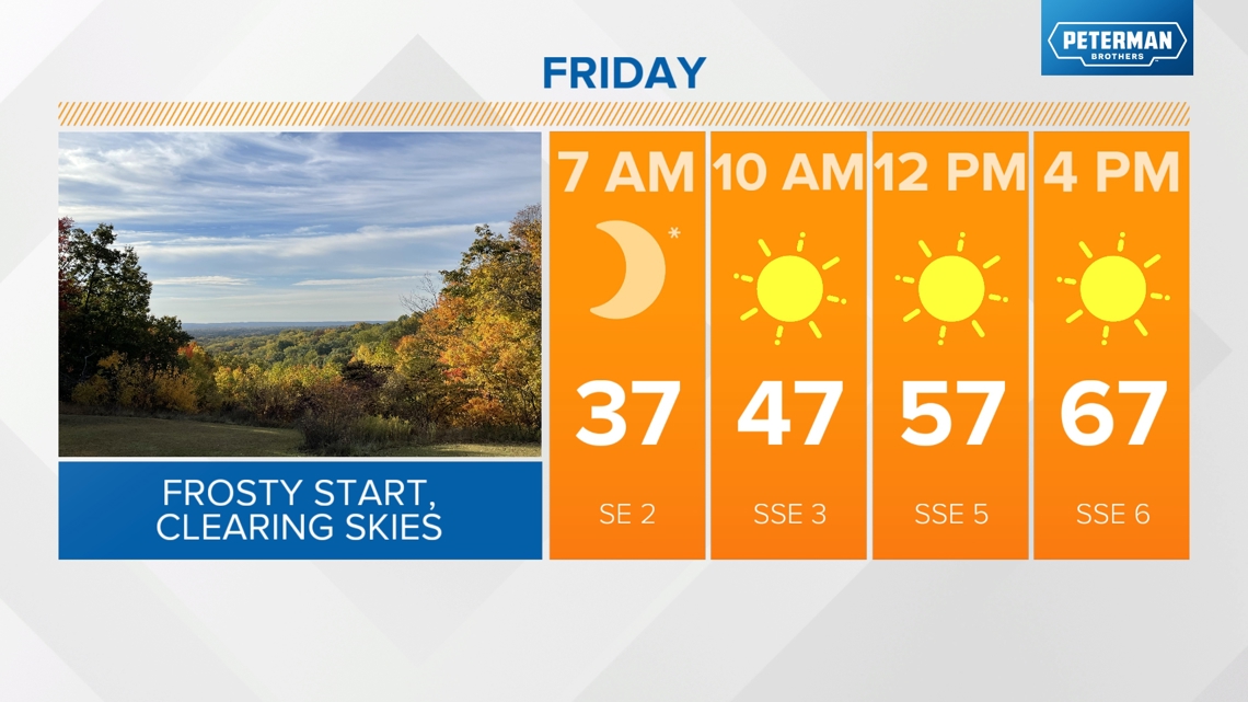
Temperatures will be more seasonal starting Friday with highs in the upper 60s under a mostly sunny sky.

The warming trend continues into the weekend with highs back in the low 70s and lows in the low to mid-40s. Skies stay clear for both Saturday and Sunday.
Above-average temperatures look to stick around into next week with highs in the low to mid-70s. Keep in mind, the average for this time of year is in the mid-60s. The next chance we could see some rain around central Indiana will be along a weak boundary on Tuesday, but only a few stray showers are possible.