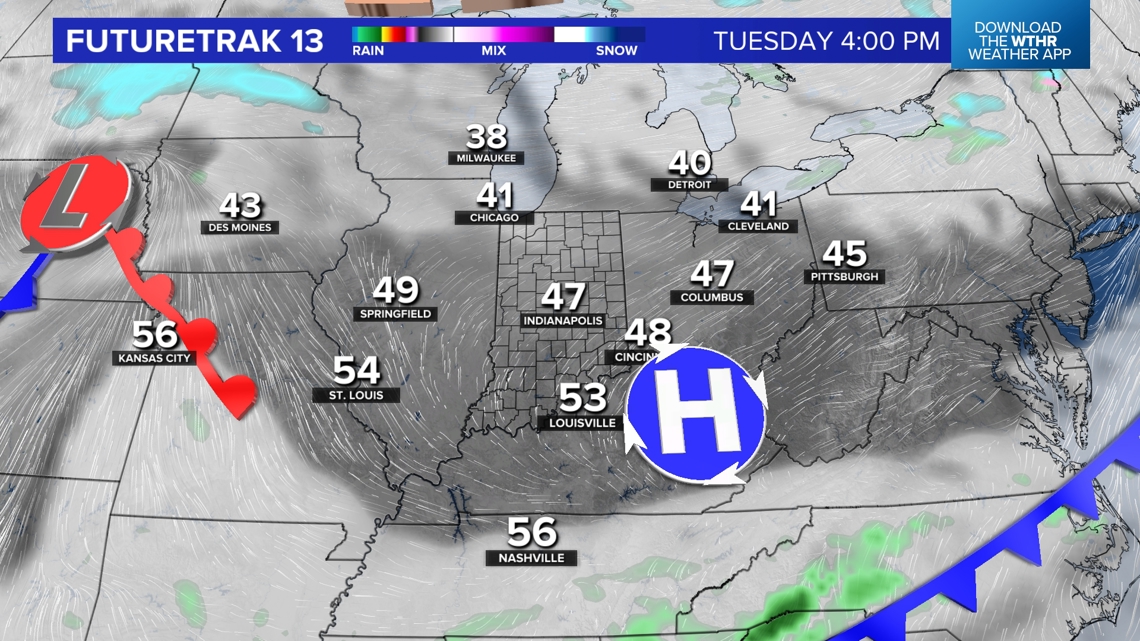
INDIANAPOLIS — Despite a blanket of clouds and another round of widespread rain, a lot of which was heavy, temperatures peaked this afternoon near 60°. That's a good 20° above average and closer to the daily record high (65°) than the average (40°) for mid-December.
This is courtesy of a continued south-southwesterly wind and an airmass/upper disturbance that originated in California. In fact, it's the same atmospheric energy that triggered a tornado in central California over the weekend.
Just some minor flooding locally with this system due to a combined 1"-2"+ rainfall over the past 48 hours.
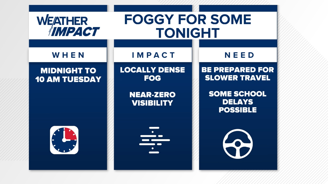
Patchy Fog Possible Tonight
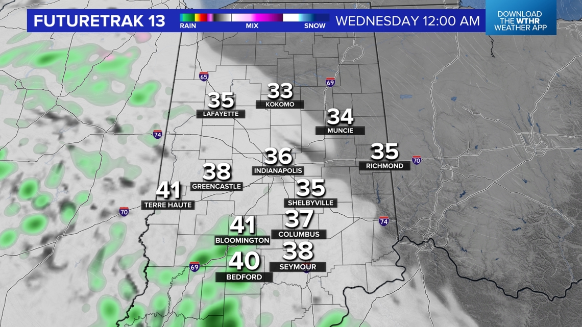
Rain is ending west-to-east between now and 7 p.m. We'll be on the lookout for patchy, but possibly dense, fog developing within the saturated air and over the soggy soils as temperatures cool into the 30s by sunrise.
![](https://media.tegna-media.com/assets/WTHR/images/c79aac87-edc7-46f6-b88b-1fc00a309c05/20241216T202636/c79aac87-edc7-46f6-b88b-1fc00a309c05_16x9.jpg)
![](https://media.tegna-media.com/assets/WTHR/images/c79aac87-edc7-46f6-b88b-1fc00a309c05/20241216T202636/c79aac87-edc7-46f6-b88b-1fc00a309c05_1140x641.jpg)
![](https://media.tegna-media.com/assets/WTHR/images/f0effe0b-bdde-469d-9527-97452203fc25/20241216T202700/f0effe0b-bdde-469d-9527-97452203fc25_16x9.jpg)
![](https://media.tegna-media.com/assets/WTHR/images/f0effe0b-bdde-469d-9527-97452203fc25/20241216T202700/f0effe0b-bdde-469d-9527-97452203fc25_1140x641.jpg)
![](https://media.tegna-media.com/assets/WTHR/images/edd8793b-2b40-4575-a334-8a89e4516ff1/20241216T202735/edd8793b-2b40-4575-a334-8a89e4516ff1_16x9.jpg)
![](https://media.tegna-media.com/assets/WTHR/images/edd8793b-2b40-4575-a334-8a89e4516ff1/20241216T202735/edd8793b-2b40-4575-a334-8a89e4516ff1_1140x641.jpg)
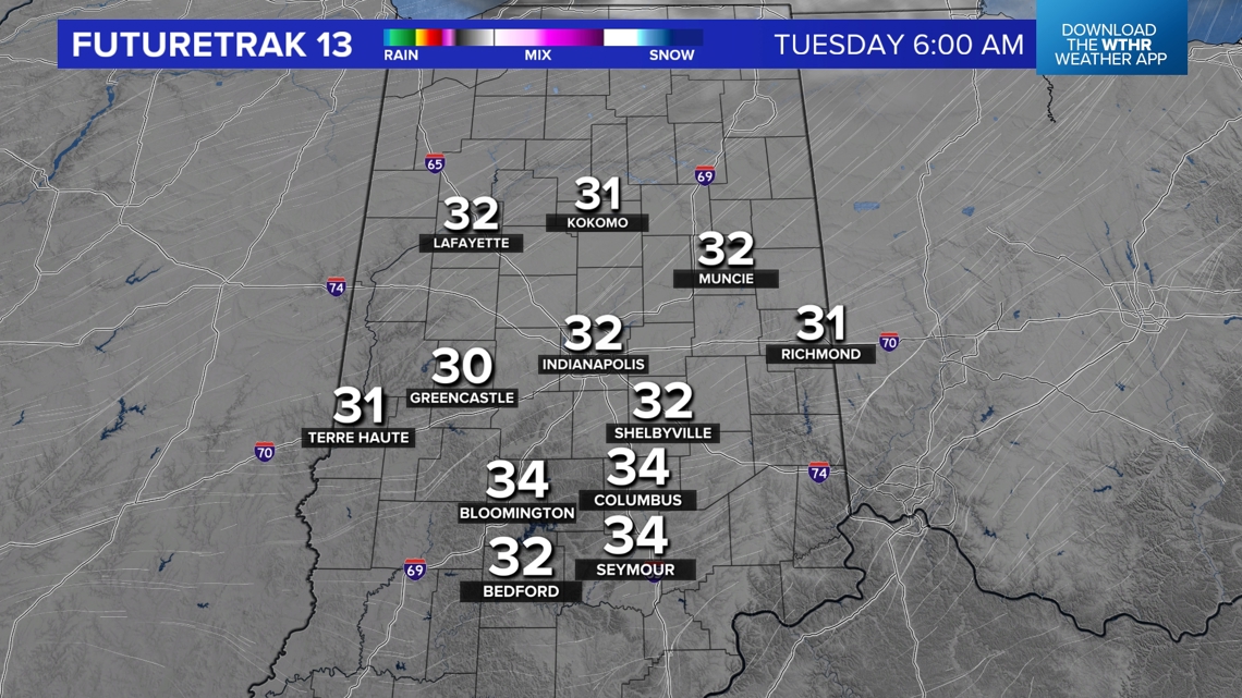
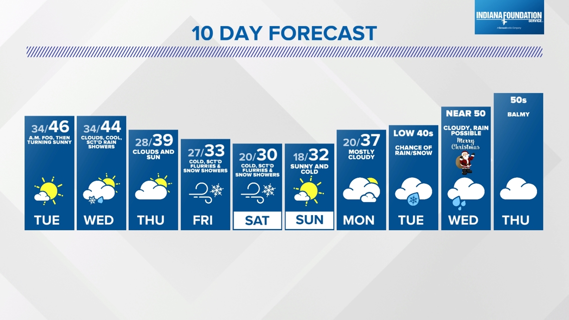
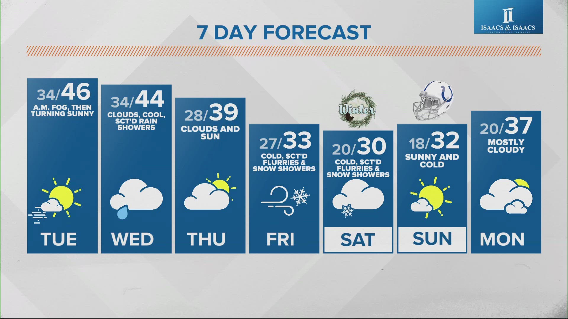
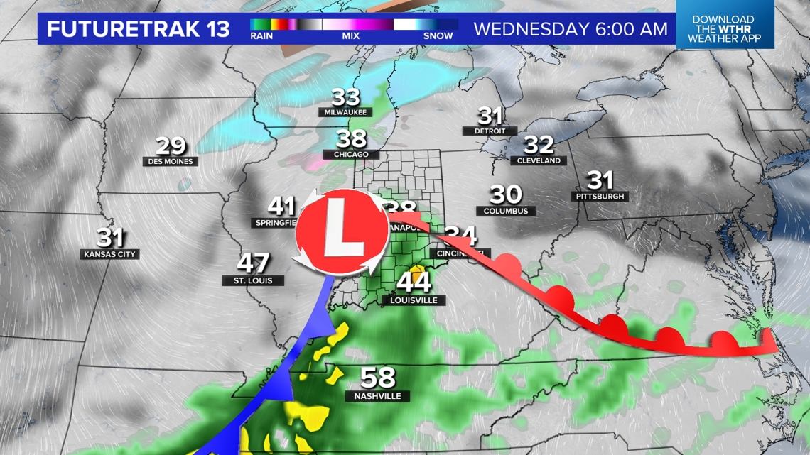
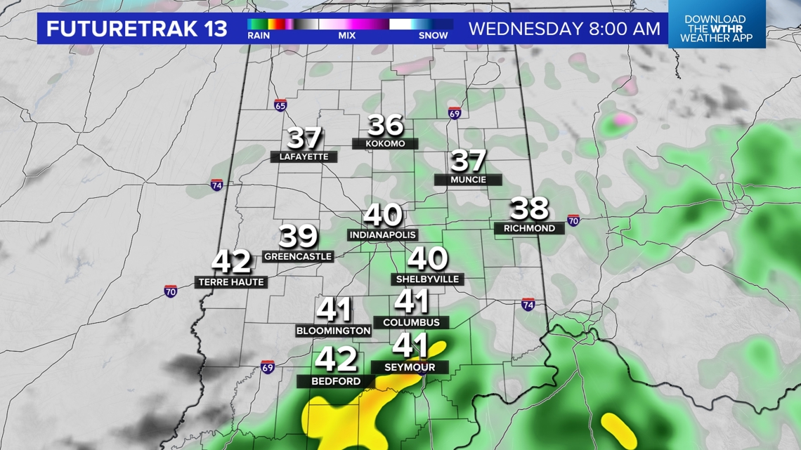
Any fog will dissipate by 10 a.m. and open the gates for one of the brighter days this week. Sunshine and highs in the mid-40s tomorrow before the next quick-moving weather system arrives to bring mainly rain showers on Wednesday—though marginally cold air may allow for some wet snowflakes north of I-70.
![](https://media.tegna-media.com/assets/WTHR/images/f5c1ab0e-186c-4511-86d0-0a9a667fee88/20241216T202945/f5c1ab0e-186c-4511-86d0-0a9a667fee88_16x9.jpg)
![](https://media.tegna-media.com/assets/WTHR/images/f5c1ab0e-186c-4511-86d0-0a9a667fee88/20241216T202945/f5c1ab0e-186c-4511-86d0-0a9a667fee88_1140x641.jpg)
Showers Returning Wednesday
![](https://media.tegna-media.com/assets/WTHR/images/b0946e6f-3632-4544-866e-d47422ffc00f/20241216T202809/b0946e6f-3632-4544-866e-d47422ffc00f_16x9.jpg)
![](https://media.tegna-media.com/assets/WTHR/images/b0946e6f-3632-4544-866e-d47422ffc00f/20241216T202809/b0946e6f-3632-4544-866e-d47422ffc00f_1140x641.jpg)
![](https://media.tegna-media.com/assets/WTHR/images/de0ed56a-781e-4c88-9abf-57c05130685a/20241216T202831/de0ed56a-781e-4c88-9abf-57c05130685a_16x9.jpg)
![](https://media.tegna-media.com/assets/WTHR/images/de0ed56a-781e-4c88-9abf-57c05130685a/20241216T202831/de0ed56a-781e-4c88-9abf-57c05130685a_1140x641.jpg)
![](https://media.tegna-media.com/assets/WTHR/images/cf78d5cc-75a4-4821-9828-69756bdd80f5/20241216T202904/cf78d5cc-75a4-4821-9828-69756bdd80f5_16x9.jpg)
![](https://media.tegna-media.com/assets/WTHR/images/cf78d5cc-75a4-4821-9828-69756bdd80f5/20241216T202904/cf78d5cc-75a4-4821-9828-69756bdd80f5_1140x641.jpg)
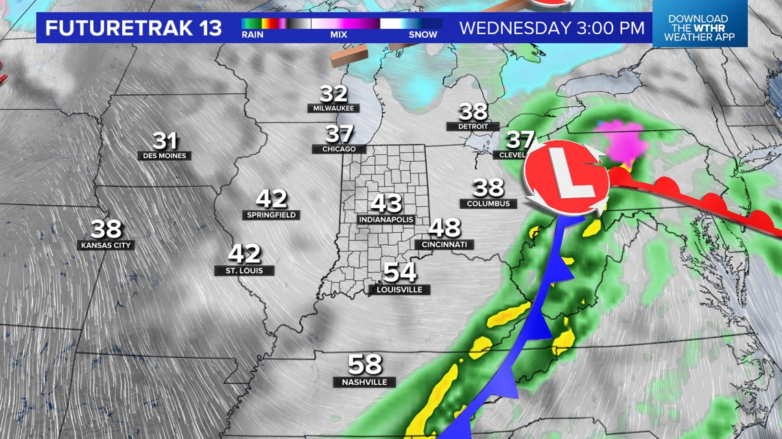
This system departs quickly by sunset Wednesday and we're back to mainly dry on Thursday. The well-advertised punch of much colder air (relative to what's over us now) hits this Friday and will be accompanied by wind-whipped flurries and snow showers into Saturday.
Winter Cold Returns Heading Into The Weekend
Snow rates may be heavy at times to coat the ground and certainly make for snow globe conditions too—including at Notre Dame Stadium for the 8 p.m. kickoff of the IU-Notre Dame playoff game. We'll have to monitor the wind direction for potential lake effect snow bands impacting the field. Stay tuned.
While this weekend will look and feel like winter, we're expecting another swing to much above average temperatures next week—arriving either on or just after Christmas Day. Updates to come, but we're in the camp that multiple 60°+ days and possibly some near-record highs are in play the last week of 2024.
![](https://media.tegna-media.com/assets/WTHR/images/d643761b-9104-401b-af77-8e9a3bf9aea1/20241216T203404/d643761b-9104-401b-af77-8e9a3bf9aea1_16x9.jpg)
![](https://media.tegna-media.com/assets/WTHR/images/d643761b-9104-401b-af77-8e9a3bf9aea1/20241216T203404/d643761b-9104-401b-af77-8e9a3bf9aea1_1140x641.jpg)