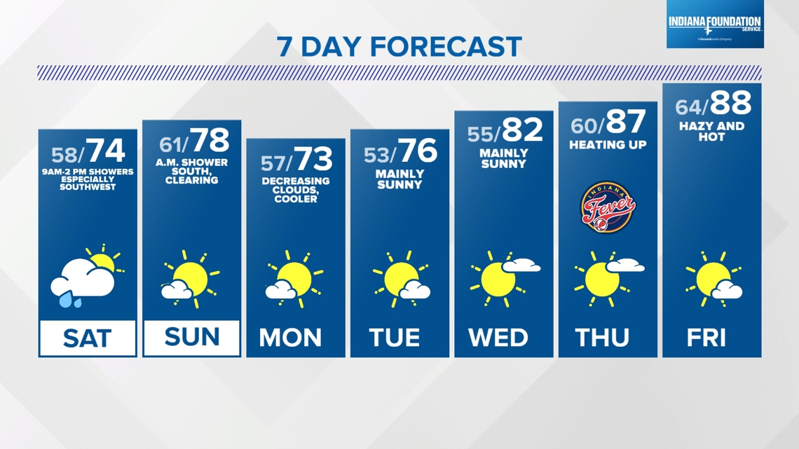
INDIANAPOLIS — Another spectacularly beautiful day in central Indiana with sunshine, a few clouds, and a refreshing breeze that continues to deliver dry air.
That's evident by dewpoints well in the 40s. The dry air allows seasonably warm temperatures in the lower 80s to cool pleasantly after sunset (9:16 p.m.). It is also key in impacting the evolution of an expected storm complex approaching Indiana during Saturday morning.
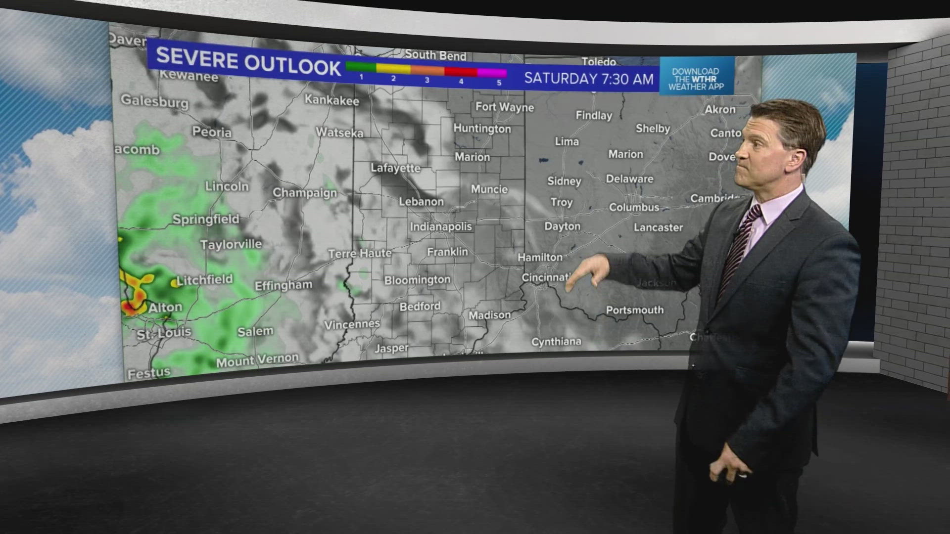
Our current thinking is that drier low-level air should limit coverage and intensity of any rain with this feature between 9 a.m. and 2 p.m. Though it will "eat away" at a lot of the moisture, it won't completely keep all areas dry tomorrow.

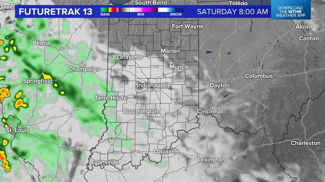

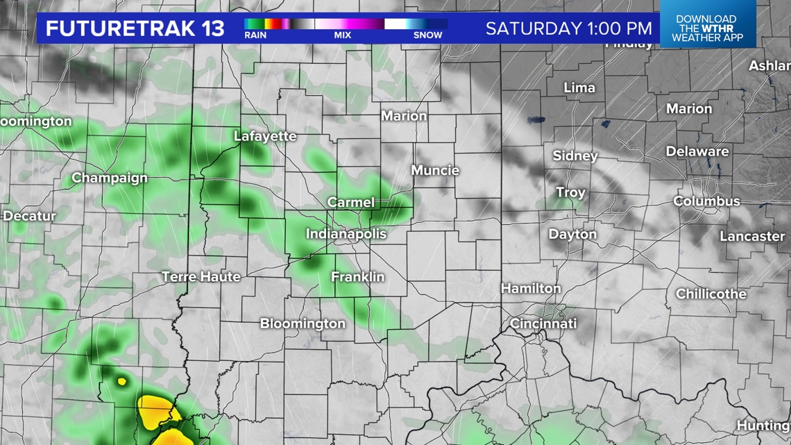

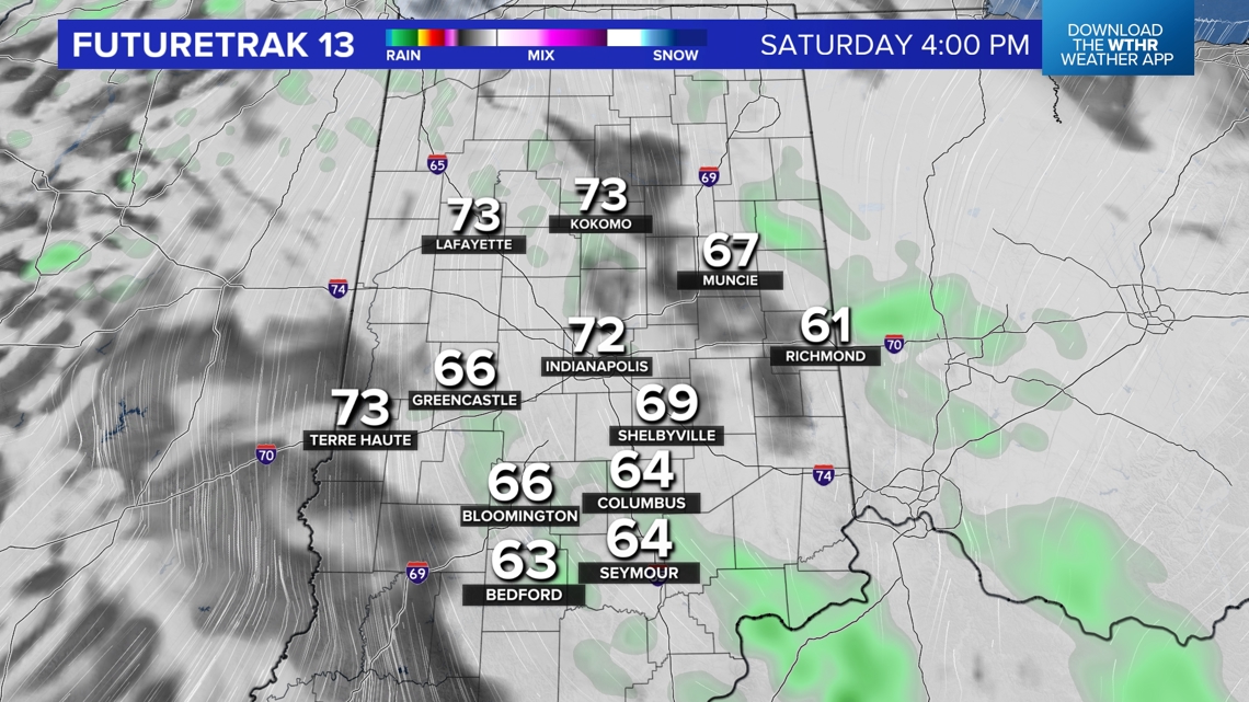
At minimum we're going to have a much cloudier day tomorrow. At worst, it will sprinkle and/or steadily rain lightly in some areas. The most probable places for steadier rain appear to be south-southwest of Indianapolis. But we do expect some raindrops at times during the Indy Pride Parade along Mass Avenue between 10 a.m.-12 p.m. Saturday.
Clouds have more bark than bite in the afternoon and temperatures gradually rise from the mid-60s to mid-70s with peeks of sun later in the day.

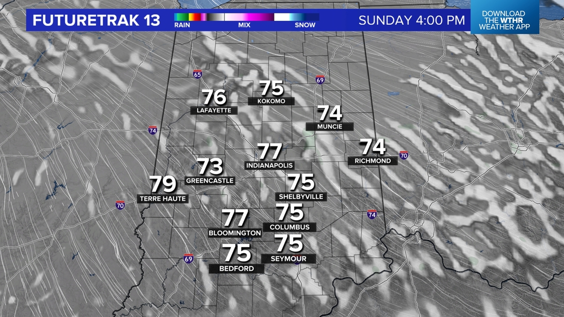
Another disturbance moves through the state later Saturday night and very early Sunday morning, providing another shower chance and maybe some lingering clouds early Sunday.
But we continue to expect plenty of sunshine to finish the weekend and to continue into the middle of next week. We're still targeting a warm-up to emerge later next week into Father's Day weekend.