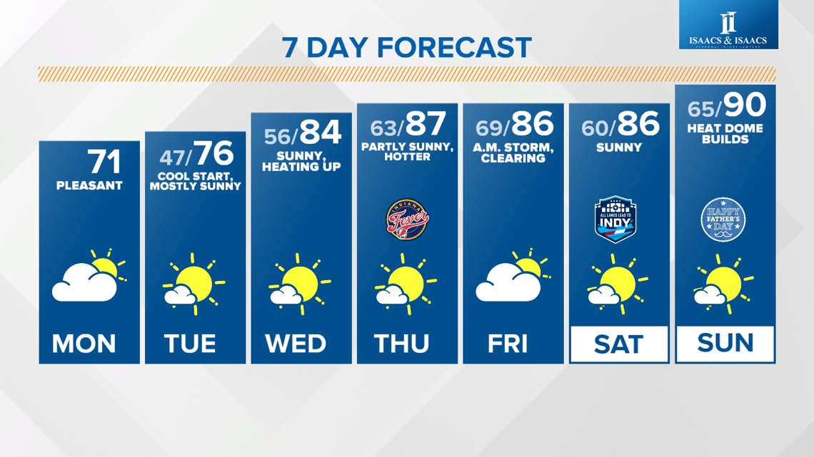
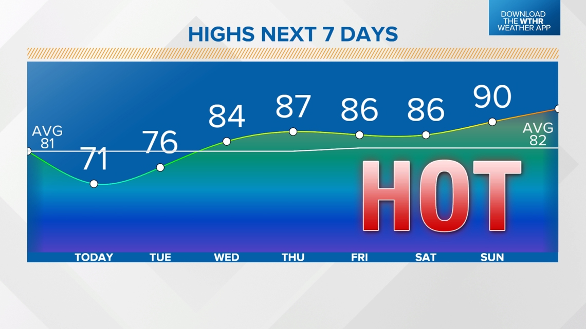
INDIANAPOLIS — The coolest air in the extended forecast will be in place today and tonight. Above-average temperatures return midweek with the hottest air yet of the season returning this weekend.
TODAY:
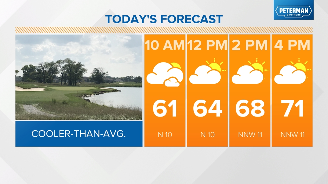
A frontal boundary will move through during the first part of the day and briefly bring increased clouds. Sunshine returns in the afternoon.
- Breezy north wind gusts up to 20 mph at times
- Highs: Upper 60s east/low 70s elsewhere — about 10 degrees below average

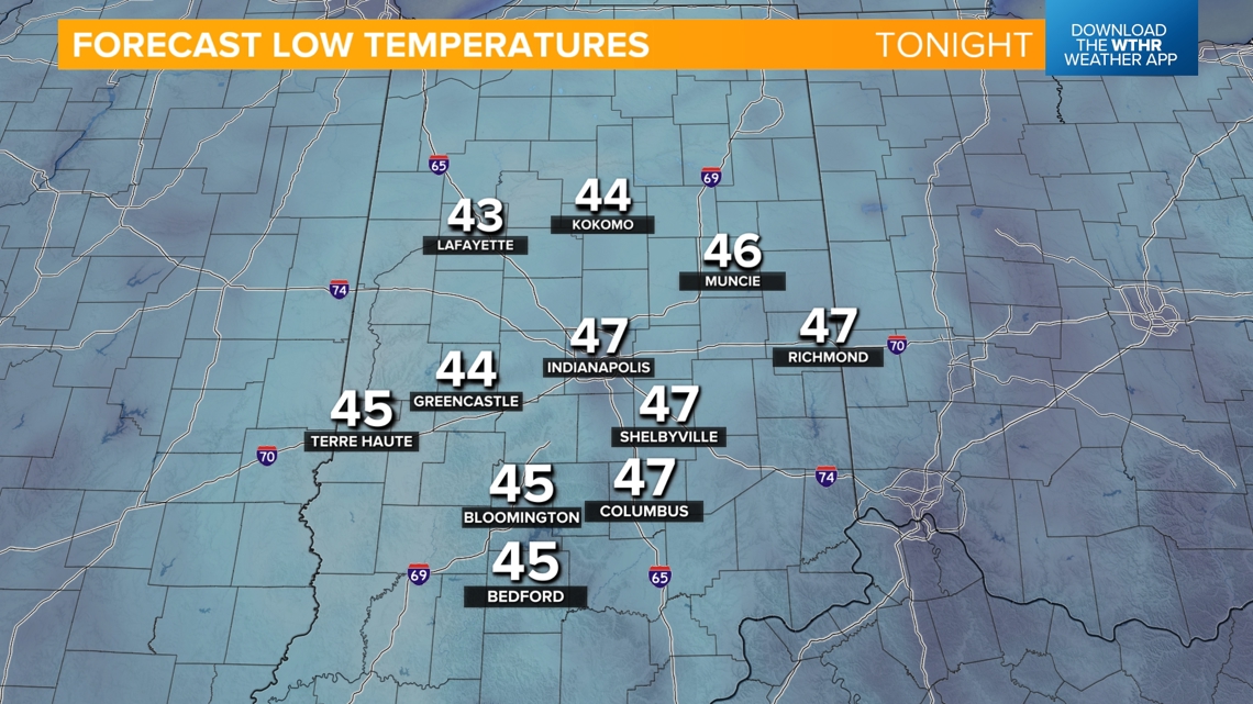
CLEAR AND COOL OVERNIGHT:
Lows in the upper 40s around the Indy metro and into the low 40s in outlying locations. This is the coolest air we've had since late April.

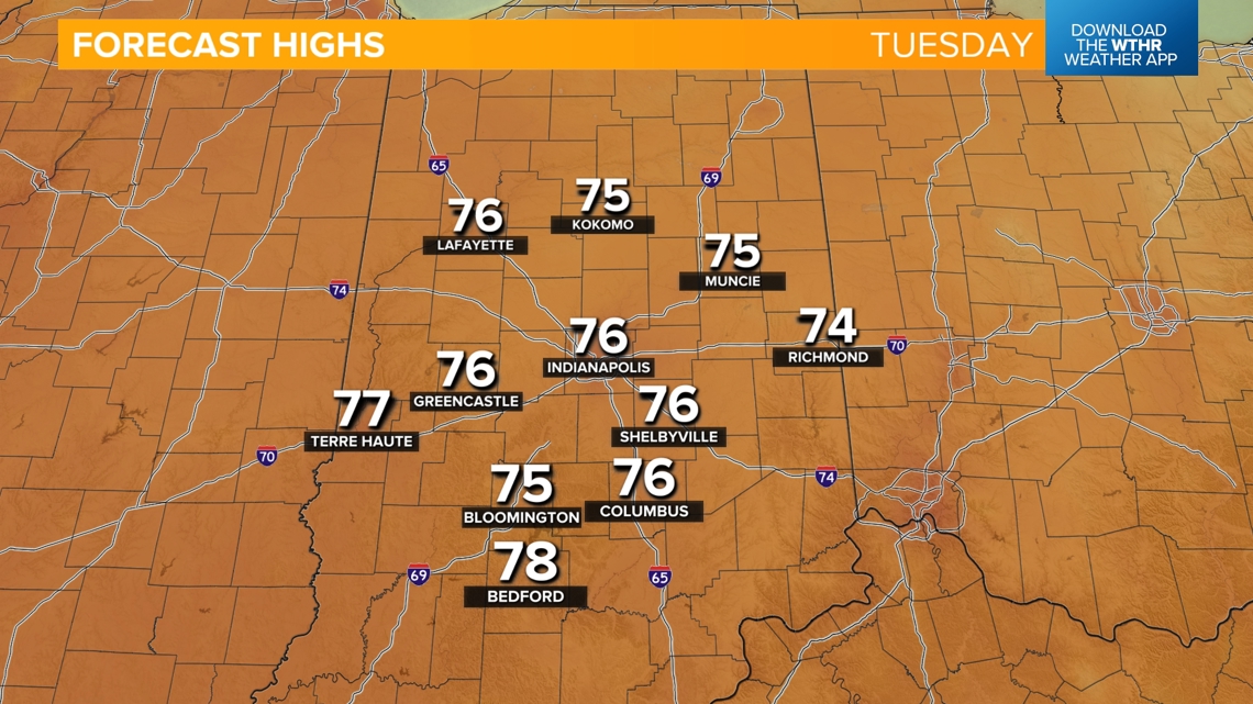
TUESDAY:
A high pressure dome will continue to dominate Tuesday keeping skies clear and temperatures slightly below average with highs in the mid-70s.

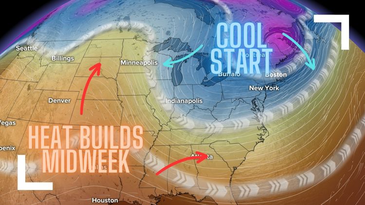
When will we start to feel the heat?
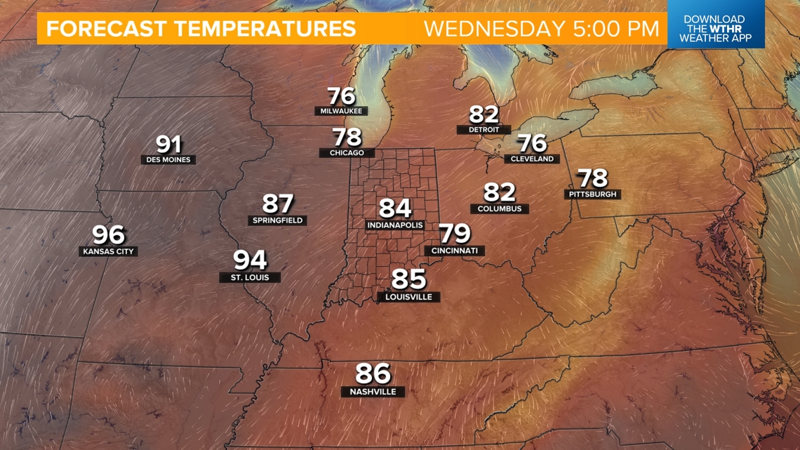
Wednesday will be a transitional day to warmer weather as winds shift to the southwest. A heat dome building west will slowly push this direction, increasing temperatures. Look for highs in the mid-80s Wednesday and into the upper 80s Thursday.


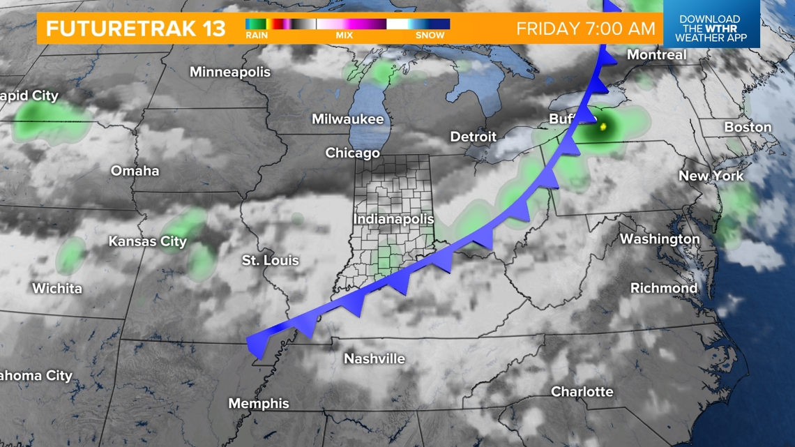
When is the next rain chance?
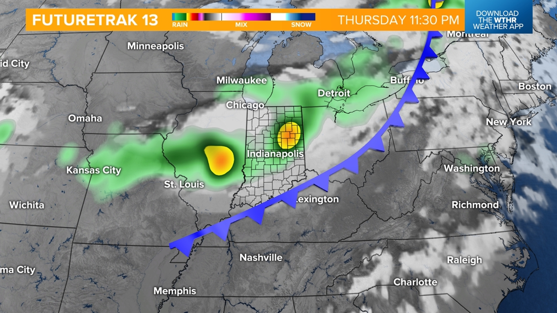
A weak boundary brings a few storms overnight Thursday into Friday morning. Temperatures remain stagnant with highs in the mid-80s as skies clear Friday afternoon.


The core of the heat dome takes over this weekend with highs in the mid to upper 80s Saturday and into the 90s starting Sunday. According to the long-range weather models, once the 90s arrive, the pattern stays hot, with several days in the 90s next week as well.