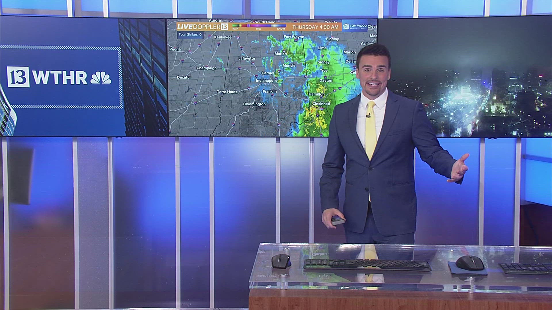
INDIANAPOLIS — Welcomed rainfall across Indiana today with radar estimates of a trace in eastern Indiana to locally near a half-inch west of I-69...including parts of the Indy metro area.
The coverage of this rain will diminish the remainder of the evening as the better atmospheric lift drifts to the north. Despite clouds and sogginess, it's been a rather balmy early November day. This is courtesy of a steady south-southwesterly wind that developed overnight and remains with us until Tuesday night.


It delivered a record-breaking warm "low" temperature for this date. In fact, the 63° low is not only a record warm low for November 4th...it's one of only two days on record since 1871 with a low of 63° this late in the season. The last occurrence was on the 6th of November in 1924. So truly "rare air" blanketed the Indiana and the Ohio Valley for that matter.
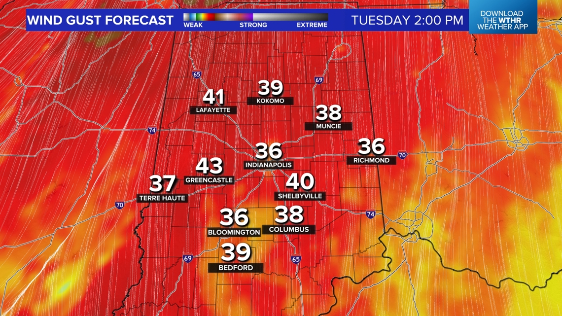
Plan on another balmy night in the 60s as the wind remains elevated. If you're planning to head to the polls tomorrow morning (they open at 6 a.m.) it will be unseasonably warm, breezy, with spotty showers around. Wind gusts go above 30 mph by midday and much of the afternoon with peak gusts of 45+ mph possible, if not likely.

A brief lull in rain chances late tonight into Tuesday morning
The bulk of the rain lifts north late tonight and during the overnight hours. With the exception of a stray shower or two, we stay mainly dry, cloudy, breezy and mild with lows in the 60s.

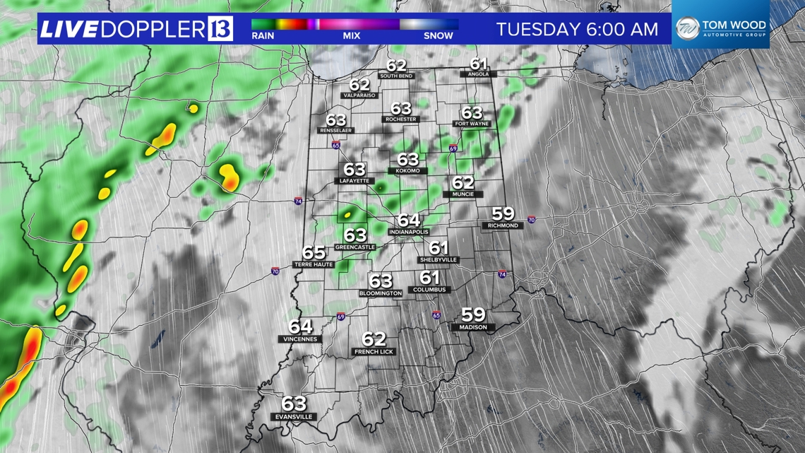
Election Day weather and latest rain timeline
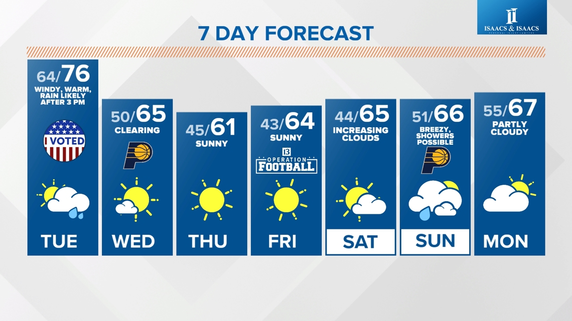
We start Tuesday on a dry note, but it will be warm and rather windy with gusts up to 40 mph possible through the morning. Temperatures will rise from the mid 60s to highs in the mid 70s by the early afternoon.

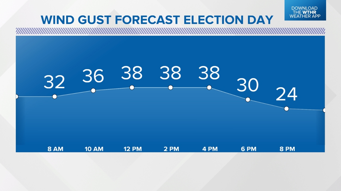
Due to the larger gap in precipitation tomorrow...temperatures area-wide reach the mid/upper 70s making it one of the warmest Election Days in Indiana.
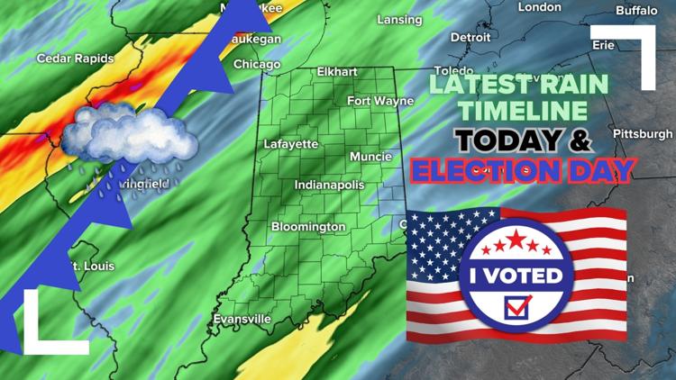
The next round of widespread rain will be near/east of an approaching cold front later Tuesday.

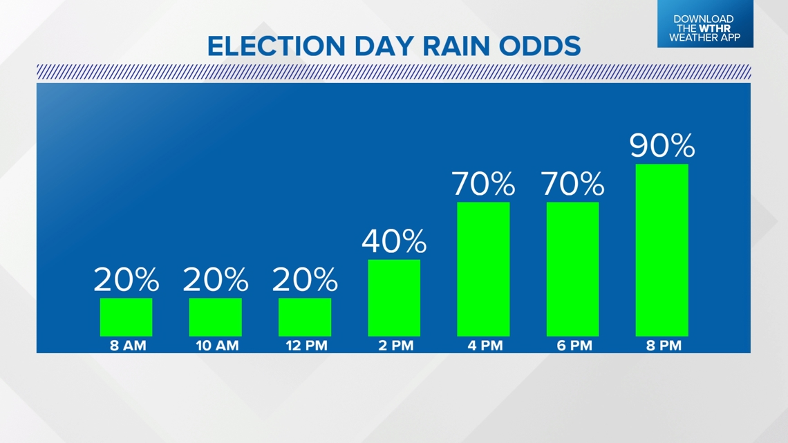

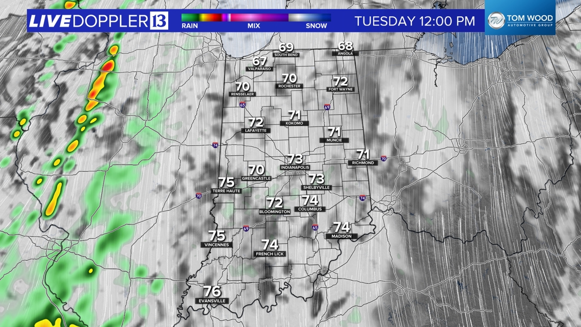

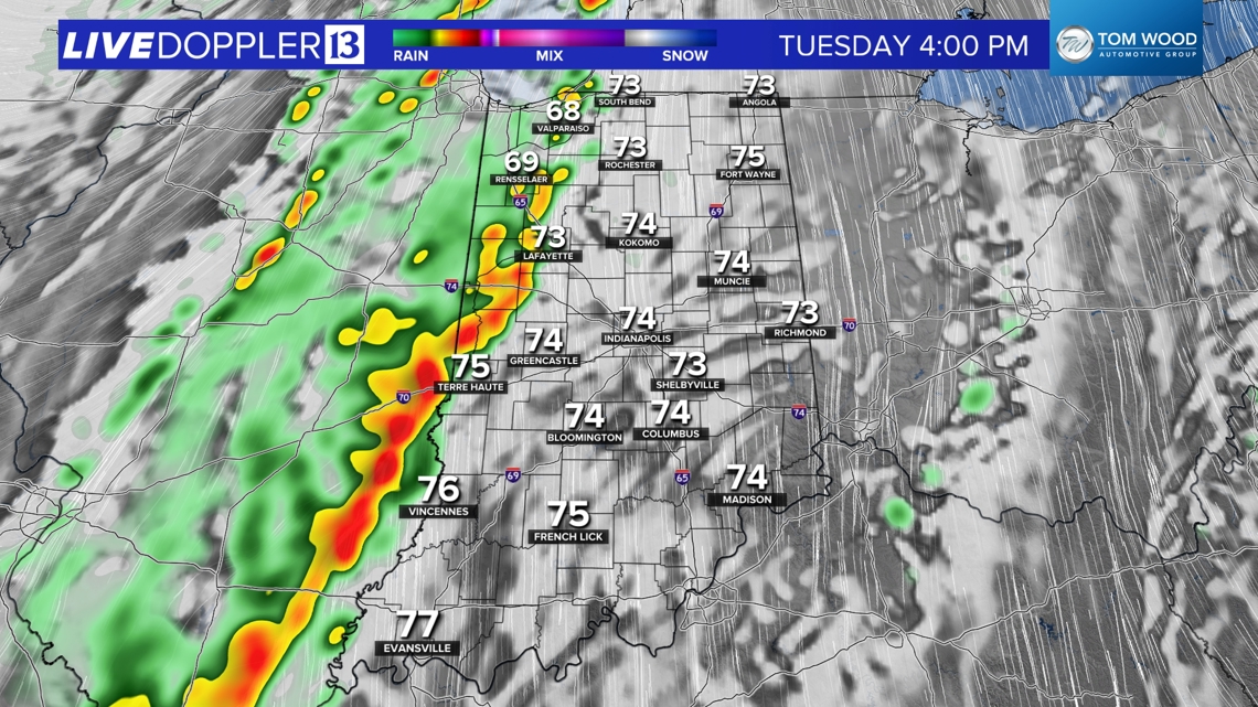
If you're planning to vote later in the day you should know a wind-whipped line of downpours near the Illinois/Indiana border around 3-4 p.m. and then reaches the Indy metro area between 6-7 p.m.
This will impact some waiting in line (if there are some) during those hours. Eastern Indiana likely should be able to finish voting with minimal impact tomorrow.

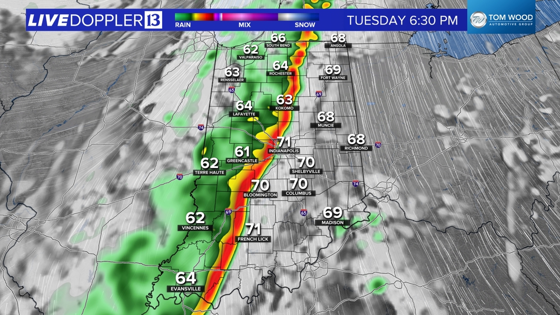

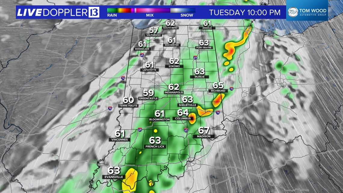
Showers will then linger across the southeastern tier of the state through the evening and eventually wrap up by daybreak Wednesday.
How much rain are we expecting with this weather system?
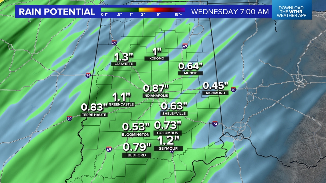
With much of the state reporting abnormally dry to severe drought conditions, this will be much-needed rainfall. Most spots can expect between 0.75-1.50" by Wednesday morning.

Temperatures stay above average this week
In its wake, Wednesday will be a brighter day with cooler highs in the 60s. But those temperatures remain well above average and that's a trend that lasts the next 7-10 days.

