INDIANAPOLIS — For now, it's severe clear over central Indiana, and temperatures are responding nicely with afternoon back well into the 50s again. Clouds gradually build up later today, but not before we enjoy a pleasant February afternoon.
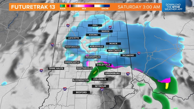
But we'll be on radar watch later this evening with the arrival of a quick-moving and potent upper-level system overnight. A mixture of rain and snow is expected to emerge on radar between 9 p.m. and midnight, with snow being the predominant precipitation-type farther.

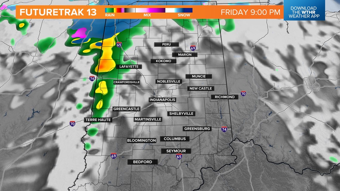
It appears the track of this system will come over the Indy metro area and then southeastward through Cincinnati. If that doesn't change much, it would place the eastern and northeastern portions of our viewing area in more favorable zone to have 1"+ snow depth come Saturday morning.

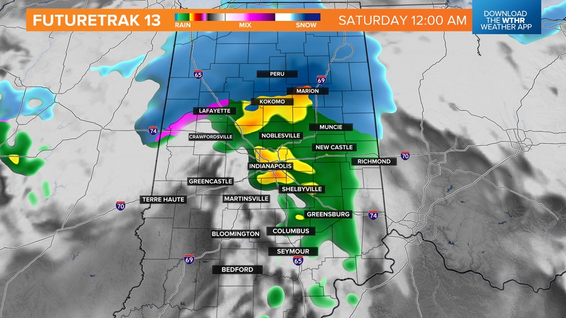
Most of us will start switching to only snow around 3-4AM with the heaviest bands north and east of Indianapolis.

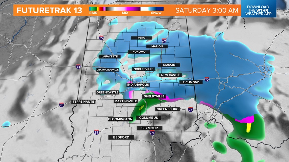
The highest totals will be north and east of Indianapolis. Some good snow bursts are likely from Richmond to Muncie to Marion and Kokomo.

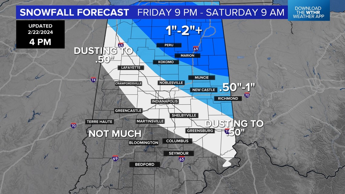
A dusting to around a half-inch is expected around Indy, with amounts going up northeast and going down southwest. Road impacts should be minimal, with the exception of the heavier snow rate zones in the darker shaded area on our forecast map.

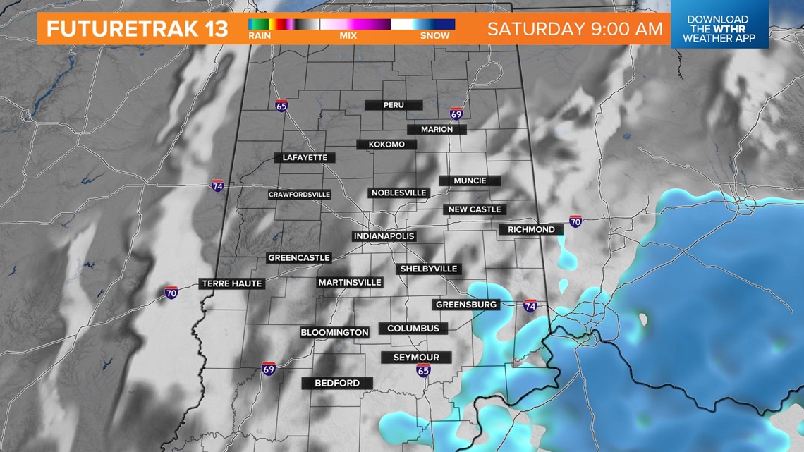

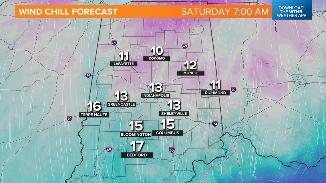
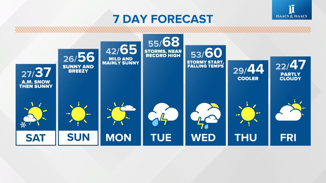
Some lingering snow early Saturday morning gives way to increasing sunshine Saturday, but it will be deceivingly bright, with highs only in the 30s.
But a warming wind quickly takes over Sunday to send afternoon temperatures back into the mid/upper 50s.
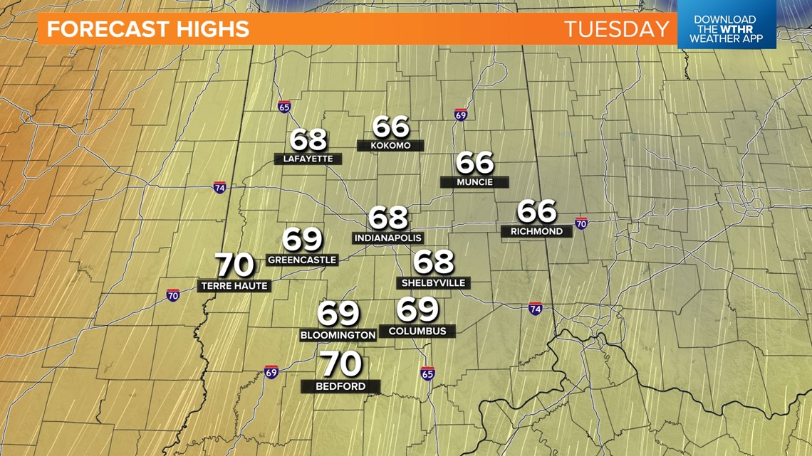
Even warmer air is on deck early next week, with high temperatures flirting with 70° and near-record highs Monday and Tuesday.

That warmth comes with the likelihood of some heavy rain and thunderstorms — the latter may become severe Tuesday evening into early Wednesday morning. Check back for updates.