INDIANAPOLIS — The first of several weather systems to move through central Indiana over the next week arrives overnight.
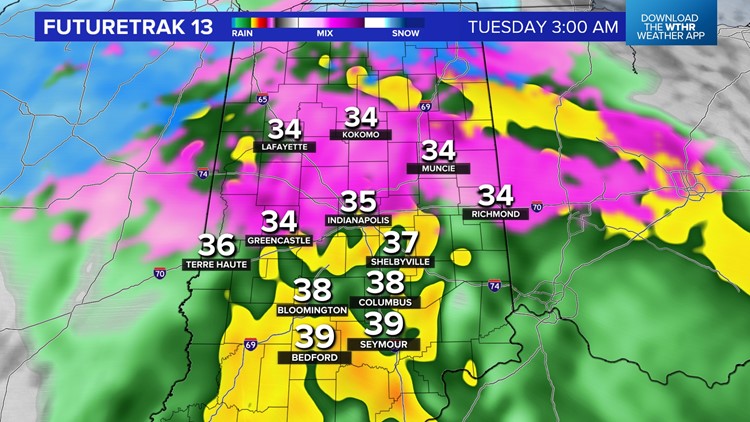
While this storm triggers a severe weather outbreak along the Gulf Coast and blizzard conditions in the central U.S., parts of our viewing area only get a glancing blow of wet, possibly heavy, snow for some hours tonight.
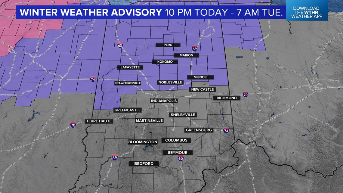
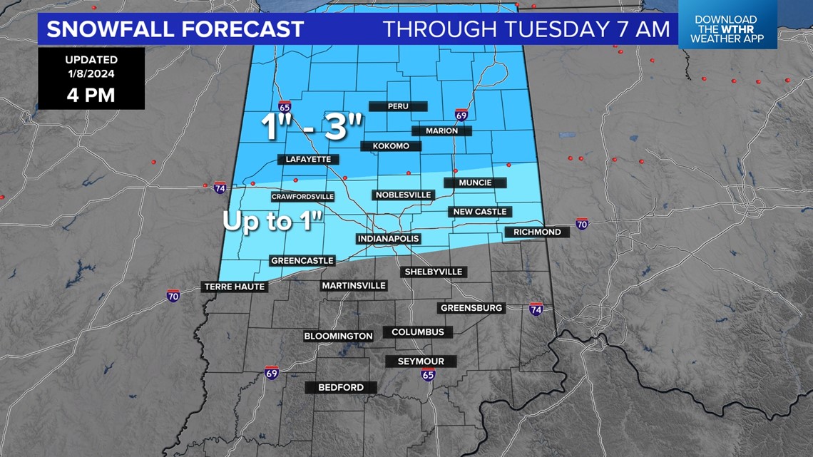
The most probable area to see snow accumulation is north of I-70 where there will be a fine line between cold rain and heavy snow tonight.
But within the Winter Weather Advisory area there’s potential for a quick hit of heavy or wet snow rates to occur for a few hours.


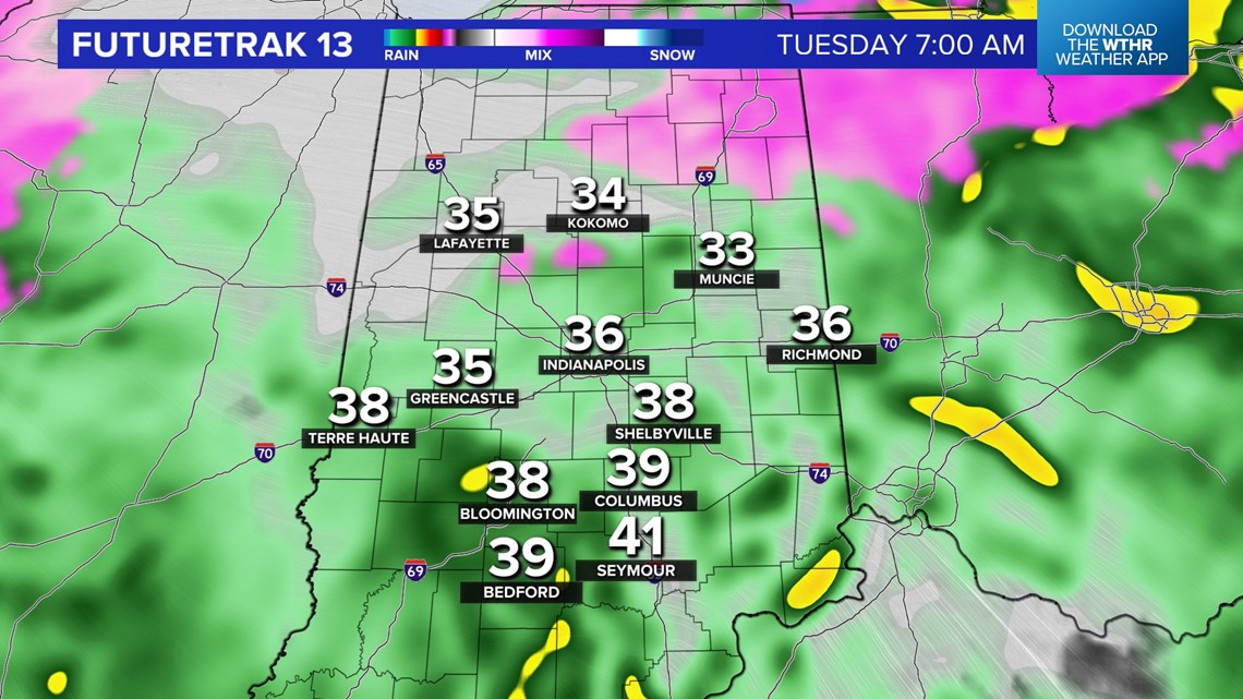

During the brief time where heavy snow may occur, roads could become slick or slushy before a transition to quick melting occurring after the heavier snow rates stop and temperatures stay above freezing.
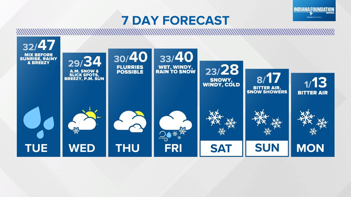
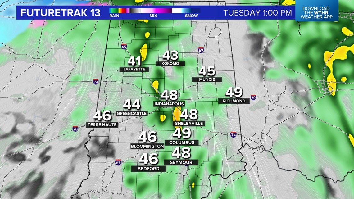
Wind-whipped rain and drizzle much of the day on Tuesday with gusts over 30 mph at times.
Temperatures elevate into mid to upper 40s as that wind shifts to the south-southwest before the next cold front arrives Tuesday.

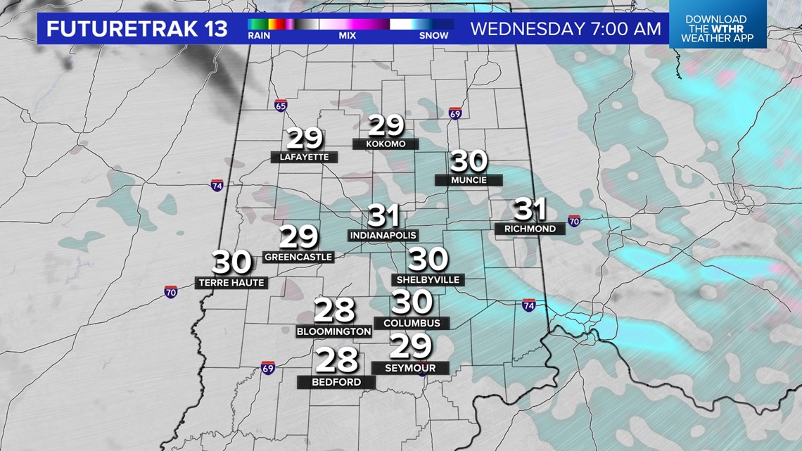

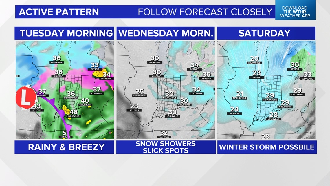
In the wake of that front, Wednesday morning has a higher chance for slick spots over a greater area due to colder temperatures (20s) and wind-whipped snow-showers.
A much stronger storm looks more likely for the weekend in the Great Lakes/Ohio Valley.
Specific local impacts of how much snow/wind/road conditions are to be determined… but there’s high probability on MUCH colder air in the wake of this system hitting Sunday into next week.