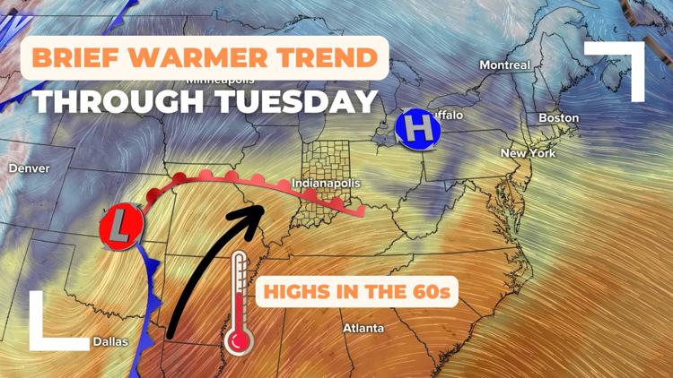
INDIANAPOLIS — A brief warming trend is taking highs back into the 60s, 10-15 degrees above average, ahead of the potential first wintry precipitation this season.


PATTERN CHANGING THIS WEEKEND:
Indiana has been stuck in a stagnant pattern under a stratus cloud deck keeping gloomy and damp conditions around with steady cool temperatures.
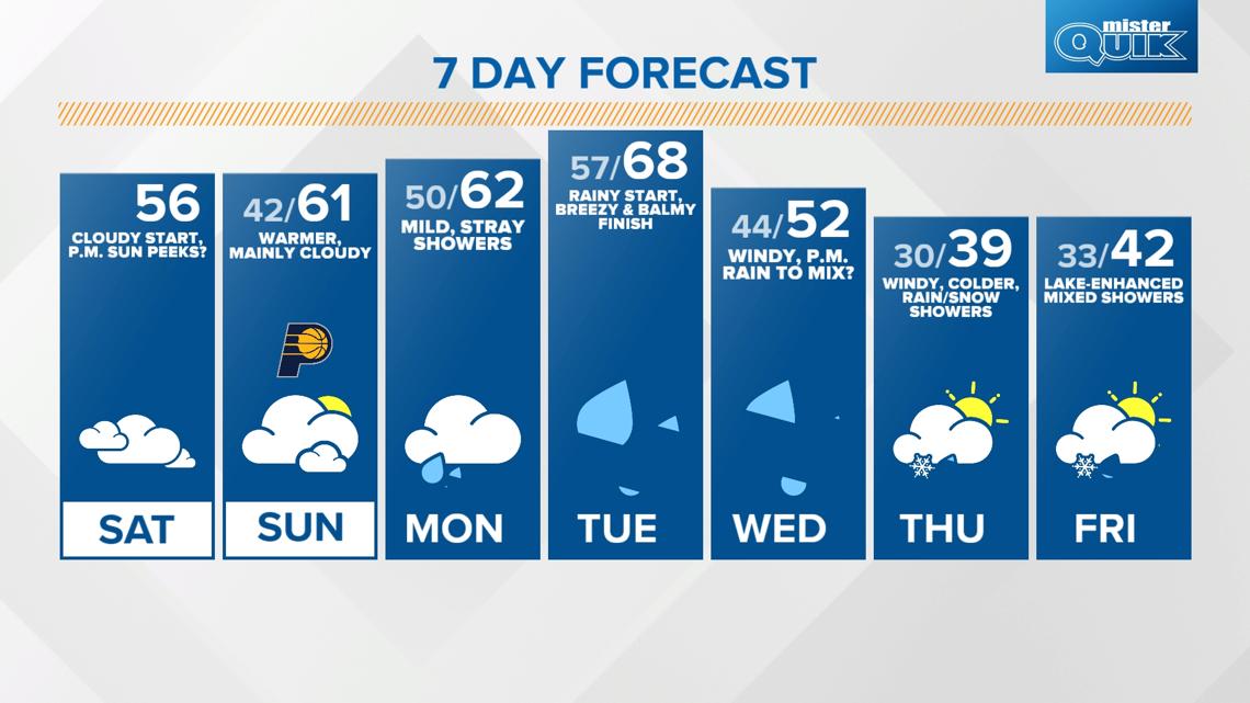
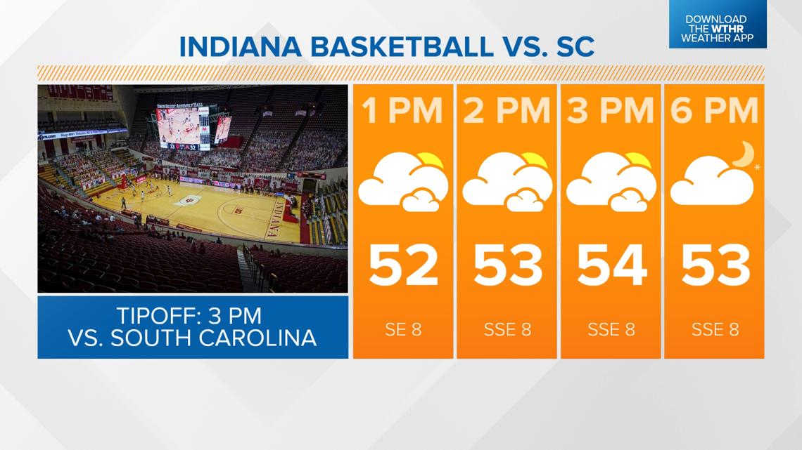
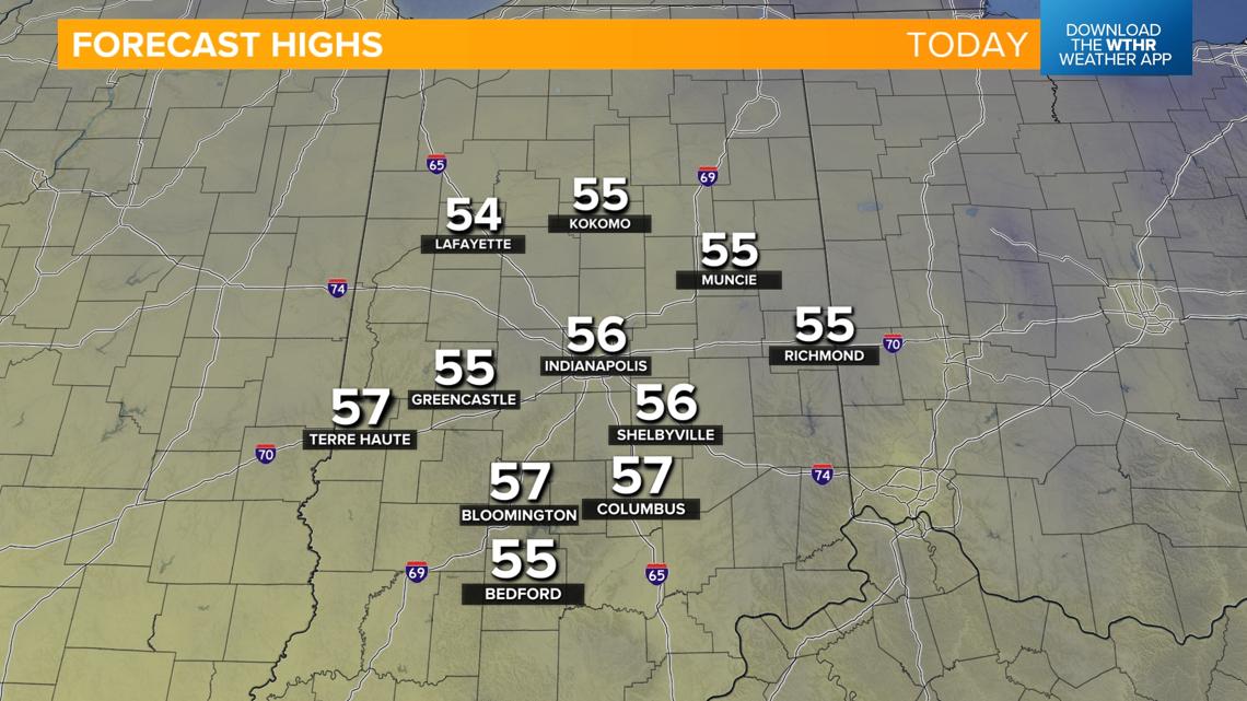
While it will be a cloudy start to the day, we'll see winds shifting from the south later this afternoon, increasing warmer air which will help to chip away at the cloud cover. While it won't end up being a sunny, blue sky kind of day, we will see some peeks of sunshine later this afternoon, especially across central and southern parts of the state. Temperatures recover into the low to mid 50s.


TONIGHT AND SUNDAY:
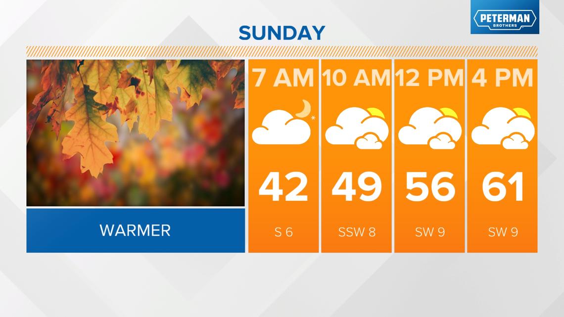
Staying partly cloudy this evening and overnight with lows in the low 40s.
A stretch of well above average temperatures begins tomorrow as a warm front lifts through central Indiana. We'll see lots of dry time tomorrow with gradually increasing clouds in the afternoon as temperatures warm into the low 60s.

FIRST OF TWO WET WEATHER SYSTEMS AHEAD:
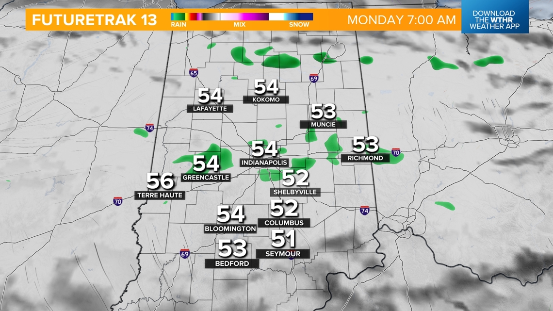
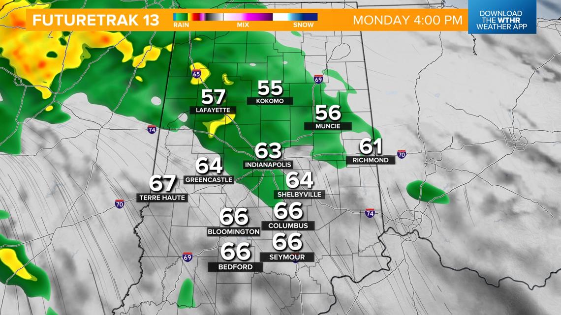
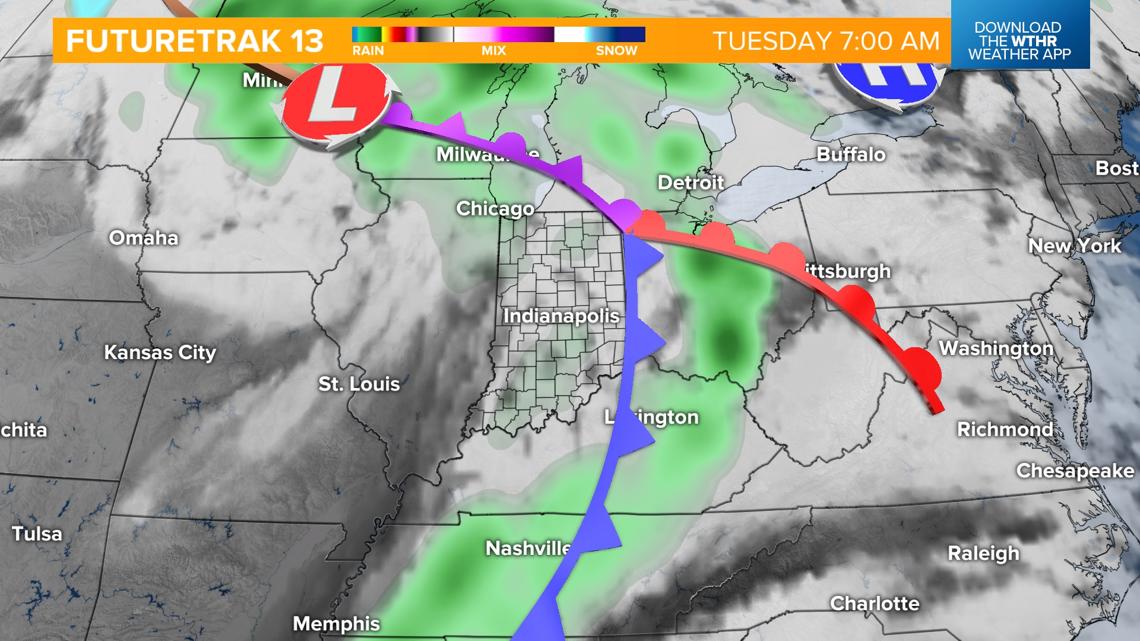
As the boundary lifts northward, some stray showers will be possible starting Sunday night into Monday morning, with the best chance of more widespread rain arriving Monday night through the first part of the day Tuesday. Look for highs in the low 60s Monday warming into the upper 60s Tuesday.



WAVE TWO BRINGS FIRST FLAKES OF THE SEASON:
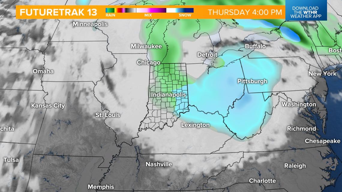
The more potent weather system this week arrives Wednesday. There are still discrepancies in weather models with the timing and location track of this system, but it does look to bring steady rainfall by Wednesday afternoon changing into a wintry mix late Wednesday night as much cooler air takes over. Temperatures will drop from the 50s into the low 30s by daybreak Thursday.

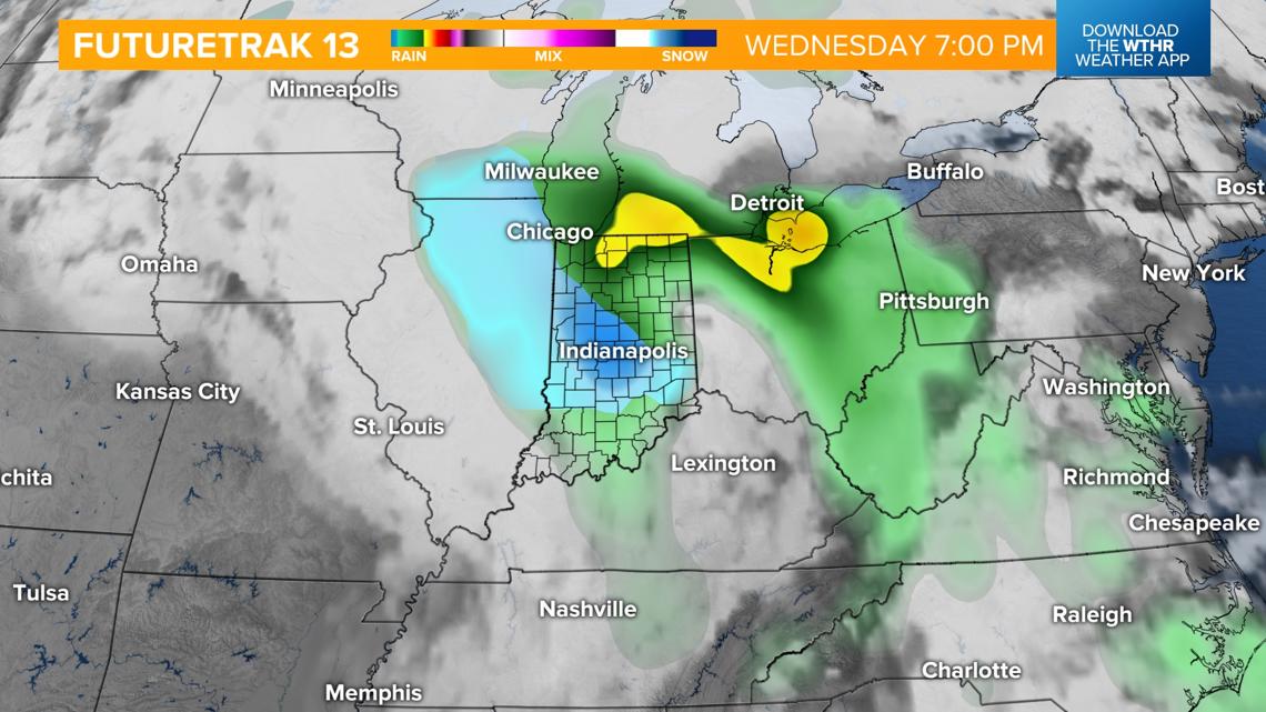
A much colder pattern settles in for the remainder of the week and with a strong northwest wind expected through Friday, lake-enhanced rain/snow showers will be possible.

