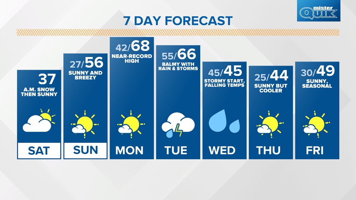
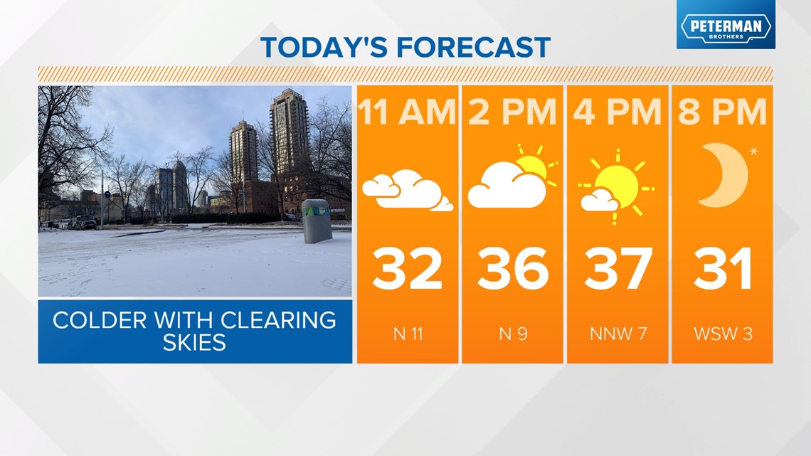
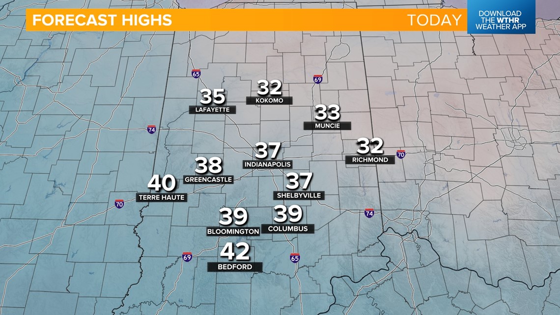
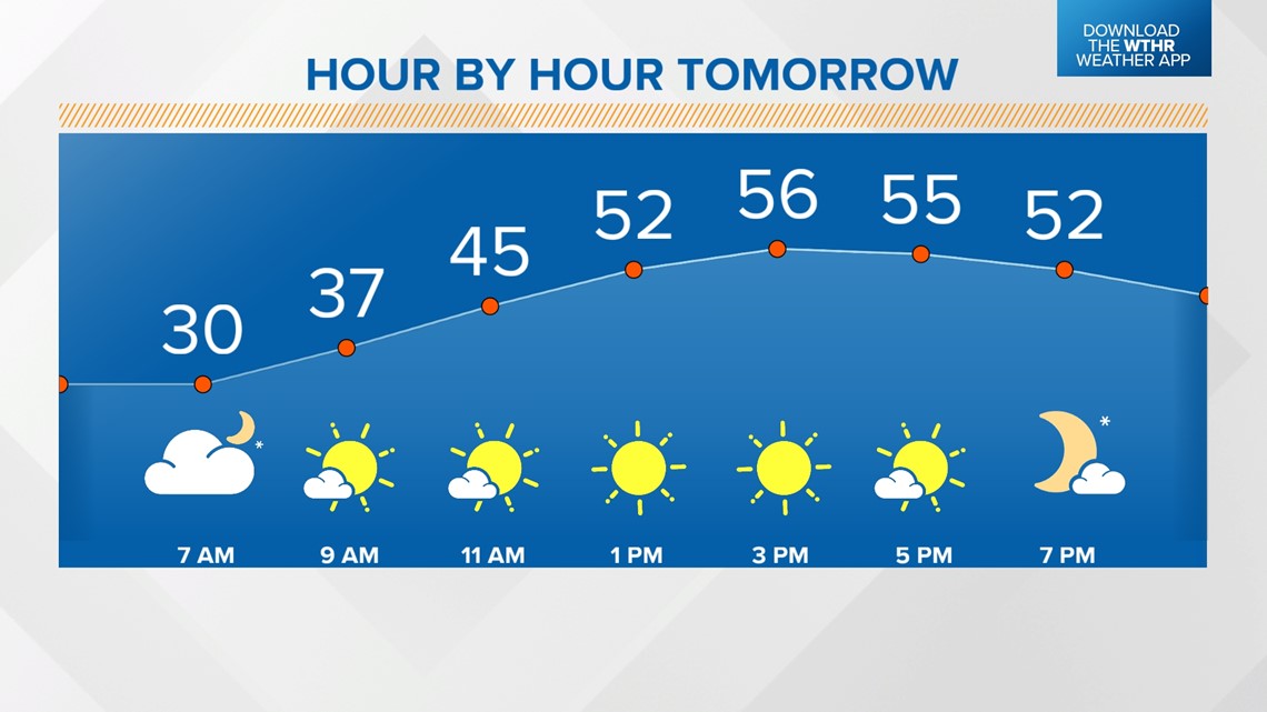
INDIANAPOLIS — Another brief blast of winter has returned to central Indiana as a much colder air mass takes over. Overnight/morning snow is wrapping up and skies will become mostly sunny across the state by the late afternoon. Today will be the coldest day in the extended forecast as temperatures only recover to the mid-to-upper 30s.


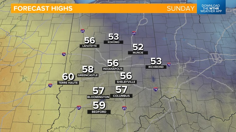
Skies stay clear as winds shift from the north to the south overnight. Temperatures hold steady in the upper 20s. Gusty southwesterly winds on Sunday will bring a major warming trend with highs jumping about 20° compared to Saturday in the mid-50s under sunny skies.


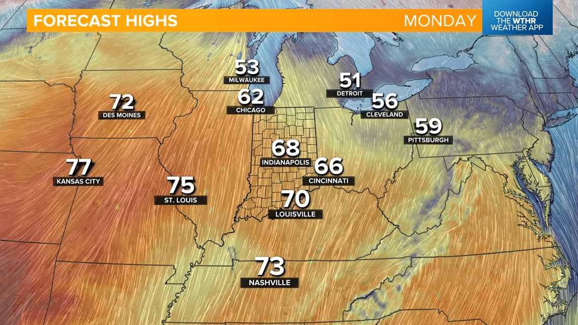
We're headed to near-record warmth to start next week with highs in the mid-to-upper 60s on Monday. The record high temperature for Indianapolis on Feb. 26 stands at 68 from 1998. It will stay dry and mainly sunny.

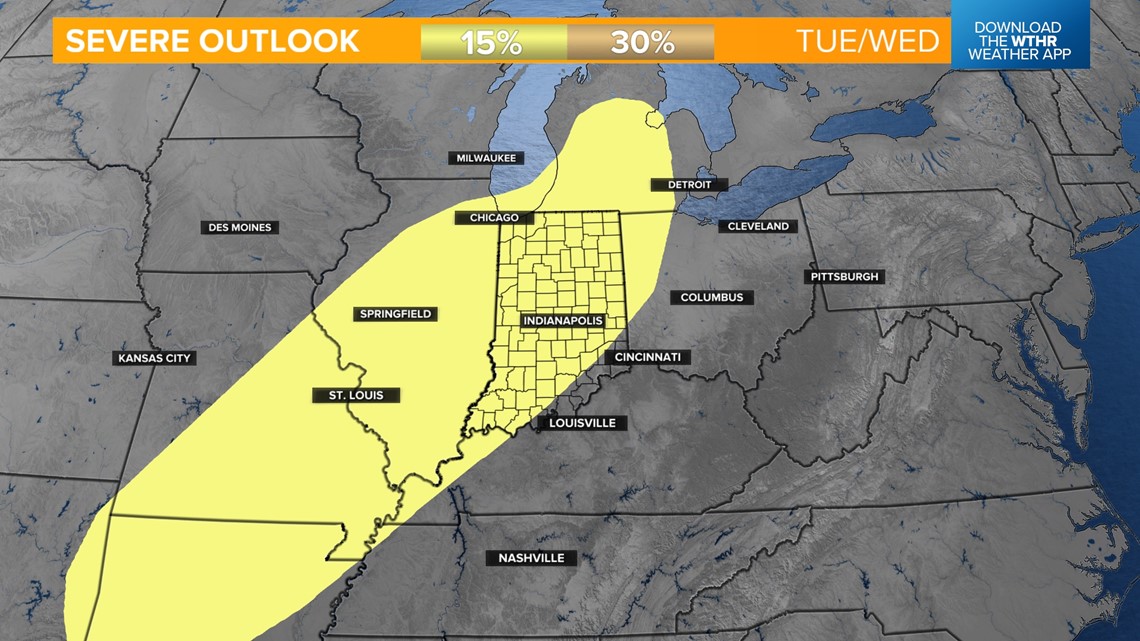
Rain returns on Tuesday as we sit in the "warm sector" of our next weather system, keeping temperatures in the mid-60s.
As the cold front approaches late Tuesday night into Wednesday morning, we could see a few strong thunderstorms with a threat of damaging wind gusts. Temperatures will drop from the 60s overnight into the 50s/40s by Wednesday morning as the storm threat comes to an end.
We'll eventually drop into the 30s by Wednesday afternoon as the sky continues to clear.


Sunshine and more seasonal temperatures return for the remainder of the work week with highs back in the mid-to-upper 40s. Temperatures then look to climb back above average with highs in the 50s and 60s next weekend.