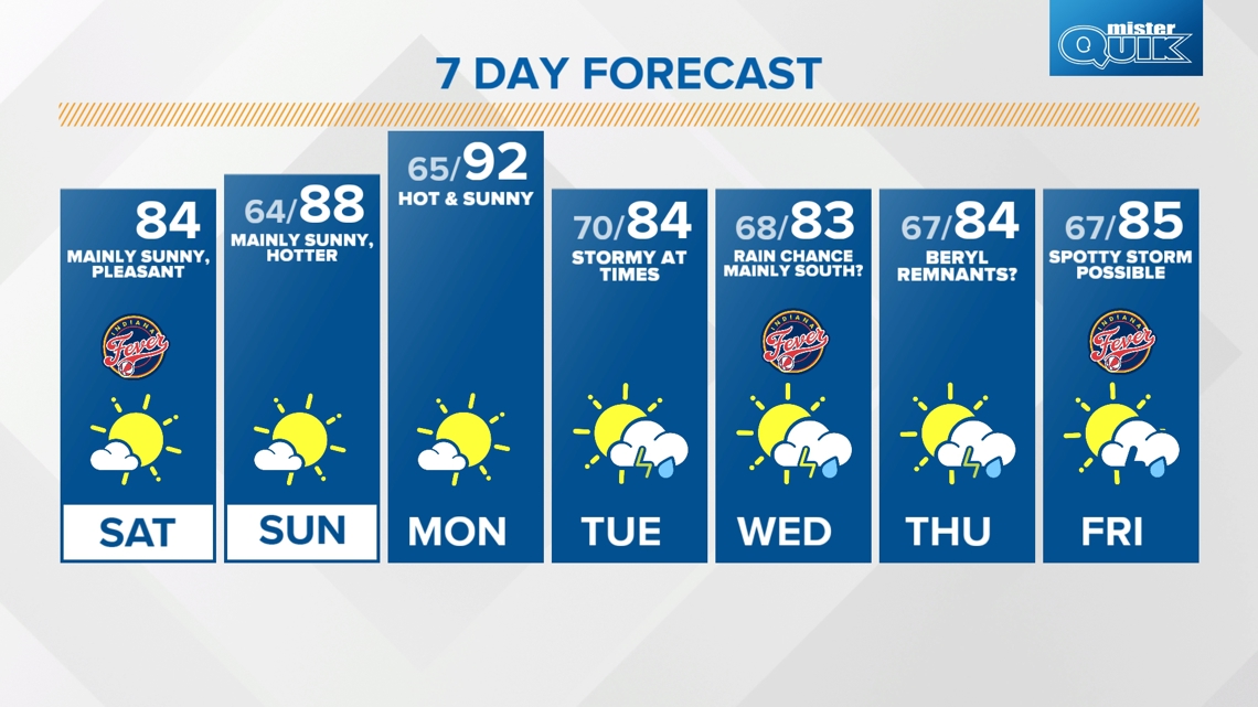
INDIANAPOLIS — We're headed into a quiet stretch of weather with plenty of sunshine and dry conditions today through Monday as a dome of high pressure takes control of our pattern across the Great Lakes region.
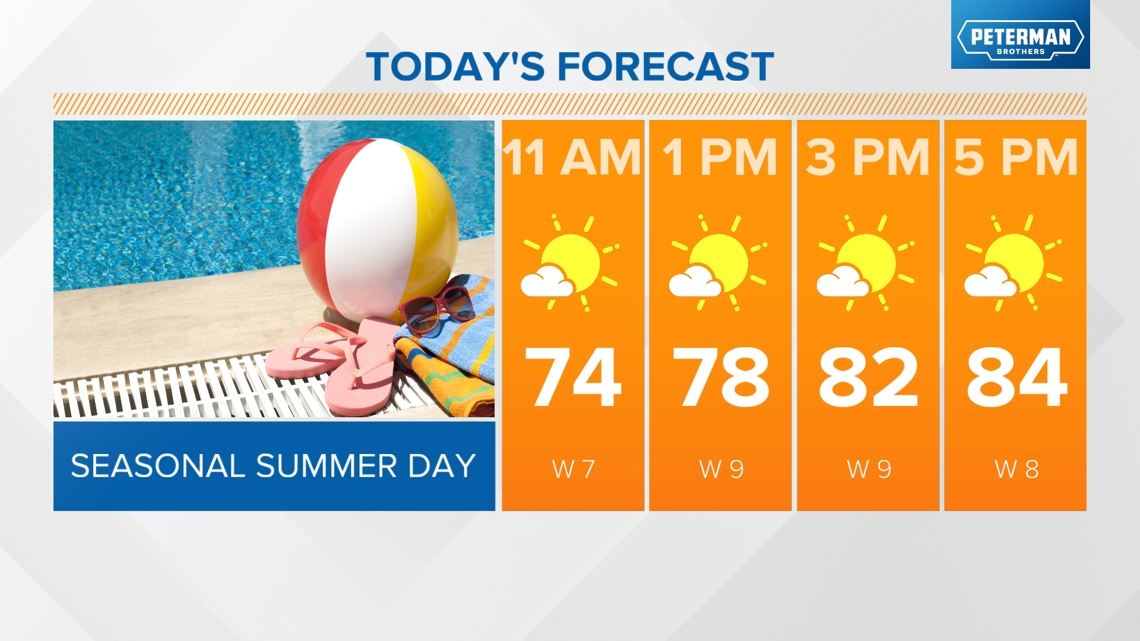
TODAY:
Mainly sunny skies, seasonal highs in the low to mid 80s.

TONIGHT:
Clear, overnight lows in the mid 60s.
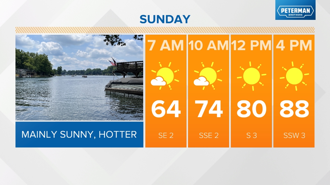
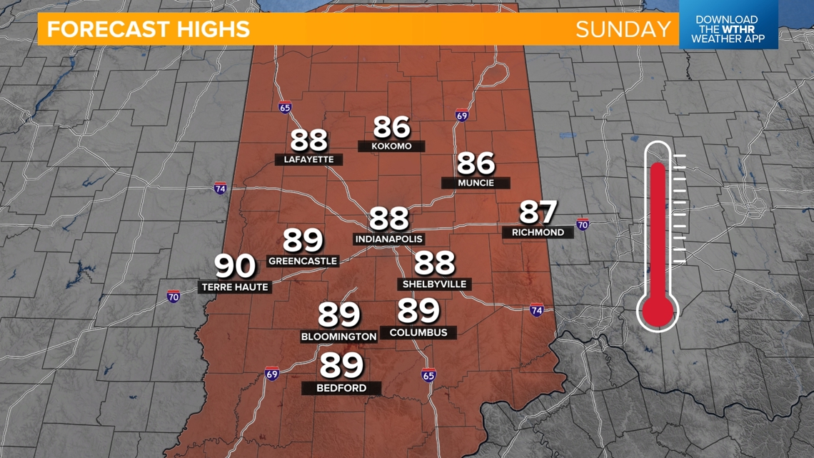
SUNDAY:
Winds will shift out of the south, southwest tomorrow which will bring in slightly hotter temperatures and more muggy air. Look for highs back in the upper 80s under a mainly sunny sky.


Monday will be the hottest day in the extended forecast with highs in the low 90s. Staying dry and mainly sunny on Monday.
When is rain back in the forecast?
Our next storm system looks to bring rain chances back into the forecast by Tuesday morning. While we'll still see lots of dry time on Tuesday, scattered storms will be possible. This hinders temperatures slightly with highs in the mid 80s.

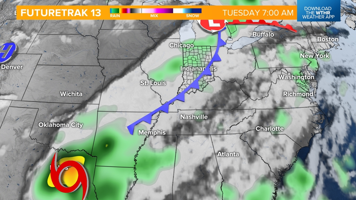
We're watching what will be the remnants of what is now Tropical Storm Beryl sitting in the Gulf of Mexico. This storm is forecast to strengthen back into a Category 1 hurricane as it approaches south Texas by Monday morning.

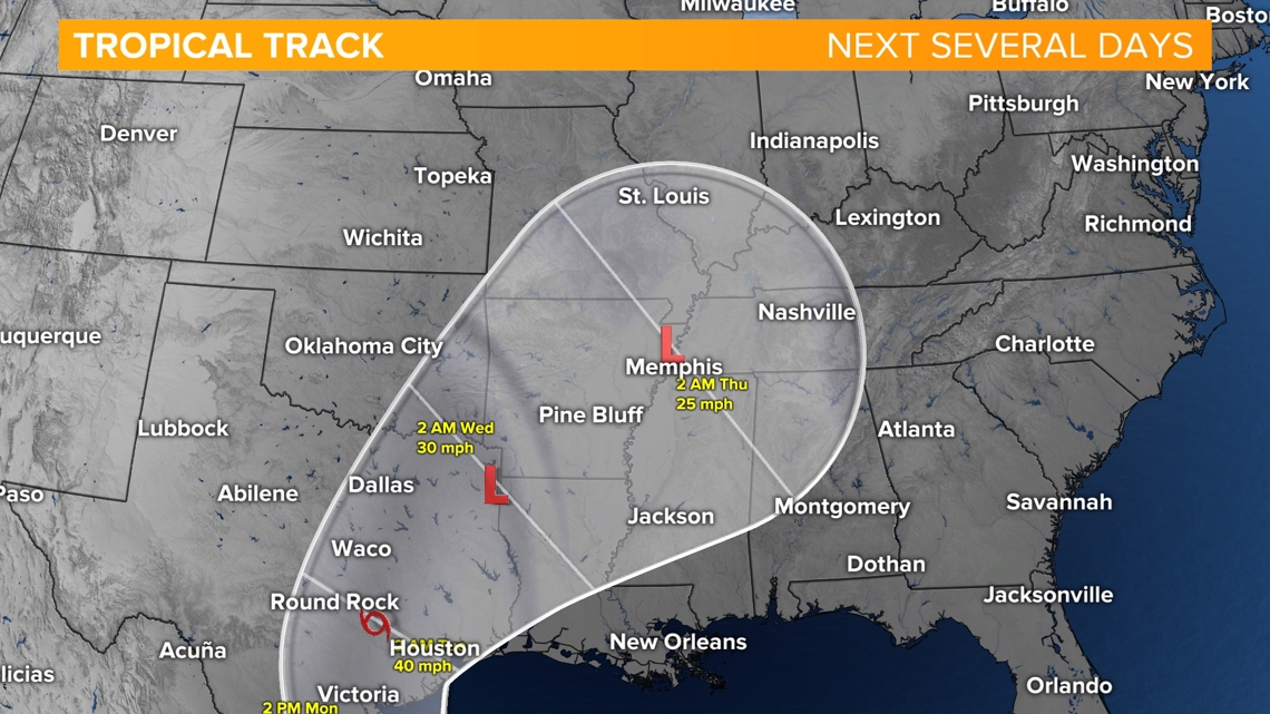
Current weather models take the track of this system north into the Mid-South and eventually northeast into southern Indiana. If this track verifies, we'll likely see some rain chances out of this system Wednesday (mainly south) with scattered rain on Thursday.