

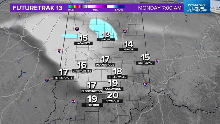
INDIANAPOLIS — Dress kids for a bitter bus stop Monday morning with temperatures in the teens and wind chills in the single digits. We're also expecting an area of light — but possibly impactful — snow to develop early Monday morning in Illinois and drift into central Indiana, near and especially north of I-74 between 4 a.m.-10 a.m. With temperatures in the teens, any snow could create slick spots.
Otherwise, morning clouds depart for a sunny but cold afternoon of highs in the 20s and single-digit wind chills. Dress warmly for the walk into and out of Lucas Oil Stadium if you're going to the College Football Playoff National Championship game.
Single-digit temperatures Tuesday morning will be the coldest this week before we embark on a warming trend that delivers 40s for highs Wednesday.
The medium-to-long-range pattern suggests a pattern conducive of Alberta Clippers impacting the Ohio Valley, possibly as early as later this week. But for now, there isn't a good deal of agreement in guidance to narrow down days in which we'd have snow potential.
Definitely follow the forecast closely this week for snow potential updates.
