INDIANAPOLIS — You can certainly feel the impacts of a cool front that dropped south through central Indiana overnight. Though it didn't produce much precipitation... it has returned the wind to the northwest and dropped the Muggy Meter down as dewpoints are back in the lower 50s versus the 60s on Saturday.
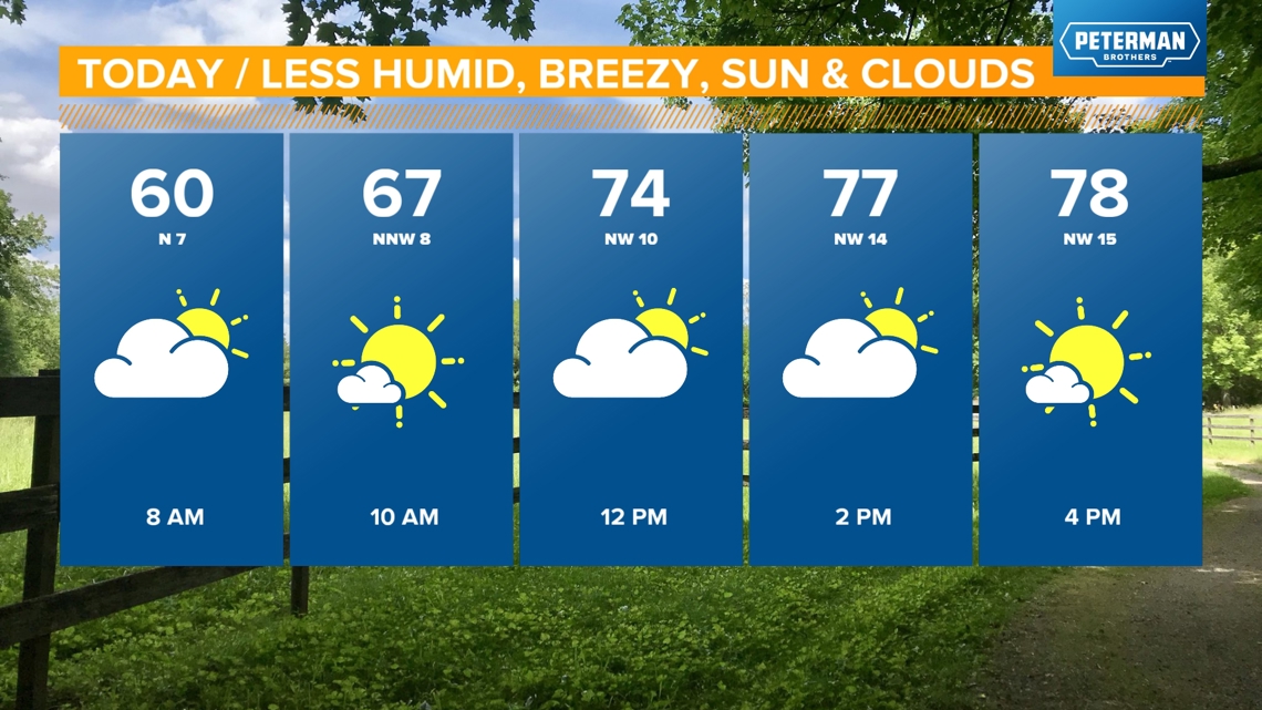
It will be less humid to finish the weekend with the refreshing breeze ramping-up during the afternoon and possibly gusting over 25 mph at times. Highs near/above 80 degrees today with a mix of sun and clouds.


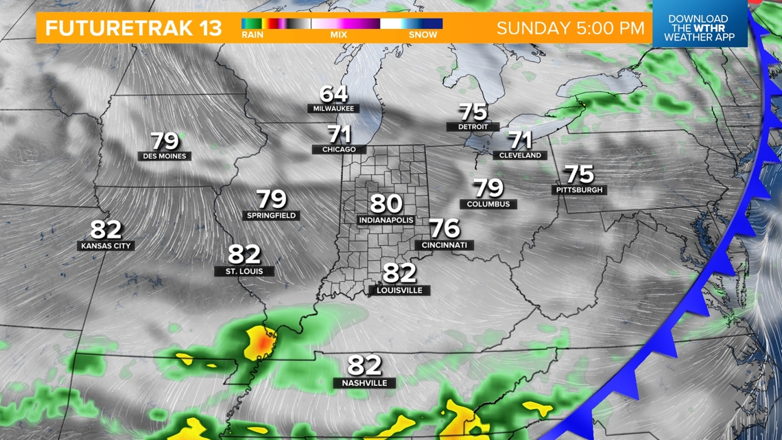

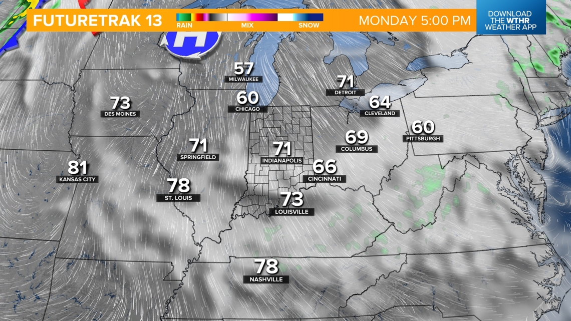
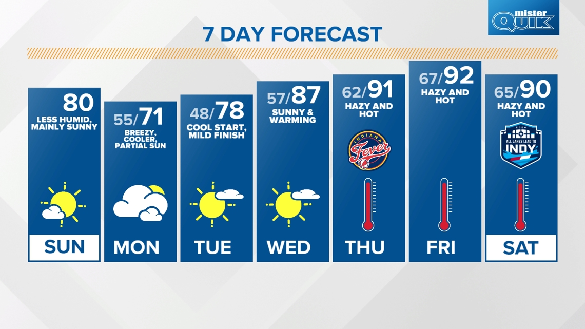
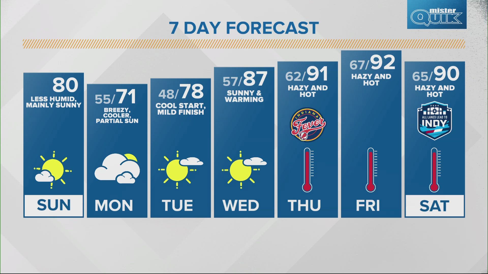
A strong cool front crosses the state tonight and sets the stage for brief period of unseasonably cool air. Expect the breeze to be stronger on Monday and temperatures to be much cooler and closer to 70 degrees (in not in the 60s) versus 80s today. In addition, there will be intervals of low-cloud cover that range from overcast to only partial sun in what may feel like more of an early spring day than early June.

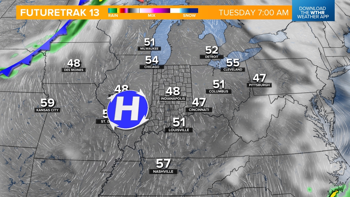

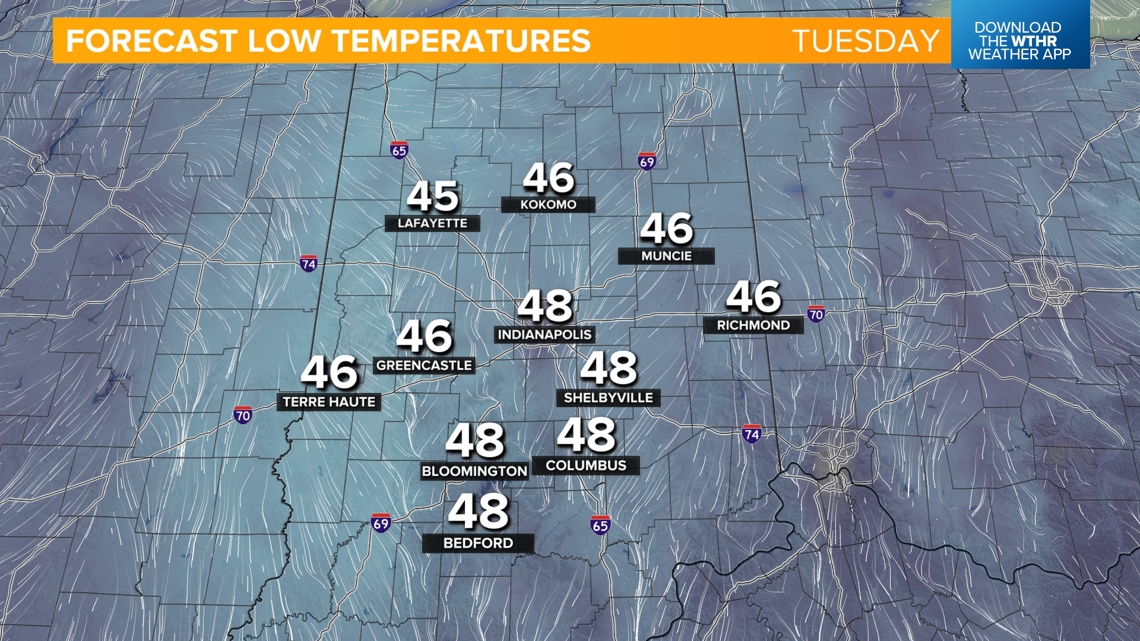
As high pressure spreads over Illinois and Indiana later Monday, clouds clear and the wind eases to provide the perfect recipe for maximum raditional cooling. This basically means that as much "heat" from Monday will be lost as possible Monday night into Tuesday morning. That leads to unseasonably cool lows in the 40s and our coldest morning since April 26.

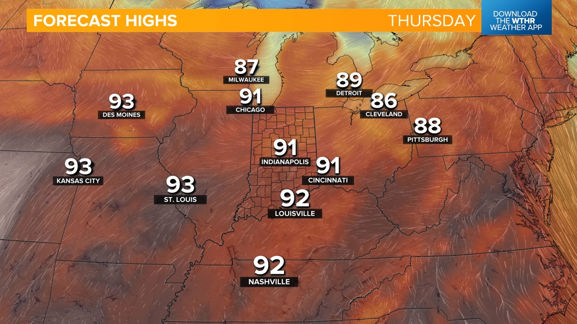

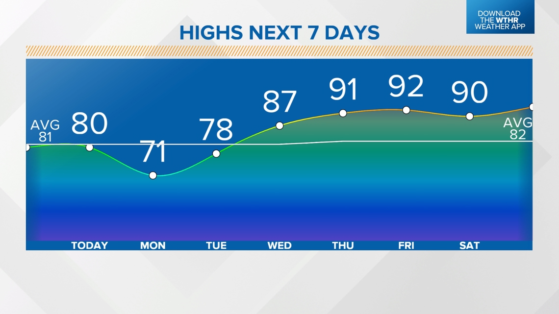
That will likely be our coolest temperatures for a long while with all signs pointing toward a heat wave emerging later this week and having staying power well into next week. The outcome will be many days near/above 90 degrees with limited chances of rainfall. It's very possible Heat Advisories and/or Heat Warnings will be needed for central Indiana if this verifies. Please stay tuned for updates on what could be impactful heat conditions.

